
Flood warning issued for NSW as Sydney prepares for rain deluge
One region in Sydney has copped the brunt of Wednesday’s rainfall but there’s more to come, with forecasters warning up to 140mm could fall across the city and its surrounds tomorrow.

NSW
Don't miss out on the headlines from NSW. Followed categories will be added to My News.
The Northern Beaches has copped the brunt of Wednesday’s rainfall but there’s more to come, as forecasters warn up to 140mm could fall across coastal areas of Sydney and surrounds tomorrow.
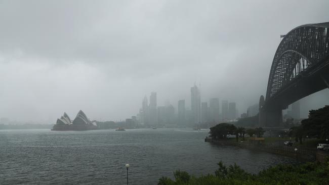
Heavy rain hit the city and surrounding areas on Wednesday after the Bureau of Meteorology issued a warning for heavy rainfall for the Greater Sydney, the Illawarra, south coast and parts of Hunter, Central Tablelands and Southern Tablelands areas.
The BOM revealed the northern metro area had seen the bulk of the falls today, with the highest total recorded in Belrose which received 92mm between 9am and 3pm.
Elsewhere, Wahroonga received 64mm, Mona Vale got 62mm and Chatswood saw 53mm.
But the warning for six-hourly rainfall totals between 60 to 100mm will extend into tomorrow, with the downpour to reach up to 140mm in some areas.
Senior forecaster Alex Majchrowski said showers would continue across Sydney this evening but the bulk of the rainfall would come when a “loosely related” system of rain moved in tomorrow, with no reprieve in sight until Sunday,
“We saw a convergent band of showers mostly across the northern Sydney metro … but showers across the metro area will remain possible for the rest of Wednesday,” Mr Majchrowksi said.
“But the widespread falls (of between 60 to 100mm) are expected tomorrow afternoon, the heaviest rain will come tomorrow.”
A strong upper trough and embedded low is amplifying over NSW today, with a coastal trough forecast to deepen in response to this upper weather system and will remain slow-moving, producing areas of heavy rainfall before weakening during Friday morning.
Mr Majchrowski added: “Conditions will ease and decrease by Friday morning, but Sydney won’t properly clear until Sunday.”
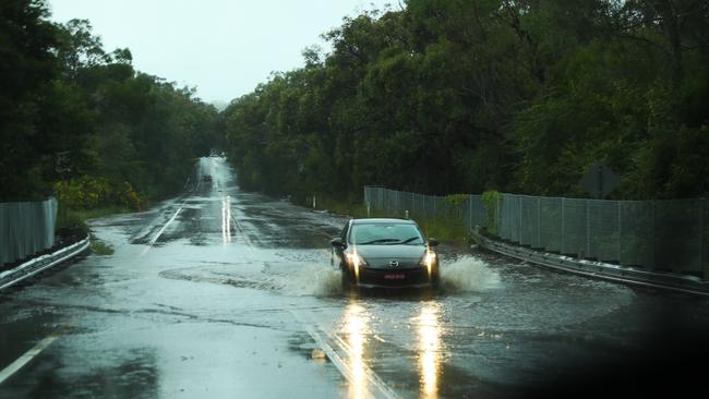
Flooding has impacted roads across Sydney, with drivers warned to take “extreme care” as the downpour continues.
Part of the Wakehurst Parkway closed due to flooding and a warning for the M5 motorway at Mascot, where water is on the road.
A lane of the Pacific Highway closed at 2pm today because of water on the surface, and Riverside Dr in Lane Cove National Park is closed due to flooding.
Water is also impacting O’Riordan Street in Alexandria and West Head Road at Ku Ring Gai Chase.
Areas of NSW forecast to be hit with heavy rainfall throughout the rest of today and tomorrow include Sydney, Bega, Batemans Bay, Nowra, Goulburn, Wollongong, Katoomba and Gosford.
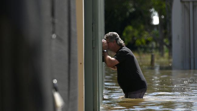
There is a current flood watch issued for parts of southern and central NSW and flood warnings for the Richmond, Orara, Paroo, Culgoa, Birrie, Bokhara and Narran, Snowy, and Macintyre River (Qld) Rivers.
Flood watch warnings have also been issued for the minor to moderate flooding expected on the Hawkesbury and Nepean, Colo, Upper Nepean and Lower Hunter Rivers, plus Wollombi Brook.
The Georges and Woranora, Shoalhaven, Moruya, Deua, Queanbeyan and Molonglo Rivers plus St Georges Basin and the Central Coast area are all expecting minor flooding, the Bureau of Meteorology predicts.
MEDIA RELEASE 🗣🗣
— NSW SES (@NSWSES) April 5, 2022
The NSW State Emergency Service (NSW SES) is urging residents across the State to prepare for significant rainfall later this week.
Read more: https://t.co/68WtlFwnslpic.twitter.com/gzvZFuEIgW
Just before 3pm this afternoon, a tree smashed through the roof of a three-storey apartment block in Merrylands in Western Sydney.
Ten residents were evacuated as emergency services arrived to inspect the site.
“There’s no structural damage to walkways and balconies. There’s broken roof tiles and branches penetrating the roof,” FRNSW Superintendent Adam Dewberry said.
“They need a crane to remove the tree and they need to work out if they can tarp it. They’re going to do some internal tarping.”
No injuries were reported, and it is believed that some residents were allowed to return to properties inside that were not visibly damaged.
A few hours later at around 5:30pm, emergency services crews attended a scene on Elizabeth St in Redfern where a tree was found leaning against a building.
FRNSW Superintendent Adam Dewberry said a crane and an arborist were likely required to remove the slanted tree from touching the structure.
Traffic in the area is impacted and motorists are advised to drive slowly in the area.
BOM Senior Forecaster Samantha Conner said a strong upper trough and embedded low would grow over central NSW during Wednesday, causing a coastal trough to deepen. Ms Conner said some parts of the state could see up to 140mm in six hours, and warned locals to be alert to flash flooding.
“The Illawarra will likely get the main focus of the rain, broadly around (the warning area) we will see between 60 to 100mm, especially in Sydney … but falls in some parts could reach 140mm in six hours,” Ms Conner said.
“There are flood warnings for numerous catchments … any rain that does fall goes straight into run-off, causing a higher chance of flooding because there has been so much rain already.”
“Residents should stay alert of warnings and observe any flood warnings ahead of time.”
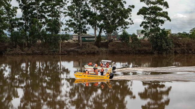
The rainfall is expected to move further north of Thursday. It comes as Grafton received its third flood warning in three months, with the BOM predicting waters could rise again in the flood-stricken region.
âš ï¸ Initial Minor #Flood Warning issued for the #Clarence River. Minor flooding possible at #Grafton early Wednesday morning on the high tide. See https://t.co/AdztI2rqg1 for details and updates; follow advice from @NSWSES. #NSWFloodspic.twitter.com/pREMJhBSJ0
— Bureau of Meteorology, New South Wales (@BOM_NSW) April 5, 2022
In an initial flood warning for Grafton on Tuesday evening, forecasters predicted the Clarence River could rise for a third time during high tide in the early hours of Wednesday morning.
“Local rainfall has caused river rises across the Clarence River catchment … minor flooding is possible at Grafton early Wednesday morning with high tides,” the BOM wrote online.
“The Clarence River at Grafton (Prince St) may peak near the minor flood level (2.10m) early Wednesday morning with high tides.”
It follows major flooding on the river in late February and late March, with water levels reaching 7.3m during the first round of devastation before a second peak of 5.4m just under a week ago.
More Coverage


Read related topics:NSW floods
Join the conversation
Postcode wars links to drive-by shooting key line of investigation
A mistaken identity shooting in Sydney’s west is believed to be the latest escalation in a feud between two gangs involved in the city’s “postcode wars”.
Read more
NSW Liberal leader calls for party to move to the ‘sensible’ centre
The Coalition’s devastating election defeat on Saturday has left the Liberal Party reeling, with moderate NSW state MPs saying the party needs to lean more to the centre to beat Minns in 2027.
Read more