
Watch and wait as flooding eases but more rain forecast
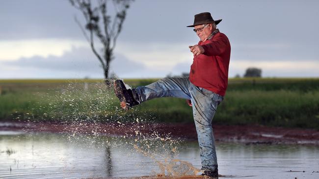
FLOODING, and the threat of further devastation, has eased in Victoria and South Australia, but the respite may be brief.
National
Don't miss out on the headlines from National. Followed categories will be added to My News.
FLOODING, and the threat of further devastation, has eased in Victoria and South Australia, but minor flooding is forecast in NSW and Queensland country areas as the rainy weather creeps slowly north.
And the threat of further flooding isn’t over, with emergency services and weather watcher enjoying the respite, but wary of forecasts for more rain.
The Bureau of Meteorology this morning issued a minor to moderate flood warning for the Murrumbidgee River at Narrandera in the Riverina in NSW, with the river expected to peak at 7.3 metres later today. Further rain is forecast. Minor flooding is also expected around Boggabilla in the NSW northwest.
And in inland Queensland flood warnings are in place in the Channel Country, Maranoa and Warrego, Darling Downs and Granite Belt, Central West and Central Highlands and Coalfields after some of those areas had up to 80mm of rain in 24 hours by early Sunday, and the rain is continuing and another round of heavy falls is due on Tuesday
In Queensland's’s central west around Blackall falls of between 25mm and 60mm or rain drenching the upper Barcoo River catchment in the 24 hours to 9am Sunday.
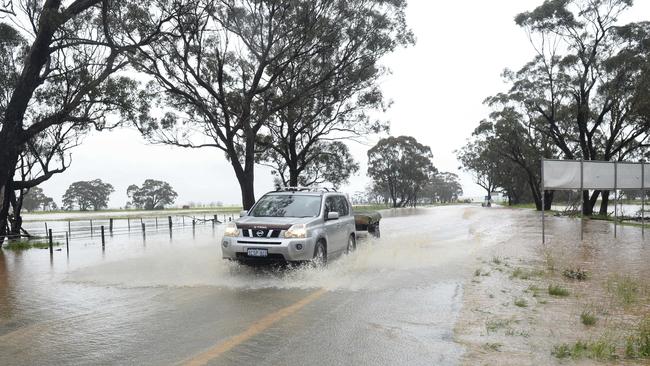
In Victoria, with so much of the west and northwest ravaged by floods last week, alerts remain in place amid fears a second drenching this week would send flood levels into overdrive.
“A front and tough interacting with tropical moisture will trigger rain and storms across the eastern half of Australia on Tuesday and Wednesday. All areas currently being affecting by flooding will see more wet weather during these two days,” according to Weatherzone.
The floods turned deadly in Victoria last Friday, when police found the body of 84-year-old dairy farmer Frank Bell, whose ute was swept away at Wallacedale in central Victoria last Wednesday.
There was weekend respite in Charlton, in Victoria’s northwest, where floodwaters are dropping after the Avoca River peaked at 7.5 metres. A major flood warning remains in place but the river levels is expected to fall to 7 metres on Sunday afternoon.
There were no evacuations from the town overnight but precautionary sandbagging had been done, authorities say, and will continue around low-lying homes.
A major flood warning for the Avoca River remains in place on Sunday, with high waters expected downstream of Charlton, but only small amounts of rain are forecast for the rest of the day.
Flood warnings remain in place across Victoria, with major warnings in Wimmera and Horsham as levels continue to rise.
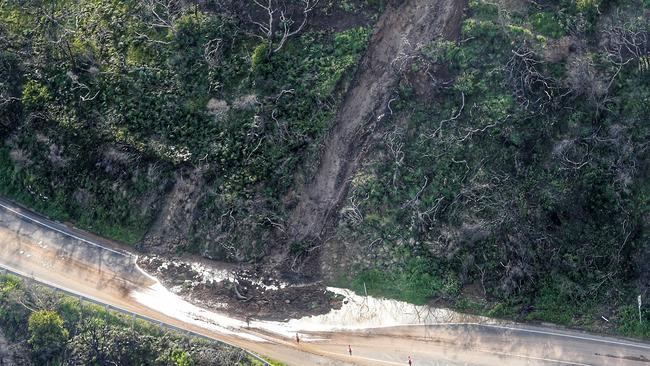
Elsewhere in Victoria, the Great Ocean Road between Eastern View and Lorne has been reopened after landslides and flooding forced extensive closures for almost four days.
Bureau of Meteorology forecaster Peter Newham said a cold front from the west would hit Victoria on Tuesday and Wednesday, bringing isolated showers to parts of the flooded west, some area predicted to receive up to 20 millimetres.
Scattered showers are predicted for around the state on Sunday and patchy showers for Monday.
Meanwhile in South Australia, the Adelaide Hills has so far escaped devastating flooding after a forecast deluge failed to materialise on Saturday.
But another system is forecast to move over the state again on Monday and Tuesday,” the Bureau of Meteorology warned.
The BoM had been expecting up to 30mm of rain on Saturday, which it feared could cause rivers across the hills to rise, with the prospect of further damage.
More than 100mm of rain fell in some parts of the Mt Lofty Ranges on Wednesday, causing flooding across a wide area.
About 80 homes were damaged along with a number of roads. The bill is expected to run into millions of dollars.
Originally published as Watch and wait as flooding eases but more rain forecast

Case for interest rate cut ‘getting stronger’
The Australian economy is growing at its slowest pace since the early 1990s recession, with a key group saying the RBA is focusing on the wrong thing to fix it.
Case for interest rate cut ‘getting stronger’
The Australian economy is growing at its slowest pace since the early 1990s recession, with a key group saying the RBA is focusing on the wrong thing to fix it.