
First snow of the year forecast for kunanyi/ Mount Wellington this week
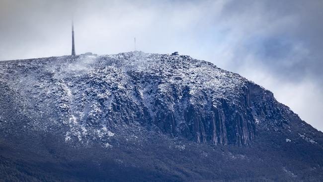
This week Hobart could see the first light dustings of snow begin to appear on kunanyi/ Mount Wellington for the year as winter approaches.
News
Don't miss out on the headlines from News. Followed categories will be added to My News.
This week Hobart could see the first light dustings of snow begin to appear on kunanyi/ Mount Wellington for the year as winter approaches.
Bureau of Meteorology senior meteorologist Anna Forrest said Hobart could see snow roughly around the 800 metre mark on Wednesday.
However Ms Forrest said they would be able to have a more precise estimate closer to the day itself.
“We’ll have to keep an eye on it, but at the moment it’s looking like there could be a smattering of snow about,” Ms Forrest said.
“We could get some frost towards the latter part of the week when the cloud cover wears off after the cold air comes through so it could be clear and frosty overnight.”
The forecasts are showing a light shower or two on Monday morning in Hobart followed by a mostly sunny day on Tuesday.
Wednesday could see a shower or two in Hobart, potentially turning into snow higher up on Mount Wellington.
Minimum temperatures will be hovering just around the 1 degree mark in the latter half of the week, although the chance of rain will be slim.
kenji.sato@news.com.au
More Coverage


Originally published as First snow of the year forecast for kunanyi/ Mount Wellington this week

Mr International: Owen lands another overseas chance
On the back of his brilliant BBL season, Hobart Hurricanes hero Mitch Owen has landed another overseas chance after returning from South Africa. He opens up on potential IPL interest here.

‘Making a difference’: Shine Award winners honoured
Regional women making a difference in their communities have been honoured at the eighth annual Shine Awards lunch.