
Woolworths and Coles explain alternative plans for groceries amid North Queensland flooding, Bruce Hwy closure
A shortage of fresh produce and vegetables is being felt across supermarkets in Far North Queensland, as flooding cuts the Bruce Hwy and impacts supply to the region. Here’s the latest update.
Cairns
Don't miss out on the headlines from Cairns. Followed categories will be added to My News.
A shortage of fresh produce and vegetables is being felt across supermarkets in Far North Queensland, as flooding cuts the Bruce Hwy and impacts supply to the region.
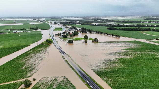
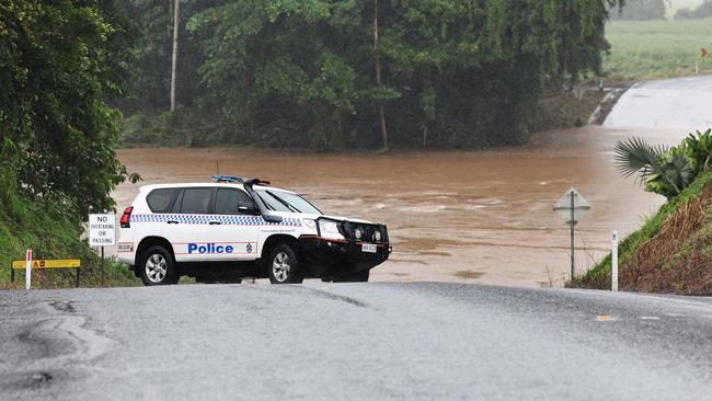
Logistics planning was under way on Sunday after the Bruce Hwy was cut in multiple locations, isolating a number of towns between Cairns and Bowen.
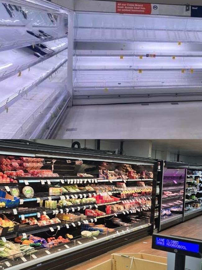
Despite the major supermarkets insisting significant disruptions were not expected at their Far Northern stores fresh produce shelves remained empty on Monday morning.
Fruit, vegetables and fresh meat were unavailable in most major supermarket chains across the city.

On Monday morning spokesperson for Woolworths said its teams were working hard to secure additional freight resources via road, while also monitoring road conditions.
“We’re continuing to respond to the impact of heavy rains in Far North Queensland and are working with our key transport and logistics partners to keep moving stock into our stores,” she said.
“Our team is working hard to get additional stock to many stores today.
“However, as always, we ask customers to be mindful of others in the community and buy only what they need.
“The safety and wellbeing of our customers, team members, and the communities we serve are our top priority.”
Smaller stores such as IGAs and the Night Owls across the city remained stocked with fresh fruit and veggies for those seeking groceries.
Far North trucking boss Les Blennerhassett of Blenners Transport, which moves fresh produce from the region to southern markets and returns with grocery items, said his fleet had been grounded with the highway closed in multiple locations.
Mr Blennerhassett said based on prior experience of similar flooding, he anticipated the Bruce Hwy would remain closed for at least a week, and the east coast rail line – used by the major supermarkets – had suffered damage of its own.
“But we won’t understand how bad that is until the waters go down,” he said.
“I’d say there won’t be anything moving today (Sunday), but with a bit of luck we might start going inland from Monday or Tuesday.
“The Bruce will be out for week. I would say to the Crisafulli government, as soon as the floods are over, start prioritising the inland routes and all the bridges because this time of the year we’re extremely reliant.”
On Sunday evening a Woolworths spokeswoman said the grocer had already commenced back up plans to deliver goods to the north and weren’t expecting major disruptions.
“We’re not experiencing major disruptions to stores at this stage, with additional stock supplied to many stores in previous days.
The spokeswoman said rail stock from Mackay was being shifted to on-road routes to continue deliveries into the Cairns region, and additional stock was being sent to Mount Isa and Charters Towers in preparation for further impacts.
She said all home deliveries had been suspended until Monday, and stores at Hermit Park, Fairfield and Ingham were closed due to evacuation orders.
A spokesman for Coles said the supermarket already had stock on its way via alternative inland routes.
“Our team worked hard to prepare our stores with essential supplies ahead of this weather event, and we are working closely with suppliers, transport partners and local authorities to maintain deliveries where roads remain accessible.
“We ask customers to only buy what they need so that everyone in the community can access essential items.”
Between 9am Friday and 9am Sunday, up to 1m of rain fell across parts of North Queensland, including 999mm at Rollingstone, 662mm at Ingham, 545mm at Townsville, 402mm at Ayr and 184mm at Mackay.
The Far North faired a little easier, with no gauge between Cairns and Innisfail recording over 100mm in the 24 hours to 9am, Sunday, February 2.
However, Tully received 304mm, Euramo recorded 232mm and Cardwell 326mm in the same period.

As a result, Cassowary Coast Mayor Teresa Millwood said there had been some localised flooding within Tully and the “backstreets” of Cardwell, late Saturday and early Sunday.
Ms Millwood said Queensland Fire Department Swiftwater Rescue crews on Sunday were deployed from Tully to assist residents awaiting assistance on their roof at Cardwell.
“The emergency centre down at Cardwell has been activated,” Ms Millwood said.
“The advice we’re getting is the weather system is moving south, but there could still be some substantial falls around Tully and Cardwell up until Tuesday.
“I also asked for crews to check on residents who are on dialysis at Jumbun.”
Jumbun is an Aboriginal community at Murray Upper, southwest of Tully.
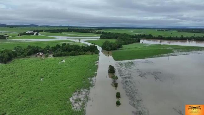
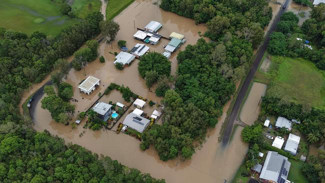
Local drone operator Nathan La Fauci of Cassowary Coast Drones captured widespread flooding around Mission Beach and Tully, describing it as “nothing out of character”.
“It has been a lot of rain, but probably not as much as there has been in the past,” he said.
“With the water over the road, there’s a bit of damage around, a few potholes, it’s an annual thing.”
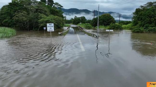
On Sunday, the Bureau of Meteorology was reporting moderate flooding at Euramo, south of Tully, due to the flooding of the Tully River which was at 8.75m at 7.20am.
The Bruce Hwy was also temporarily closed between Tully and Cardwell – isolating the seaside community – which was also cut off from Ingham with flooding of the Seymour River.
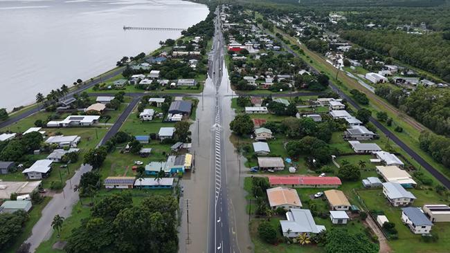
Cardwell resident and business owner Robyn Smith the town which was generally “pretty safe” from flooding had experienced water through homes in lower-lying backstreets.
“In general the business street of Cardwell is high and dry, but the lower areas like Roma and Gregory St, there are residents there with water through their houses,” she said.
“I know out at Stoney Creek and Five Mile Creek, they’ll be struggling with water out there.
“Cardwell is generally a safe place from flooding, it has to be a big event, and we had almost 400mm overnight and that does impact the lower streets.”
Ms Smith the oceanfront town had experienced elevated wind levels on Saturday.
“We were watching the water and it was like surf, you don’t really see that up here. But today (Sunday) there has been a bit of a lull in the weather, so hopefully that will clear out some of those backstreets.”
While the SES had conducted a small number of rescue efforts from Cairns to Cardwell over the past 24 hours, the situation was rapidly worsening in other areas.
SES Far Northern Queensland regional director Wayne Coutts said nine SES team members were being flown into flood-affected Ingham to assist as of Sunday morning.
The town on the Herbert River is facing its worst flooding disaster since the record inundation of 1967.
SES team members will work on a five-day roster to assist with flood management, with rotations in place to prevent fatigue and burnout if extended shifts are needed.
“We start with a five-day plan, however, that’s the point where fatigue can begin to set in for first responders,” Mr Coutts said.
Queensland Fire Department carried out 19 rescues across Far North Queensland in the past 24 hours, including Ingham, Cardwell, Tully, Halifax, and other coastal areas.
The rescues have been “very scattered,” with teams responding to multiple, urgent calls for help as floodwaters rose.
“We’re called to assist with water rescues, helping people out of the water and getting them to safety,” a QFD spokesman said.
It is understood many of those rescued had been in danger after leaving it too late to evacuate.
In response to the growing crisis, 32 Swiftwater teams have been deployed between Mackay and Cairns, with an additional 20 teams deployed to other regions across Queensland.
“We only deploy what we can manage and where it’s needed most,” the spokesman said.
On Friday, January 31, five rescue crews with four members each were dispatched from the southeastern region, alongside a sixth crew from Rockhampton.
Teams were also scheduled to drive up to Townsville and Cairns on Friday, with additional support headed to Mackay on Saturday.
Bureau of Meteorology senior meteorologist Dean Narramore said the most severe weather would continue to focus between Ingham and Ayr, where rivers were expecting record flooding and isolated totals of up to 300mm in 36 hours were expected.
For the Far North, Cardwell is expected to remain within the flood warning zone on Monday and Tuesday, while the Tully and Murray Rivers will likely experience minor to moderate flooding.
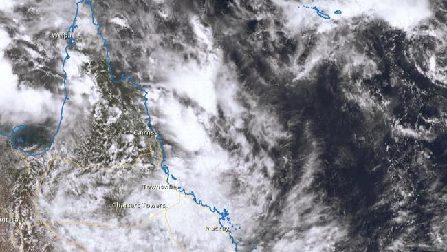
“What’s driving all this rainfall and will continue to do so is we’ve got a shear zone and low pressure system just continuing to hang off the north tropical coast (near Cardwell),” he said.
“We’re getting very moist tropical air coming down from the north and also coming in from the east as well and that’s converging on the area between Cardwell and Ayr.
“As we get through Monday morning and into Tuesday, the feed of moisture (into the low pressure system) continues around that Cardwell-Ayr area.”
For Monday and Tuesday, residents around Cairns can expect totals up to 100mm, with the rain in the Far North expected to ease from Wednesday.
More Coverage


Originally published as Woolworths and Coles explain alternative plans for groceries amid North Queensland flooding, Bruce Hwy closure
Join the conversation

Student rushed to hospital after being hit by car near school
A primary school student has been rushed to hospital after he was hit by a car while to riding to school.
Read more

True stories behind the faces forever connected by tragedy
These are the true stories of 15 everyday Queenslanders who never met but will forever be connected through tragedy and heartbreak.
Read more