Western Sydney Airport flight paths released, giving residents their first look at what’s ahead
Proposed flight paths for Western Sydney Airport have finally been released, along with an online tool to help residents measure how much noise they will face.
Business
Don't miss out on the headlines from Business. Followed categories will be added to My News.
Proposed flight paths for Western Sydney Airport have finally been made public, along with a sophisticated online tool for local residents to measure how much overhead aircraft noise they will have to contend with when operations begin in just over three years’ time.
The interactive tool uses graphics and video to demonstrate flight paths and associated aircraft noise at various altitudes over residential areas and sites of interest.
It’s a significant step up from the technology used to inform Brisbane residents about noise from the city’s new parallel runway, which opened in 2020, triggering a tsunami of complaints from blue-chip and riverfront suburbs.

Infrastructure and Transport Minister Catherine King said the Western Sydney Airport flight path tool would allow residents to see the expected altitude of flights over their home, daily aircraft numbers and predicted aircraft noise.
“Supporting material has also been released to explain the approaches to the preliminary flight paths design and noise modelling,” Ms King said.
Planners worked to avoid certain pockets, including much of the Blue Mountains World Heritage-listed area, as well as a restricted defence zone within the airport’s catchment.
A draft environmental impact statement of the flight paths is due for release later this year.
Ms King said an expert steering group developed the flight paths, led by her department and including Airservices Australia, the Civil Aviation Safety Authority, Defence and the airport operator.
“Importantly, the preliminary flight paths were developed according to airspace design principles that reflect community feedback from the ‘proof-of-concept’ flight paths released in 2015,” she said.
“These principles include minimising flights over residential areas and reducing the impact on the community of aircraft operations at night.”

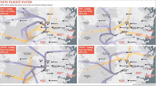
According to the draft plan, aircraft will arrive from the southwest and depart to the northeast when runway 05 is in use, and arrive from the northeast and depart to the southwest when runway 23 is operational.
Wind conditions would dictate which runway is used when, with the plan aiming to avoid incoming and outgoing aircraft flying over the same area.
During evening operations from 11pm to 5.30am, the plan is for all aircraft to land on runway 05 from the southwest and take off on runway 23 to the southwest, to minimise the impact on the most heavily populated areas of western Sydney.
Ms King said community information and feedback sessions would be held by her department across western Sydney and the Blue Mountains over the coming months.
In the meantime, she encouraged residents to visit the online portal at wsiflightpaths.gov.au to use the aircraft overflight noise tool.
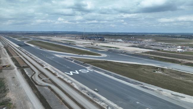
Western Sydney Airport is on track for completion by the end of 2026, with 15 million people expected to use the gateway by 2033.
Earlier this month, Qantas chief executive Alan Joyce joined Prime Minister Anthony Albanese at the construction site to announce both Qantas and Jetstar would operate from Western Sydney.
The airport has already been bestowed with its three-letter identifier of WSI by the International Air Transport Association in recognition of its importance to the Australian aviation industry.
Originally published as Western Sydney Airport flight paths released, giving residents their first look at what’s ahead


