‘Still icy’: Aussie cold snap to worsen
After freezing temperatures across Australia last week, the sun is forecast to shine again — but the reprieve won’t last long.
Environment
Don't miss out on the headlines from Environment. Followed categories will be added to My News.
After near-freezing temperatures from Queensland to Tasmania last week, the sun is forecast to shine again Down Under — but the reprieve won’t last long.
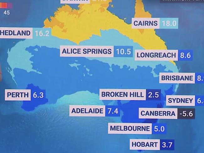
Parts of NSW shivered through their coldest June mornings in 23 years on Wednesday as the winter cold change hit new extremes.
Early recordings from the Bureau of Meteorology put minimum temperatures across most of Sydney, except for the Airport, Observatory Hill and Harbour, below 5C.

BOM readings reported Camden, also in the southwest, dropped to -2.3C before 7am on Wednesday.
Sydney Observatory Hill reached 5.2C on Wednesday morning — the coldest June day since 2000.
The central west and tablelands towns all dropped to overnight minimums below freezing, with Orange plummeting to -6.6C, Dubbo to -4.7C, and Mudgee the coldest of them all at -6.9C

And although the below-average temperatures will continue for a few more days, sunnier skies are coming.
BOM meteorologist Miriam Bradbury told news.com.au temperatures were not expected to be “quite as icy” this weekend.
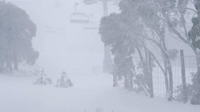
A wet weather system that swept the country this week, leaving frosty precipitation and alpine snow in its wake, is forecast to move across the bite, towards southern Australia and eventually offshore, according to Sky meteorologist Bradlyn Oakes.

Cold and showery conditions are forecast to continue in Sydney through Thursday and Friday before clearing, making way for a sunny weekend. Minimum temperatures in the city are expected to rise slightly to between 8C and 9C on Saturday and Sunday, with Sunday warming up to a much friendlier 21C.
The clouds are also expected to clear in Brisbane before the weekend, with both Friday and Sunday forecast to reach a balmy 27C. Maximum temperatures should continue to hover in the mid-20s well into next week.
Temperatures in Canberra — which fell to -7.2C on Wednesday, the coldest June morning in the capital since 1986 — will rise slightly to hover just above zero. Zero degrees Celsius is the expected minimum on Thursday, warming to between 2 and 3C over the weekend before dropping back down to zero by Wednesday next week.
Melbourne, too, will experience a sunnier weekend, with maximum temperatures of 14C on both days. The reprieve won’t last long in Australia’s second city, though, with a second wet weather system bringing rain on Monday that’s expected to linger into mid next week.
A showery cloud band stretching across the western two thirds of Australia is bringing low to moderate rainfall to WA, NT, and SA over the coming days. For detailed forecasts visit our website: https://t.co/jlOoTZL1iFpic.twitter.com/dlcy0wxeK6
— Bureau of Meteorology, Australia (@BOM_au) June 20, 2023
In Perth, which has shouldered much of the past week’s rain, showers are forecast to continue through the weekend before clearing on Monday. Temperatures will stay low, with highs below 16C all week long.
Adelaide residents won’t be so lucky, with a second wet weather system sweeping through SA almost as soon as the first one clears. Cold and wet conditions are forecast every day for the next week in Adelaide, with strong winds also expected on Saturday.
Hobart, too, will stay rainy and cold aside from a brief smattering of sun on Sunday. Light showers are forecast every day until Wednesday, with stubbornly low minimum temperatures of between 5 and 7C.
Darwin, meanwhile, has stayed steadfastly warm with full sun or light cloud cover expected every day for the next seven days. Maximum temperatures will remain in the low 30s, while minimums are forecast to hover between 20 and 23C.
Originally published as ‘Still icy’: Aussie cold snap to worsen


