
Sydney freezes through coldest June morning so far, as NSW records near -7C temperatures
Parts of Sydney have shivered through their coldest June morning in 13 years as Australia’s cold change hits new extremes.
Parts of Sydney have shivered through their coldest June morning in 13 years as Australia’s cold change hits new extremes.
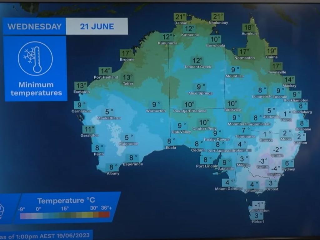
Early recordings from the Bureau of Meteorology have minimum temperatures across most of Sydney, except for the Airport, Observatory Hill and Harbour dropping below 5C on Wednesday morning.
Even so, bureau meteorologist Miriam Bradbury told news.com.au, that made this the coldest morning of June 2023.
“Looking a bit more broadly over the Sydney suburbs, Campbelltown – though it didn’t have the coolest record in five years, it is the most impressive at -1.6 degrees,” Ms Bradbury said.
BOM readings reported Camden, also in the southwest, dropped to -2.3C before 7am on Wednesday.
Sydney Observatory Hill reached 5.2C on Wednesday morning - the coldest June day since 2000.
“More broadly across NSW, quite a bit of NSW, the west and Central Tablelands had their coldest mornings in five years,” Ms Bradbury added, pointing to Orange, Dubbo, Mudgee and Bathurst as particularly “chilly”.
The central west and tablelands towns all dropped to overnight minimums below freezing, with Orange plummeting to -6.6C, Dubbo to -4.7C, and Mudgee the coldest of them all at -6.9C
“And it’s cold not just across inland NSW, but northern Victoria, Tasmania and Queensland have widespread temperatures dropping below zero,” Ms Bradbury said.
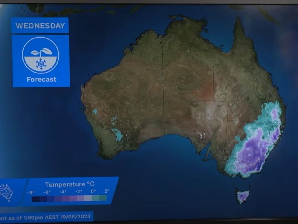
Temperatures will drop well below freezing in parts of Tasmania, Victoria, the ACT and NSW, reaching record-breaking lows early on Wednesday, bringing with them widespread frost
And although it might have made waking up a nightmare for many in the southeast the cold burst has brought much-needed snowfall to Australia’s ski resorts in what has been a slow start to the ski season.
On Wednesday Melbourne also woke to a similarly frosty morning as Sydney, hitting a low of 4C. Hobart, meanwhile, dropped to 2 degrees and Canberra was the coldest of all, with temperatures expected to drop to -5 degrees.
Ms Bradbury explained that the colder temperatures were hanging around due to a high pressure system that followed an initial cold front that moved through on Monday.
The high pressure system, the meteorologist explained, “tends to slow down, recirculate air” meaning that cold air has not had a chance to shift for a few days.
And although the below-average temperatures will continue for a few more days, temperatures are not expected to be “quite as icy” as they have been this week.
Ms Bradbury said forecasts could be closer to “1 or 3 degrees below average, not ...up to 8 or 10 below average” as they were this week.
“It may still be a bit cooler along the south coast but inland it is becoming milder,” she continued.
“We are still likely to have frost in some areas, but much smaller areas; and we are not necessarily expecting widespread subzero temperatures.
“We’ve seen the worst of it. Temperatures are gradually improving as we continue to the weekend, we will see large parts of the southeast coming close to above average.”
Sydney is set to see minimum temperatures of 7 and 8 degrees Celsius on Saturday and Sunday, respectively and single-digit lows right into next week.
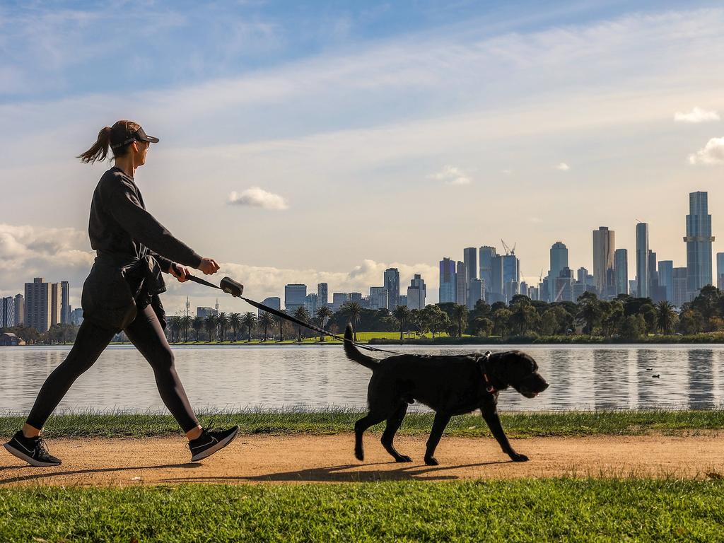
In Melbourne, showers are expected in the city on Thursday and Friday, while minimum temperatures aren’t forecast to break 10 degrees until at least the beginning of next week.
Showers are also forecast in Tasmania from Thursday and will last right through the weekend.
Canberras sub-zero mornings are set to continue, with the nation’s capital expected to wake up to a -1C morning on Thursday.
A silver lining in this cold burst is the much-needed snowfall it brings to Australia’s ski resorts in what has been a slow start to the winter holiday season.
Meanwhile, across the country in WA, a rain band has formed and will sweep eastwards, bringing rain to almost all of Australia.
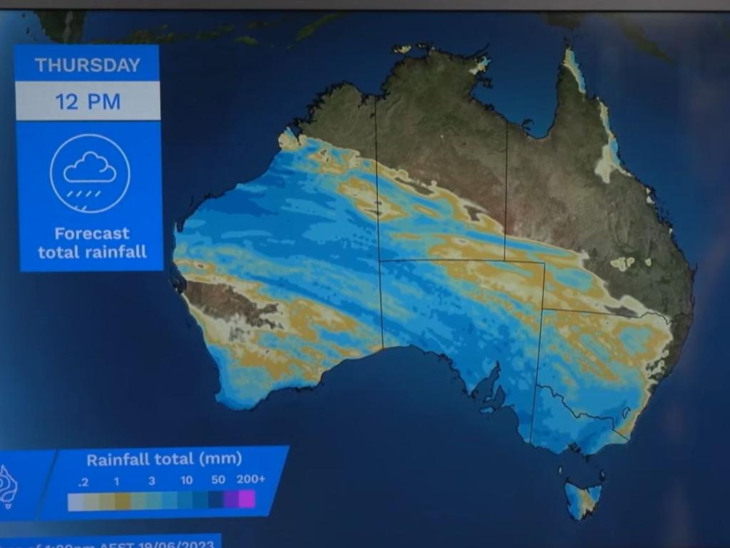
Perth will shoulder the brunt of that rain band right into next week, with more than an 80 per cent chance of showers forecast every day until Sunday. Minimum temperatures are expected to hover between 6 and 10 degrees Celsius, and maximum temperatures between 15 and 17 degrees Celsius.

The rain will move into SA from Wednesday, with showers forecast in Adelaide right into the weekend. Thursday will be icy, with a low of 9 degrees Celsius and a high of 14.
Brisbane will start the week cold and clear, with skies and minimum temperatures of between 8 and 9 degrees Celsiu through to Thursday. Though it’s expected to stay sunny, cold air will keep minimum temperatures below 13 degrees all week long.
Darwin will stay warm and dry, with maximum temperatures above 30 degrees Celsius all week and minimums in the 20s. Residents can expect cloudy conditions throughout the week, clearing up into a sunny weekend.
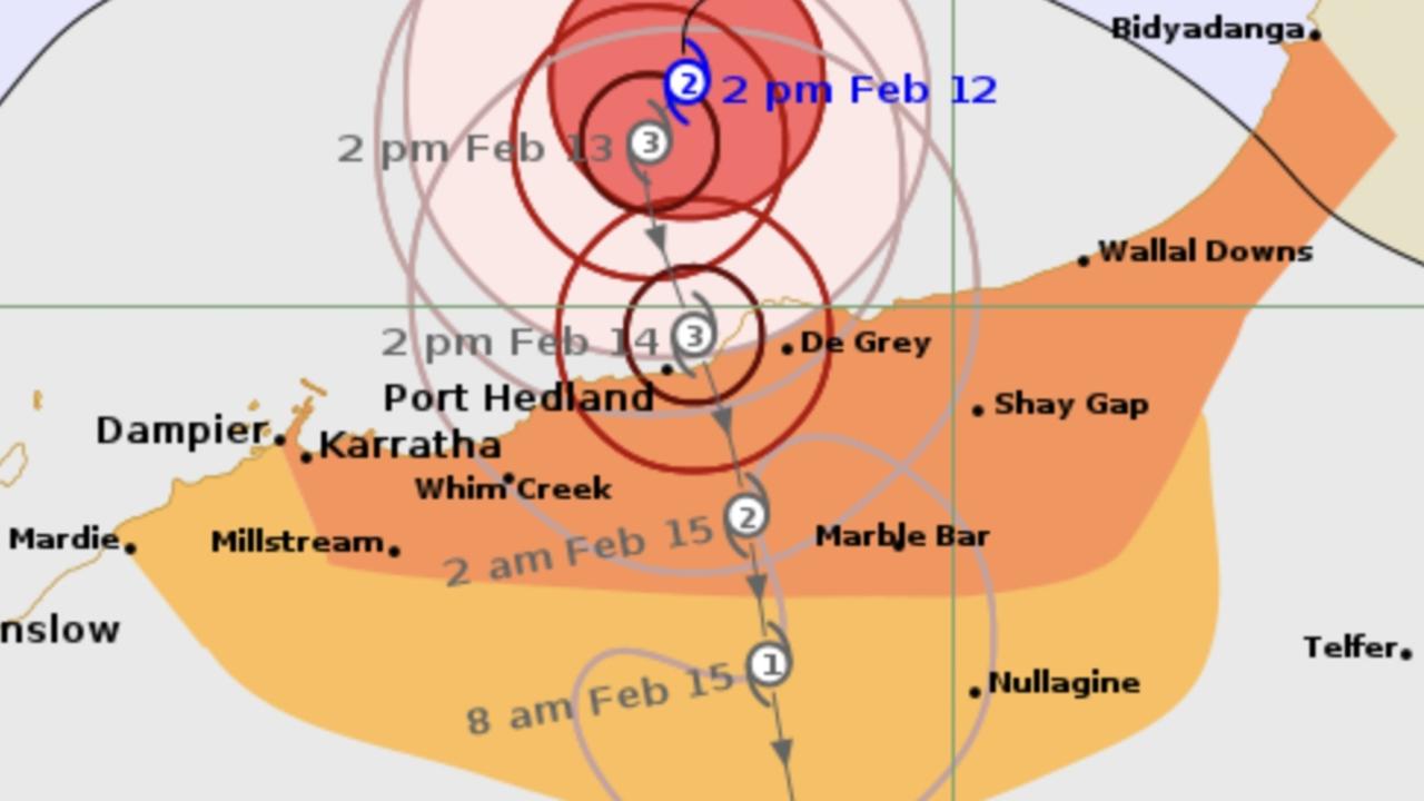
Thousands brace for ‘destructive’ cyclone
Residents are gearing up for days of wild weather as Tropical Cyclone Zelia is expected to cross the coast over the coming days.
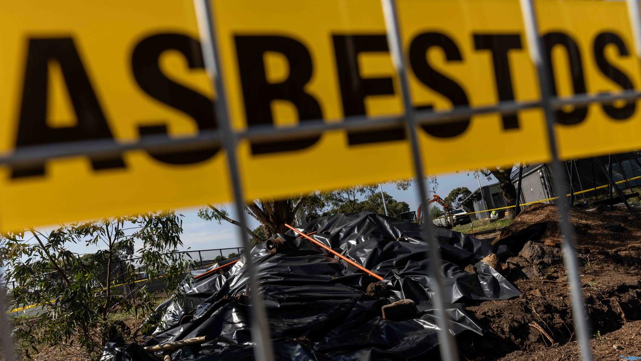
Building company fined for asbestos dumping
A construction company has been fined after providing false information to authorities about dumping asbestos at a property.
Major city swelters as temp soars to 43C
Aussies in one state are being urged to keep cool as temperatures climb above 40C while other parts of the country battle bushfires.