
Oakey, Toowoomba, Cecil Plains, Jondaryan and Leyburn hold World War II history
Did you know there were 18 designated air raid shelters across Toowoomba during World War II? What about heavy bomber airfields and a notorious detention centre? Find out about our WWII Darling Downs history here.
Toowoomba
Don't miss out on the headlines from Toowoomba. Followed categories will be added to My News.
The outbreak of World War II saw numerous shelters, detention barracks, airfields and facilities erected to support the nation against a possible invasion.
Ahead of Anzac Day, The Chronicle has compiled a list of World War II locations across the district, some of which have been filled in or converted.
AIR RAID SHELTERS
About 18 official air raid shelters were established throughout Toowoomba, however many residents constructed their own in backyards.
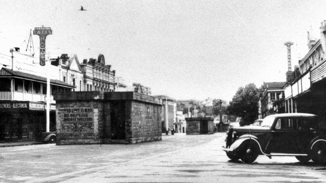
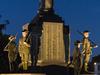
Multiple air raid shelters were established along Ruthven and Margaret Streets, with one in front of the Tatts Hotel, Old Post Office Building, and near the Mother’s Memorial in Queen’s Park.
While those shelters have been dismantled, a bunker in Queen’s Park has now been converted into a public toilet block.
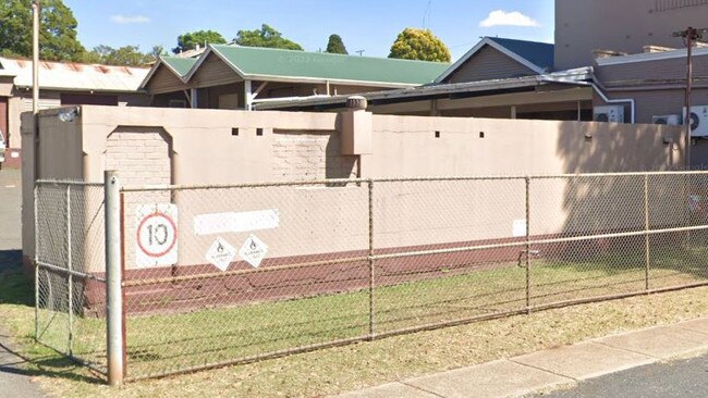
According to The Queensland Government, there are also two shelters at the Toowoomba Railway Station.
The Toowoomba Railway Station’s public air raid shelter, constructed of brick and concrete, is located on the west side of the car park outside the railway station building, and can still be seen today.
There is also a smaller concrete shelter located on the northern platform near the honour board, which was designed for the use of railway employees.
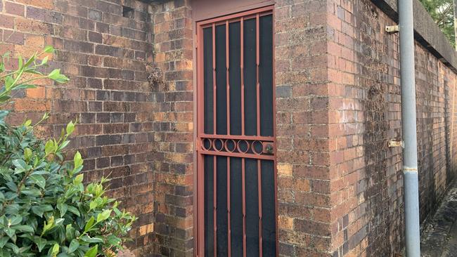
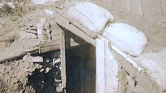
A concrete air raid shelter survives off Mort Street, Toowoomba, south of the former Bulimba Brewery which is now the McDonald Printing Group.
An entrance towards the street has been bricked up, but the size and shape of the structure is typical of the public air raid shelters built in early 1942. Ventilation holes are still visible at intervals along the top of the wall facing the street.
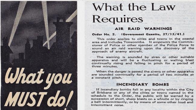
FUN FACT: The owners of any building in the coastal areas of Queensland (Toowoomba included) with over 30 people normally present at any one time were required to build shelters either within the building or adjacent to it.
A dug out air raid shelter was also constructed on the Corner of Tomkinson and Greenwattle Streets, with the bunker now filled in.
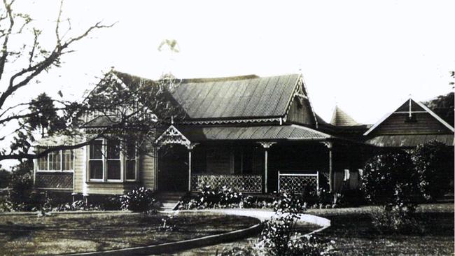
An air raid shelter was also established where Federation Park now sits south of Toowoomba, while the former Mylo Private Hospital on the corner of Arthur and Mackenzie Streets had a constructed shelter in the garden.
DETENTION BARRACKS
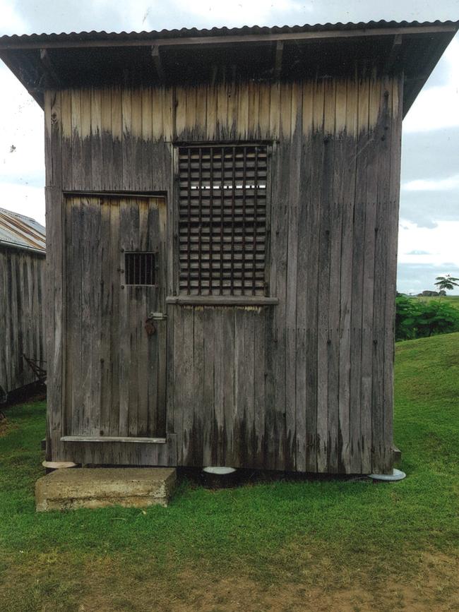
Warwick once had a detention barrack, which through its history, was the scene of violent riots and charges of mistreatment placed against officers.
The site of the Australian Army’s No 3 Army Detention Barracks is located on the south side of Warwick, east of the New England Highway and north of Filtcroft Street.
Quinn and Carmody Streets reportedly run across the site now, which has been subdivided and developed since the war.
AIRFIELDS
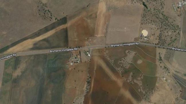
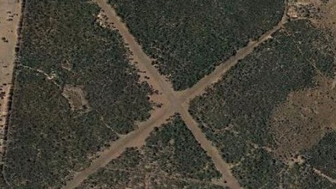
Brymaroo/Jondaryan Airfield consists of two runways and is visible west of Jondaryan/Nungil Road, with one runway north and the other south of Brymaroo-Irvingdale Road.
The airfield was known as Heavy Bombardment Field No 1, and was used for heavy bombers to land, should Australia be invaded near Brisbane.
Cecil Plains Airfield is located north of the township and to the west of Dalby-Cecil Plains Road. The airfield is still visible from the sky, which was also to be used by heavy bombers should they be required.
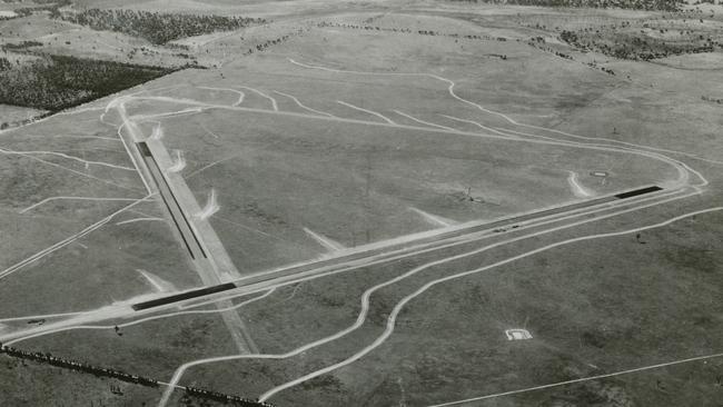
Leyburn Airfield sits north of Leyburn between Wirraway Ave and Elerby Road, and was constructed in 1942 to provide a landing spot for heavy bombers if the nation was invaded.
The Australian Grand Prix was later held on the site in 1949.
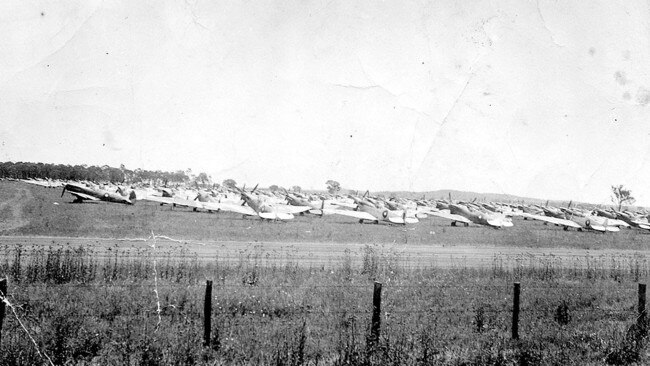
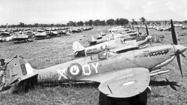
Oakey Aviation Army Base sits on the site of the Oakey Airfield used during World War II to provide the RAAF with what would become its 6AD (No 6 Air Depot). According to the Queensland Government, several RAAF Squadrons were formed and equipped with aircraft at the Oakey Airfield before proceeding north.
THE LEGEND OF THE SPITFIRES
For many years, it has been fabled that there are dismantled World War II spitfires buried under Oakey in old coal mines.
A group of people have been convinced of the burials for many years, with the first expeditions starting in 1980.
Disused mines, with entrances later filled in across the township, fuelled the mystery, with Oakey used as a storage base during World War II, in preparation of a Japanese invasion into Brisbane.
While many believe the township has secrets beneath its surface, the containers of plans have still not been located.
Have we missed other World War II hot spots across the Darling Downs? Let us know at toowoomba@news.com.au.
More Coverage

Originally published as Oakey, Toowoomba, Cecil Plains, Jondaryan and Leyburn hold World War II history

Man killed after he was crushed under ute
Tragedy has struck a community after a car fell on top of a man.

‘I’ll stab some c**ts’: Serial flasher attacks third victim, threatens public with knife
A man with a history of exposing himself in public, terrified passers-bys when he threatened to stab people in a busy train station.