
Multiple storm cells smash SEQ as state braces for 44C temps
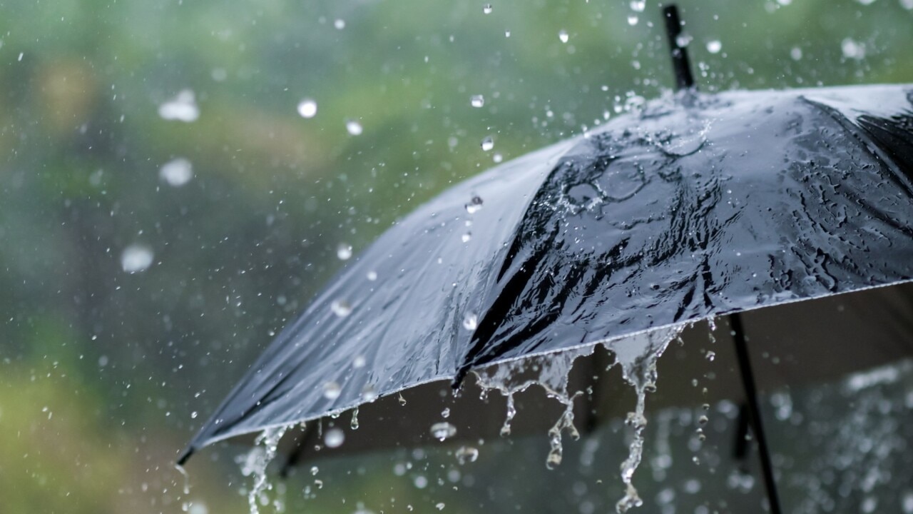
Severe thunderstorms hit parts of South East Queensland on Tuesday, with almost 100mm dumped. It comes as the state braces for multiple days of 44C.
QLD weather news
Don't miss out on the headlines from QLD weather news. Followed categories will be added to My News.
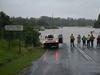
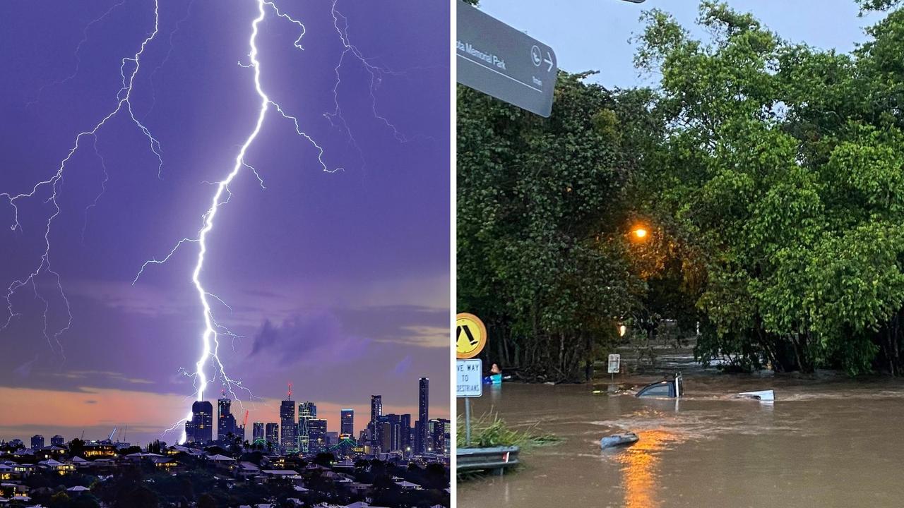
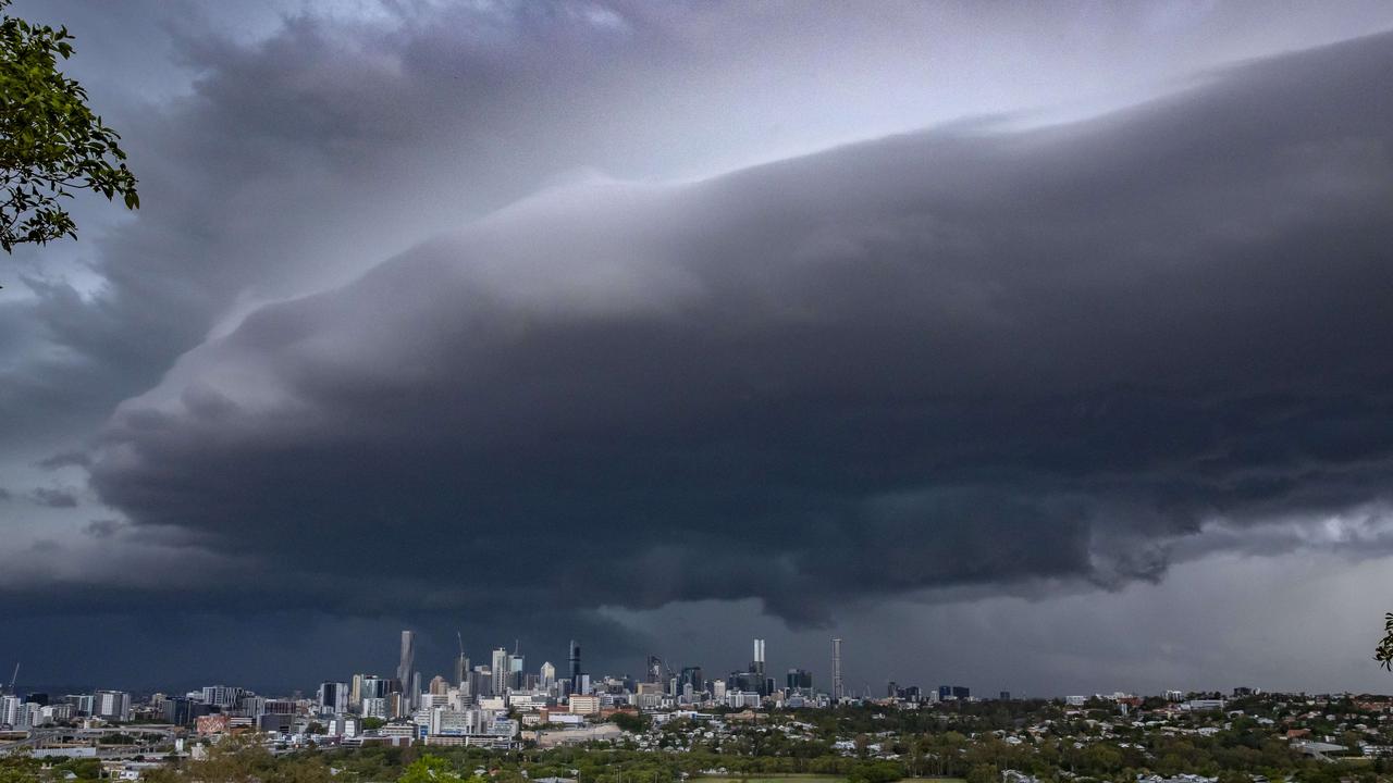
Dangerous thunderstorms smashed the South East on Tuesday as humidity and temperatures rise statewide, with some areas receiving almost 100mm of rain in an hour.
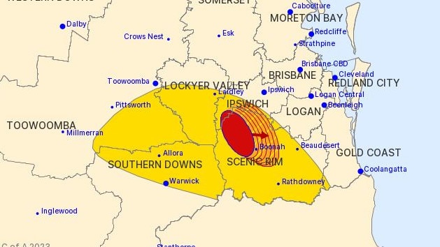
The Bureau of Meteorology warned residents in the Ipswich, Scenic Rim, Southern Downs, Toowoomba, Lockyer Valley and Gold Coast Council Areas could face deadly flash flooding. All warnings were cancelled by 6.50pm but thunder could still be heard in parts of Brisbane at 7.20pm.
Before their cancellation, the latest warning had said severe thunderstorms were detected near Aratula and Rosevale at 5.55pm and were moving eastwards toward Boonah and Harrisville and then Beaudesert, Kooralbyn, Peak Crossing and the area south of Amberley.
The Bureau had warned of damaging winds and heavy rainfall that may lead to flash flooding after 96mm of rain fell at Innisplain in the hour to 5.30pm, while Rathdowney recorded 78mm in the hour to 5:15pm.
Two severe storm cells had earlier hit the western reaches of the Scenic Rim while the other reached the Gold Coast hinterlands before being killed by stable sea breeze air as the storms weakend.
Storms also hit south of Warwick and Toowoomba affecting Dalveen, Killarney, the area south of Helidon and the area west of Toowoomba over Tuesday afternoon.
The Bureau also warned that people in parts of Darling Downs and Granite Belt and Southeast Coast Forecast Districts should also prepare for severe thunderstorms as 45mm of rain fell in the 30 minutes to 4:45pm at Spicers Peak.
A moist and unstable air mass across southeast Queensland and an upper trough over southeast Australia enhanced the thunderstorm risk over Tuesday afternoon for Boonah, Allora, Clifton, Beaudesert and Laidley.
These warnings came after overnight humidity made for a sticky night’s sleep in across the state and Bureau of Meteorology forecaster Brooke Pagel warned that the South East could expect more of the same.
“We have a trough system at the moment that is stretched from Mount Isa down to Stanthorpe,” she said. “We are looking at that bringing a lot of heat down from the north.”
Ms Pagel said overnight temperatures will vary from 22C to 23C across SEQ, but the trough will also bring down a lot of moisture which will make it quite humid.
“That will make it feel a little bit warmer than the temperature is,” she said.
“We are pretty much going to see the pattern repeat right into the weekend.”
A scorching hot Australia Day is in store for Western Queensland, while thunderstorms could dampen celebrations in the state’s South East.
The Bureau of Meteorology’s Danny Teece-Johnson said while no heatwave warning had been issued for January 26, hot north-easterly winds would blow in above 40C temperatures across Channel Country this week.
Thunderstorms forecast #QLD 24 Jan: Severe Thunderstorms possible in the southern and southeastern interior incl #Toowomba#Warwick#Dalby#Roma#Charleville and inland #SEQLD. Heavy rainfall, damaging winds & large hail are possible. Warnings when issued https://t.co/5lziPnXn5Ppic.twitter.com/F8MN7slJPO
— Bureau of Meteorology, Queensland (@BOM_Qld) January 23, 2023
“Birdsville is looking like the hottest; it’s seeing 44C there on Wednesday, Thursday and Friday,” Mr Teece-Johnson said.
“There’s no real change over the week for that region. They’re going to see a lot of high temperatures.”
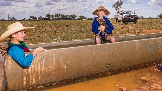
Quilpie is set to hit 40C on Australia Day, but for local farmer Louise Hoch, it is no excuse for a day off.
“It’s just another day for us, the work doesn’t stop – particularly with livestock,” Ms Hoch said.
“We’ve got beef cattle, goats, and we’ve been doing a lot of fencing lately.”
Children Abbie, 11, and James, 9, were excited for a day off school.
Ms Hoch said while they would be chipping in with whatever work needed doing, there might be time to cool off with a swim.
“The weather’s been great this summer; it doesn’t need to get hotter,” she said.
“If it’s hot then it’s straight to the lake – it’s always nice and cool in the lake.”
Brisbane, Gold Coast and Sunshine Coast will be spared the hottest temperatures, with highs in the low 30s this week.
But the Bureau said warned Queenslanders that more heat, humidity, showers and possible storms could dampen afternoon barbecues on the public holiday.
“A lot of the severe weather will stay to the west of Brisbane because of the south-easterly winds we’re getting,” Mr Teece-Johnson said.
“But this time of year, we get that build up to rolling thunderstorms, so some afternoon storms are possible on Thursday.”
In good news for those planning a long weekend, forecast showers in the South East remain minimal with expected rainfall up to 2mm.
“It’s very summer weather, very beachy weather,” Mr Teece-Johnson said.
Severe thunderstorms could hit some of the Darling Downs and Maranoa region, and damaging winds are possible, particularly around Charleville.
Meanwhile, average temperatures are expected in northern and central parts of the state, with mostly dry conditions a welcome reprieve after a record-breaking amount of rain in recent weeks.
‘Everything was on fire’: Teen recounts being struck by lightning
A Southeast Queensland teen has recounted the horrifying moment she was struck by lightning during last night's wild weather, which saw her and another woman raced to hospital.
SEQ to be lashed with storms, 100mm downpour ahead of Anzac Day
Showers and storms are forecast to soak South East Queensland on Thursday afternoon with lingering rain expected to fall on Anzac Day Dawn Services and marches.