
Brisbane weather: Bureau of Meteorology forecasting week of rain and severe thunderstorms
Storms remain active in Queensland tonight after tornadoes. hail and heavy rain earlier slammed parts of the state. SEE PICS, VIDEO
QLD weather news
Don't miss out on the headlines from QLD weather news. Followed categories will be added to My News.
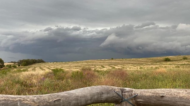
Tornadoes, golf-ball-size hail and 51mm of rain in 30 minutes have been recorded in Queensland today as a storm risk remained for the Gold Coast following heavy rain in the southeast.
A weather system moving into the southeast was expected to bring up to 40mm of rain.
Weather bureau meteorologist Pieter Claassen said while the systems were weakening, the region could expect some decent rainfall of around 20mm to 40mm on Monday evening.
SCROLL DOWN FOR THE LATEST ALERTS
“The system is moving very slowly so we should get some good rainfall out of it,” he said.
“It will continue to move offshore but there may be one or two storms sticking around tomorrow morning.”
It comes after tornadoes were spotted at Pittsworth near Toowoomba and Bracewell near Gladstone, while hail has also fallen in the Toowoomba and central Queensland regions.
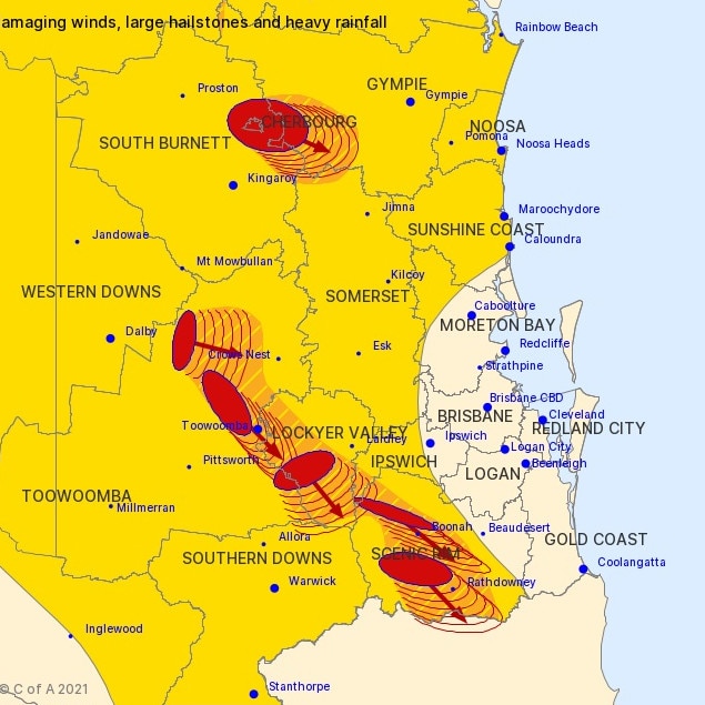
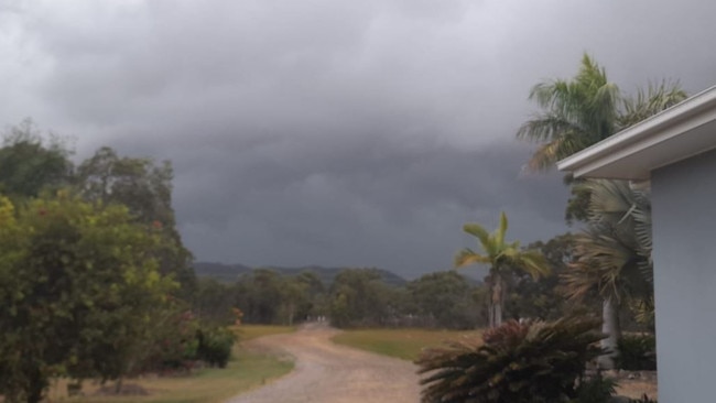
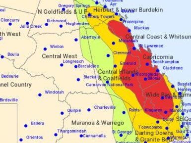
The Bureau of Meteorology earlier warned severe thunderstorms could impact much of Queensland on Monday, as well as a large swath of the east coast from Cooktown to the NSW border.
Sky News meteorologist Rob Sharpe warned of “nasty” thunderstorms delivering destructive winds over 125km/h and “giant hail”, particularly in the state’s central east, with the likelihood of multiple supercell storms developing along the stretch between Mackay and Bundaberg.
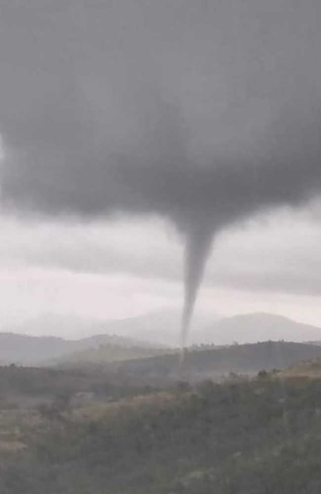
A tornado was photographed at Bracewell near Gladstone, as multiple severe thunderstorms developed about 10am on Monday, while golf-ball-size was reported at Mt Larcom, west of Gladstone, and Centenary Bridge on the Darling Downs recorded 51mm of rain in just 30 minutes.
A very dangerous supercell was been reported near Pittsworth and Mt Tyson southwest of Toowoomba, with reports of a tornado being seen.
The Bureau of Meteorology confirmed it had received reports of tornado activity from residents and it would thoroughly investigate the claims.
A video was posted to Facebook of a tornado reportedly near Pittsworth:
A confirmed tornado has briefly touched down near Pittsworth QLD at 10.40am this morning captured by HSC Contributor Colin G. There are no reports of damage or injuries at this time - Video via our partner page: https://t.co/X61Fn5Fpjupic.twitter.com/ROlMoN4lGz
— Severe Weather Australia (@SevereWeatherAU) October 18, 2021
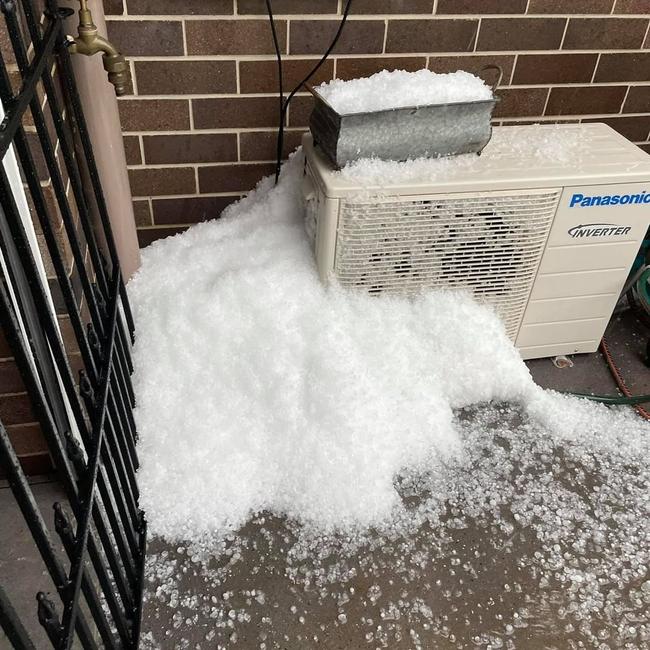
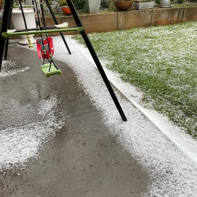
Further north, where golf-ball-size hail was recorded at Mt Larcom, resident Michelle Wheatcroft said the hail at East End in the Gladstone region was “crazy”.
“The hail here was crazy. Haven’t seen hail like it for years,” she wrote on social media.
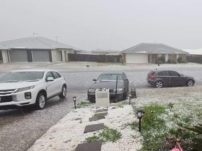
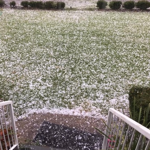
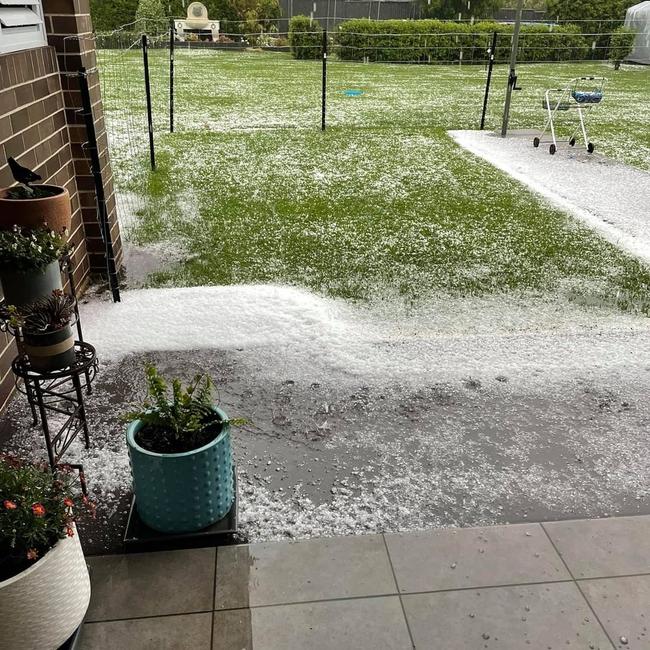
Communities outside Toowoomba have been smashed by a massive hailstorm as part of a severe weather system moving through the region.
Cambooya resident Alyce Nelligan captured the incredible footage of hail raining down, turn the neighbourhood completely white.
She said the hail was so thick she could barely see the houses across the street.
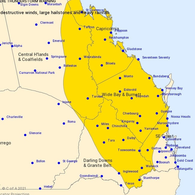
LATEST SEVERE THUNDERSTORM WARNINGS
An ealier severe thunderstorm warning for South East Queensland and the Gold Coast in particular has been cancelled but a warning remains in place for the Capricornia area.
At 8.02pm the Bureau of Meteorology warned that a small cluster of strong to severe thunderstorms had developed over parts of southern Capricornia.
“Severe thunderstorms may produce damaging winds and large hailstones in the warning area over the next several hours. Locations which may be affected include Gladstone and Calliope.”
Meteorologist Pieter Claassen said that the most severe thunderstorm activity, including damaging wind gusts and hail, would impact Capricornia, the central coast and parts of the northern Wide Bay Burnett district.
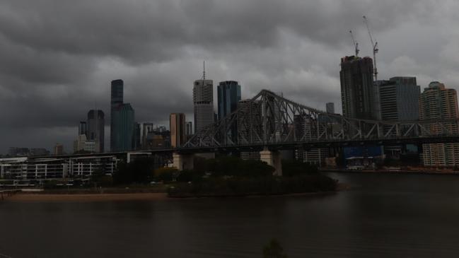
He said the most damaging storms were expected to narrowly miss Brisbane.
“If we do get a severe storm in Brisbane it’s most likely going to be heavy rainfall rather than damaging wind gusts or large hail,” he said.
Mr Claassen said the driver of the weather was an upper trough coming across central and parts of southeast Queensland.
“We are expecting close to 50mm in the first half of the week,” he said.
“But the risk will be disappearing almost entirely by Thursday,” he said, adding Brisbane would experience “very, very warm” weather.
“Mount Isa’s forecast is in the 40s for the entire week, it’s not very pleasant over in the west of Queensland, and that heat will be transferred east with as that trough comes across,” he said.
More than 40mm could fall in Brisbane on Monday and Tuesday, with another 10mm on Wednesday.
The rain will be widespread, with Ipswich set for a 30mm drenching on Monday another 20mm on Tuesday, while Surfers Paradise can expect 40mm over three days.
The Sunshine Coast is forecast to get 15mm on Monday and 20mm on Tuesday.
BOM is forecasting the showers to persist all the way through to Saturday, with maximum temperatures in the high 20s before peaking at 32C at the weekend.

Feels like -5.3C: Icy blast sends temps plummeting again
South East Queensland has again shivered through a freezing start to the day, as a brutal cold front continues to blast the region with subzero temperatures, made worse by chilling winds.
Read more

Feels like MINUS 7.1C: Brutal cold front blasts southern Qld
A brutal cold front is blasting across southern Queensland with subzero temperatures and widespread frost.
Read more