
Weather bureau officially declares end of El Nino, as severe rainfall forecast looms for Qld
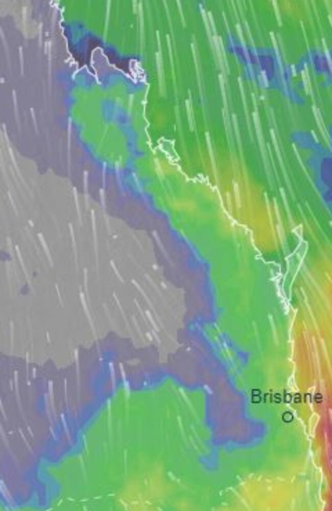
An 1100km stretch of the Queensland east coast including the southeast is being warned to expect intense rainfall and possible flooding as early as Thursday, coinciding with the end of El Nino.

QLD weather news
Don't miss out on the headlines from QLD weather news. Followed categories will be added to My News.
Severe thunderstorms have been forecast for parts of the South East tomorrow with the threat of heavy rainfall, large hail and damaging wind gusts looming large.
The Bureau of Meteorology put out Thursday’s forecast about 4pm for regions in the Border Ranges, Granite Belt and possibly in SEQ.
Severe thunderstorms with heavy rainfall are also possible for the northeast, the warning read.
It comes as weather bureau has officially declared the end of El Nino, as the threat of a significant rainfall event looms for Queensland.
In a statement, the Bureau confirmed that the Pacific Ocean had changed to ENSO neutral conditions, marking the end of the El Nino climate pattern.
“The tropical Pacific Ocean has returned to ENSO-neutral according to the latest monitoring by the Bureau of Meteorology,” the statement read.
“The change to ENSO (El Nino-Southern Oscillation) neutral conditions means neither El Nino nor La Niña are active.
“The long-range forecast is the best guidance for future rainfall and temperature beyond the short-term weather forecast.”
⛈ï¸Thursday's forecast: severe thunderstorms with heavy rainfall, large hail, damaging wind gusts are likely over the Border Ranges and Granite Belt, and possible in #SEQLD. Severe thunderstorms with heavy rainfall are possible in the northeast . Warnings: https://t.co/FBmpsInT9opic.twitter.com/xfrb1YnwsC
— Bureau of Meteorology, Queensland (@BOM_Qld) April 17, 2024
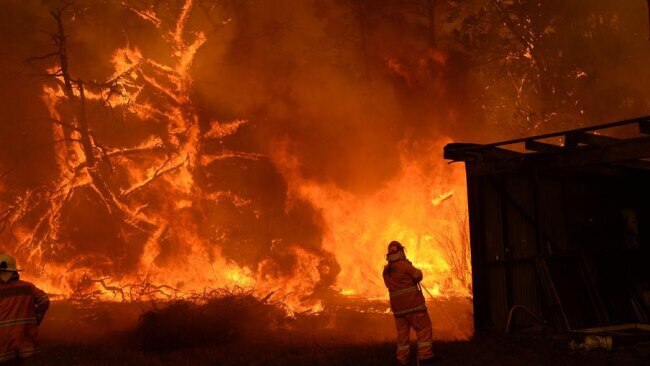
Sky News Weather meteorologist Rob Sharpe said while El Nino had not been influencing Australia’s weather patterns for many months now, it did have an impact during the horror bushfire season Queensland experienced last year.
“El Nino was part of the reason why Australia had a particularly dry August to October period,” Mr Sharpe said.
“I would think that El Nino had a part to play in exacerbating the fire risk that we saw back in spring last year in Queensland.
“Looking back on it El Nino was one of the factors adding to that fire risk in Queensland.”
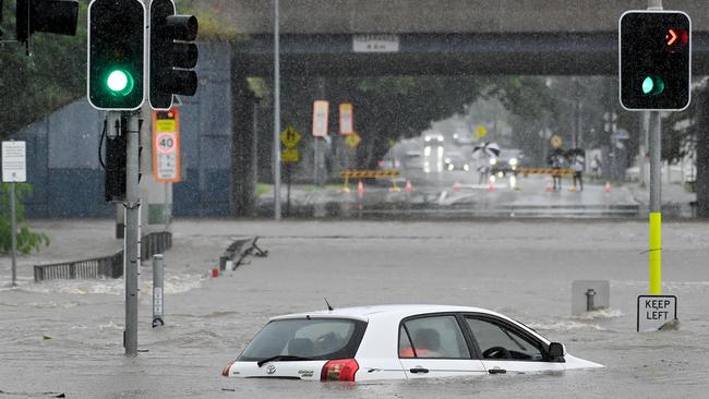
Mr Sharpe said that following the end of El Nino, Queensland faces the immediate threat of a “significant rain event”, several months after severe thunderstorms caused significant flooding in South East Queensland.
“In the short term, there is actually potential for a significant rain event in Queensland that could kick off as early as this weekend,” he said.

“The zone for the rain event potential at this stage is from Mackay to the New South Wales border.
“There is still a fair bit of model uncertainty about how this weekend into the start of next week could play out, but there is potential that we could end up with heavy to possibly intense rainfall, there’s potential for flooding.
“In the last 24 hours, a number of models have started hinting there could be a substantial rain event on the way.
“It is definitely one that we’ll have to watch quite closely.”
In regards to the formation of La Niña, Mr Sharpe said it is a case of “wait and see”.
“The Bureau have said we’re likely to be in neutral conditions until July for the Pacific Ocean,” Mr Sharpe said.

“We’re in an inactive phase of the Pacific Ocean, but beyond July there is significant potential for us to move towards a La Niña event.
“But that’s a little bit of a wait and see.”
Read related topics:Weather

Ice ice baby: Spectacular images of unseasonal frost as Qld freezes
Queensland’s overnight temperatures will increase to double digits in the coming days, following the coldest start to winter in 16 years, bringing frost and ice to many regions. SEE THE PHOTOS
Read more

City’s coldest June start in 16 years, feels like MINUS 9.8C out west
Southeast Queensland is shivering through its coldest morning in more than 15 years but feels-like temperatures have dropped to insane levels in the southern inland.
Read more