
Ugly summer weather to continue as ex-tropical cyclone Ellie moves east
Parts of Queensland are likely to be hammered by a “severe storm outbreak” moving up from the south, as the state also braces for big falls from an ex-tropical cyclone.

QLD weather news
Don't miss out on the headlines from QLD weather news. Followed categories will be added to My News.
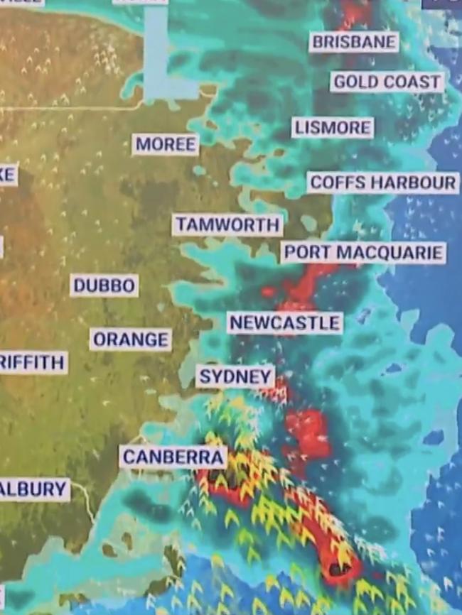
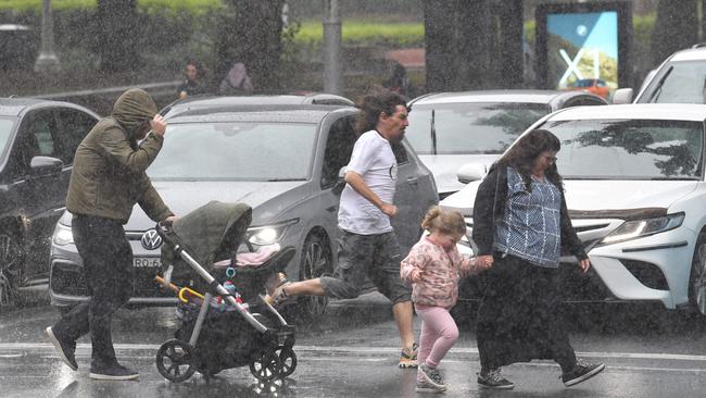
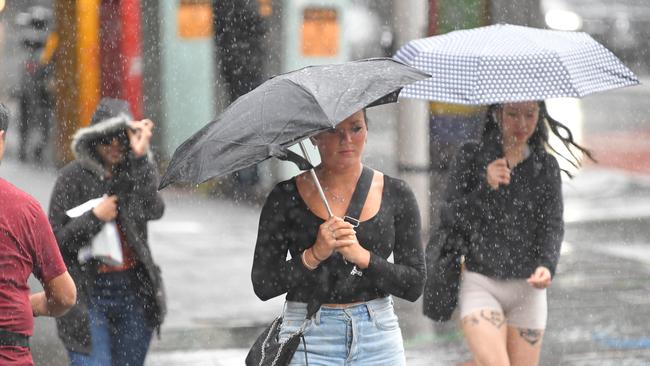
A “severe storm outbreak” is continuing across Sydney and up the east coast into Queensland, with more wild weather on the way as a damaging weather system moves across from the nation’s northwest.
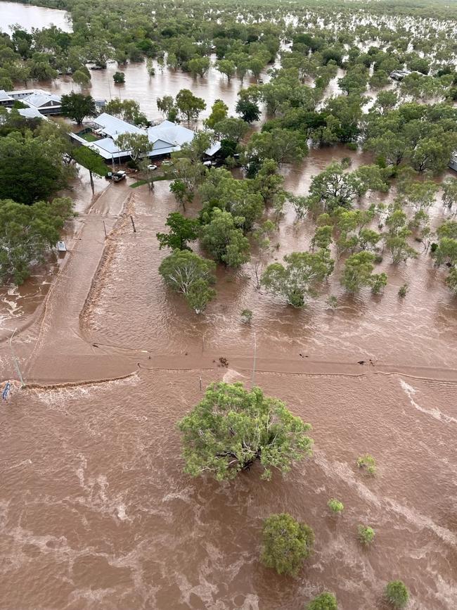
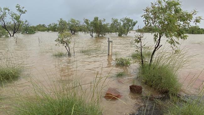
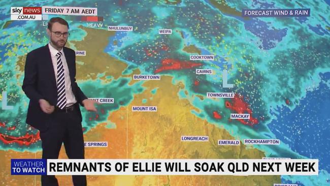
Ex-tropical cyclone Ellie will begin to move across the country on Friday from its current position over northern Western Australia, where it has caused the worst flooding emergency in the state’s history.
Thousands of residents and visitors have been stranded in Broome, which has been cut off by floodwater, while a flood watch has been put in place for the Sandy Desert, Tanami Desert and Western Desert regions.
The Bureau of Meteorology said ex-TC Ellie was currently just inland of Broome and moving slowly, but would soon take off.
“It will then rapidly move to the southeast across the southern Kimberley and North Interior during Friday, before reaching the WA/NT border in the Tanami Desert and Western Desert on Saturday,” the Bureau said.
“Moderate to heavy rainfall is forecast across the Flood Watch area, with 50 to 80mm and isolated totals of 120mm possible on Friday and Saturday.
“Heavy rainfall will result in significant river level rises and flooding of low-lying areas. “Some roads and possibly secondary highways are likely to be affected and communities may become isolated.”
Sky News Weather meteorologist Rob Sharpe said Ellie would “deteriorate a fair bit” as it travelled across the country, but would still lead to heavy rainfall of about 50mm in Townsville and Mackay, and as far south as Rockhampton.
“Its tropical moisture will move all the way into Queensland, maybe far northern NSW as well, with the risk of some heavy rainfall next week as that moisture lingers on,” Mr Sharpe said.
December 2022 rainfall was 33% above average nationally with the tropics experiencing above average rainfall and the southern half of Australia below average rainfall. The national mean temperature was 0.21°C below average. Learn more: https://t.co/dT7Zmn4pSspic.twitter.com/pmVG9ha8BD
— Bureau of Meteorology, Australia (@BOM_au) January 5, 2023
Severe storms would continue in Sydney on Friday, particularly in the Blue Mountains area, he said.
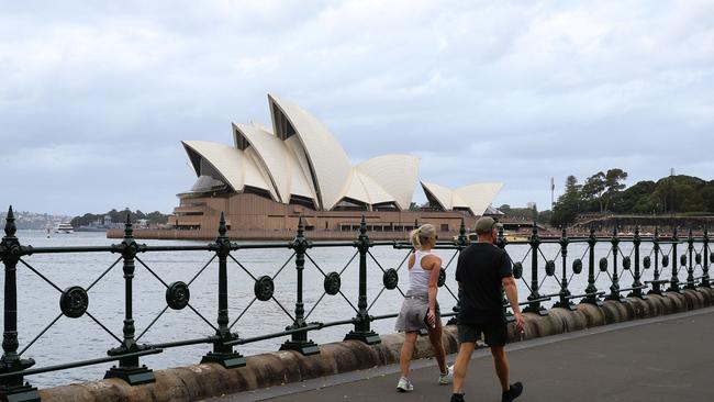
As the storms roll up the coast towards northern NSW and southeast Queensland, the weather in Sydney will improve, with sunny days of 25C and 27C forecast for Sunday and Monday after a Saturday with a medium chance of showers.
Canberrans have avoided the storm outbreak, with partly cloudy conditions forecast over the weekend and maximum temperatures building to a peak of 27C on Sunday.
The next four days in Melbourne will bring some of the city’s best weather all summer, with sunny days of 30C and 33C on Saturday and Sunday, followed by 29C on Monday.
Conditions will not be as warm in Hobart, but the Tasmanian capital will remain dry, with temperatures of 19C, 23C and 26C from Friday to Sunday, which will also be the sunniest day for the weekend.
Adelaide will be bone-dry over the weekend amid stinking hot conditions, with Saturday and Sunday to bring maximum temperatures of 36C and 37C respectively, while light winds tend north-easterly across the city, according to the Bureau.
Perth residents could be forgiven for being oblivious to the wild conditions in Western Australia’s north, with dry conditions ranging between 29C and 33C over the weekend and almost no rain in sight, except for a slight 10 per cent chance of a thunderstorm late on Tuesday.
Darwin’s next seven days all feature possible storms and maximum temperatures in the low 30s, but the heaviest rain will come on Friday as ex-TC Ellie remains influential in the region.
Up to 25mm could fall on Friday, while Saturday has a lower chance of morning and afternoon showers and possible rainfall of only up to 8mm.
Brisbane will also likely be unaffected by the movement of Ellie next week, with partly cloudy conditions and temperatures of 30C for the next few days before a moderate chance of showers later in the week around Thursday.
Originally published as Ugly summer weather to continue as ex-tropical cyclone Ellie moves east

Monster weather system brings storm, heavy rain to Qld
Brisbane and surrounding parts of the southeast have been hit by storms and heavy rainfall this afternoon as a 3000km-long monster low moves across the state.

Wild storms, polar blast as 3000km monster low barrels towards Qld
The system, which stretches 3000km from north to south and encompasses 30 per cent of Australia, is forecast to pack a punch when it hits Queensland.