
Tropical Cyclone Jasper set to make landfall on Wednesday
Tropical Cyclone Jasper has strengthened to a Category 2 storm and is expected to deliver a 500mm deluge when it makes landfall on Wednesday. Multiple emergency alerts have been issued
QLD weather news
Don't miss out on the headlines from QLD weather news. Followed categories will be added to My News.
Cyclone Jasper has intensified to a Category 2 cyclone and was expected to make landfall at Wujal Wujal, about 100km north of Port Douglas, Wednesday afternoon, the Bureau of Meteorology has confirmed.
The cyclone was tracked at 7pm Tuesday travelling north-northwest at 8kmh about 235km off the Cairns coast, producing wind gusts of 130kmh with centre winds reaching 95kmh. The Bureau said there was still a “small chance that Jasper will intensify to Category 3 prior to landfall”.
It is expected to dump 500mm of rain in just 24 hours, with residents in the impact zone warned to prepare for life-threatening flash flooding.
The tourist hotspot of Port Douglas is being warned to brace for flooding, with residents in storm surge areas told to be ready to leave their homes. Multiple emergency alerts were issued late Tuesday including for Yarrabah (destructive winds and heavy rainfall leading to flooding) and Wujal Wujal (destructive winds).
Residents of Wujal Wujal were on Tuesday night advised to “warn neighbours, secure belongings and seek safe shelter”.
Senior BoM meteorologist Laura Boekel some residents could wake up to gale force winds tomorrow morning.
“A category 2 system typically sees enough wind to bring up and down large trees and also move around large objects that have not been secured,” she said.
“It’s important to note too that gale force winds aren’t just gusts of winds that happen occasionally, but they can be consistent and sustained winds, so very strong winds occurring at a very consistent rate.”
The storm tide is expected to hit with the crossing, at “some stage late morning or early afternoon tomorrow”.
“We are likely to see with this system within a six hour period rainfall of up to 250 to 300mm,” Ms Boekel said.
“You could also see up to 500mm occurring within a 24 hour period for those areas in that watch and warning zone.”
Energy Minister Mick de Brenni had announced low lying areas will start to experience a drop in power from Tuesday afternoon to prevent damage to the energy grid.
“That means that residents in built up areas around CBDs in particular…could expect power to start being removed from the system later this evening and overnight,” he said.
“This is a preventative measure that is done to prevent damage to the systems, de energising those systems.”
He advised those with rooftop solar to switch off their systems now.

It comes as 18 arrival flights and seven departure flights have so far been cancelled at Cairns Airport ahead of the arrival of Cyclone Jasper, with the airport to shut down by the end of the day.
Chief executive officer Richard Barker said the airport was following its cyclone plan in line with advice from the weather bureau and was “progressively winding down” operations.
He urged both domestic and international travellers to stay away from the airport on Wednesday, as it would be closed due to the unsafe weather conditions.
“(Operations) will likely cease on Tuesday evening,” he said.
“Our domestic and international terminals will not be open on Wednesday 13 December.

“Please do not come to Cairns Airport on Wednesday.
“Operations will recommence when it is safe to do so.”
Qantas, Alliance Alliance, Regional Express, Jetstar and Virgin Australia have cancelled all flights scheduled to both arrive and depart from Cairns after 3.55pm Tuesday.
Travellers have been advised to contact their airline directly for flight updates.
At 11am, the system was sitting 245km east-northeast of Cairns, travelling at 12km/h.

The Bureau has warned destructive wind gusts reaching 140km/h will start affecting residents in Wujai Wujai, Wonga, Port Douglas, Cairns, Babinda, Innisfail, Ravenshoe, Herberton, Atherton and Mareeba from early tomorrow morning.
Heavy rainfall and flash flooding is expected to lash the north coast from Wednesday morning, with areas between Cape Flattery and Ingham forecast to receive at least 150mm within six hours or 250mm in 24 hours for areas situated along the coast.
The Bureau has warned isolated falls of 350mm are possible for areas in direct impact zones.
Cyclone Jasper is expected to develop into a category 2 cyclone by 1pm today.
It will remain a category 2 system until 7pm Wednesday night, before weakening back into a tropical low on Thursday.

Jasper remains a category 1, but the Bureau’s Brooke Pagel says it is likely to re-intensify and is expected to make landfall as a Category 2 system sometime on Wednesday within a 400km stretch of coastline between Innisfail and Cooktown.
“At the moment we are expecting landfall to be about lunch time tomorrow around Port Douglas, where the winds and rain will really ramp up,” she said.
“We are expecting gales with damaging wind from today as far north as Cape Melville, with up to 120km/h winds expected to develop along the Queensland coast from Cairns down to Townsville.”
It was earlier said heavy rainfall leading to flash flooding is forecast to develop Wednesday morning between Cape Flattery and Ingham, with six-hourly totals of 100-150mm likely, and isolated falls of 250mm along the coast and adjacent ranges possible.
“In the 24-hour period residents can expect 150-250mm of rainfall and possible isolated falls of 350mm,” Ms Pagel added.
When Jasper makes landfall on Wednesday, Ms Pagel said the Mackay coast to Cooktown coast would see the most marine impacts and storm surge impacts localised with the cyclone crossing.

“In terms of the swell, we won’t see much impact south of Mackay with the way [Jasper] is situated, only north of Mackay will really be feeling the impacts.
“Because the system is on a straight westward trajectory it won’t see too much impact on southeast Queensland.”
The Bureau has warned there is a slim chance of a severe category three crossing overnight Wednesday or Thursday morning.
“If it slows down enough to get the sea surface to warm up the core of the cyclone then we could see that category three severity.”
Cairns District Disaster Co-ordinator Acting Chief Superintendent Sonia Smith asked holidayers to reconsider travelling north and for those who were driving to keep up to date with road closures and flash flooding warnings.

Swiftwater rescue teams, extra police and power crews have all been deployed to the state’s north in anticipation of flooding and electricity outages.
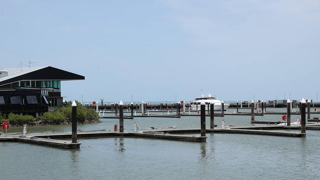
The Cairns Marina was evacuated with vessels ordered to take shelter in nearby creek systems.
Reef Runner Charters owner Dan Kelly, who runs fishing, diving and snorkelling tours, said all commercial activity had now ceased until after the cyclone had passed.
“Once we’re there (in the creek), we tie up as best we can and lock the doors and hope everything is OK,” he said.
“It’s forecast to drop off pretty quickly once it hits the coast but we’ll wait and see.
“Hopefully we’ll be back at work Saturday or Sunday.”
At Machans Beach in northern Cairns, Bob and Liz Adams were busy preparing their property for the expected storm surge with the help of their granddaughters, Zoe, 13, and Kyra, 15, Lashmore.

“We’re taping up all the windows and putting down sandbags and securing anything that could fly away,” Mr Adams said.
Down the street, Fin Patterson was busy boarding up the windows and securing loose items.
“I grew up here so I’ve been through a few (cyclones) before,” he said.
“I’m just strapping things down and tidying up.
“I noticed that there seems to be a lot of really relaxed attitudes about it but I think it’s better (to be prepared) just in case.”
The Machans Beach SES was busy delivering sandbags to residents along the foreshore on Monday as they prepared for the expected tidal surge in the beachfront community.
In Cairns, supplies of essentials including water and canned goods were dwindling but still available.
WHAT ARE THE CYCLONE CATEGORIES?
Category: 1 – Tropical Cyclone
Strongest gust: Less than 125 km/h. Gales
Typical effects: Minimal house damage. Damage to some crops, trees and caravans. Boats may drag moorings.
Category: 2 – Tropical Cyclone
Strongest gust: 126-164 km/h. Destructive winds
Typical effects: Minor house damage. Significant damage to signs, trees and caravans. Heavy damage to some crops. Risk of power failure. Small boats may break moorings.
Category: 3 – Severe Tropical Cyclone
Strongest gust: 165-224 km/h. Very destructive winds
Typical effects: Some roof and structural damage. Some caravans destroyed. Power failure likely.
Category: 4 – Severe Tropical Cyclone
Strongest gust: 225-279 km/h. Very destructive winds
Typical effects: Significant roofing and structural damage. Many caravans destroyed and blown away. Dangerous airborne debris. Widespread power failures.
Category: 5 – Severe Tropical CycloneStrongest gust: More than 280 km/h. Extremely destructive winds
Typical effects: Extremely dangerous with widespread destruction.
Source: Get Ready Queensland


Join the conversation

Ice ice baby: Spectacular images of unseasonal frost as Qld freezes
Queensland’s overnight temperatures will increase to double digits in the coming days, following the coldest start to winter in 16 years, bringing frost and ice to many regions. SEE THE PHOTOS
Read more

City’s coldest June start in 16 years, feels like MINUS 9.8C out west
Southeast Queensland is shivering through its coldest morning in more than 15 years but feels-like temperatures have dropped to insane levels in the southern inland.
Read more