Thunderstorms and above average temperatures across South East Queensland
Paramedics expect to treat up to 3000 patients today as extreme heatwave conditions grip Queensland ahead of potentially supercell storms this afternoon.
QLD weather news
Don't miss out on the headlines from QLD weather news. Followed categories will be added to My News.
Parts of Queensland are sweltering in 37C temperatures with paramedics admitting the sudden rise in temperatures has caught many off guard.
Clermont at 36. 4C was the hottest place in Queensland at 1.15pm, followed closely by Normanton and Moranbah, both at 35.8C.
In South East Queensland, Brisbane was 32.8C while Archerfield was 32.3C.
It comes as the Bureau of Meteorology warns of possible severe storms between Bowen and Gympie, with the threat of damaging winds, large hail and heavy rain.
More dangerous storms may develop between St Lawrence and Bundaberg.
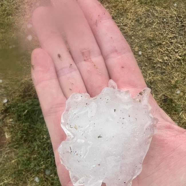
It comes after thousands were left without power as multiple storm cells hit parts of the state’s south on Sunday, with hail the size of cricket balls falling in some parts.
Queensland Ambulance Services clinical director Tony Hucker described the sudden heatwave as “pretty scary”.
“It has been a very mild start to spring to date, so today’s peak temperatures reaching 35 is pretty scary and that is why we are urging people to take care of themselves,” Mr Hucker said.
As the mercury rises, QAS recommends checking in on elderly neighbours and watching young babies for any signs of dehydration.
⛈ï¸Monday 21/11 Storm Forecast⛈ï¸
— Bureau of Meteorology, Queensland (@BOM_Qld) November 20, 2022
Possible severe storms between Bowen & Gympie today, w. localised damaging winds, heavy rain & large hail. More dangerous storms may develop between St Lawrence & Bundaberg. Warnings will be issued here, as required: https://t.co/sXDDGviQ21pic.twitter.com/FTQzDaSW4v
Mr Hucker said those living with chronic illness should limit their time outdoors and regularly sip cold water.
“Today as always is really busy for us, we are seeing around 3000 patients a day, when it gets really hot like this we see a jump in disease,” Mr Hucker said.
“If you are living at home with a chronic disease a hot day can make things worse, so make sure you are having a think about that and keeping yourself safe.”
Mr Hucker also urged those participating in Schoolies celebrations to watch their alcohol intake as they spend time outdoors.
“When we have schoolies on everyone is having a great time, we understand that, but you have to be careful about the amount of alcohol you take, alcohol is the worst thing you can take to rehydrate yourself,” Mr Hucker said.
Earlier, at 8.30am, the apparent temperature hit 32C in Nambour while the relative humidity was a sultry 98 per cent at Cunungra.
In Brisbane, it was 26.4C at 8.30am while it was 28C in Redcliffe, 26.4C on the Sunshine Coast and 29.2C at Beerburrum.
The Bureau has on Monday issued a fire weather warning from the Sunshine Coast to Gold Coast and extending west to Toowoomba.
Meteorologist Olivio Regano said fresh, dry west to south-westerly winds combined with warm temperatures are expected to cause elevated fire dangers over southeast Queensland on Monday.
“Hot and humid north-westerly winds have turned around to become dry south-westerly winds,” he said.
“Hot, dry, windy conditions are conducive to elevated fire danger.”
Brisbane is expected to reach a maximum temperature of 35C on Monday followed by Ipswich (35C), Gatton (34C), Redcliffe (34C), Gold Coast (33C), Maroochydore (32C), Toowoomba (29C)
Meanwhile, a severe heatwave warning remains in place for the Peninsula, North Tropical Coast and Tablelands and Central Coast and Whitsundays Districts.
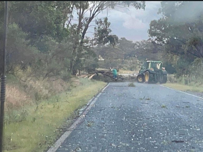
On Sunday afternoon, huge hail hit Westwood, in the Rockhampton region, while Red Hill near Biloela recorded 49mm of rain in the 30 minutes to 7.04pm.
Storms started rolling across Queensland’s south from about 3.20pm, with cells still lashing some areas at 5.45pm.
Energex reported more than 6200 customers were without power at 5.30pm, with the worst hit area being Brisbane, where 5726 customers were impacted, followed by the Somerset council area (423 customers) and Gympie (83).
In Brisbane, Nundah was the worst hit area with more than 2500 customers without electricity at the height of the outage at 5.30pm, followed by Taringa (1120 customers), Wynnum West (934 customers) and Toowong (747 customers).
At 7.45pm there were still more than 4000 customers without power but this figure was down to 446 at 9.15pm.
By Monday 6.15am, power had been restored to all but 61 customers.
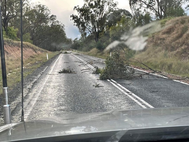
Thunder, lightning, strong winds and heavy rain hit Brisbane about 4.45pm, lasting about 15 minutes in the CBD.
There were still severe storms detected in the South East region at 5.40pm but by 6.46pm the Bureau of Meteorology said “severe thunderstorms are no longer affecting the South east Queensland area (east of Dalby from Rainbow Beach to Stanthorpe)”.
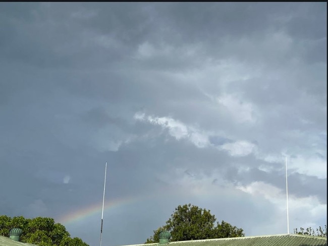
A more general severe thunderstorm warning remained for the Central Coast and Whitsundays, Central Highlands and Coalfields, Capricornia and Wide Bay and Burnett forecast districts but this, too, was cancelled by 9.30pm.
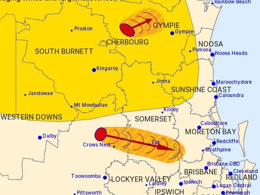
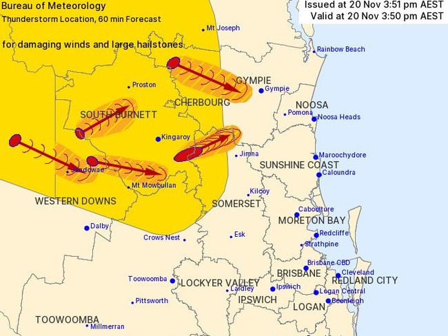
The Bureau of Meteorology had earlier issued an updated severe thunderstorm warning at 5.43pm for people in parts of Gympie, Somerset, Toowoomba, Brisbane City and Moreton Bay council areas.
It followed several updates, including when at least five severe storm cells had been detected.
#oldschool #brisbane #summer #storm #stafford 20 November pic.twitter.com/sDaWpZuUJP
— @SChandlerBing@mastodon.au (@SChandlerBing) November 20, 2022
yo the rain kinda crazy rn pic.twitter.com/opw7PXxagF
— グレース grace @ holotempuspilled 📗 (@skeletonpal) November 20, 2022
EARLIER
Thunderstorms and above average temperatures could smash parts of the state this week, as some regions have recorded wind gusts of almost 100km/h.
Parts of the North West were issued with severe thunderstorm warnings this morning, with damaging winds and fast moving thunderstorms expected to hit the area between Julia Creek and Richmond.
Julia Creek has already recorded gusts of wind up to 96km/h this morning at 7am, according to the Bureau.
Possible thunderstorms could hit majority of the state, according to the latest Bureau update, including the likelihood of severe thunderstorms for most southern areas.
Central eastern inland regions from Moranbah to south of Biloela were likely to see severe thunderstorms, damaging winds and heavy rainfall this afternoon, according to the Bureau.
Severe thunderstorms could also be possible in areas from the southeast coast as far west as Roma and Aberfoyle, north as Charters Towers and south to the border, including the threat of large hail hitting areas south of Gympie.
Meteorologist Steven Hadley said this morning, South East Queensland has seen plenty of cloud cover with pockets of rain that could continue through to the afternoon.
“We’re expecting it to move through quite quickly. We’re expecting the sun to break out but there’s also a risk of thunderstorms this afternoon,” he said.
While things are set to clear up through Toowoomba, Brisbane and south of the Gold Coast this afternoon, Sunshine Coast up into Central Queensland may see severe thunderstorms into the evening, according to Mr Hadley.
Temperatures are also expected to soar this afternoon with a maximum of 35C in Brisbane.
“It’s around 5C to 7C above average in South East Queensland, that’s affected by the cloud cover,” he said.
Monday is expected to reach higher temperatures as well with Mr Hadley saying dryer conditions are expected throughout the week.
“We’ll lose the humidity overnight and tomorrow morning there’ll be some dry westerly winds,” he said.
“This also means there’ll be an elevated fire danger. Potentially reaching extreme in some parts of South East Queensland.”
Throughout the rest of the week, the region will see dry conditions for the most part with the warmest temperatures expected on Tuesday as Brisbane should see an average of 30C for most of the week.
“It’ll be generally dry for the rest of the week, except on Friday there could be a risk of showers returning,” he said.


