
Queensland weather: Very dangerous thunderstorm, giant hail and torrential rain hit Gold Coast
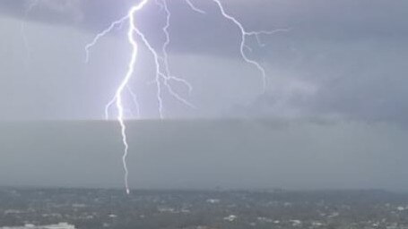
A supercell storm has slammed into the Gold Coast, hammering the city with giant hail and torrential rain, with forecasters predicting more storms for SEQ this afternoon. WATCH THE VIDEO

QLD weather news
Don't miss out on the headlines from QLD weather news. Followed categories will be added to My News.
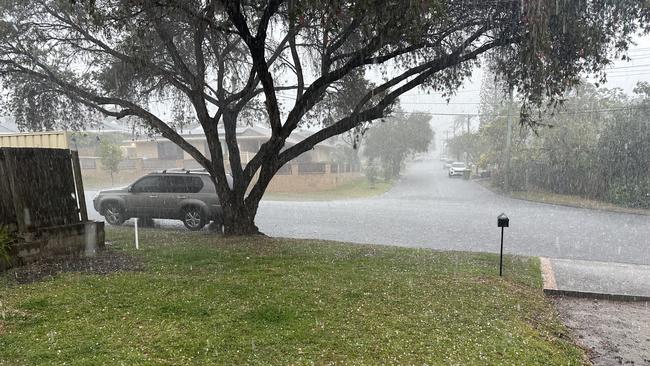
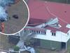
Giant hail and torrential rain has slammed into parts of the Gold Coast after a fast-moving, very dangerous thunderstorm impacted the city about 1pm.
A warning was issued and cancelled 30 minutes later as the storm cell moved out to sea.
However, the Bureau of Meteorology has suggested that won’t be the end of the afternoon storm activity.
Earlier this afternoon, the Bureau said a southerly change moving along the coast was likely to trigger instablity.
It comes as heatwave conditions and high humidity grip the state.

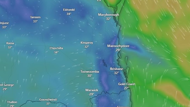
At 12.30pm, the hottest place in Queensland was Hughenden at 40.3C, while it was 39.9C in Richmond, 37C in Rolleston, 37C in Longreach, 36.4C in Rockhampton, and 35.3C in Townsville.
Across the southeast, it was 36.2C in Gatton, 34.2C in Amberley, 30.9C in Brisbane, 27.8C in Redland and 27.9C in Nambour.
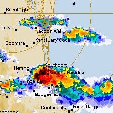
High temperatures, humidity and an inland trough being pushed across the state by strong winds are combining to create an increase threat of severe storms, with large hail, torrential range and damaging winds possibly.
The Bureau of Metrology’s Patch Clapp said Thursday’s cloud cover delayed the forecast storms, with Friday looking more threatening.
“We definitely saw quite a large system and a few drops of rain in the Wide Bay and Burnett regions and a couple of strikes through the Gold Coast Hinterland, but not severe as previously forecast, he said.
“Today we should definitely be seeing it come to fruition.
“There are clearer skies for a lot of South East Queensland today so more potential for those severe thunderstorm to sweep through.
“The humidity and high dew point are definitely adding to the thunderstorm potential and now with the fact we are cooling down heading into the weekend we should be seeing some of what has been previously been forecast.”
After a week of heatwave conditions, Mr Clapp said a cooler change is expected into the weekend.
“South-easterly winds are forecast for tomorrow which will sweep through and drop back that temperature,” he said.
“We are looking at high 20Cs to low 30s around much of Brisbane, a bit warmer around greater Brisbane and cooler again around the Gold Coast area.”
The heatwave conditions saw maximums up to 45C recorded in the state’s north.
“Yesterday was the peak of it so it seems but it doesn't mean that it’s not going to be hot up around the north,” Mr Clapp said.
“These conditions are likely to hang around heading into the weekend and next week.”

Feels like -5.3C: Icy blast sends temps plummeting again
South East Queensland has again shivered through a freezing start to the day, as a brutal cold front continues to blast the region with subzero temperatures, made worse by chilling winds.
Read more

Feels like MINUS 7.1C: Brutal cold front blasts southern Qld
A brutal cold front is blasting across southern Queensland with subzero temperatures and widespread frost.
Read more