Storms possible again before heat hits
More storms are expected after yesterday’s supercell dumped 100mm on Brisbane in an hour and delivered its first tornado in five years. Temperatures are then expected to soar 8C above average.
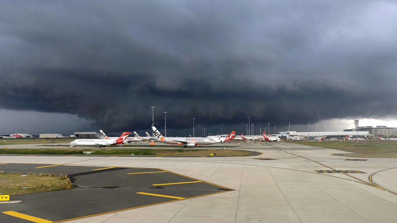
The southeast is bracing for more unstable weather after a mini tornado ripped through the Brisbane Airport.
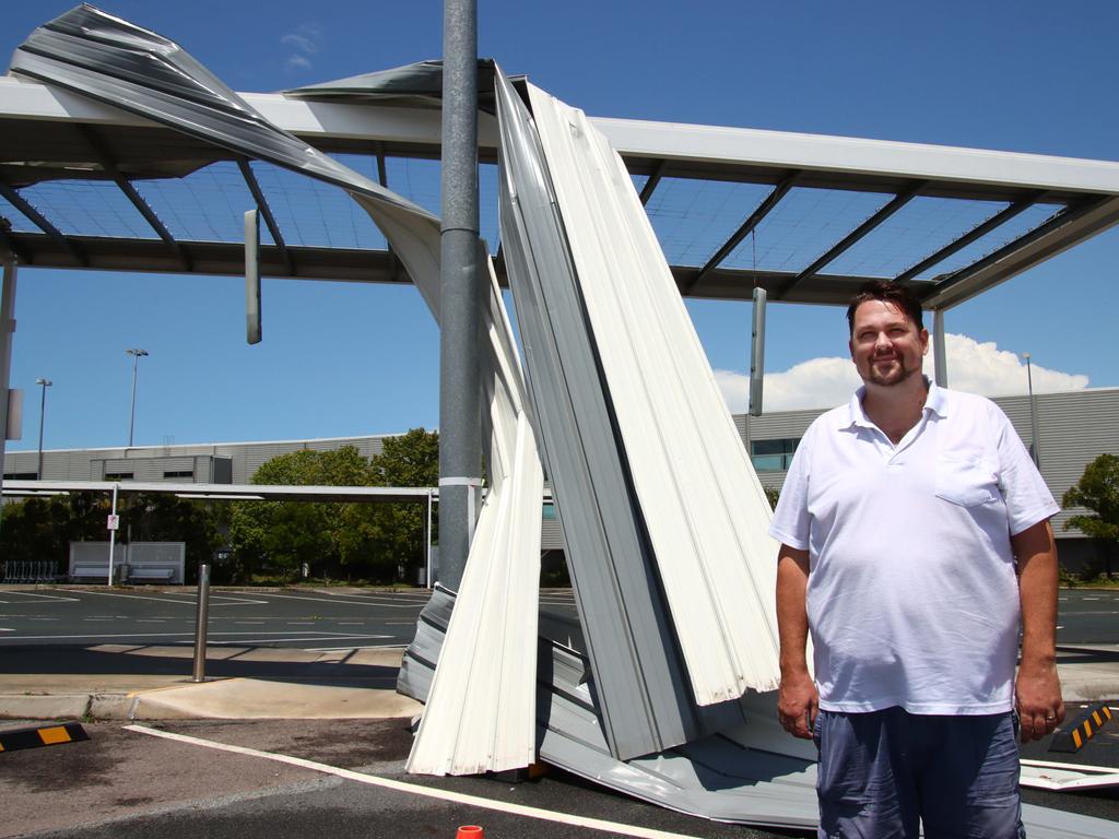
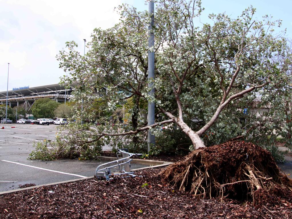
Flights were grounded, signage was ripped from the ground and overhead walkways were ripped to pieces as winds of up to 125km/h battered the airport.
The supercell storm brought Brisbane’s first tornado in five years and dumped close to 100mm of rain in just an hour.

The Bureau of Meteorology confirmed a small tornado hit the airport at around 10am, while other areas across the state were on red alert.
But it’s not the end of the wild weather. Storms, wind and rain are forecast to lash the Darling Downs and parts of the coastline today.

Brendan Smith was sitting in his van in the international airport terminal car park when the wild weather unfolded, he said he saw the “vortex” fly across the carpark towards him.
“At that point all the trolleys started running everywhere, the roof sheets got ripped off, there was another bus beside me and we genuinely thought the bus was going over,” he said.

Mr Smith said while tornado didn’t last long, he thought the roof above him was going collapse as it wobbled and moved with the wind.
A spokeswoman from Brisbane Airport said roads were left flooded and covered with debris, with an aircraft and skylight left damaged.
The domestic terminal flooded in the central screening area, which had to be closed temporarily.

Storm cells popped up on the radar across the southeast, with destructive winds, large hail and heavy rainfall from the NSW border to just north of the Sunshine Coast.
Luggage Point received 105mm of rain, while Brisbane Airport totalled 91mm.
On the south side of the river, Hemmant recorded 55mm, South Stradbroke 51mm, the Sunshine Coast hinterland 50mm, Kin Kin 48mm and Kilcoy recorded 4.5cm in hail.
BOM Meteorologist, Pieter Claasson, said there was potential for more severe storms today.
“(There) is a pretty good chance of showers and storms and even severe storms around Eastern Darling Downs area in the late morning and early afternoon,” he said.

“They could then track towards southeast in the evening but there is really high chance of severe storms in the Eastern Darling Downs.”
On Sunday things will dry out and heat up, with temperatures to soar to 8C above average.
Brisbane is forecast to hit 35C, the Sunshine Coast 32C and the Gold Coast 31C.
On Monday high humidity of 70 per cent and above will bring the chance of storm activity again.


