
Heavy rain hits parts of southeast Queensland as storms forecast
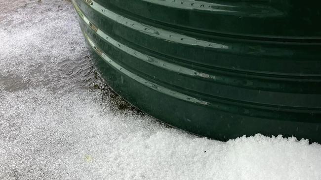
Parts of the southeast have been hit by heavy rain, with reports of flash flooding. Severe thunderstorms with potential for hail and damaging winds had been forecast.
QLD weather news
Don't miss out on the headlines from QLD weather news. Followed categories will be added to My News.
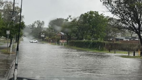
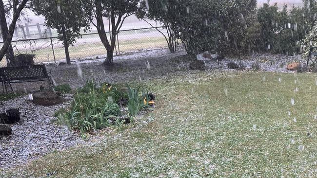
Parts of the southeast have been hit by heavy downpours Thursday afternoon, with reports of flash flooding.
The region had earlier been told to brace for hail, damaging winds and rainfall as severe thunderstorms were forecast.
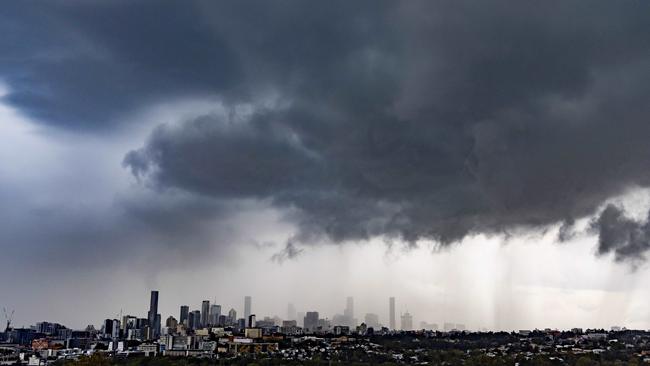
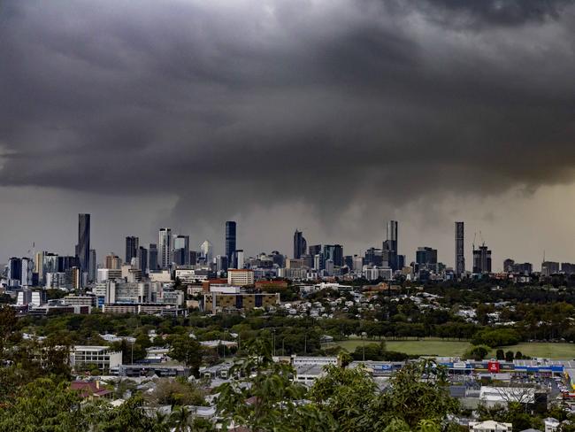
Storms could be seen on the radar from about 3.30pm, with fast-moving systems reaching Brisbane’s south from the west by 4pm.
Brisbane city copped a massive, yet brief, downpour about 4.30pm as the system moved east towards the coast.
There were reports of flash flooding in some parts of the southeast, including Goodna.
Some areas of Brisbane got more than 20mm of rain in an hour.
The south western suburbs of Brisbane copped the brunt of the cell, with Greenbank recording the highest falls of 25mm in the hour between 4pm and 5pm.
Surrounding suburbs Corinda and Waterford saw 21mm fall, while Archerfield saw 17mm of rain in the hour.
Highest falls between 4pm and 5pm:
• Greenbank: 25mm
• Waterford: 21mm
• Cordina: 21mm
• Everton Hills: 17mm
• Archerfield: 17mm
• Mitchelton: 15mm
• Brisbane AP: 12mm
• Inala: 12mm
• Rochdale: 12mm
• Normanby Way: 11mm
• Samford Village: 10mm
EARLIER
It comes after The Courier-Mail reported an “unpredictable September” would bring a cool change for parts of South East Queensland and storms and showers to parts of the region from today.
Parts of SEQ were pummelled by severe thunderstorms on Tuesday, with hail smashing towns across the Darling Downs, with more on the way.
The weather bureau forecast severe thunderstorms with damaging wind gusts of up to 90km/h and 2cm hail for the Darling Downs and Granite Belt regions.
“So we’ve had a trough lying over inland Queensland for a few days now, and it’s contributed to the stormy weather yesterday and the day before,” the bureau’s Angus Hines said.
“We’re looking at some showers and storms spreading in southern parts of the Darling Downs, and the Granite Belt area today, and that actually includes the possibility of severe thunderstorms in that area, which could bring damaging wind gusts, or some large hail to the southern downs.”
While Brisbane locals have woken to clear skies, and a top of 26C for parts of the city, the weather is set to turn into the afternoon with possible thunderstorms to bring heavy rainfalls.
“We also expect to see some showers and the outside change of a storm moving across the Brisbane area,” Mr Hines said.
“In terms of how much rain we are anticipating in Brisbane, it does really depend on whether those storms ramp up and get going or not.
“If we do see some thunderstorms running away later on in the day, that could easily double that amount of rainfall in the last few hours of Thursday, so a damp finish after a bright start.”
Isolated to scattered showers in central and southern districts south of Emerald and east of Thargomindah, tending widespread at times in the southeast. Isolated thunderstorms south of Roma and east of Cunnamulla.
Isolated to scattered showers over the east coast north of Rockhampton and over Northern Cape York Peninsula.
With temperatures across southeast Queensland expected to shift to “slightly below average” for most places on Friday.
“When we do see those showers and possible storms moving through later on, it’s also bringing some cooler conditions up from the south, southerly wind change, so temperatures will be dropping away for Friday and the weekend,” he said.
“That doesn’t include the far north of the state, but generally, most of central southern Queensland will be a couple of degrees below the norm for Friday and right through the weekend.”
Mr Hines said there will be an elevated fire danger ratings across western parts of the state from Thursday and into the weekend.
Gulf Country, Northern Goldfields and Upper Flinders, Central West, North West, Channel Country, and Maranoa and Warrego currently have a high fire danger rating in place.
“We are seeing a bit of a shift towards springtime weather, in regards to seeing some slightly more elevated fire danger ratings across particularly Western parts, with quite dry and somewhat breezy conditions for the next few days, lots of districts have high fire danger,” Mr Hines said.
“We’re anticipating that to become more and more frequent over the next few months, as parts of the shift towards the springtime weather.”

Ice ice baby: Spectacular images of unseasonal frost as Qld freezes
Queensland’s overnight temperatures will increase to double digits in the coming days, following the coldest start to winter in 16 years, bringing frost and ice to many regions. SEE THE PHOTOS

City’s coldest June start in 16 years, feels like MINUS 9.8C out west
Southeast Queensland is shivering through its coldest morning in more than 15 years but feels-like temperatures have dropped to insane levels in the southern inland.