
Qld weather: Hail pounds parts of state’s south
South East Queensland has been hit by hail and heavy rain, with wet, unpredictable weather expected to continue.
QLD weather news
Don't miss out on the headlines from QLD weather news. Followed categories will be added to My News.
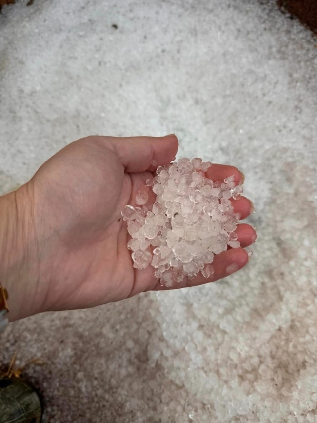
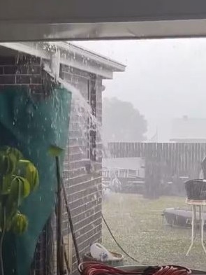
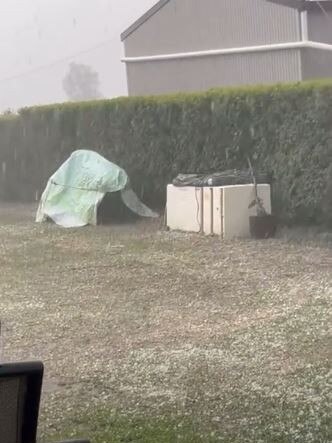
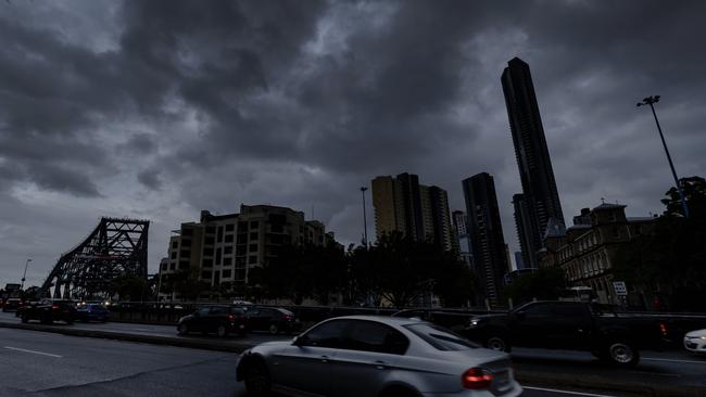
Parts of South East Queensland were pummeled by severe thunderstorms on Tuesday, with hail smashing towns across the Darling Downs.
Thunderstorms rolled through from the west to the coast, with heavy rain and hail initially reported on the Darling Downs at Cambooya, Westbrook, and Wyreema.
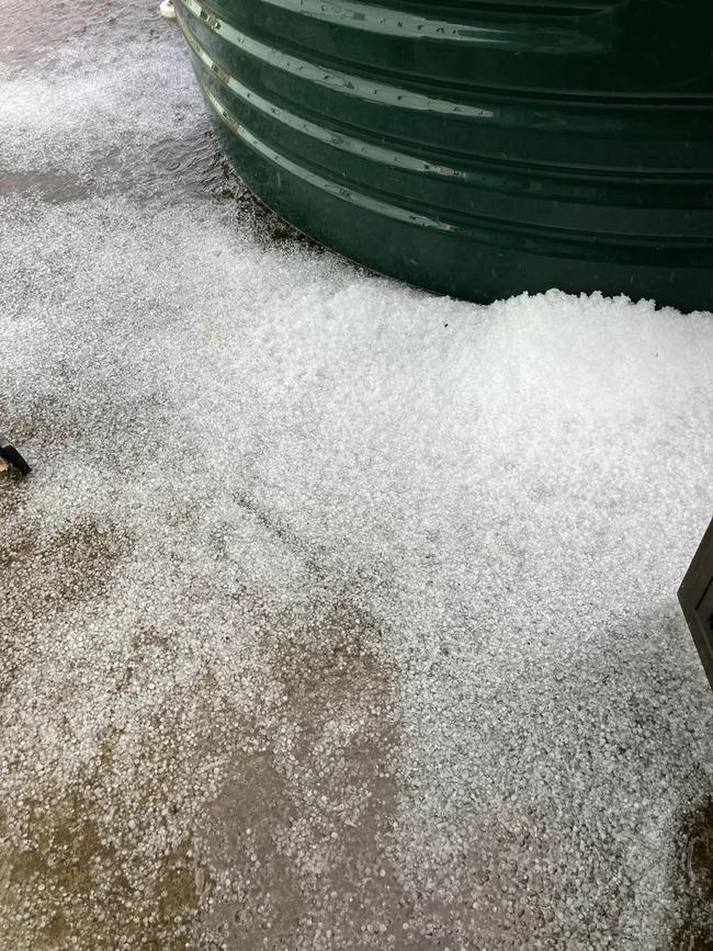
About 20mm of rain was recorded at Wyreema and 16mm recorded at Cambooya.
The thunderstorms swept through from the Darling Downs to Brisbane and the Moreton Bay region by 4.40pm, where they remained an hour later but had eased by 6pm. Storms east of the Gold Coast had also eased by 6pm.
Rainfalls of 58mm were recorded at the top of the Brisbane River, 55mm fell at Cannon Cove and 32mm at Rosewood.
Cambooya resident Jasmine Rose posted that the town was getting smashed by hail.
“Mother Nature is relentlessly giving it to us in Cambooya, hail the lot,” she wrote.
The Bureau of Meteorology’s Shane Kennedy on Tuesday afternoon said it had been a pretty active day.
“We had some early storms move across the Gold Coast this morning, but then we’ve had a broad area develop from the late morning and continue through the day from around Kingaroy down through the Darling Downs to the border, and we’ve had another round for the Gold Coast and just a brief storm across Brisbane city in the late afternoon,” he said about 5.30pm.
“We’ve seen scattered falls between the 10 to 30mm range, with 58mm at the top of the Brisbane River, 55mm at Cannon Cove, and 32mm at Rosewood bucking the trend with heavier falls.
“We’re seeing thunderstorms through the Warwick area, Scenic Rim, Gold Coast hinterland, and around the Esk area at the moment and we could see these showers and storms continue for the next few hours.”
Mr Kennedy said the wet weather would likely continue. “We’re expecting it to be a bit more showery tomorrow, mostly around Brisbane, the Sunshine Coast, and the Gold Coast, but we could see a few showers inland through the Darling Downs once again,” he said.
It comes after The Courier-Mail reported an “unpredictable September” would bring a cool change for parts of South East Queensland and storms and showers to parts of the region this week.

A new trough may start to move east across southern Queensland from Wednesday and off the east coast on Thursday or early Friday. A new high will move east from The Great Australian Bight to the Tasman Sea later this week and strengthen the ridge and south-easterly winds along the east coast.
For Friday, isolated showers can be expected in eastern, central Queensland east of Longreach, tending scattered along the east coast, North Tropical Coast and over Northern Cape York Peninsula.
“September can be quite a swing month or a bit of a roller coaster,” Mr Kennedy said.
“[It’s] looking a bit colder at this stage, so dropping to 24C on Friday, so a couple degrees of below average. On Sunday potentially down to 23C to 22C on Monday, so the start of the school holidays will likely be a few degrees below average during the afternoon, so not a true winter chill.”
Isolated showers in the western Gulf Country District near the coast as a trough and associated cloud band may move into western Queensland from early next week bringing cooler temperatures to the region.

Monster weather system brings storm, heavy rain to Qld
Brisbane and surrounding parts of the southeast have been hit by storms and heavy rainfall this afternoon as a 3000km-long monster low moves across the state.

Wild storms, polar blast as 3000km monster low barrels towards Qld
The system, which stretches 3000km from north to south and encompasses 30 per cent of Australia, is forecast to pack a punch when it hits Queensland.