
Brisbane weather: Storms move north after heavy rainfall
South East Queensland has been buffeted by an afternoon of severe storms, with warnings still current for areas north of Brisbane. It follows rainfall of nearly 60mm in 30 minutes.

QLD weather news
Don't miss out on the headlines from QLD weather news. Followed categories will be added to My News.
South East Queensland has been buffeted by an afternoon of severe storms, with warnings still current for areas north of Brisbane.
Storms were forecast to affect Deception Bay waters, Beachmere and Bribie Island by 7.05pm and Comboyuro Point, waters off Bribie Island and northern Bribie Island by 7.35pm.
They were expected to hit Redcliffe, Scarborough and Narangba by 6.35pm.
Nearly 400 properties were without power, mainly in Moorooka, Loganlea, Darra and Richlands. The outages also affected traffic signals.
There was also heavy rainfall across the southeast this afternoon.
In Brisbane, Kenmore received 47mm in the 30 minutes to 5.37pm, and Jindalee 45mm in the 20 minutes to 5.25pm.
On the Gold Coast earlier, storms delivered 59mm in the 30 minutes to 2:45pm at Coplicks Bridge Alert, while Currumbin Creek recorded 59mm in the 45 minutes to 2.15pm.
A humid and unstable air mass east of an inland trough was fuelling the severe thunderstorm activity.
The Bureau of Meteorology said wet weather was expected to persist through the weekend for southern and South East Queensland.
Meteorologist Brooke Pagel said severe storms were likely throughout Friday afternoon for southern parts of the state including St George, Goondiwindi, Stanthorpe, Warwick, Toowoomba and Dalby.
“For Gold Coast and Brisbane, severe thunderstorms are possible and that just depends on how these storms develop and which way they track,” Ms Pagel said.
“It’s just a shower or two and possible storms for most of that region.”
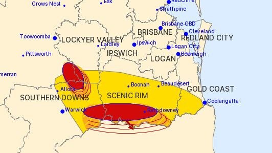
Ms Pagel said showers would continue on Saturday from the Sunshine Coast to the Gold Coast and inland to Ipswich and the Scenic Rim.
She said storms were unlikely to be severe near the coast but could be more intense around the St George and Roma areas.
“And there is a chance of thunderstorms inland on Sunday as well. We’re not sure if they’ll be severe just yet,” Ms Pagel said.
The possibility of severe storms across the weekend extends right out to Charleville and up to Carnarvon.
Residents from Rockhampton north should enjoy a sunny weekend with stable conditions and average March temperatures forecast to Monday.
Read related topics:Weather
Join the conversation
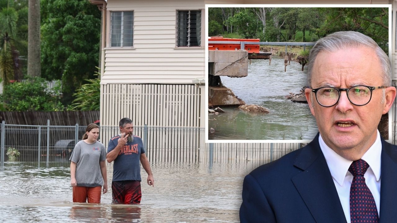
PM slams Bruce Hwy, as military might unleashed on flood clean-up
The Prime Minister hasn’t pulled any punches in his assessment of a critical part of the Bruce Highway as he visits flood-ragaved North Queensland, vowing to provide “whatever support is necessary”.
Read more
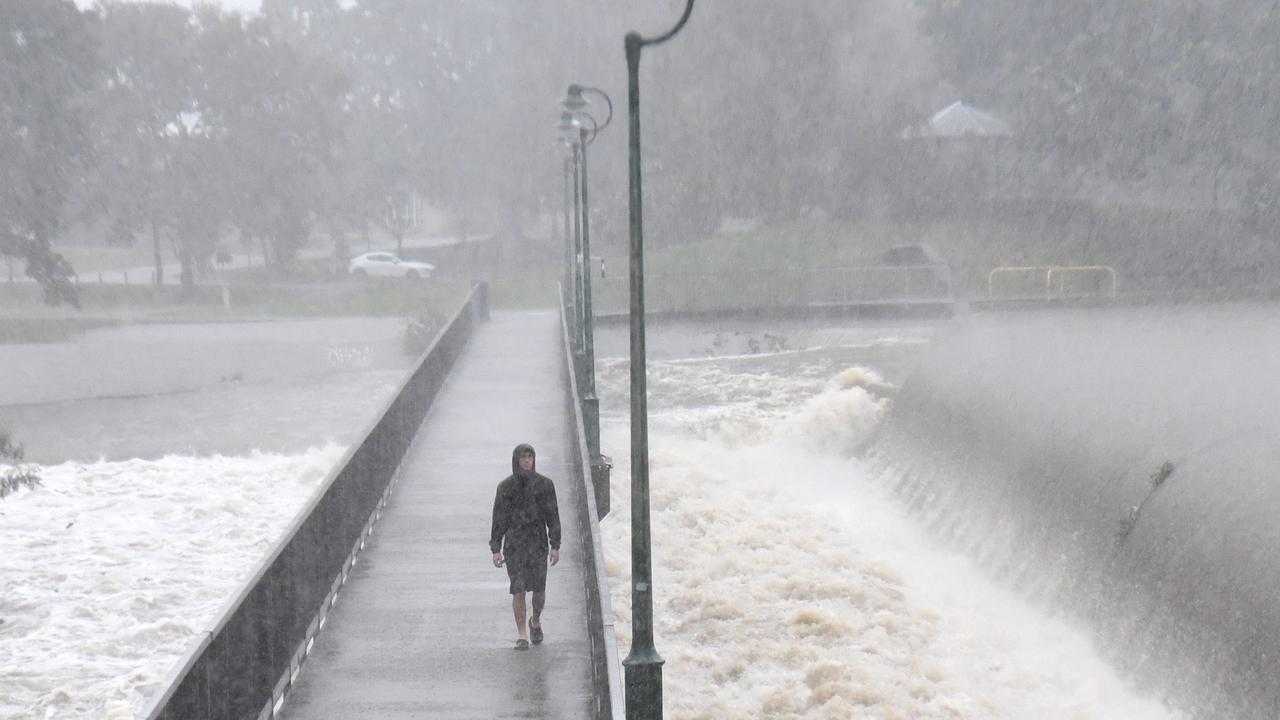
‘Big impacts’: New 300mm rain bomb, cyclone threat for NQ
Flood-soaked NQ communities have been warned of more heavy rain that could lead to life-threatening flash flooding in coming days – and even the slight chance of a tropical cyclone developing off the coast.
Read more