
Storms ease but warnings remain for damaging winds
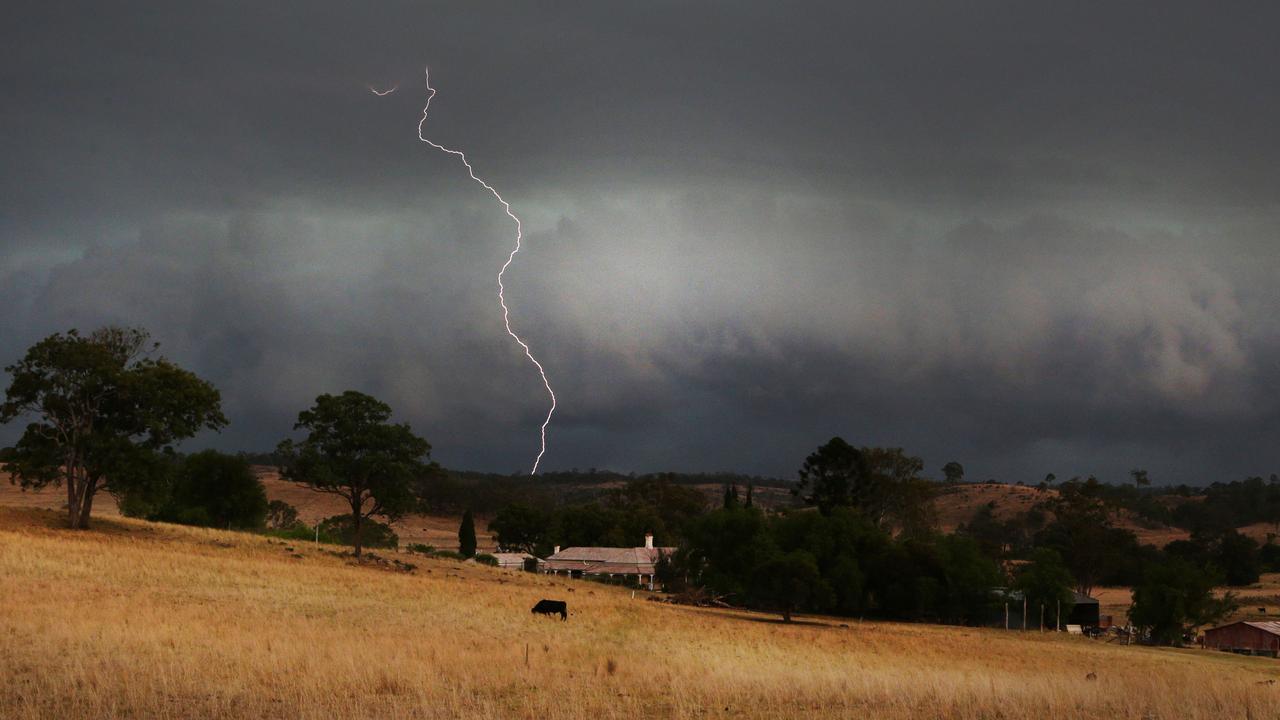
A severe storm warning remained for damaging winds in parts of Queensland Tuesday night. It followed several storms hitting the South East.

QLD weather news
Don't miss out on the headlines from QLD weather news. Followed categories will be added to My News.
A severe storm warning remained for damaging winds in parts of Queensland Tuesday night. It follows several storms hitting the South East throughout the afternoon.
Issued at 8.32pm, the Bureau of Meteorology’s warning for damaging winds was for people in parts of North West, Central West, Channel Country and Northern Goldfields and Upper Flinders districts.
“Gusty thunderstorms are currently moving into the northwest of the state from across the Northern Territory border,” the warning said.
“Severe thunderstorms are likely to produce damaging winds in the warning area over the next several hours. Locations which may be affected include Boulia, Dajarra, Urandangi, Duchess, Mckinlay and Brighton Downs.”
Urandangi Airport, near the NT border, recorded a 109 km/h wind gust at 6.41pm.
Severe thunderstorm warnings for other parts of the state had been cancelled.

It comes after storms hit the region throughout the afternoon, although some were brief.
Lord Mayor Adrian Schrinner on Tuesday afternoon reminded everyone in Brisbane to “stay informed”.
“@BOM_Qld has issued a thunderstorm warning for Brisbane, with possible damaging winds, large hail and heavy rain,” Cr Schrinner wrote on Twitter.
“Continue to stay informed by checking the Bureau of Meteorology’s website and sign up to our Brisbane Severe Weather Alerts to receive quick and reliable weather alerts.”

Earlier in the afternoon, Danny Teece-Johnson from the Bureau of Meteorology said flash flooding “is possible” in Southeast Queensland as the severe storms move through the region.
The Bureau is expecting rainfall totals of about 30ml in areas including Brisbane, although the storm will move quite quickly.
“We just issued a severe thunderstorm warning for Southeast Queensland for damaging winds, large hailstones and heavy rainfall,” Mr Teece Johnson said.
“They’re moving towards the east so they’re forecast to affect Brisbane CBD, Camp Hill and Enoggera by five to 4pm.
“Damaging winds, large hailstones and heavy rainfall that may lead to flash flooding are likely.
“Considering how much rain we’ve had recently, the catchments in the creeks are pretty full so it doesn’t take long for them to jump back up.
“Given the catchments of the creeks are quite full from all the weather that we’ve had, and we’re just coming into that thunderstorm season activity where the temperatures are rising.”
#BePrepared for potential severe storms this afternoon and tonight, as advised by @BOM_Qld. 🌧⚡ Secure loose outdoor items, bring your pets indoors, charge your electronic devices and have your emergency kit handy: https://t.co/tsJJDZBcuDpic.twitter.com/zShoBZoxIG
— Brisbane City (@brisbanecityqld) October 25, 2022
Our radio antennas amongst the clouds pic.twitter.com/HPnaEVLTCh
— SEQUEST (@SEQUESTRADIO) October 25, 2022
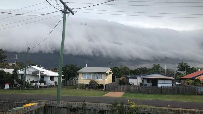
South East Queensland as a whole is on supercell storm watch after a “savage” hailstorm pummelled parts of the state on Monday.
It comes as the Bureau of Meteorology warns of extreme humidity that will “hit like a tonne of bricks”.
Hailstones more than 10cm in size were recorded after supercell storms hit near Rockhampton with the communities of Mt Larcom and Ambrose in the firing line.
Thunderstorms also slammed into South East Queensland early Tuesday morning, leaving more than 3500 homes without power.
The Bureau of Meteorology is warning that intense humidity will “hit like a tonne of bricks” over coming days, with the first 30C days since April.
A weak ridge and warm, humid air mass will remain over the north of the state for the next several days.
Parts of South East Queensland recorded 100 per cent humidity at 7.21am Tuesday.
The Bureau of Meteorology’s Helen Reid said the chance of severe thunderstorms today depended on the cloud cover.
“There is a lot around Brisbane this morning and if that sits, it won‘t enable enough energy to fire off the next lot of storms,” she said.
She added that the storms overnight were very isolated, with only 5-10mm of rain falling in most areas impacted.

FLOOD WARNINGS ISSUED IN THE LAST 24 HOURS:
MINOR:
Wallam and Mungallala Creeks at Bollon
May again reach near the minor flood level (0.50 m) during Tuesday morning.
Moonie River at Flinton and Nindgilly
The river level is expected to be around the minor flood level between Southwood and Flinton for the remainder of Monday and Tuesday with further rises possible with more rain.
Downstream of Flinton to Nindigully.
May remain at minor flood level over the next few days however with further rain it may rise causing problems at Thallon Bridge.
Weir River and stream rises are occurring to Giddi Giddi South in response to further rainfall since Monday evening.
Downstream from Giddi Giddi South, river levels are slowly rising with areas of minor to major flooding occurring from Talwood to Jericho and is expected to fall late Wednesday.
MAJOR:
Macintyre River
Floodwaters are moving through the MacIntyre River catchment from heavy rainfall over the weekend while the main flood peak is currently downstream of Goondiwindi.
Small creek and river level rises are occurring, in response to rainfall Tuesday morning around the Dumaresq River.
Macintyre Brook may experience small renewed rises in response to rainfall Tuesday morning and the Macintyre Brook at Inglewood Bridge may reach the minor flood level (5.00 m) Tuesday afternoon.
Major flooding downstream of Holdfast is easing after The Macintyre River at Goondiwindi peaked at 10.2m around 3:00pm Monday and is likely to fall below the major flood level Wednesday.
Condamine Balonne
The Condamine River to Warwick experiencing minor to moderate flooding, with moderate flooding at Murrays Bridge and minor flooding at Elbow Valley.
Moderate flooding is continuing along the Condamine River downstream of Warwick between Loudoun Weir and Loudoun Bridge.
Renewed river level rises are occurring along the Condamine River between Brigalow Bridge and Bedarra, with minor flooding continuing at Cotswold.
Creek levels have been easing along Dogwood Creek since Sunday afternoon.
Moderate flooding is continuing along the upper reaches of the Balonne River catchment, with major flooding around Warkon likely from Monday afternoon while at Surat it is expected to remain above the moderate flood level during the remainder of Monday.
There are renewed rises occurring along Bungil Creek at Garrabarra Monday while moderate flooding is steady at Weribone, with rises occurring further downstream at Warroo.

In the past 24 hours, the SES had 18 requests for help in Central Queensland and 34 across the south east.
Most were a “mixture of the usual requests for sandbags and assistance with leaky roofs.”
Ms Reid said Queensland could today expect more isolated showers, storms and possibly hail in the west with a line of storms rolling over Brisbane on Tuesday morning.
“Right up to Wide Bay, and as we get further north, we might see hail, up at Gladstone we had hail and storms up to Townsville this morning,” she said.
“Today we’ll see those continue, not covering quite as big an area, but up to Mackay from the Darling Downs, but only the eastern parts of the western region might see storms.

83mm in 60 mins: Morning storms after inland Qld hammered
Severe thunderstorms have hit parts of inland Queensland overnight, with one area recording more than 80mm in an hour, as more flared up this morning.

Former MP withdraws senate ticket to focus on new role
A former Newman government minister has has stepped away from his senator ambitions to instead focus on helping flood-wrecked North Queensland rebuild.