
Intense rain, large hail, damaging winds as storms lash southeast
Two thunderstorm cells continue to move across southeast Queensland this evening. Wild weather saw 106mm dumped in an hour to some regions as the latest alert warned of “life-threatening flooding”. LATEST WARNINGS
QLD weather news
Don't miss out on the headlines from QLD weather news. Followed categories will be added to My News.
Two thunderstorms are moving across southeast Queensland this evening.
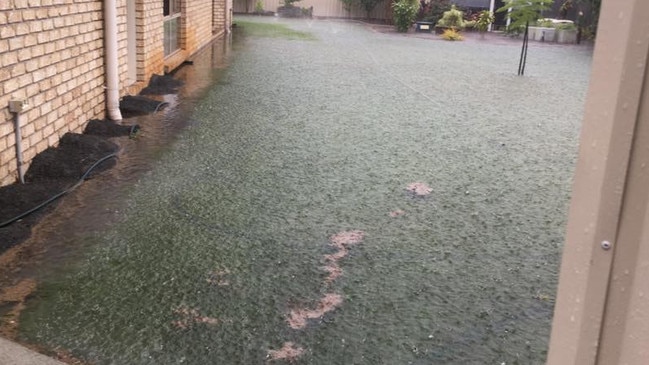
Severe thunderstorms have dumped more than 100mm in an hour to some regions and are expected to last into the evening. The latest alert warns of “life-threatening flash flooding”.
The latest southeast warning, for heavy rainfall and damaging winds, was issued at 8.06pm for people in Sunshine Coast and parts of Gympie, Somerset, Redland City, Noosa, Brisbane City and Moreton Bay Council Areas.
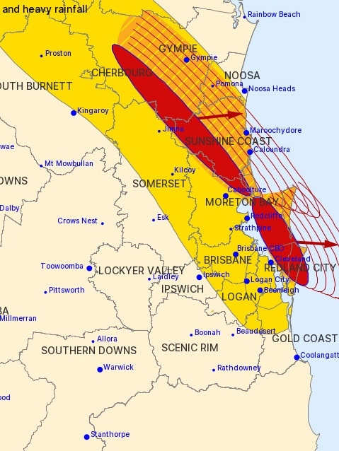
The updated warning said thunderstorms were detected on the weather radar at 7.55pm southwest of Gympie, the ranges between Gympie and Murgon, Maleny, Conondale, Kenilworth, Borumba Dam and Dunwich
These thunderstorms are moving towards the east.
“They are forecast to affect Caloundra, the area southwest of Caloundra, the area south of Gympie, Kandanga, Amamoor and Kilkivan by 8:25 pm and Maroochydore, Gympie, the area west of Noosa Heads, the area southeast of Gympie, the area northwest of Gympie and Pomona by 8:55 pm,” the warning read.
The BoM said a whopping 118mm of rain was dumped over Redland (Alexandra Hills) in the hour to 7.15pm, while 105mm was recorded at Stewart Road, south of Beenleigh, in the hour to 6.55pm.
Other heavy rainfall totals included 73mm at Kluvers Lookout, north of Mt Glorious, in the hour to 7pm, 69mm at Woodford in the same period, 67mm at Foxley in the hour to 4.20pm, 60mm at Harbers Crossing near Boonah in the hour to 4.25pm, 47mm at Mulgowie in the 30 minutes to 3.35pm, and 53mm at Palen Creek in the hour to 3.15pm.
Buaraba, southwest of Toowoomba, recorded 60mm from 4pm to 5pm.
Carney Creek, near the NSW border, cracked 100mm just after 5pm, recording 108mm in a six-hour period.
Stewart Road, south of Beenleigh, recorded 24mm in 10 minutes and 46mm in 30 minutes.
By 6pm Energex had recorded more than 24,700 lightning strikes across the southeast, with a spokesman telling The Courier-Mail it paled in comparison to Saturday’s storms.
“That’s actually a pretty tame number compared to Saturday, which saw over 115,000 strikes.” He said.
It comes after Premier Annastacia Palaszczuk said at 4pm that further storms could bring up to 100mm to the state’s southeast.
A BoM spokeswoman described the southeast storms as “very dangerous” and said the storms could push into the evening and early morning.
A separate severe thunderstorm warning remains in place for damaging winds and heavy rainfall for people in parts of Wide Bay and Burnett and Southeast Coast forecast districts.
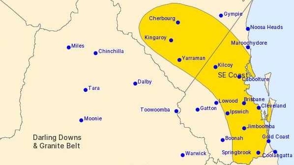
That updated warning was issued at 6.36pm and said the severe thunderstorms were likely to produce damaging winds and heavy rainfall that may lead to flash flooding in the warning area over the next several hours.
“Locations which may be affected include Brisbane, Maroochydore, Gympie, Caboolture, Moreton Island, Cleveland, Cherbourg, Jimboomba, Kilcoy, Mount Tamborine, Nambour and Redcliffe,” it warned.
“Severe thunderstorms are likely to produce intense rainfall that may lead to dangerous and life-threatening flash flooding and damaging winds over the next several hours in parts of the Southeast Coast district. Locations which may be affected include Cleveland and Beenleigh.”
Severe thunderstorms are no longer occurring in the Darling Downs and Granite Belt district
EARLIER
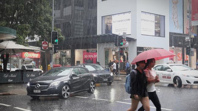
Southeast Queenslanders are being warned of damaging winds, heavy rainfall and large hail as a series of severe storms move towards the coast today.
The Bureau of Meteorology this morning warned of “severe thunderstorms possible about the southeast interior to the coast” bringing the risk of “damaging winds, heavy rainfall & large hail”.
âš¡Thunderstorm Forecastâš¡ Severe thunderstorms possible about the southeast interior to the coast, risk of damaging winds, heavy rainfall & large hail. Severe weather likely in the northeast due to #CycloneKimi
— Bureau of Meteorology, Queensland (@BOM_Qld) January 17, 2021
âš ï¸Warnings: https://t.co/v9dbbCZC1A
📡 Radar: https://t.co/RAAhcttn16 pic.twitter.com/b6iBzeiaeK
Forecaster Alex Majchrowski said storms would travel across the western southeast throughout the day, before reaching the coast later this afternoon or early this evening.
The Bureau warned that severe storms are likely for inland regions from Warwick up to the Burnett and possible for regions between the Wide Bay and the New South Wales border.
“We could see damaging winds as well as large hail in the Lockyer Valley and Somerset region into the early afternoon,” Mr Majchrowski said.
Whether the heavy rain, hail and damaging winds will impact Brisbane “really depends on if those storms are severe by the time they get to the coast,” Mr Majchrowski said.
“We may not see as heavy falls as we do in the west,” Mr Majchrowski said.
“The risk of severe thunderstorms with heavy rainfall that may lead to flash flooding may continue overnight into early Tuesday morning,” the Bureau of Meteorology said in a tweet.
North Queenslanders have been warned of possible flash flooding and “destructive wind gusts … strong enough to bring down trees and powerlines” as Tropical Cyclone Kimi continues to build.
Mr Majchrowski said falls of up to 300mm were likely in some
There were “several falls above 150mm yesterday around the Innisfail area”, Mr Majchrowski said.

Monster weather system brings storm, heavy rain to Qld
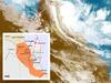
Brisbane and surrounding parts of the southeast have been hit by storms and heavy rainfall this afternoon as a 3000km-long monster low moves across the state.

Wild storms, polar blast as 3000km monster low barrels towards Qld
The system, which stretches 3000km from north to south and encompasses 30 per cent of Australia, is forecast to pack a punch when it hits Queensland.