
Tropical cyclone Kimi set to track towards Cassowary Coast
Cyclone Kimi, which will deliver winds up to 150km/h and the threat of flooding, is set to track further south today, while the state’s southeast is on alert for severe thunderstorms.
QLD weather news
Don't miss out on the headlines from QLD weather news. Followed categories will be added to My News.
UPDATE: Tropical cyclone Kimi could develop into a Category 2 and hit between Innisfail and Ingham, Premier Annastacia Palaszczuk says, as Queensland’s Disaster Management Committee prepares to meet.
Preparations are underway across the state, with warnings of destructive winds of more than 150km/h heavy rain and flash flooding expected across the region from Lucinda to Ayr.
The state’s southeast, however, is also on alert for severe thunderstorms later today, which could bring hail to the region.
In light of the rain that’s expected to occur, Queenslanders have been urged to remember - if it’s flooded forget it.
#CycloneKimi will bring big impacts caused by destructive winds, heavy rainfall & abnormally high tides to the warning zone currently Port Douglas to Ayr incl Cairns & Townsville, & inland to Mareeba & Atherton. #GetReadyQueensland and follow #QLDweather https://t.co/FPJVN6DXOP pic.twitter.com/qyyosLRB36
— Bureau of Meteorology, Queensland (@BOM_Qld) January 17, 2021
Cyclone Kimi is expected to develop into a Category 2 either today or early tomorrow.
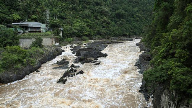
Heavy to intense rainfall is expected for the tropical east coast and a flood watch is in place from Cape flattery and Ingham.
Cassowary Coast Division 1 councillor Barry Barnes said his home south of Tully had drizzling rain all night, but his major concern was how saturated the ground already was.
“I’m very concerned about the rivers,” he said.
“We’ve never had them so full before we’ve had a bit of a low. But our main ones are the Tully and Hull (Rivers), and they’re already sitting at about 75, 80 per cent full.
“The ground is very saturated and my other concern is the banana farms, a bit of wind will knock those trees over.”
State Disaster Coordinator Steve Gollschewski said communities should stay connected and listen to the messaging, which will continue all day.
Emergency Services Minister Mark Ryan said there is a watch zone from Lucinda to Ayr.
He said Cyclone Kimi could bring destructive winds of up to 150km/h.
“Be aware that during this event you could have flash flooding,” he said.
“We are concerned about the flooding,” the Premier said.
“That’s why we have that flood watch out.”
Swift water rescue crews are on standby in the north.
“We’re on the ground now,” Mr Ryan said.
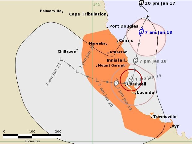
At 7am the system was 85km east northeast of Cairns and 295km north of Townsville, moving south at 9km/h.
The current cyclone warning zone is in place for Port Douglas to Ayr and inland to Mareeba and Atherton, including Cairns and Townsville.
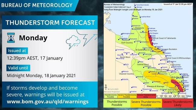
The Bureau of Meteorology has also warned that severe thunderstorms are likely between Cooktown to south of Ingham on Monday as the system approaches the coast.

Cairns Central shopping centre has already announced it will be closed on Monday as the storm approaches.
“Cairns Central centre management will continue to monitor the situation closely, and will act according to the advice of emergency services,” the shopping centre advised on Sunday night.
“Our focus continues to be the safety of all retailers, staff, customers and the Cairns community.”
Hazards
Destructive winds with gusts to 150 km/h may develop about coastal and island areas between Innisfail and Lucinda on Monday evening or early Tuesday morning as the core of the cyclone approaches.
Gakes with gusts to 120km/h may develop about coastal and island areas between Port Douglas and Innisfail during Monday morning, then extend inland to Mareeba and Atherton, and further south to Lucinda, later on Monday. Gales may also extend southwards to Townsville and Ayr early Tuesday depending on the movement of the cyclone.
Heavy rainfall with the potential to produce flash flooding and major river flooding expected to affect coastal and adjacent inland areas between Cairns and Townsville during Monday and Tuesday. A Flood Watch is current for this area.
Abnormally high tides are likely on Monday as the cyclone approaches the coast.
A storm tide is possible between Yarrabah and Cardwell, where large waves may produce minor flooding along the foreshore. People living in areas likely to be affected by this flooding should take measures to protect their property as much as possible and be prepared to help their neighbours.
‘Take care’ Premier’s message

Queensland Premier Annastacia Palaszczuk said Queensland was well prepared with emergency services on full alert and ready to help.
“North Queenslanders know what to do — listen to emergency warnings and, above all, stay off flooded roads,” Ms Palaszczuk said.
“The bureau is warning of strong winds and very heavy rain.
“I just urge everyone to take care.”
‘A lot of uncertainty’: BOM
The low-pressure system hovering off the tropical north coast last week had a very low chance of developing into cyclone before it intensified into a category one about noon on Sunday.
Meteorologist Kimba Wong said conditions may deteriorate overnight before making landfall.
“Given the current forecast, it’d arrive just north of Cairns but it could be anywhere along the north coast as there’s still quite a lot of uncertainty,” Ms Wong said.
“There’s a risk of it developing into a category two before crossing the coast, but that very much depends on how quickly it moves.”
RELATED: HOW CAIRNS AUTHORITIES ARE PREPARING
Ms Wong said their initial analysis of the low-pressure system indicated a very low chance of developing into a cyclone.
“Given how close it was to land, we believed the interactions with land would arrest the chance of it developing into a cyclone, but it managed to do so,” she said.
“As for the rate of intensification, it’s still reasonable. Once it’s two categories per day then it’d be a more rapid rate.”
Ms Wong said the compact nature of the system may have been a contributing factor to it developing quickly.
“Communities up in the north are very accustomed to potential impacts of cyclones so hopefully people are aware of the hazards,” she said.
“People in the warning zone need start or continue preparations, including securing loose items.”
Council to barricade flood-prone areas
Cairns deputy mayor and chairman of the Local Disaster Management Group Terry James said their response had moved to the second stage, which involved notifying every member who’s part of the local disaster co-ordination centre to be prepared.
Cr James said council staff were also preparing to “barricade known flooding areas”, which included numerous streets around Portsmith and the Esplanade.
MORE NEWS
Shock result in Golden Gumboot competition
Cyclone-hit towns bracing for more pain
Investigation launched into FNQ farm fatality
Alerts for vessel operators
Cairns-based Regional Harbour Master Captain David Ferguson on Sunday night issued a red cyclone alert for vessel operators at ports in Cairns, Half Moon Bay Marin, Mourilyan, Innisfail, Clump Point, Cape Flattery, Cooktown and Port Douglas.
The ports are now open only to emergency movements.
“Vessel operators should take all necessary precautions and follow the Extreme Weather plans for this port,” Mr Ferguson’s statement reads.
The extreme weather plan is available via the Maritime Safety Queensland website.
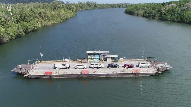
A Douglas Shire Council spokesman said the Daintree Ferry would resume normal operations on Monday at 5am after there were initial plans to halt the service from midnight Sunday.
The council and the ferry contractors will provide a further update on the status of the ferry service mid-morning on Monday unless there is a significant development overnight.
WHAT YOU SHOULD DO
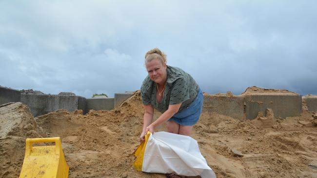
People between Port Douglas and Cardwell should immediately commence preparations, especially securing boats and property using available daylight hours.
– For cyclone preparedness and safety advice, visit Queensland’s Disaster Management Services website (www.disaster.qld.gov.au)
– If you choose to take shelter away from your home, stay COVID-19 safe and pack a mask and hand sanitiser (if you have them).
– For emergency assistance call the Queensland State Emergency Service (SES) on 132 500 (for assistance with storm damage, rising flood water, fallen trees on buildings or roof damage).
Authorities hold extraordinary meeting
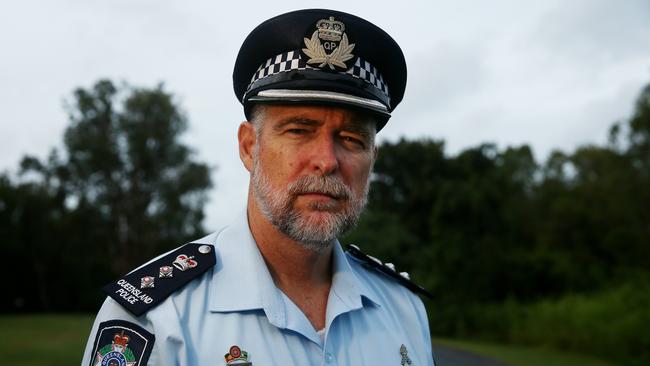
Far North police Chief Supt Brian Huxley said an extraordinary meeting for the District Disaster Management Group was held on Sunday afternoon followed by a second in Mareeba.
“Each local government areas is well prepared to respond to the issues from Cyclone Kimi,” Chief Supt Huxley said.
“We’ve identified vulnerable persons who need to be removed to safe locations, which is happening at the moment.
“Arrangements are also in place for pregnant women should they need to be also assisted.”
He said most vulnerable people were in Wujal Wujal, Cooktown, Daintree and Mossman.
“We’re advised that the movement of the cyclone is still difficult to predict, possibly moving further south so there is a greater risk to Cairns itself.
Extra resources allocated
Chief Supt Huxley said five extra police officers had been deployed to Cooktown for better on-the-ground co-ordination with other emergency services.
“Swift water rescue and rapid damage assessment crews from QFES are also being deployed to Port Douglas,” he said.
“They are also amassing resources in Cairns to enable a fast response to any developing issues.”
At this stage, there have been no major incidents with the chief superintendent urging residents to restrict their movements unless urgent.
“We anticipate there could be very strong wind gusts associated with this system that could bring down large trees,” he said.
“If you do have to drive on the roads, exercise extreme cautions and under no circumstances should you be crossing flooded roads or bridges.”
Impact on transport, services
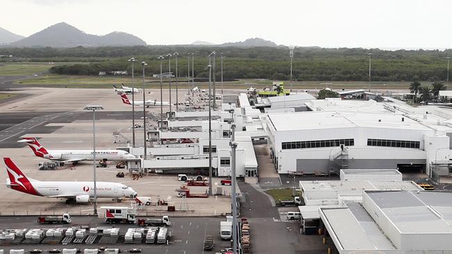
Cairns Airport is operating normally as it monitors the cyclone as it started its preparations.
Flights into and out of Cairns Airport may be affected.
Customers are urged to contact their airlines for information on specific flights.
The fever clinics at Mossman and Aumuller Street are being stood down for the time.
All normal theatre operations at Cairns Hospital have not been impacted.
Other closures
The Cairns Botanic Gardens and the Arrow tracks will close from 3pm Sunday due to the possible impact from Cyclone Kimi.
In a statement, the Council Regional Council said both sites would remain closed until further notice.
Reopening of the sites occur once they are deemed safe to use.
Originally published as Tropical cyclone Kimi set to track towards Cassowary Coast

‘Can’t be ruled out’: Potential for freak Qld snowfall this week
Queensland could see snow this week with weather models predicting up to 14cm falling on the Granite Belt.

Monster weather system brings storm, heavy rain to Qld
Brisbane and surrounding parts of the southeast have been hit by storms and heavy rainfall this afternoon as a 3000km-long monster low moves across the state.