
Queensland weather: Supercell storms cause damage, heatwave conditions across SEQ
South East Queensland will be gripped by a brutal heatwave over the next four days after supercell storms wreaked havoc overnight. WATCH THE VIDEO

QLD weather news
Don't miss out on the headlines from QLD weather news. Followed categories will be added to My News.
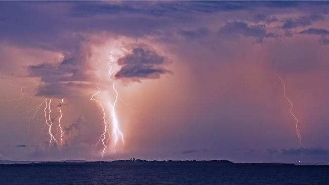
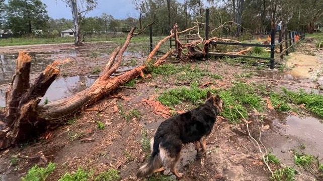
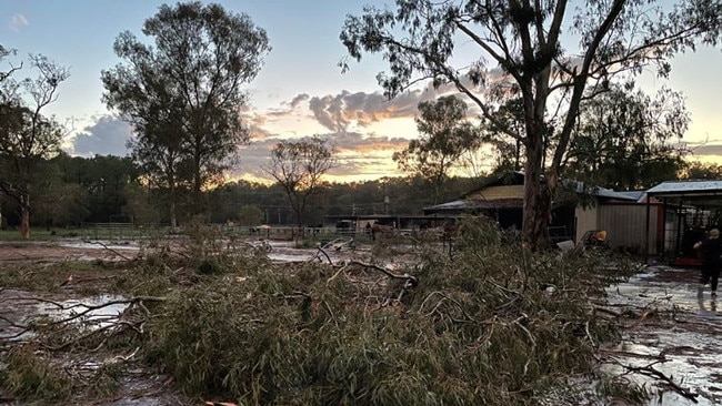
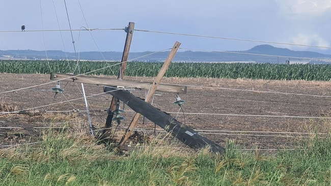
South East Queensland is set to swelter over the next four days following wild supercell storms that delivered almost 450,000 lightning strikes, brought down trees and snapped power poles.
Brisbane will be 33C today and Saturday before temperatures climb to 35C on Sunday.
It will be 34C in Ipswich today, 35C on Friday and 37C on Sunday, while it will be 36C in Beaudesert.
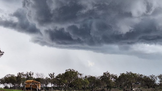
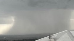
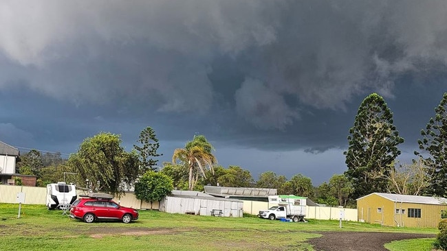
The heatwave conditions come after dangerous storms barrelled over the western Darling Downs into Brisbane and surrounding regions on Wednesday night.
Bureau of Meteorology Senior Meteorologist Angus Hines said the highest rainfall total was 47mm in Greenhaven.
“That was closely followed by Elbow Valley at 43mm, Reedy Creek at 35mm, Lyons at 33mm and Rudds Road at 30mm,” Mr Hines said.
Mr Hines said there were around 449,000 lightning strikes across Queensland and slightly crossing over into Northern NSW.
“They travelled slightly along the border as the line of thunderstorms moved across,” he said.
Photos posted to social media show power poles snapped near Dalby while large trees were brought down across Caboolture.
There were also reports of giant hail at Beaudesert. Mr Hines said the south east especially saw large hail.
“Glass House Mountains had hail of about 5cm,” Mr Hines said.
“The environment was perfect for hail with freezing temperatures in the atmosphere and upwards moving moisture from the heat closer to the ground,” he said.
Mr Hines said temperatures were a few degrees above average across parts of Queensland and a heatwave warning remained for Far North Queensland.
“It was a couple of degrees warmer than normally due to the northerly flow of the winds off over the Coral Sea,” he said.
Winds gusts reached into the high fifties with Dalby reaching 52km/h.
Mr Hines said the wind was “significant.’’
“Toowoomba had about 56km/h and Brisbane Airport reached 41km/h.
Meanwhile, the Sunshine Coast had 41km/h, Gold Coast 33km/h and Bundaberg 32km/h.
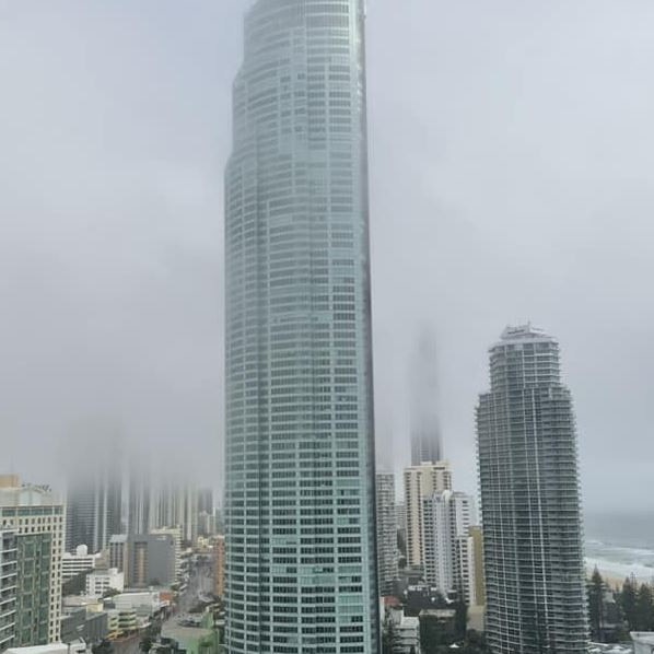
This morning, a layer of fog has blanketed the South East which Mr Hines said was due to left over moisture from the storms.
“Just to remain careful when driving due to the decreased and poor visibility,” he said.
Mr Hines said moving into next week, South East Queensland could expect storm activity in the afternoon on Friday, pushing out to the East Coast on Saturday.
“Tomorrow’s rainfall could see similar figures to this week between 20-30mm and reaching 40mm in certain spots,” she said.
Today the Bureau is warning severe storms are possible in the Wide Bay and Burnett during the early morning, with the threat of heavy rain, damaging winds and large hail.
Afternoon storms are possible in northern and western Queensland.
Read related topics:Weather
Join the conversation

Ice ice baby: Spectacular images of unseasonal frost as Qld freezes
Queensland’s overnight temperatures will increase to double digits in the coming days, following the coldest start to winter in 16 years, bringing frost and ice to many regions. SEE THE PHOTOS
Read more

City’s coldest June start in 16 years, feels like MINUS 9.8C out west
Southeast Queensland is shivering through its coldest morning in more than 15 years but feels-like temperatures have dropped to insane levels in the southern inland.
Read more