
Queensland weather: Severe storms, heatwave for southeast as Outback transforms into inland sea
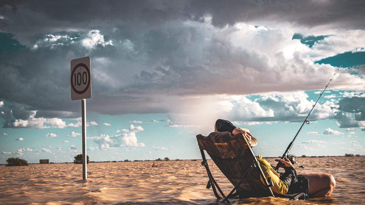
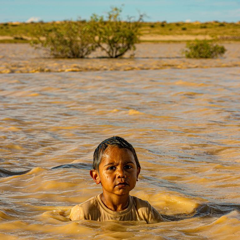
Stunning images have emerged from outback Queensland’s inland sea transformation as the South East braces for a week of wild storms and heatwave conditions.

QLD weather news
Don't miss out on the headlines from QLD weather news. Followed categories will be added to My News.
Severe thunderstorms are forecast for South East Queensland all this week ahead of a 34C blast of heat while incredible images capture the Outback’s transformation into an inland sea.
Meteorologist Livio Regano said “a pulse of significant thunderstorm activity” was expected on Monday evening going into Tuesday.
“It’s a trough that’s crossing over, affecting mostly northern New South Wales but it will spill over into Queensland so two quite unstable days,” he said.
“There’s a potential for severe thunderstorms but there aren’t any warnings out yet … so watch out for that.”.
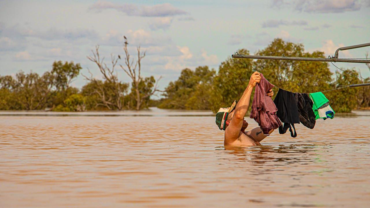
Photographer Thiwi (Peta) Rowlands has captured a posed up photo of Liam Brooker “hanging up the washing” in chest-deep floodwaters, using a Hills hoist as a make-believe washing line.
“We actually set that up… because we are isolated we’ve been taking photos and videos and posting them you know, just about the community and what we’ve got going on here,
“I just said, jump in that water, that’s going to be a great shot and pretend to hang out some clothes.”
Ms Rowlands said that as an artist and as a traditional owner she wanted her photos to showcase the resilience of those living in the outback.
“This is us as bush people, people out in the outback, you know, that have seen a lot of bushfires and floods,” she said.
“Us bushies, we just roll with the punches and every sort of adversity that comes up and slaps us in the face. We meet it head on and got to have a bit of a laugh.
“Every afternoon we’re jumping in the water on the road and swimming with the kids and the dogs and making the best of it.
“I grew up in Birdsville… I’ve seen the floodwaters come up quite high in the town but I haven’t seen it like this for a while… it’s quite exciting.”
Mr Regano said after a brief reprieve, the storm activity was likely to fire up again on Friday night into Saturday.
“We have a cold front coming through Friday, Saturday so at the head of the cold front you get these really hot northerly winds, quite humid, and then you get thunderstorms forming on the front.
“Saturday afternoon to evening will be the potentially the most worrisome time for thunderstorms but they could be as early as Friday night and by Sunday they will probably be clearing with a cooler change coming after.” he said.
Expected average rainfall across this period is 1-10mm with some areas expected to get more.
“That’s an aerial average expectation. If you’re under the storm, you’ll get a lot more than that but if you’re in between storms, you get nothing.” Mr Regano said.
Meanwhile, Queensland’s wild storm season has sent a seemingly boundless stream of floodwater down the Channel Country and created an inland sea in the Outback.
Bureau of Meteorology forecaster Felim Hanniffy said it would be weeks before major flooding in the Diamantina catchments receded.
“The major flood peak is probably in the next day or two, before it will kind of slowly subside,” he said.
“It’s mainly a knock on effect from that very heavy rain related to Cyclone Kirrilly when it was slow moving over to the west a couple of weeks back,” he said.
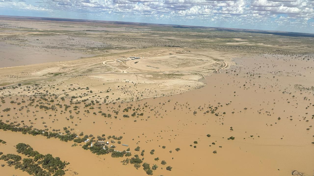
Owner of Outback flight specialists Wrightsair Trevor Wright was able to capture the inland sea from the sky, revealing its scale near the Outback town of Birdsville.
“This should be around for weeks or months yet so it is a great opportunity to get up this way and see it. – it will take weeks to get to Lake Eyre,” he said.
“In some areas it is 50km wide, this really is a big flood and there is more to come from the weather systems further north.”
For the southeast corner, Mr Hanniffy said a wet week was in store with the risk of localised heavy falls, a concern for the regions already saturated catchments.
“Some shower and thunderstorm activity over parts of the southeast is expected later tomorrow, and particularly during the first part to Tuesday,” he said.
“We’re not expecting as widespread or as heavy as what we saw on Friday, but certainly some localised heavy falls across some parts of the southeast, particularly the Scenic Rim, Lockyer Valley and the Border Ranges.”
“It wouldn’t take much rainfall to get some rapid responses from the creek and river systems.”

Brisbane soldiers seriously hurt in disaster zone truck crash
The Australian Army soldiers injured when their trucks rolled in a crash while helping during Ex-Tropical Cyclone Alfred’s chaos were from Brisbane.
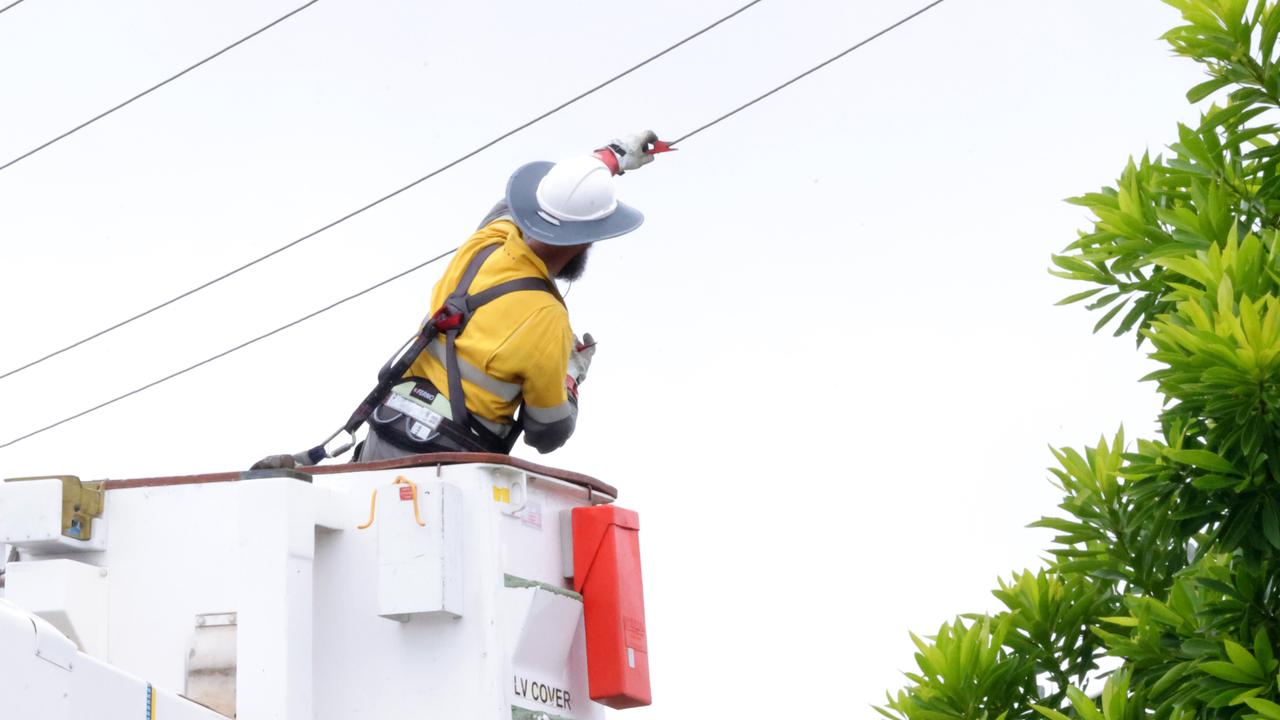
Total blackout: Power cut to more than 320k SEQ properties
More than 320,000 homes and businesses across South East Queensland have been plunged into darkness amid stark warnings it could take a fortnight to restore the hardest hit areas.