Queensland weather: El Nino likely this year with threat of droughts, floods and storms
Queensland may be facing a winter of “blockbuster” weather extremes with warnings a “super El Nino” could form within the next 90 days.
QLD weather news
Don't miss out on the headlines from QLD weather news. Followed categories will be added to My News.
A “super El Nino” could form in the next 90 days bringing an increased risk of extreme droughts, floods and storms.
The National Oceanic and Atmospheric Administration issued the warning, saying it could develop as early as this month and persist throughout winter.
The NOAA is also predicting a 55 per cent chance of a significant or “super El Nino” on the horizon later in the year from November to January and an 80 per cent chance of at least a moderate El Nino.
US National Oceanic and Atmospheric Administration Senior Research Scientist Dr Mike McPhaden said El Ninos typically come every four years or so.
“We’re due one. However, the magnitude of the predicted El Niños shows a very large spread, everything from blockbuster to wimp,” he told The Inertia.

Dr McPhaden said big El Niños tended to come along every 10 to 15 years and so it would be “very unusual” to see one so soon after the last major one in 2015 and 16.
“Even so, nature has a way of tripping us up just when we think we know it all,” he said.
“The really big ones reverberate all over the planet with extreme droughts, floods, heatwaves, and storms. If it happens, we’ll need to buckle up. It could also fizzle out. We should be watchful and prepared either way.”
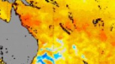
The Bureau of Meteorology, in a report issued on May 9, said modelling showed that sea surface temperatures would pass the El Nino threshold by August.
Queensland-based Early Warning Network meteorologist Ken Kato said confidence of an El Nino developing later this winter or spring was much higher than usual.
“Typically autumn is quite difficult with predictability but even after these months, the modelling is not only sticking to its guns but it’s gotten stronger,” he said.
“With El Nino there will be less rainfall and hotter daytime temperatures particularly into spring.
“If that were to happen, that would also raise the risk of bushfires especially after our recent La Nina and the increase of vegetation which could get dried out.
“At the moment all models were suggesting an El Niño would develop into late winter.”
A Queensland Fire and Emergency spokesman said preparations had already started ahead of the state’s bushfire season.
QFES Superintendent James Haig said although they are expecting a normal fire season, people should prepare a bushfire fire survival kit as well as taking simple measures to reduce the risk of fires.
“We are watching weather conditions very closely and have a forecaster embedded in our office,” he said.
“We have been working to reduce the risks of bushfires within our community not only through prescribed burning but also alongside nature land management.”
It comes after Queensland endured its coldest start to May in 50 years ahead of a predicted cold, dry winter and potentially devastating bushfire season.
Oakey’s -5.7C on Tuesday last week was the town’s coldest May minimum on record, while the Sunshine Coast Airport at 3.3C surpassed its previous record of 3.5C set in 2019.
The Bureau of Meteorology’s Brad Jackson said since the start of May, Toowoomba had averaged 7.7C, Coolangatta 10.7C, Beaudesert 7.1C and Brisbane 10.9C.
“This is one of the coldest starts we have seen,” Mr Jackson said.


