
Queensland weather: 200km-long band of rain dumps up to 400mm on state’s southeast
Heavy rain that’s expected for the Darling Downs and Granite Belt on Friday is set to move into the southeast by Sunday, adding to already big falls enjoyed this week. LATEST RAINFALL FIGURES
QLD weather news
Don't miss out on the headlines from QLD weather news. Followed categories will be added to My News.
HEAVY rain is expected for southern Queensland today, bringing much-needed relief to drought-affected locations across the Darling Downs and Granite Belt.
Bureau of Meteorology forecaster Kimba Wong said: “We’re looking at double-digit falls across quite a wide area, and the potential for some isolated triple-digit figures as well, which is really good news for those drought-stricken areas.
“The focus of that heavy rainfall shifts back into the southeast again on Sunday, and possibly lingering into Monday.”
Ms Wong said the recent deluges would bring big falls and king tides, increasing the danger of flooding in the southeast.
‘We’re talking 50-100mm scattered across the Sunshine Coast, Brisbane and the Gold Coast, maybe stretching up as far as the Wide Bay as well.”
Flood warnings have been issued for both the Noosa and Maroochy rivers, as rain causes dam and river levels to rise.
A flood watch is current for all coastal catchments, from south of Caboolture to the NSW border.
“With the wet ground that we do have there is the possibility of… flash flooding and some riverine flooding as well,” Ms Wong said.
While no rainfall records had been broken, Ms Wong said it was not off the cards.
“We could see a few more weeks of quite wet weather,” she said.
“It certainly was a very dry year last year, so maybe we’ve forgotten a little bit what the wet season can feel like.”
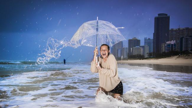
Earlier it was reported the deluge is forecast to continue across Queensland this weekend with up to another 200mm of rain predicted after more than 400mm of rain was dumped across parts of the southeast by a 200km-long rain band.
Online forecasts of 500mm earlier this week seemed like a long shot, however, with falls of over 400mm recorded near Maryborough and up to 300mm+ across the Sunshine Coast, Brisbane and the Gold Coast, the forecast ‘rain bomb’ could become a reality.
LATEST ROAD CLOSURES: FLASH FLOODING BLOCKS MAJOR ROADS
Bureau of Meteorology forecaster Kimba Wong said parts of Queensland had experienced a delayed start to the wet season.
“Some places are starting to get up to their average rainfall for February and it is only early in the month,” Ms Wong said.
The current weather system, which kicked off at the start of the week, has delivered some 405mm of rain to Teddington Weir, near Maryborough.
Brisbane has received some 200mm courtesy of the weather system – 60mm more than its February average of 130mm.
320mm has pelted the Sunshine Coast, drowning the region’s February average of 190mm.
The Gold Coast also eclipsed its monthly mean of 165.6mm, receiving some 200mm of rain this week.
On Thursday alone, 250mm fell on Coops Corner, south of Tin Can Bay.
Byron Bay’s town centre is currently flooded as the result of the 252mm deluge overnight.
Byron Shire Council’s acting manager of infrastructure services, Phil Warner, said the city was experiencing drainage issues after the recent downpour.
He said the council had lowered a sand boom at Belongil Creek, but current ocean and tidal conditions were hampering stormwater drainage for the region.
Ms Wong said the rainfall is expected to lighten today but that severe weather is still a possibility for some parts of Queensland.
“There is potential that we might issue some storm warnings through the day today,” she said.
“As we head into Sunday the heavy rainfall will return,”
“It’s possible that we’ll see the same rainfall that we had yesterday,”
The bureau has issued a flood watch for all catchments south of Caboolture to the NSW border.
“I would encourage people to keep up to date with that in case it does get upgraded to a flood warning,” Ms Wong said.
Brisbane and the Sunshine Coast can expect another 100-150mm of rain between today and Sunday, according to Weatherzone meteorologist Joel Pippard.
Another 150-200mm of rain was expected to hammer the Gold Coast during that time.
Weatherzone is forecasting heavy rain and storms expected for Moreton Island, and Mr Pippard said the weather could drift inland causing coastal rainfall figures to increase further.
Last night, three people were rescued from floodwaters in Brisbane and the Sunshine Coast, including a woman who was strapped in her car near Mount Coot-Tha.
A severe storm warning was also issued last night for the Sunshine Coast as more than 93mm of rain pelted down in just one hour.
The rain caused flash flooding, which led to swift-water rescuers and firefighters being called to Glenwood.
Just north of Noosa, a car was washed away but luckily no one was inside at the time.
A man was rescued after his car was trapped in floodwater on Gap Creek Rd, Kenmore Hills about 5.45pm.
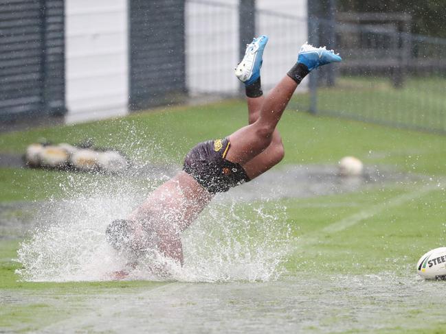
Yesterday, morning and evening peak hours became a mess of crashes and water over major roads, prompting warnings for drivers to slow down.
Brisbane City Council buses were last night delayed by up to an hour by weather.
Bureau of Meteorology forecaster Kimba Wong said the warnings would remain due to the mixture of yesterday’s heavy rain and the consistent rain forecast.
“South of about Caboolture to the NSW border has the potential of flash flooding and river rises over the next couple of days,” she said.
The amount of rain was not abnormal, but the intensity was “a bit less usual”.
“We had quite drenching rain … peaking around rush hour,” Ms Wong said.
Rain and storms will continue for a week with Monday potentially bringing intense weather to the southeast.
Early yesterday, Vulture St was shut after a car bogged, while Kingsford Smith Drive was flooded. But as citysiders in suits sighed, the rain dancers in drought country have been jumping in the mud.
“We should see some useful rainfall totals for drought-stricken areas through the southern Inland, through the eastern parts of the Maranoa and Warrego, east of Charleville and through the Western Darling Downs,” Ms Wong said.
Roma’s February average rainfall is 85.2mm. It is already at 83mm, with heavier rains predicted on Sunday.
Even as the skies opened, the drought still brought perils. The lack of vegetation has raised the risk of flash floods.
Queensland Fire Emergency Service’s South-West Region manager Bob Bundy warned people to prepare.
“There’s no vegetation on the ground to reduce the flow of water as a result of the drought, so be prepared for flash flooding and water across roads,” he said.
“Prepare for forecast thunderstorms for the Darling Downs and Granite Belt area this week by clearing gutters, trimming overhanging branches, securing loose items such as outdoor furniture and moving cars undercover, away from trees.”
Meanwhile, Western Australia’s Pilbara region is bracing for Cyclone Damien, which is expected tomorrow as a Category 4 system.

‘Can’t be ruled out’: Potential for freak Qld snowfall this week
Queensland could see snow this week with weather models predicting up to 14cm falling on the Granite Belt.

Monster weather system brings storm, heavy rain to Qld
Brisbane and surrounding parts of the southeast have been hit by storms and heavy rainfall this afternoon as a 3000km-long monster low moves across the state.