Qld weather: Temperatures to climb 10C above average
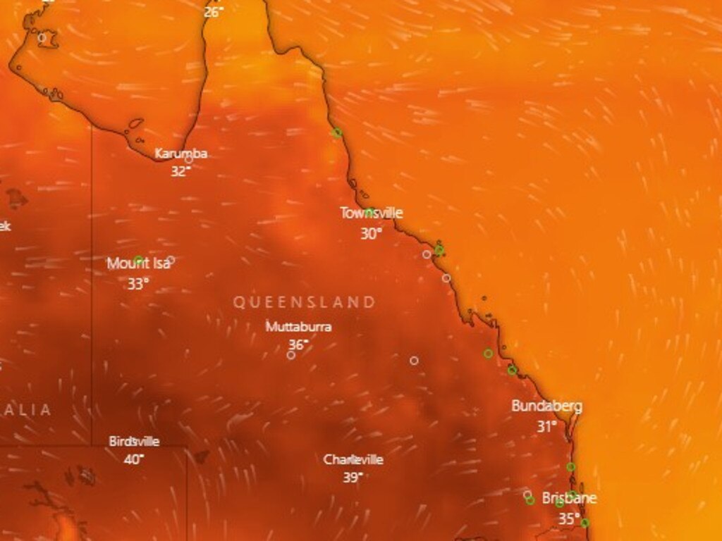
Temperatures have reached 40C in several parts of Queensland as parts of the state swelter through the hottest day of the year so far.

Temperatures have hit 40C in multiple parts of Queensland as the state swelters through what is expected to be the hottest day of the year so far.
Birdsville hit 40.1C at 12.30pm - the highest temperature in the state at the time - followed by Roma on 40C and Miles on 39.3C.
The state’s South East was slightly cooler, with Archerfield sitting on 35.1C at 12.30pm, Nambour on 35.3C and the Gold Coast Seaway on 31.3C.
It was 35.7C in Brisbane - making it officially the River City’s hottest day for the year so far.
Other areas, however, had already recorded their highest temperature of the year so far by 9am.
Temperatures had hit 2023 highs in the Maranoa, Warrego and Channel Country, with Roma hitting 34.1 degrees at 9am, Birdsville trailing just behind at 33.1 degrees, and Cunnamulla at
32.7.
However the lack of humidity was bringing some reprieve to many areas, with apparent temperatures slightly less..
The South East was also feeling the heat early, with 9am temperatures reaching 30.3C at Coolangatta (apparent temperature of 29.2C), 30.4C at Sunshine Coast Airport (apparent 30.1C) and 29.7C at Archerfield in Brisbane’s south (apparent 32.7C).
Birdsville and Roma are both tied for the hottest forecast temperatures in the state, with the mercury expected to hit 42 degrees.
Gatton is expected to reach 40C, Brisbane 36C and places in the Wide Bay about 41C.
It comes after parts of the state saw temperatures dip no lower than 27.6C overnight (recorded at Birdsville at 4am and at Ballera at 3.27am).
The South East had more comfortable overnight lows of 21.9C in Brisbane (recorded at 5.30am), 20.9C at the Gold Coast Seaway (recorded at 4.18am) and 18.7C at Nambour (3.30am).
The apparent temperature made a hot night even worse in many parts of the state. By 5.50am the apparent temperatures were as high as 31.5C, which was recorded at Burketown Airport. In Brisbane the apparent temperature at 5.50am was 24.5C while the Gold Coast Seaway was sitting at 23.8C and Nambour 22C.
Bureau of Meteorology forecaster Danny Johnson said huge chunks of the state will experience another heatwave but with drier conditions compared to the week before.
He had said lower dew point would make overnight temperatures and humidity milder, but afternoon temperatures were still expected to be high.
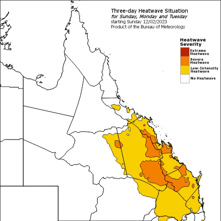
“We will have a heatwave in place for most of South East Queensland tomorrow,” he said.
“We will see some hot temperatures like today but we will see those temperatures increase more tomorrow.
“But it will be much hotter out west.”

Severe warnings are in place for Central Coast and Whitsundays, Capricornia, Central Highlands and Coalfields and Wide Bay and Burnett Districts
Mr Johnson said Toowoomba was forecast to hit 37C which is about 10C above its usual average.
“We’ve got the trough up north and the cyclone moving off and we’ve got this big trough pushing through this hot dry air,” he said.
“Except for the Cape, everything is very dry on the map.”
Brisbane is predicted to hit a high of 36C compared to an average of 30C.
BOM has warned the heatwave could be dangerous for many people, and those impacted should seek shelter where they can keep cool, such as at home, a library, community centre or a shopping centre.

Those looking to cool off will have to keep the surf conditions in mind, with a hazardous surf warning in place for much of the South East due to Ex-Tropical Cyclone Gabrielle.
A hazardous surf warning has been issued for this weekend for the Fraser Island Coast, Sunshine Coast Waters and Gold Coast Waters.
The warning is expected to remain until Monday.
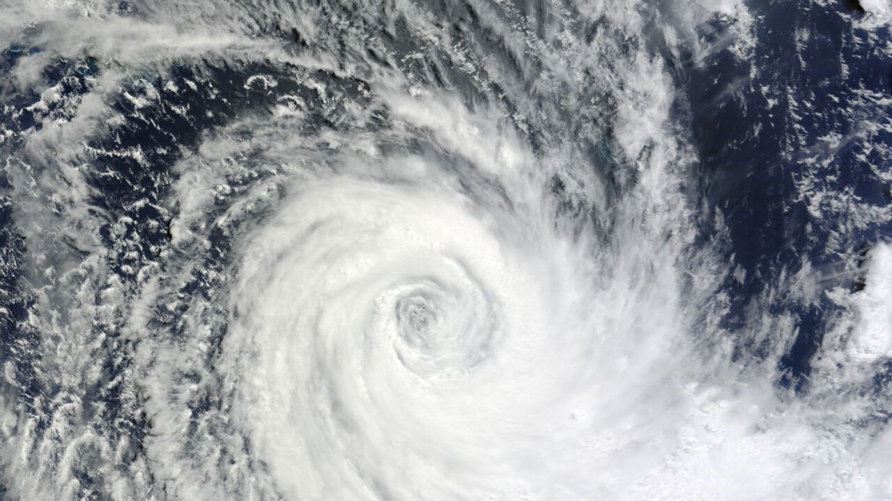
Weatherzone meteorologists say the heat is intensifying as a result of clear skies, westerly winds and the proximity of Ex-Tropical Cyclone Gabrielle.
High humidity will make the state feel even hotter.
While the heat will be severe, it’s expected to cool by Monday as a cooler onshore wind change arrives prompting widespread rain and storms on Tuesday.
CYCLONE GABRIELLE PASSES NORFOLK ISLAND
Norfolk Island has seen power outages and trees down as Tropical Cyclone Gabrielle passed overnight.
The cyclone came within 30km of the island but has since been reclassified as a tropical low and the tropical cyclone advice cancelled for Norfolk Island.
It was downgraded from a category 2 cyclone at 4am after passing Norfolk Island about 7pm AEST.
“Norfolk Island has avoided the strongest winds of the cyclone although gale-force winds are likely to resume for a period on Sunday morning then easing by the afternoon,” the Bureau of Meteorology said at 6am Sunday.
“Ex-Tropical Cyclone Gabrielle has transitioned into a vigorous sub-tropical low pressure system as it continues to move further away from Norfolk Island.
“Winds about the island have eased and gales with damaging wind gusts are no longer expected. However, high waves are likely continuing around parts of the island.”
Bureau forecaster Jonathan Howe said despite Norfolk Island avoiding the full brunt of Tropical cyclone Gabrielle, the island was still hit with wind gusts over 100km per hour.
“The Centre went very close to Norfolk Island, we started to see the centre come into proximity to the island at 9pm local time (7pm AEST),” Mr Howe said.
“Norfolk Island has approximately just over 100 millimeters of rainfall as well and the strongest wind gusts that they saw was 102 kilometers an hour.”
Despite the worst being over for Norfolk Island, the North island of New Zealand is now in the firing line of the weather system.
“The worst is now over for Norfolk Island, but it is making its way towards the North Island of New Zealand, where it’s already producing rainfall across the northern parts of North Island and winds already increasing for places like Auckland” Mr Howe said.
“So it is expected to still be quite strong and expected to approach Auckland and kind of move over the North Island in the next 24 hours,
“So really peaking tomorrow morning to afternoon in terms of rain and wind across the North Island, but then fizzles out over Tuesday, but certainly for New Zealand, it’s looking like quite a strong and impactful system.”

The system was at 6am sitting about 185km east-southeast of Norfolk Island, moving east-southeast, with winds near the centre of the tropical low of 100kmh and gusts up to 140kmh.
A “red alert” had been issued on Norfolk Island Saturday night.
Emergency Management Norfolk Island issued the alert, warning of potential wind gusts of 155km/h as the cyclone was expected to pass over or near the island overnight.
On Saturday night power was reportedly going off and on as ferocious wind gusts lashed the island, where the Queensland government oversees essential health and education services.
Norfolk Island resident Alex MacGillicuddy said late Saturday night that it was “pitch black” outside but he could hear “powerful wind gusts” and his neighbour’s shed “slowly coming apart”.
Mr McGillicuddy said some trees were down but he and his family were safe in their relatively new home which had been built to withstand cyclones.
He said torrential rain of up to 200mm had been forecast but estimated only about 20mm had fallen by late Saturday night.
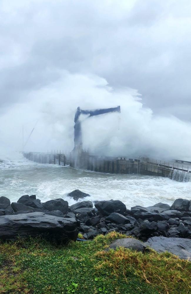
Mr McGillycuddy said he took photos earlier in the day of Cascade Pier on the eastern side of the island which “took a pummelling” as the weather “ramped up quickly over the course of a couple of hours”.
“But all in all we are good and the community as a whole have looked after each other,” he said.
EMNI emergency controller George Plant had on Saturday warned Norfolk Island residents to “prepare to move to the strongest part of your house, or if you need to, relocate to the Emergency Shelter at Rawson Hall”.
“Stay inside until a ALL CLEAR message is sent through by the SMS blast system,” he advised in the latest cyclone bulletin.
“EMNI will issue this message as soon as it is safe to do so.
“If the cyclone centre passes over the island this evening, destructive winds may ease for short period of time, beware of this and do not go outside.
“Destructive winds are then likely to redevelop from the opposite direction.”
Mr Plant told residents it was important they kept up to date with the cyclone development through internet or local radio.
“Rawson Hall is open and manned by volunteers,” he said.
“If you do go to the hall, please bring your own bedding and things such as your phone and its charger.
“EMNI will provide updates on the cyclones progress through local radio and the EMNl’s Facebook page.”
More Coverage
Read related topics:Weather


