
Qld weather: Severe storms, heavy rain warning for SEQ
Severe storms with damaging winds and large hail are forecast to hit SEQ on Wednesday with a heatwave warning for parts of the state’s north, central and Southeast regions.
QLD weather news
Don't miss out on the headlines from QLD weather news. Followed categories will be added to My News.
Severe storms with damaging winds and large hail are forecast to hit Queensland on Wednesday with a heatwave warning for parts of the state’s north, central and Southeast regions.
The hot and humid week comes after southeast Queensland was lashed by torrential rain on Tuesday, with some catchments copping over 40mm in the space of an hour.
The Luscombe weather station north of the Gold Coast’s Cedar Creek recorded 73mm of rain from 9am, with 53mm falling between 12pm and 3pm.
Meanwhile, 56mm fell near Clagiraba Road at Coomera as 41mm falls were recorded at Tallai in Nerang between 2pm and 3pm.
63mm fell at Greenbank in Logan, Amberley near Ipswich saw 41mm falls from 9am, and looking to the state’s north Samuel Hill in the Capricornia region recorded 77.6mm, 44 of which fell between 2pm and 3pm.
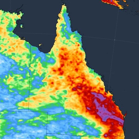
Bureau of Meteorology meteorologist Livio Regano said most of Queensland could expect a drenching over the next week with potentially “horrible” humidity.
“There’s not really an area that isn’t going to get rain,” he said.
“All the way from Cairns down to The Gold Coast. And I think the only difference is that the timing, the further south you are the more likely the rain will be tomorrow and Wednesday.”
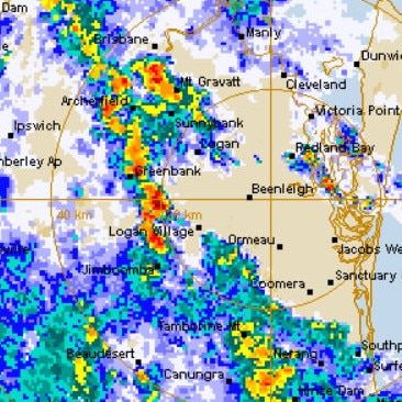
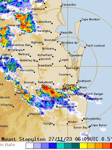
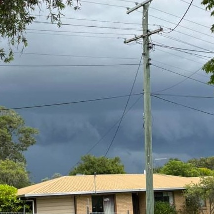
The Bureau of Meteorology radar showed several severe storm cells forming over the southeast on Tuesday afternoon, with the heaviest falls over Brisbane’s southwest, Logan and across the Gold Coast.
More than 20mm was recorded at Greenback in half an hour to 1.30pm.
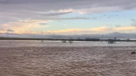
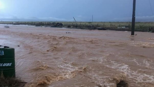
Earlier this morning, almost 200mm of rain was recorded at Audreystone, 15km northwest of Barcaldine, from 2-4.50am. The deluge caused flash flooding with incredible photos posted to Who Got the Rain? capturing the aftermath.
A major flooding warning is active for the Moonie River, while moderate flooding is occurring in Wallan Creek, Paroo River and the Barcoo River.
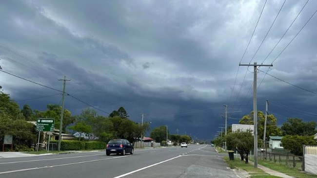
It comes after South East Queensland was lashed by a trifecta of “very dangerous” storm cells overnight, triggering a fierce 80mm deluge in less than an hour.
The impacted areas included Logan and Brisbane’s south as well as across Somerset and Cherbourg – where 147mm of rain fell over a 24 hour period.
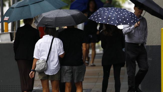
Brisbane and the Gold Coast will continue to be drenched on Tuesday, with up to 25mm of rain falling across the two areas, and storms to persist on Wednesday.
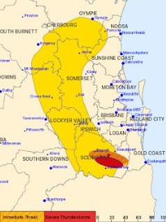
Overnight. the Bureau of Meteorology issued multiple warnings for parts of the state’s southeast, including Cherbourg, Gympie, Kingaroy and the area north of Goomeri, with “heavy, locally intense rainfall” recorded amid fears of potential “life-threatening flash flooding”.
Gregor Creek, near Kilcoy and Somerset Dam, had already recorded a drenching on Monday afternoon, with 80mm recorded in one hour at 5pm, for a 24-hour total of 120mm.
Other heavy rainfalls include 55mm in Mt Stanley, 60mm in Bellbird Park and 71.5mm in Cherbourg, which in 24 hours received 147mm.
Moderate flood warnings still remain for Moonie river and Wallam and Mungallala creek.
At least one of the storms, around Proston and Goomeri, was described as “near-stationary”, adding to the intensity of the rainfall in localised areas.
Further north, severe thunderstorms also affected the North Tropical Coast and Tablelands, Northern Goldfields and Upper Flinders, Herbert and Lower Burdekin and Peninsula districts.
Community Information Officer with the Bureau of Meteorology Patch Clapp on Monday night told the Courier-Mail two major storm cells across Queensland caused the severe thunderstorms.
Mr Clapp added there were some 30mm falls to the North of Mt Isa and Cloncurry.
The severe storms were a result of Monday’s moist tropical air.
“We knew if the storms got started we were going to see this severity,” Mr Clapp said.
“The ingredients were all there for these severe storms across Queensland.”
Senior Meteorologist Felim Hanniffy on Tuesday said Queensland hasn’t seen the end of the storm activity, with chances of severe storms forecasted for the next two days.
“There are patchy rain areas around today and we could still see further severe developments into parts of the southern interior today,” Mr Hannify said.
“Tomorrow that risk returns to the southeast with large hail, damaging winds and heavy rainfall being the primary risk, with the storm more likely to be more mobile.”
Mr Hannify said Thursday may bring hotter, drier conditions but humidity and showers will return on Friday and into the weekend.
“We’re looking at hot conditions during Thursday with hot westerlies coming through,” Mr Hannify said.
“Then the humid conditions return for Friday and the weekend and we see increased shower and thunderstorm activity return.”
Parts of Queensland would be in for a triple-whammy of weather events with hot temperatures, humidity and storms expected for most of the week.
Bureau of Meteorology meteorologist Livio Regano said most of Queensland would expect a drenching over the next week.
“There’s not really an area that isn’t going to get rain,” he said.
“All the way from Cairns down to The Gold Coast. And I think the only difference is that the timing, the further south you are the more likely the rain will be tomorrow and Wednesday.
“Whereas going further north it might be Wednesday morning and Thursday.”
Mr Regano said there was a lot of humidity in the air and that was going to cause the moisture to condense into the clouds.
“We’ve had our moisture now for many, many days, it’s very humid,” he said.
“We’ve got tropical moisture, and that’s important. And it’s not just near the coast over the last week, it’s literally penetrated right towards the western border of Queensland.
“So the whole atmosphere over Queensland is primed for rain because it’s got plenty of moisture.”
Mr Regano said it was so humid that even in the inland areas the dew point was getting above 20 combined with above average temperatures.
“Now it’s not unusual to have dew points in the 20s on the coast as they come into November and December but to have them inland that’s, that’s really saturated air, that’s prime for rainfall,” he said.
“So Longreach for example, it’s 32C Today, 35C Tomorrow, 39C On Wednesday,” he said.
“That’s going to be a horrible 39C. The dewpoint in Longreach, currently, heaven forbid, is 21 degrees.
“So if we sustain that dew point and we get a temperature of 39 in later this week, that will feel horrible for them, even though they’ve experienced the temperatures in the 40s many times before. It’ll probably feel worse than that.”
Brisbane will reach a high of 35C on Thursday, while Ipswich will get to 36C.
Mr Regano said while many areas were going to be quite hot, it would depend on if the area was right under storms and clouds.
“If you are right under a storm and they are slow moving this is the problem if they turn out to be severe, it’ll be because of localised flash flooding because even if the storm isn’t very strong but because it just sits in one place for such a long time,” he said.
“You know that area may not cope with draining that water quickly enough in the creeks and dams etc.
“And so it sort of goes under. At this stage. We don’t have any such warnings, but if it happens, it’ll be because the storms are slow moving.”
Join the conversation

Feels like -5.3C: Icy blast sends temps plummeting again
South East Queensland has again shivered through a freezing start to the day, as a brutal cold front continues to blast the region with subzero temperatures, made worse by chilling winds.
Read more

Feels like MINUS 7.1C: Brutal cold front blasts southern Qld
A brutal cold front is blasting across southern Queensland with subzero temperatures and widespread frost.
Read more