
Qld weather: Storms forecast for almost the entire state
Queenslanders are being warned to brace for the possibility of widespread thunderstorms following days of destruction in the southeast, with only the far southwest of the state likely to escape.
QLD weather news
Don't miss out on the headlines from QLD weather news. Followed categories will be added to My News.
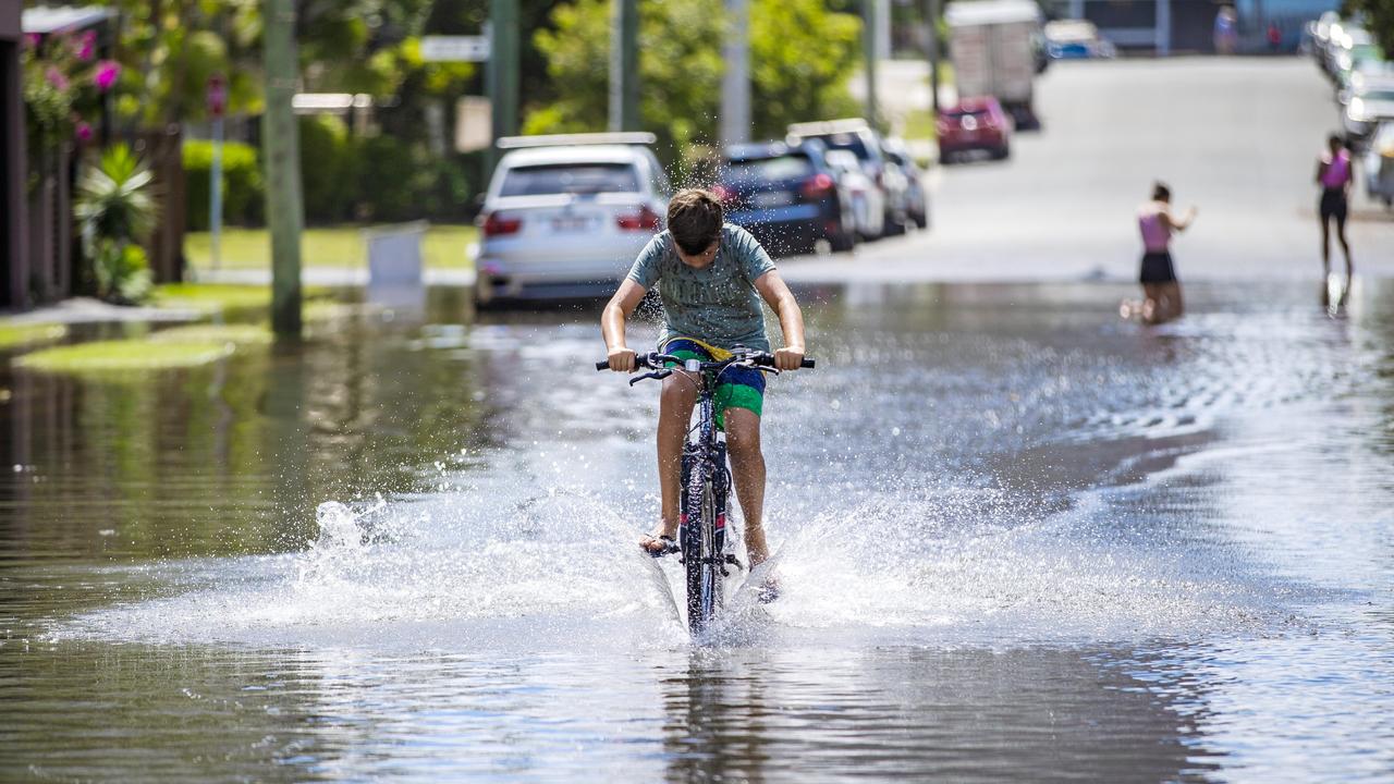
Thunderstorms have been forecast for about 75 per cent of the state, with the potential for severe storms to develop in the southeast just days after it was drenched by a low pressure system.
A Bureau of Meteorology forecast warned that the entire coastline and inland to Quilpie and Mt Isa could expect possible thunderstorms, with the southeast corner, Central Highlands and Northern Goldfields regions told to expect possible severe storms.
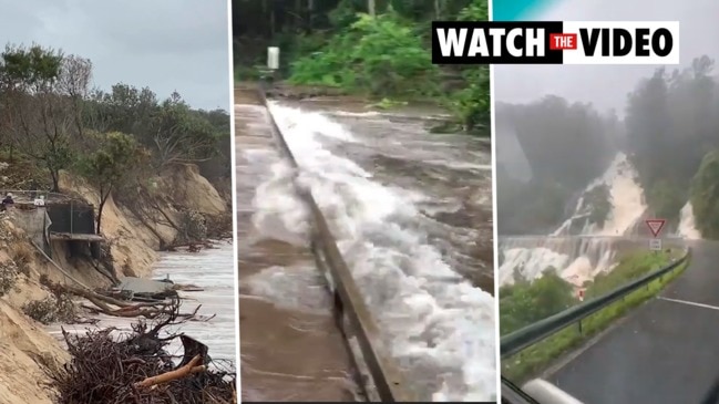
It comes just two days after the Gold and Sunshine coasts and Brisbane were drenched by more than 900mm of rain in places.
The Gold Coast is set to be hit again by heavy rainfall and storms, with the wet weather predicted to last heading into Christmas.
The Bureau of Meteorology (BOM) is forecasting more rain for the Gold Coast with the Seaway already receiving 211mm of rain since Saturday and Lower Springbrook recording 733mm in the same time.
🌩ï¸Thunderstorm forecast - Wed 16th Dec 🌩ï¸
— Bureau of Meteorology, Queensland (@BOM_Qld) December 16, 2020
While widespread severe weather has eased across #SEQLD, severe thunderstorm activity with heavy rainfall still possible over parts of northern, central and southern Queensland today. Warnings: https://t.co/H3BR5bMmDN pic.twitter.com/j2uvIVRZMR
BOM meteorologist Kimba Wong said storm activity is sitting offshore and the Gold Coast can expect it to hit the region later today or early tomorrow.
“The storm activity is likely to move across from tonight. Depending when it hits the Gold Coast could see more heavy rainfall,” she said.
“Today the Gold Coast is predicted to have rainfall reach the double digits from 15mm up to 40mm depending when the storm comes through.
“The same is expected early tomorrow, with 15mm to 40mm depending if the storm brings large rainfall.
“Once the storm clears, which is expected to be in the early afternoon, the rain should start to ease.
“The cloud cover will continue to sit over the Coast and isolated showers of a few millimetres are expected to stretch across the weekend.”
Ms Wong said the Christmas forecast is no certainty but it’s looking like it’ll be a gloomy day for the Gold Coast.
“From what I can see now a cloud band is expected to stay for the start of next week and doesn’t look like clearing,” she said.
“At this stage the Gold Coast can expect a cloudy Christmas.”

In Moreton Bay the extent of the damage of the weekend’s storms remains unknown.
The cyclonic weather dropped more than 150mm of rain on parts of the bay, with high seas littering beaches with debris, felling trees and raising tides to astronomical levels.
“We don’t know the total damage bill at this stage, but our crews were out immediately to assess our roads and pathways and fix damage to our Arana Hill Works Depot where a tree fell on the roof,” Mayor Peter Flannery said.
“Council’s crews are currently focusing on cleaning up debris from our beaches and the Redcliffe Lagoon in the wake of the weekend’s abnormally high tides.
Moreton Bay Council is continually developing a hazard adaptation strategy - which centres on the impacts of wild weather.
“The wild weather over the weekend has shown the damage severe weather events can cause to our beaches and waterways, which is why a (Coastal Hazard Adaptation Strategy) is an absolutely critical investment in the future planning of Moreton Bay Region,” Mr Flannery said.
“The Changing climate is having an impact on our Beaches ... the CHAS will help Council and the community make better decisions to mitigate potential risks from coastal hazards such as erosion, storm tide inundation and predicted sea level rise.

Piles of heartbreak: Ingham counts devastating cost of floods
The Hinchinbrook region has begun counting the cost caused by the “perfect storm” as talk turns to potential buybacks and re-building homes ravaged by the floods.
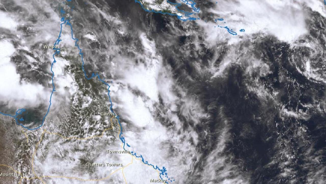
Search for man missing in flood waters as NQ faces another 300mm monster
A search and rescue mission is underway in NQ for a man who drove into flood waters while the region braces for an active monsoon trough expected to dump falls of up to 300mm.