
Qld weather: Deluge set to worsen, with falls of up to 400mm expected, as state’s north cops a drenching
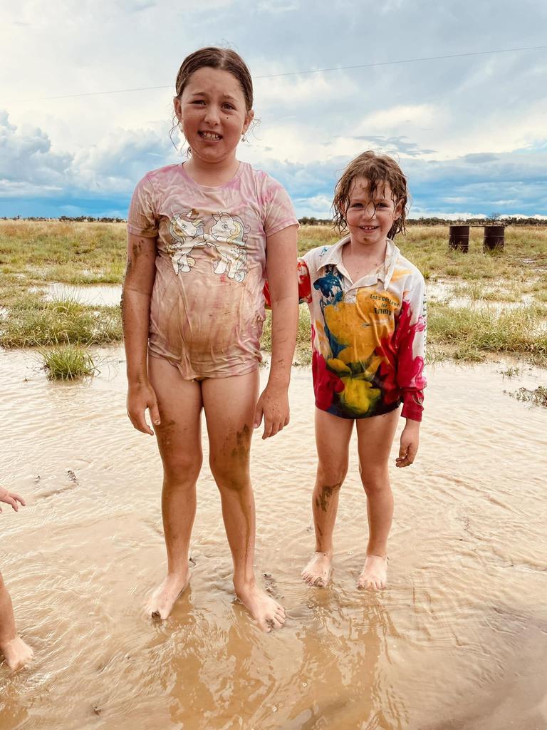
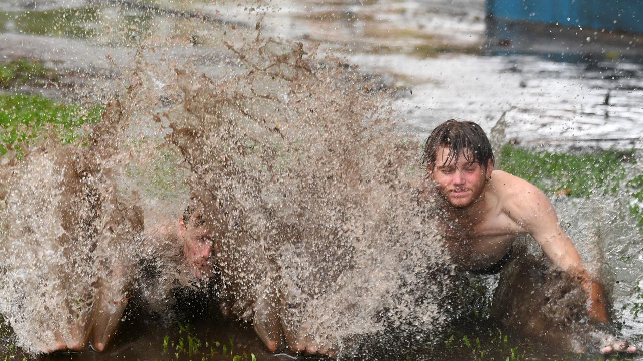
Three people, including two teenagers, are in hospital after clinging to a tree as parts of Queensland are hit with “life-threatening” flash flooding, with the peak of the severe weather event to come.
QLD weather news
Don't miss out on the headlines from QLD weather news. Followed categories will be added to My News.
Three people are in hospital after being rescued as parts of Queensland are hit with “life-threatening” flash flooding, with the peak of the severe weather event to come.
The three women rescued - two teenagers and a woman in her 20s - were taken to the Proserpine Hospital after being rescued in Palm Grove, north of Mackay.
The Queensland Ambulance Service said they were rescued from flood waters near Cedar Creek Road at 3.15pm on Sunday.
They were found in a swollen creek, clinging to a tree before emergency services were able to rescue them.
All three women were transported in stable conditions.
A QFES spokesman said two Swift Water Rescue teams rescued the three females after gaining access to the creek through a private property.
“We had two trucks and two Swift Water Rescue teams attend,” he said.
“They were in the hands of the QPS and QAS just after 4pm.
“It did not take too much time.”
SES volunteers also attended the scene.
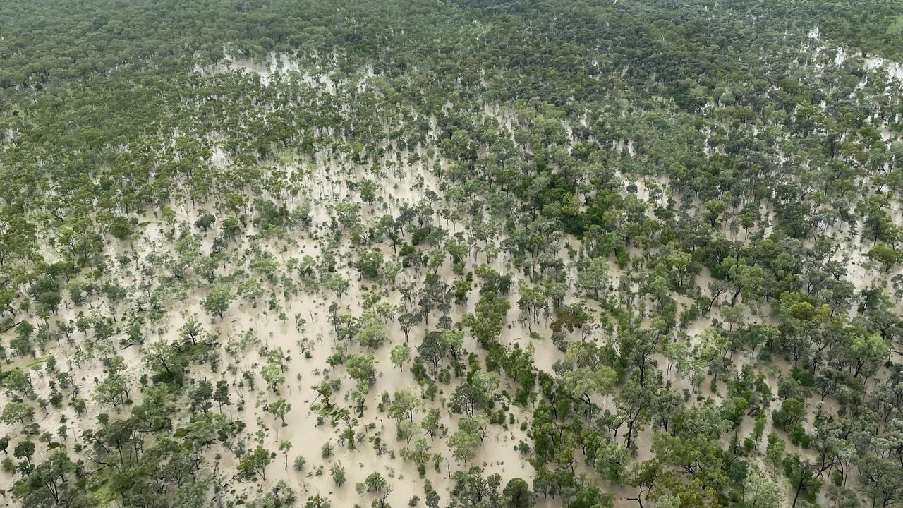
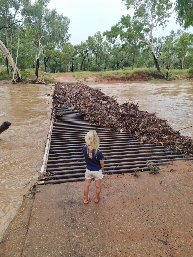
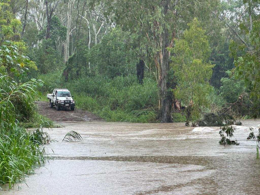
Rising floodwaters are causing chaos across Queensland, cutting off small towns and leaving at least nine people in need of rescue after up to 271mm mm of rain fell in some parts of the state in the 24 hours to Sunday morning, with a further 200mm expected.
Jubilee Pocket recorded 100mm and Lower Gregory recorded 104mm from 9am to 4pm on Sunday. Up River Road at Proserpine recorded 110mm in just over six hours on Sunday.
Meteorologist at the Bureau of Meteorology, Felim Hannify said while houses and businesses are not yet reporting widespread flooding, those living in the affected areas should remain on high alert over the next two days, with falls of 200mm predicted.
“Given the slowness of the system there is certainly a risk for the river systems to flood and also flash flooding as the conditions continue to impact the rivers,” Mr Hannify said.
“We are talking rainfall totals of 100 to 180 mm in a six hour period, some areas may even see falls of up to 200 mm a six hour period and this will likely peak on Monday.”
Mr Hannify said the highest totals are expected in the Clarke Range and Bowen, with the extreme conditions expected to move further north from Wednesday.
“It’s going to be a very active period over parts of northern Queensland, particularly parts up along the central coast and around the Bowen area,” Mr Hannify said.
“There has been heavy to localised intense rainfall over this particular stretch of the coast and the adjacent inland areas today and it will continue into the early parts of the coming week too.
“After Monday and Tuesday it will eventually move back north, where the heavy rainfall risk transfers back to northern Queensland for the second half of the week,” he said.
Mr Hannify said residents should expect significant disruptions on roads as the rivers continue to rise, adding the knock-on effects of the rain will continue once the heaviest falls subside.
“Once the weather subsides in the central areas, northern parts of the state, which are already pretty wet from the monsoon falls over the past weeks, will need to brace for more heavy falls,” Mr Hannify said.
The Bowen PCYC was to be set up as a flood refuge Sunday from 6pm.
“If anyone is stranded, you can use the facilities there,” a police spokesperson said.
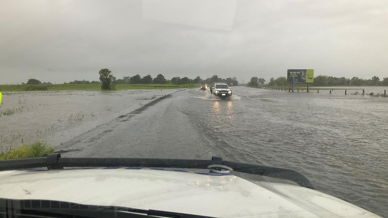
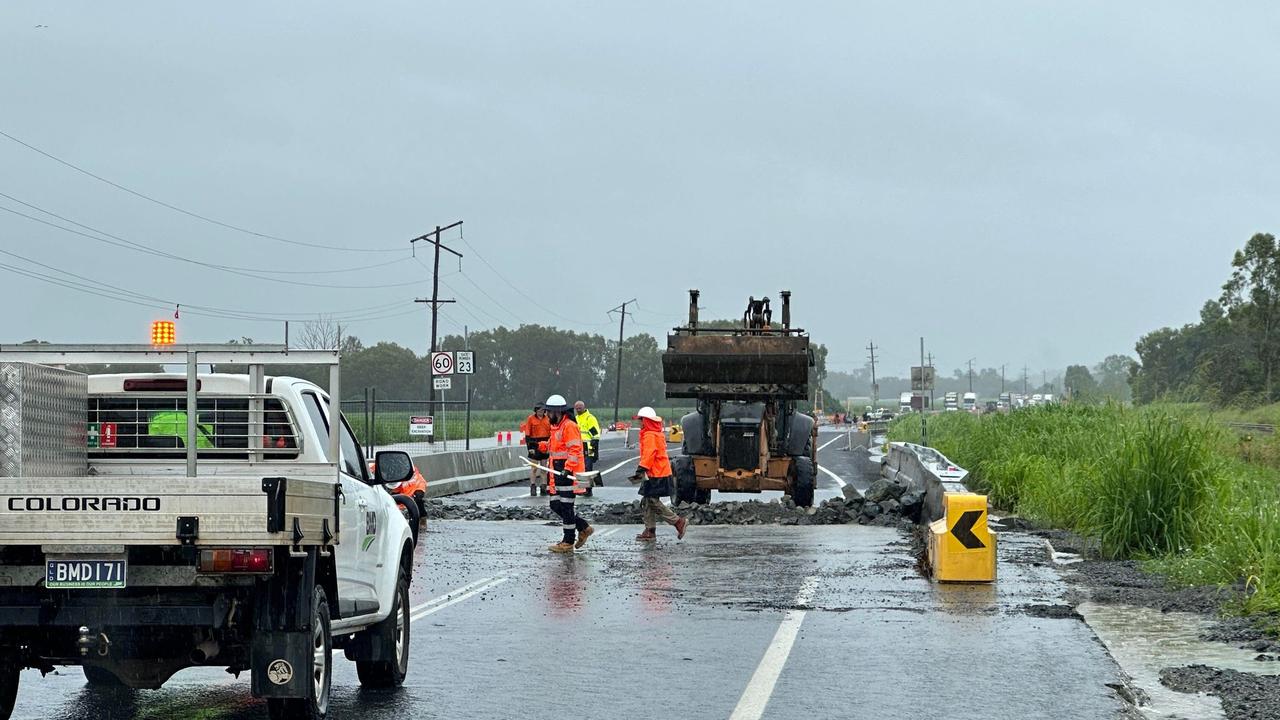
The Bruce Highway has been shut in different locations 4km north of Bowen and south of Proserpine at Goorganga Plains.
Police were on scene Sunday and advising motorists to delay non-essential travel and avoid the area.
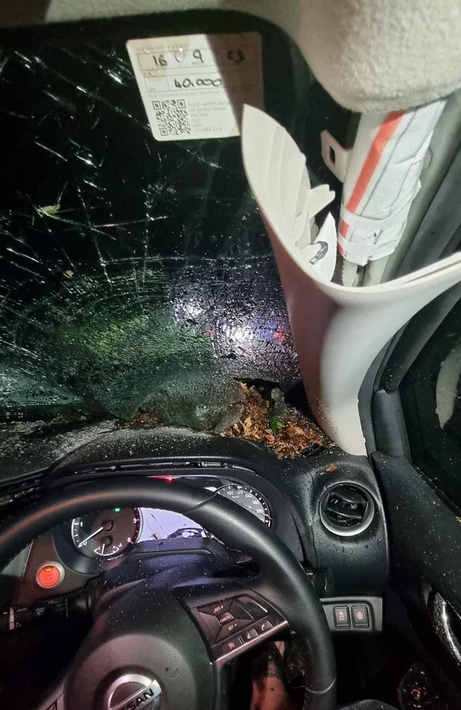
The rain was smashing the Eungella region, west of Mackay, where resident Chris Clarke and his wife had a near-miss last night.
The small mining town of Dysart was also close to being cut-off Sunday afternoon.
Writing to the Eungella Community Noticeboard on Facebook, Mr Clarke said trees were “falling everywhere” across Dalrymple Heights.
“While I was removing a tree, my wife was standing next to the car,” he said.
“Just missed her by about a meter … this is the result…
“Thank god it just missed us, could of turned the situation real bad.”

The Mackay and Whitsunday SES volunteers had not been called to any rescue jobs Sunday, as of 1pm, despite the heavy rainfall that has flooded roads across the region.
But SES Controller Michael Young said his members were on standby in case the situation deteriorates over the coming days.
“It will depend on how this low develops off around Townsville,” he said.
“Members are sort of staying on standby and around.
“Just prepared I guess. We’ve got plenty of resources, we’ve got plenty of equipment, it is just a matter of waiting to see what comes in.”
Mr Young said the SES had conducted nine “roof jobs” across Sunday.
“Same up in Proserpine, they have only had a couple of jobs,” he said.
“It is more the road closures and localised flooding that is the issue.”
Speaking at a press conference Sunday afternoon, Acting Premier Steven Miles said he had been receiving regular briefings on the extreme weather.
“Our greatest concern at this stage is flooded roads,” Mr Miles said.
“The Bruce Highway is closed in and out of Mackay, and we’re concerned that as drive-in drive-out workers begin to go back to their mines tonight and into tomorrow, that they’ll come across those flooded roads. The main safety message, of course, continues to be ‘if it’s flooded, forget it’.”
“Don’t put your life at risk. Don’t put the lives of our swiftwater rescue teams at risk. If it’s flooded, do not try and cross it.”
In the latest severe weather warning issued at 10.16am Sunday, the Bureau warned heavy rainfall would continue over coastal areas between Townsville and Carmila, and potentially over nearby inland regions.
The weather warning was for locally intense rainfall, which could cause life-threatening flash flooding, was possible over far southeastern parts of the Herbert and Lower Burdekin, and the Central Coast and Whitsundays from later Sunday and through Monday.
SCROLL DOWN FOR MORE INFORMATION ON ROAD CLOSURES AND TRAIN DELAYS
Rainfall totals between 200 to 250mm could fall within a sixhour period, with up to 400mm possible over 24 hours, particularly around North Mackay.
The areas that copped the most rain in the 24 hours to 9am Sunday included Upper Finch Hatton with 271mm, 256mm at Finch Hatton, 234mm at Hamilton Island, 224mm at Rollingstone, and 210mm at South Townsville.
Severe weather warnings were cancelled for the Northern Goldfields and Upper Flinders district as the rain moves south.
The Central Queensland town of Clermont has been isolated since Friday after some parts recorded more than 240mm in a matter of days and catchments swelled.
OVERNIGHT
The RACQ CapRescue helicopter was tasked to recover five adults and four children stranded by rising floodwaters on Grasstree Rd, north of Emerald.
And while less severe, rain in the state’s South East forced the cancellation of the Magic Millions race day on the Gold Coast.
Despite the chaos caused by the rainfall on the region’s roads, Central Queensland’s farmers welcomed the heavy falls.
Bob Kohler runs a property near Moranbah and said he was thrilled with the rain.
“This is absolutely beautiful, this is what the country needs,” he said.
“Any farmer that is not happy with rain is not a farmer.
“Australia sees a lot more dry days than wet ones.”
Mr Kohler said the rain would set up Central Queensland farmers for the next two years.
“You are going to have a fantastic soil profile, moisture profile in your soil,” he said.
Paul Fordyce runs cattle, hay and silage farms in the Pioneer Valley and also welcomes the downpour.
“Without rain, farmers are nothing,” he said.
“And rain at the right time, which is now, is perfect, it is beautiful.”
He said Cattle Creek was rising quickly and access to his farm at Finch Hatton was flooded but he had moved his cattle to higher ground before the rain hit.
“It is not an extraordinary event, this has all been seen many times before in my life,” he said.
“Floods are part of it,” he said.
“People on the land are stoic.
“They know you are going to have floods, you are going to have fire and you are going to have drought and you deal with it.”
There are some downsides for farmers though.
John Ashton runs the Illamahta Station at Mt Coolan and said he could not transport his cattle to an abattoir in Townsville and a feedlot in Clermont because of flooding and damage to the Bowen Developmental Road.
“I’ve had to cancel them because I will not get my truck in or out,” he said.
“It (Bowen Developmental) is absolutely shocking.
“Very slippery, due to the lack of gravel.
“The potholes in the road are horrendous.”
Despite the short term disruptions, Mr Ashton, who recorded 146mm at his station in the past three days, said the rain would be “brilliant” for farmers assuming it did not go on for too long.
“It is absolutely brilliant to get that soil profile,” he said.
“Just unbelievable for it to be this good of a season so early.”
The Bureau of Meteorology’s Patch Clapp said the worst of the weather had moved away from the Peninsula.
“There’s been a bit of a southward shift in the warning area today, so Townsville’s still in it for now but we’re expecting that focus to shift down Burdekin, Bowen, Whitsundays way, possibly even Mackay,” he said.
Mr Clapp said southeast Queensland would not be affected.
“We’re definitely not expecting it to reach Brisbane. The rain is connected to a trough that’s on the coast, so it won’t track down the coast.”
Clearer weather is expected midweek, but the worst could be yet to come for some towns already drenched from the rains.
“Some spots have seen really heavy falls, and those falls are possible again today – we could see up to 300mm in some places,” Mr Clapp said.
“Today and tomorrow are likely to have the heaviest rain.”
“The danger is the prolonged nature, with this sort of rainfall on top of full rivers and saturated ground,” Mr Clapp said.
The Bureau has warned that up to 400mm of rain could drench areas from Carmilla to Cardwell, and inland to Charters Towers on Sunday.
Bureau of Meteorology Senior Meteorologist Felim Hanniffy said residents around Ayr, Bowen and Mackay would likely face six-hourly rainfall totals between 100 to 180mm with isolated 24-hour totals up to 300mm.
The warning added that the risk may even contract south of Townsville with 400mm 24 hours totals possible about the coast and ranges on Sunday and Monday.
Six-hourly rainfall totals between 200 to 250mm were expected to fall over southeastern parts of the Herbert and Lower Burdekin late on Saturday before gradually extending over the Central Coast and Whitsundays during Sunday.
Earlier, weather bureau meteorologist Brooke Pagel said more heavy to intense rainfall was on the way for northern parts of the state, which could cause “dangerous and potentially life-threatening flash flooding”.
Ms Pagel said the forecast storms were most likely to hit the coastal and range areas on Sunday and Monday.
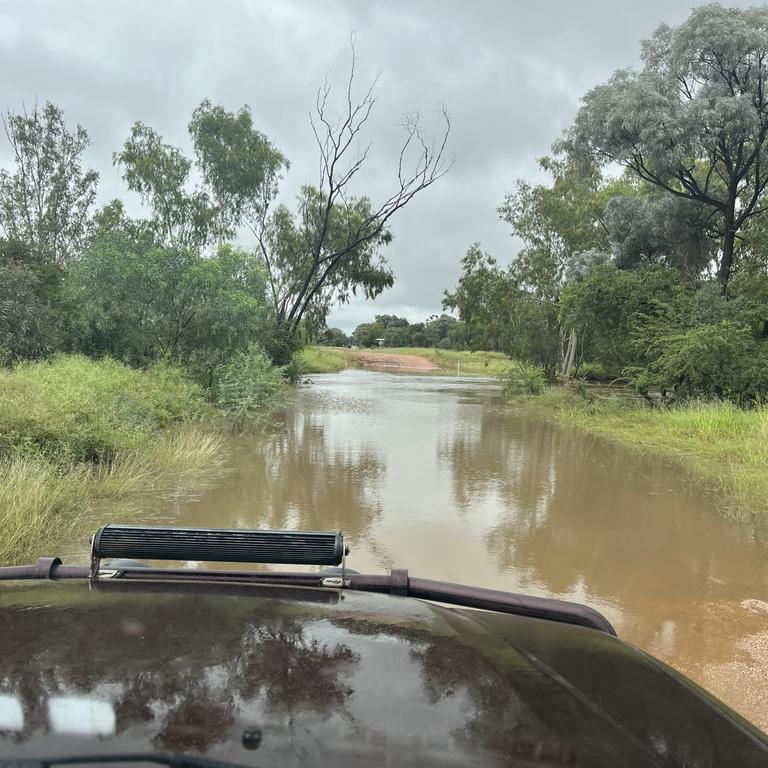
Multiple roads in central and north Queensland have been closed or impacted by flood waters, which Ms Pagel said could last a few days.
“Pretty much all of North Queensland is copping it at the moment,” she said. “Western Queensland has had a fair amount of roads cut off.
“There’s a lot of road closures out there just because they’ve had a lot of rainfall.”
Clermont Peppercorn Motel manager Darryl Shaw said residents and tourists were hunkering down to ride out the rain after they became flooded in on Friday.
“The supermarket is already out of milk and bread,” he said. “It always runs out when it rains. Just enough rain to make people worried.”
SCROLL DOWN FOR MORE INFORMATION ON ROAD CLOSURES AND TRAIN DELAYS
As of 9am on Saturday, Forbes Rd south of Proserpine recorded the highest 24-hour rainfall totals with 235mm.
Calen, north of Mackay, recorded 208mm, Cungulla recorded 205mm and Finch Hatton recorded 198mm.
Between 9am and 5pm on Saturday, Finch Hatton recorded an additional 66mm, while the heaviest falls were recorded in the Tully River catchment at Murray Flats with 115mm and Mona Park south of Townsville with 94mm.
Meanwhile, The Fisheries Alert near Innisfail recorded 80mm with 53mm of that falling within 30 minutes.
The Bruce Highway on Saturday was cut off for some time in both directions at Calen after the road was inundated by 1m of floodwaters.
It did reopen, while multiple other sections of the highway had water over the road among more than 200 traffic alerts across the state.
Aramac mother Kerryn Geltch said her small Central Queensland town, north of Barcaldine, had been completely closed off and the creeks had been overflowing for almost a week.
“It’s pretty wet up here at the moment. The road is cut off too and everything has been shut down, we’ve all hunkered down indoors,” she said.
The town has been drenched by 152mm of rain from Wednesday to Saturday.
The town’s total rainfall for 2022 was 600mm.
“This doesn’t happen too often for us, we are more than happy with the rain where we are,” Ms Gletch said.
Flooding also caused chaos for Queensland Rail with many long-haul services across the state either delayed, cancelled, or forced to terminate at a different destination.
Some passengers were left stranded in different towns without any alternative form of transport to their initial destination.
Ms Pagel urged people to stay off the roads if travelling wasn’t absolutely necessary, but of people had to travel they should make a plan before heading out, check the radar and check the warnings. State Emergency Services area controller Michael Young said his team was ready for the weekend.
He said flood and swift-water rescue units were on standby in Proserpine but had not yet been called out.
No calls for rescues had been made across the state on Saturday.
“At this stage people need to be aware of the road closures and localised floods,” he said. “If it is flooded, forget it.”
RACQ, QLD Traffic and regional council’s emergency dashboards show the following roads are closed from flooding (as of Sunday 2pm):
- Kinchant Dam Rd, Kinchant Dam
- Hicks Rd Windmill Crossing in Glenella
- Golf Links Rd, Primavera Blvd in Beaconsfield
- Black Mountain Rd in Farleigh
- Bruce Highway at Calen (lanes affected)
- Orrs Rd, Barrie Lane and Palm Tree Rd at Homebush
- Marian Eton Rd at Sandy Creek south of North Eton
- North Eton Rd, Eton / North Eton
- Leichhardt Rd at Mirani
- Peak Downs Highway (State Route 70) at Greenmount
- Stockroute Rd, Te Kowai
- Bruce Highway at Gumlu (lanes affected)
- Bruce Highway at Yalboroo (lanes affected)
- Bruce Highway at Bowen (4km north of Bowen)
- Ayr Ravenswood Rd, Mulgrave / Ravenswood
- Balls Lane, Mundingburra
- Bayswater Terrace, Hyde Park
- Bruce Highway at Lethebrook
- Lascelles Avenue, Goorganga Plains (intersection of Bruce Highway and Lascelles Avenue)
- Mount Ossa Seaforth Rd, Mount Ossa (at Jollimont Creek)
- Hannans Rd, North Eton (near the intersection of Marian Eton Rd)
- Sarina Marlborough Rd and Rifle Range Road at Sarina
- Burdekin Falls Dam Rd, Ravenswood
- Fairfield Waters Dr, Stuart Dr, Annandale / Cluden / Wulguru
- Freshwater Dr, Douglas
- Glendale Dr, Annandale
- Hopkins St, Currajong
- Ingham Rd, Bohle
- Jurekey St, Cluden / Wulguru
- McDougall St, Gulliver
- Murray Lyons Crescent, Annandale
- Oonoonba Rd, Idalia
- Palm Dr, Deeragun
- Palmerston St, Gulliver
- Railway Ave, Railway Estate (near Ninth St)
- Ralston St, West End
- Rangview St, Deeragun (near Palm Dr)
- Ross River Rd, Mundingburra
- Southwood Rd, Stuart (Stuart Creek Bridge)
- The Esplanade, Pallarenda
- Townsend St, Mysterton
- Woodstock Giru Rd, Majors Creek
- Aramac Torrens Creek Rd, Torrens Creek
- Blackwater Cooroorah Rd at the Mackenzie River (water over road at Bedford Weir)
- Degulla Rd, Laglan Pioneer Rd at Beylando River
- Golden Mile Rd at Dysart
- Dysart Clermont Rd at Dysart
- Dingo Mount Flora Rd at May Downs
- Rolfe Creek Booroondarra Rd at Middlemount
- Grasstree Rd at Middlemount
- Foxleigh Rd and Barwon Middlemount Rd at MacKenzie River
- Blackwater Cooroorah Rd at MacKenzie River
- Golf Course Access / Cheesborough Rd / Gregory Highway, Clermont
- Clermont Alpha Rd, Clermont and Peak Vale (Eastern Creek)
- Kenlogan Rd north of Clermont (road closed Growie Creek)
- Drummond St at Clermont
- Alpha Bypass Rd at Clermont
- Clermont Connection Rd, Charles St at Clermont
- Racecourse Rd at Clermont (lanes affected)
- Venus Rd at Clermont
- Huntley Rd east of Clermont, Cheesborough
- Gregory Highway east of Clermont
- Charles St in Clermont
- Laglan Rd at Clermont (lanes affected)
- Peakvale Rd in Clermont
- Clermont Rubyvale Rd south of Clermont at Theresa Creek
- Rubyvale Rd, Clermont Rubyvale Rd at Clermont (road closed at Douglas Creek)
- Meares St at Blackwater
- Russell Park Rd at the Gemini Mountains
- Kilcummin Diamond Downs Rd at Kilcummin
- Kenlogan Rd at Kilcummin
- Russell Park Rd at Kilcummin
- Russell Park Rd at Gemini Mountains
- Huntley Rd at Cheesborough and Clermont
- Apis Creek Rd at Balcomba
- Cotherstone Rd at Capella
- Rileys Crossing Rd at Comet
- Comet River Rd at Comet
- Capella Rubyvale Rd at Hibernia
- Capricorn Highway at Blackwater/Emerald
- Gregory Highway, Wyuna
- Dawson Developmental Rd at Mantuan Downs
- Pioneer Clyedale Rd – Albro Pioneer Rd at Mistake Creek
- Magenta Lagoon Rd at Retro
- Coreen Water Board Rd at Argoon near Biloela
- Zischkes Lane at Prospect near Biloela
- Blackgate and Ferguson Rd near Calliope / West Stowe
- Zischkes Lane, Prospect
- The Bend Rd, Taroom
- Cotherstone Rd, Khosh Bulduk / Magenta Creek
- Coreen Water Board Rd, Argoon
- Peninsula Developmental Rd (Laura River Bridge and Hann River Bridge), Laura
- Peninsula Developmental Rd, Coen (water over Archer River Bridge)
- Peninsula Developmental Rd, Mission River (Myall Creek)
- Peninsula Developmental Rd, Coen / Mission River (Weipa to Coen Airport - restricted to high clearance vehicles only)
- Nymbool Rd, Mount Garnet
- Lindsay Rd, Malanda (Subject to a 10 tonne GVM limit)
- Koolatah Oriners Rd, Dixie / Maramie
- Lake Julius Rd, Kajabbi Mount Isa Rd, Mount Isa / Three Rivers (several areas are cut by floodwaters)
- Kirrama Range Rd (Carruchan / Murray Upper
- Kennedy Developmental Rd, Hughenden
- Kennedy Developmental Rd, Lyndhurst (Closed at Bundock Creek Floodway, and between the Lynd and Etherbridge Shire Boundary)
- Gulf Developmental Rd, Croydon
- Iffley Rd, Savannah / Stokes (in various locations ending at the McKinlay Shire Boundary)
- Kajabbi Kamilaroi Rd, Three Rivers
- Kajabbi Mount Isa Rd, Three Rivers
- Gregory Highway, Einasleigh
- Gotak Rd, Evelyn (Subject to a 25 tonne GVM limit)
- Glue Pot Rd, Wondecla (Subject to a 10 tonne GVM limit)
- Dunbar Kowanyama Rd, Kowanyama Rd, Kowanyama
- Dunbar Koolatah Rd, Dunbar Kowanyama Rd, Maramie / Yagoonya
- Coolgarra Rd, Mount Garnet
- Cape Tribulation Rd, Thornton Beach (Subject to a 15 tonne GVM limit)
- Burke Developmental Rd (Lynd River Causeway), Gamboola
- Burke Developmental Rd, closed at Trimbles Crossing, Wrotham, and Ferguson’s Crossing, Rookwood
- Burke Developmental Rd (Munganga Mine to Mareeba Shire Boundary), Chillagoe / Highbury (Restricted to high clearance vehicles only)
- Burke Developmental Rd, Howitt / Nomranton / Maramie / Karumba (including Normanton to Walkers Creek, Walkers Creek to Dunbar Station, Dunbar Station to Mareeba Shire Council boundary, and Walkers Creek to Karumba)
- Burketown Normanton Rd, Carpentaria ? Normanton (Normanton to Wernadinga/Leichardt River)
- Toowoomba Bypass On Ramp, Charlton / Cranley (Full EB Tollroad closure from Charlton to Boundary St)
- Talgai West Rd, Talgai
- Swan Creek School Rd, Swan Creek
- Spring Creek Rd, The Head
- Schefe Rd, Thornville
- Pfeffer Rd, Yandilla
- Mount Norman Rd, Eukey / Girraween (road closed through national park)
- Mountain View Drive, Hatton Vale / Minden
- Merivale St, Allora
- Meandarra Talwood Rd, Westmar (restricted to 4WD access only)
- Logan St, Gatton
- Leahy Rd, Kleinton
- Kital Rd, Berat
- Kadow Rd, Clintonvale
- Glen Niven Rd, Glen Niven
- Jackson Wandoan Rd, Wandoan (Wolebee Creek Bridge about 70km from Warrego Highway intersection)
- Hermitage Rd, Toowoomba Bypass, Second Range Crossing (Full EB Tollroad closure from Mort St Interchange to Helidon), Cranley / Helidon Spa
- East Egypt Rd, Egypt
- Cosmo Lane, Cottonvale (Road Restricted - Subject to a 5 tonne GVM limit)
- Blackbutt Crows Nest Rd, Nukku Rd, Blackbutt South / Gilla / Googa Creek
- Berlin Rd, Mount Berryman, Abels Rd, Goombungee
- Yaraka Retreat Rd, Isisford
- Yaraka Bimerah Rd, Isisford / Stonehenge
- Wokingham Stock Route, Corfield (between Corfield Richmond Rd and Landsborough Highway)
- Winton Jundah Rd, Opalton (restricted to 4WD vehicles only)
- Winton Eskdale Rd, Corfield
- Ward Rd, Tambo / Ward (restricted to 4WD vehicles only)
- Uradangi North Rd, Piturie / Waverley
- Urandangi Border Rd (Tobermorey Rd), Carrandotta
- Tumbar Rd (restricted to 4WD vehicles only), Jericho / Mexico
- Toolebuc Rd, Min Min / Warburton
- Tonkoro Rd, Longreach / Stonehenge
- Tocal Jundah Rd (Notus Rd), Longreach / Stonehenge
- Tenham Rd (restricted to 4WD vehicles only), Windorah
- Stonehenge Warbreccan Rd, Stonehenge
- Starlights Lookout Rd, Longreach (Captain Starlight’s Lookout from Muttaburra Westside Rd)
- Star Downs Rd, Alpha / Sedgeford (restricted to 4WD vehicles only)
- Stagmount Rd, Galilee / Pelican Creek
- Springvale Rd, Min Min / Wills
- Slashers Creek Rd, Min Min
- Selwyn Rd, Boulia / Selwyn / Warenda / Wills
- Ravensbourne Rd, Blackall
- Politic Rd, Ingberry
- Pine Hill Rd, Pine Hill / Port Wine (restricted to 4WD vehicles only)
- Opalton Rd, Opalton (restricted to 4WD vehicles only)
- Tumbar Rd, Blackall / Mexico
- Olio Muttaburra Rd, Corfield
- Neverfail Rd, Blackall
- Muttaburra Bowen Downs Rd, Cornish Creek / Upper Cornish Creek
- Muttaburra Aramac Rd, Cornish Creek
- Mount Playfair Rd, Caldervale / Carnarvon Park / Tambo
- Morella Silsoe Rd, Longreach
- Longreach Tocal Rd, Longreach
- Longreach Silsoe Rd, Longreach / Vergemont
- Urandangi Rd, Urandangi South Rd, Dajarra / Waverley
- Langlo Rd, Langlo / MacFarlane (restricted to 4WD vehicles only)
- Kensington Rd, Bangall / Tablederry
- Kennedy Developmental Rd, Corfield / Warburton / Boulia (restricted to 4WD vehicles only)
- Kelso Rd, Ilfracombe / Longreach
- Jundah Winton Rd, Winton Jundah Rd, Opalton / Stonehenge / Jundah
- Jundah Quilpie Rd, Jundah / Windorah
- Jundah Cork Rd, Opalton
- Jericho Texas Rd, Garfield / Jericho
- Isisford Emmet Rd, Isisford
- Isisford Blackall River Rd, Isisford
- Isisford Bimerah Rd, Isisford / Stonehenge
- Isisford Yaraka River Rd, Isisford
- Inside Track Rd, Birdsville
- Ilfracombe Aramac Rd, Ilfracombe / Aramac / Ibis
- Hughenden Muttaburra Rd, Tablederry
- Hobartville Rd, Hobartville / Surbiton (restricted to 4WD vehicles only)
- Hammond Downs Rd, Jundah / Windorah
- Flinders Highway / Hughenden Muttaburra Rd, Hughenden
- Glencoe Miranda Downs Rd, Howitt
- Stirling Miranda Downs Rd, Howitt
- Glentor Prairie Rd, Prairie
- Eyre Developmental Rd, Bedourie / Birdsville
- Eastmere Rd, Aramac / Galilee / Upland
- Dunrobin Rd, Dunrobin / Galilee
- Donohue Highway, Carrandotta / Willis
- Dicks Creek, Elderslie Rd, Kyuna / Middleton
- Diamantina River Rd, Middleton / Opalton
- Diamantina Development Rd, Amaroo / Boulia / Bedourie / Farrahs Creek / Windorah
- Degulla Rd, Laglan Pioneer Rd, Laglan
- Degulla Rd, Hobartville / Surbiton
- Dawson Developmental Rd, Tambo / Windeyer
- Davenport Rd, Local Rd, Farrars Creek
- Darr River Downs Rd, Longreach
- Dandaraga Rd, Ilfracombe
- Crossmore Rd, Longreach Muttaburra Rd, Longreach / Sardine
- Crossmore Rd, Sardine (restricted to 4WD vehicles only)
- Crossmoor Rd, Cornish Creek / Sardine
- Cork Mail Rd, Corfield / Opalton
- Cork Macunda Rd, Middleton
- Corfield Richmond Rd, Albion / Corfield
- Coreena Rd, Inberry
- Cordillo Access, Birdsville
- Coorabulka Rd, Bedourie / Wills
- Delta Downs Rd, Howitt
- Doomadgee Rd, Geregory / Nicholson (Doomadgee to Hells Gate)
- Doomadgee Rd, Gregory (Burketon to Doomadgee - water over road)
- Westmoreland Rd, Nicholson (Hells Gate to NT border)
- Wills Developmental Rd, Four Ways / Taldora
- Wills Developmental Rd, Burketown / Gregory (between Gregory to Burketown)
- Wills Developmental Rd, Julia Creek / Taldora (road closed at Gilliat Channels)
- Cubbie Rd, Dirranbandi
- Gunnindaddy Rd, Dirrabandi
- Narline Rd, Dirrabandi
- Soonah Crossing Rd, Norley / Quilpie
- Thargomindah Rd, Thargominda
- Weir Rd, Mungindi
- Ingeberry Rd, Tobermory Rd, Quilpie Thargomindah Rd, Quilpie
- Camooweal Urandangi Rd, Barkly / Camooweal
- Gregory Downs Camooweal Rd, Camooweal / Lawn Hill / Gregory (including Flinders River Byway, and between Camooweal and intersection of Thorntonia Yelvertoft Rd)
- Lawn Hill Rd, Gregory / Lawn Hill (Century Mine to Lawn Hill National Park turnoff)
- Lotus Vale Stirling Rd, Howitt
- Macallister Mail Run, Carpentaria / Stokes
- Macallister Mail Run, Ten Mile Rd, Normanton
- Malbon Selwyn Rd, Kuridala (restricted to high clearance vehicles only)
- Mckinlay Gilliat Rd, Julia Creek / Mckinlay
- Moreston Rd, Cammoweal / Lawn Hill
- Old May Downs Rd, Barkly Rd, Barkly / Gunpowder
- Thorntonia Yelvertoft Rd, Gunpowder
- Torver Valley Rd, Dutton River / Hughdenden
- Prairie Muttaburra Rd, Prairie / Tablederry
- Richmond Winton Rd, Corfield / Richmond (restricted to 4WD vehicles)
- Riversleigh Doomadgee Rd, Riversleigh Rd, Lawn Hill
- Rocklands Rd, Camooweal / Lawn Hill
- Cacoory Stony Crossing Rd, Birdsville
- Budgerygar Rd, Jundah
- Bladensburg Access, Corfield / Opalton (restricted to 4WD vehicles only)
- Blackall Adavale Rd, Blackall
- Birdsville Simpson Desert National Park Rd, Birdsville
- Birdsville Developmental Rd, Tanbar / Windorah / Birdsville (restricted to 4WD vehicles only)
- Bimerah Yaraka Rd, Stonehenge
- Betoota Mooraberree Rd, Farrars Creek
- Barcaldine Isisford Rd, Barcaldine Downs / Ilfracombe / Barcaldine
- Coorabulka Rd, Bedourie / Wills
- Camooweal Urandangi Rd, Headingly Rd, Barkly / Camooweal
- Barcaldine Isisford Rd, Barcaldine Downs / Ilfracombe / Barcaldine
- Barcaldine Aramac Rd, Aramac / Barcaldine
- Ballyneety Rd, Dunrobin
- Avington Rd, Blackall
- Arrabury Rd, Planet Arraburry Rd, Cordillo Downs / Tanbar
- Aramac Torrens Creek Rd, Pelican Creek / Torrens Creek
- Aramac Rd, Jericho Rd, Garfield / Pelican Creek
- Amor Downs Rd, Ilfracombe
- Alpha Tambo Rd, Blackall / Windeyer / Alpha
- Additional Area Rd, Ilfracombe
Follow this link to visit the road conditions map and this one for the Queensland Traffic map.
The floodwaters are also damaging the Bruce Highway.


Ice ice baby: Spectacular images of unseasonal frost as Qld freezes
Queensland’s overnight temperatures will increase to double digits in the coming days, following the coldest start to winter in 16 years, bringing frost and ice to many regions. SEE THE PHOTOS

City’s coldest June start in 16 years, feels like MINUS 9.8C out west
Southeast Queensland is shivering through its coldest morning in more than 15 years but feels-like temperatures have dropped to insane levels in the southern inland.