
Qld weather: 35C+ scorcher hits Southeast Queensland
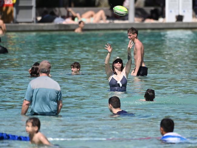
Southeast Queensland is sweltering as thousands hit beaches and local pools for a reprieve from the scorching heat.
QLD weather news
Don't miss out on the headlines from QLD weather news. Followed categories will be added to My News.
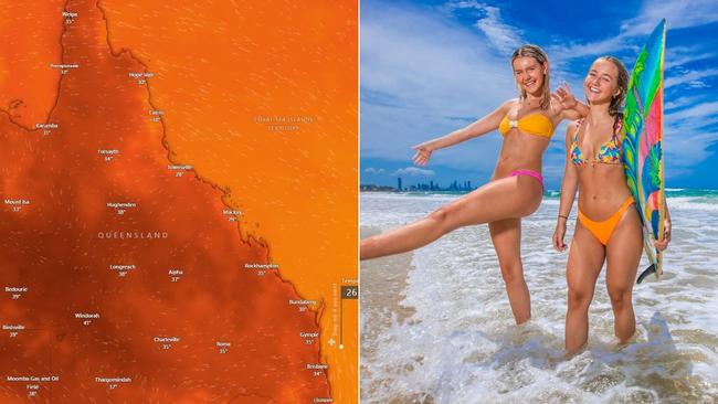
Southeast Queensland is sweltering through heatwave like conditions on Sunday, with rain late in the day set to trigger some reprieve.
A low intensity heatwave is currently sitting across much of Queensland with temperatures set to soar from the mid 30C to 40C in some areas.
Temperatures had already passed 40C before noon in Windorah in the Channel Country, which was sitting on 40.4C at 11.50am.
Scorching apparent or “feels like” temperatures made the conditions even worse in some areas, including much of the Channel Country such as Ballera which had an apparent temperature of 40.9C at 11.50am. Much of the Northwest also had apparent temperatures into the 40s, including Lake Julius (40.9C at 11.50am).
In Brisbane, the mercury was sitting at 34C at 12.10pm with an apparent temperature of 37.4C, while elsewhere in the southeast Gatton was at 35.1C, Amberley hit 34.6C, Beerburrum was at 34.4C and the Gold Coast Seaway was sitting on 32.1C.
In the Wide Bay and Burnett region Gayndah and Kingaroy had the highest temperatures at 12.10pm, both sitting on 33.8C. Gayndah had the highest apparent temperature of 37.2C.
In the Darling Downs and Granite Belt region Goondiwindi had recorded the highest temperature so far, sitting on 35.6C, with an apparent temperature of 37.9C.
Sunday’s scorching temperatures come after a humid night Saturday, when temperatures felt three to four degrees hotter than recorded.
In Brisbane the temperature dropped to 22.1C, which felt like 25.9C, and the highest apparent temperature was throughout the night was 24.6C, which felt like 27.4C.
In Ipswich the lowest recorded temperature was 20.8C, which felt like 24.8C, and the hottest temperature reached 23C but that felt like 25.8C.
On the Gold Coast temperatures averaged at 23C overnight, which felt like 25C.
The Bureau of Meteorology confirmed Brisbane would remain at a scorching 37C on Sunday, 32C on Monday, 31C on Tuesday, 29C on Wednesday and 30C on Thursday and 29C on Friday.
Ipswich is set to have a 37C Sunday, 32C on Monday with temperatures starting to drop to 31C later in the week.
The Gold Coast will have a similarly hot week at 34C on Sunday, 29C on Monday and Tuesday, 27C on Wednesday and 28C on Thursday and Friday.
The Bureau of Meteorology had warned of severe heatwave conditions in isolated patches of the state including Longreach extending into Mt Isa and Birdsville, as well as parts of the Sunshine Coast.
“Humidity is really adding to these higher temperatures at the moment and will be sticking around because of that cloud band last week and a trough system moving through, so there’s plenty of moisture in the air for the heat to grab onto,” the Bureau’s Brooke Pagel said.
While Sunday and Monday were expected to be the peak of the heatwave conditions for the southeast, Western Queensland will sit through the steamy conditions for a bit longer as the heat contracts north throughout the week, with Longreach hitting maximums of 41C Sunday and 43C on Monday.
“The southeast will be getting the brunt of it (Sunday) with severe heatwave conditions peaking this weekend in those isolated areas before extending further north over the next week,” Ms Pagel said.
Humidity is expected to bring severe thunderstorms across inland Queensland on Sunday.
“We’re looking at severe storms with locally damaging winds and heavy rain,” she said.
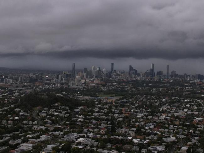
“We are really keeping an eye on the heavy rainfall as we’ve had a lot of rain in the past week and those catchments are still really wet.”
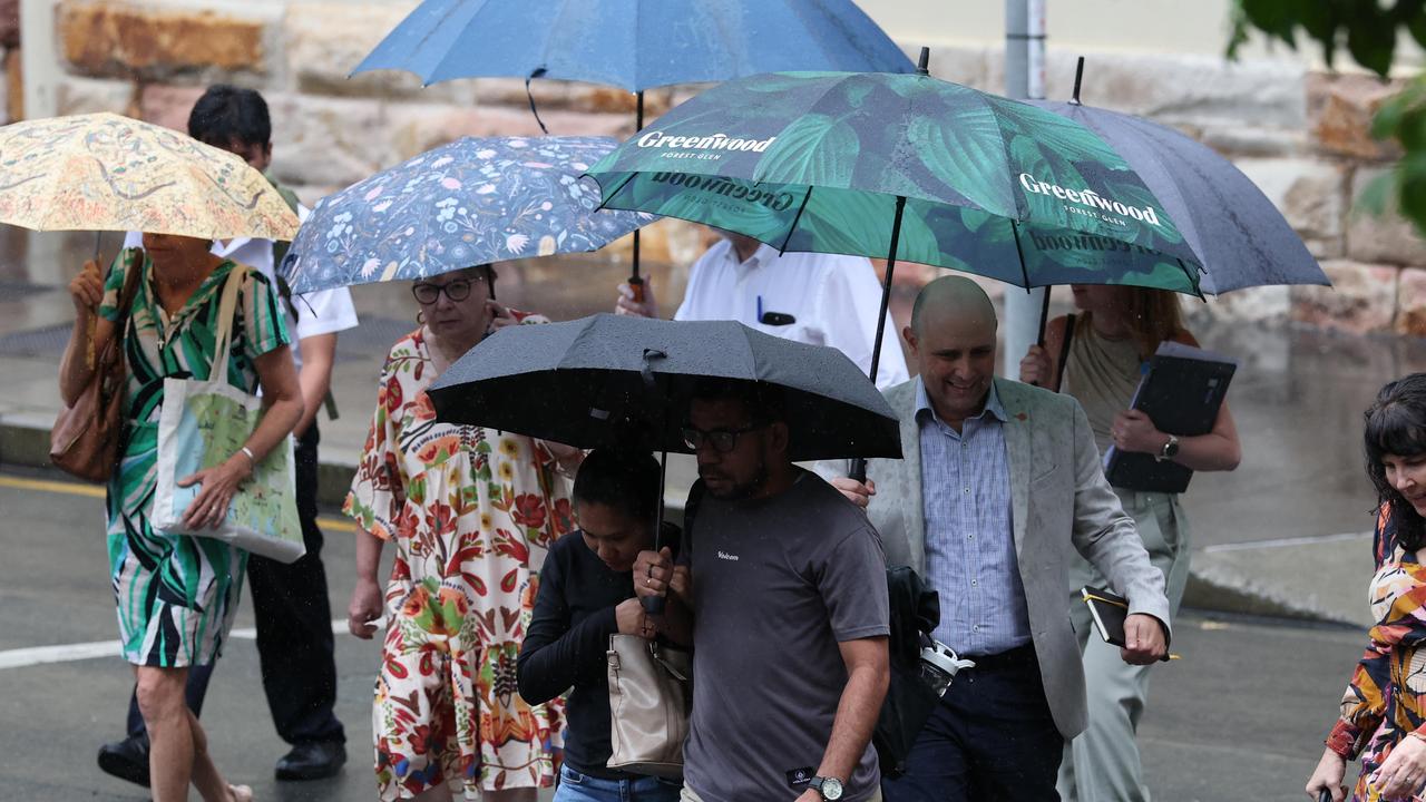
While severe thunderstorms are currently forecast for the Gold Coast and Sunshine Coast hinterland, Ms Pagel said these could shift east depending on conditions.
“We’ll be looking at run-of-the-mill summer thunderstorms for the southeast and Wide Bay with a slight easterly breeze helping to push a little bit more moisture inland,” she said.
“But we could see the risk of severe thunderstorms push to the coast from the hinterland.”
Severe thunderstorms and heatwave conditions are expected to ease by Tuesday, however humidity will likely stick around for much of next week.
‘Unusual’: Why the wet season refuses to end in SEQ
Brisbane and southeast Queensland is copping ‘Melbourne’ weather with a mixed bag of conditions proving annoying. FULL EXPLAINER

80kmh gusts: Strong wind warning for southeast
Parts of South East Queensland are being warned to expect strong winds, with gust up to 80km/h possible, as temperatures are set to drop.