
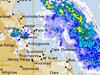
Intense rainfall as severe storms hit parts of Queensland
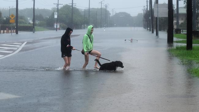
Greater Brisbane has dodged the full fury of storm activity, but not before healthy rainfall was registered across the southeast.
QLD weather news
Don't miss out on the headlines from QLD weather news. Followed categories will be added to My News.
Severe storm warnings for southern Queensland have turned out to be a damp squib... very damp.
A severe storm warning for the Gympie-Murgon region has been cancelled, after earlier storm warnings for the Greater Brisbane area failed to produce anything but healthy rainfall.
Three areas received over 80mm in an hour.
Amberley in Ipswich copped 88mm, Linville in Somerset had 87mm and Beaudesert had 83mm, with all areas ending up with around 100mm for the day.
There also were falls of 57mm near Laidley and 68mm at Highfields, north of Toowoomba.
Felton-Clifton Rd was flooded near Toowoomba as the storm passed through about 5pm.
Top southeast rain totals from 9am this morning.
Amberley 111mm
Jimboomba (Kilmoylar Rd) 103mm
Linville 102
Brassal 101
Beaudesert 98mm
Heavy falls have been recorded at Biddenham, west of Augathella, which recorded 41mm in 30 minutes, and 46mm in 30 minutes at Mount Pisgah, southwest of Emerald.
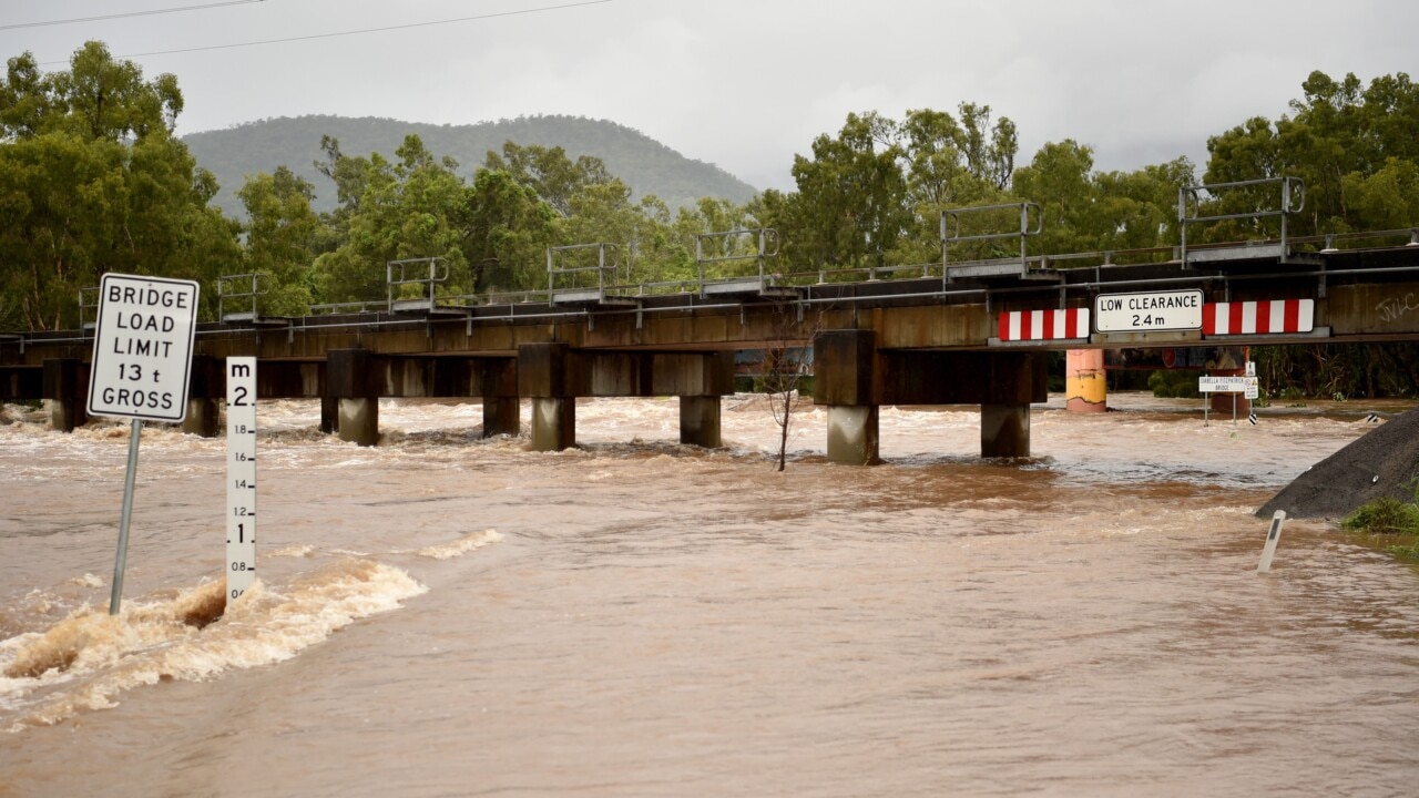
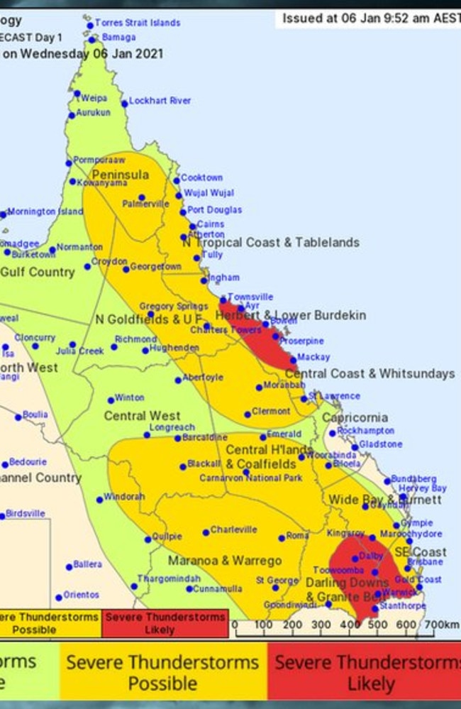
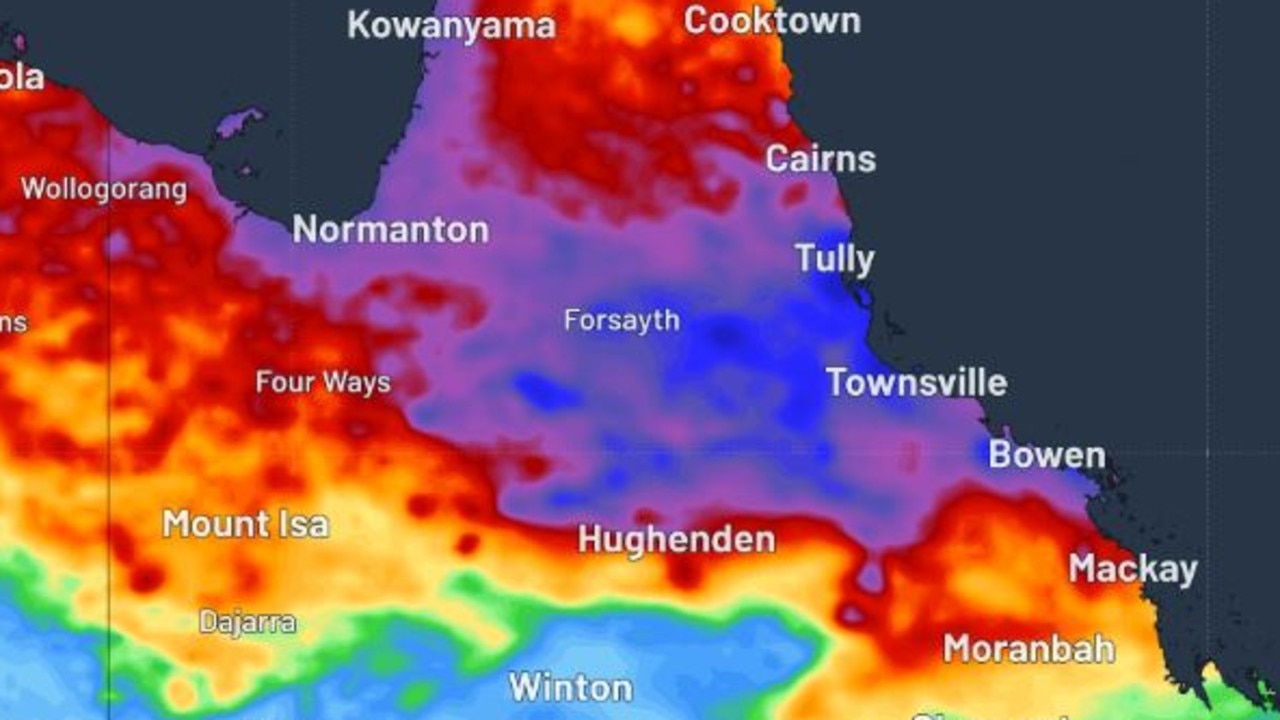
It comes as the state’s north continues to be inundated with the remnants of ex-Tropical Cyclone Imogen.
More than 240mm fell around Ingham in the six hours to 11am, causing the temporary closure of the Bruce Highway to the north and south of the town.
Fourteen flood warnings remain in place across the state.
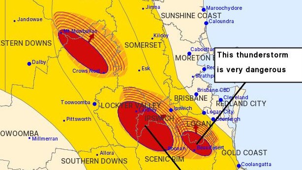
Earlier today, meteorologist Pieter Claassen said a trough separate to Imogen was moving through the west of the state and would intensify this afternoon.
“We’d be seeing that system make its ways to the southeast corner around the early evening on Wednesday, with thunderstorms possible to follow suit,” Mr Claassen said.
“We could see isolated falls in excess of 60-80mm plus.
“We should expect those falls to hang around overnight and even early into Thursday, though we shouldn’t expect prolonged thunder activity.”
More Coverage

#bnestorm be bringing us an unwanted water feature... pic.twitter.com/0cRqN5zhR5
— darth caligula 🚂💊 (@darthcaligula66) January 6, 2021
Tiny town braced for biggest flood in 30 years, set to cut off Bruce Hwy
Residents in a small town southeast of Townsville are braced for its biggest flood in three decades with the region facing another 500mm deluge that’s set to cut off the Bruce Highway.
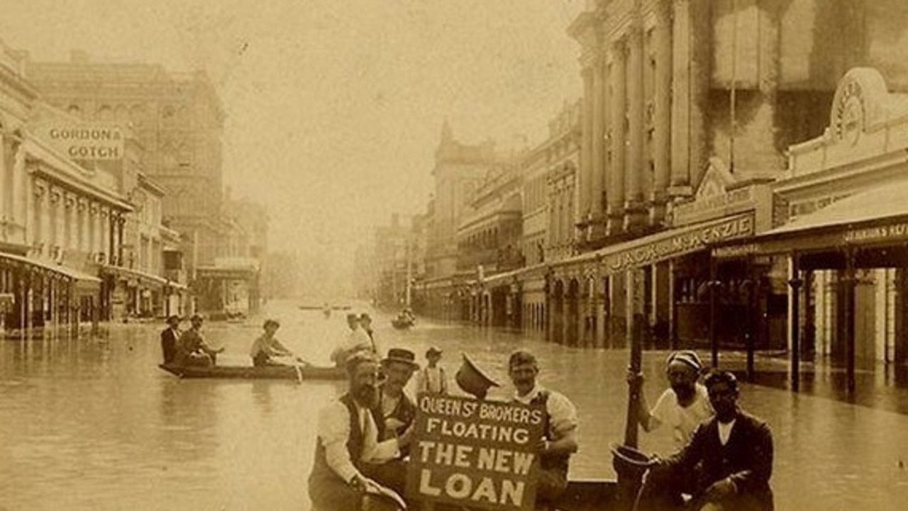
‘Wall of water 50ft high’: Great Brisbane floods of 1893
In a freakish turn of weather Brisbane flooded three times in February 1893, leaving a third of the population homeless and claiming the lives of 35.