South East Queensland hit by more severe storms with large hail, damaging winds and heavy rain
A wild hailstorm smashed into South East Queensland on Friday afternoon following multiple warnings, with more severe weather expected in the coming days. WATCH THE VIDEO

QLD weather news
Don't miss out on the headlines from QLD weather news. Followed categories will be added to My News.
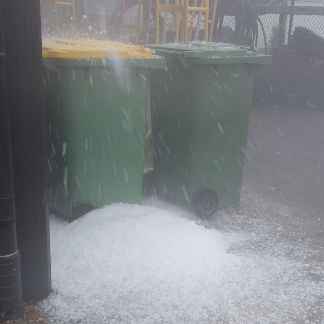
A wild hailstorm has slammed into South East Queensland this afternoon with multiple warnings for large hail, damaging winds and flash flooding active.
Gympie was hit by a severe storm around 3.30pm with the city left blanketed in hailstones up to 5cm in size.
At 4.15pm the Bureau of Meteorology advised severe thunderstorms in the warning areas had temporarily eased, but said the redevelopment of severe storms remained possible.
“The situation is being closely monitored and further detailed warnings will be issued as necessary,” the updated alert read.
At 3.20pm, the Bureau of Meteorology was tracking three severe thunderstorms near Gympie and Kilcoy, and in the Lockyer Valley, with the threat of damaging winds, large hailstones and heavy rainfall.


By 3.50pm, the warning was downgraded to just one severe cell, which was detected near Yarraman.
The slow-moving storm was forecast to affect the area north of Cooyar by 4.20pm.
A more general severe thunderstorm warning is also current for parts of the Wide Bay and Burnett, Darling Downs and Granite Belt and Southeast Coast districts.


The Bureau of Meteorology told The Courier-Mail earlier on Friday that there was a chance for severe weather across large parts of the state from mid afternoon.
A spokesman from Ergon said that more than 300,000 lightning strikes were recorded on Wednesday and Thursday, with one storm delaying the first T20 international between Australia and Pakistan at the Gabba last night.
Over the past week more than 1.15 million lightning strikes have been recorded in southeast Queensland.
There were no reports of injuries from the storms, however high voltage power lines that supplied power to the central west were struck, leaving 11,000 customers without power.
Energy Queensland and Get Ready Queensland are urging Queenslanders to have a go kit ready, if they do not already have one. The storm activity across the state is being driven by a weak ridge along the east coast that will strengthen today as a high pressure system moves into the Tasman Sea.
Areas south of the Capricornia down to the south coast of the state and pushing inland to the Scenic Rim and Darling Downs, the Burnett and Central Highlands are in the firing line for today’s storm activity.
The Bureau of Meteorology said the storms could bring heavy rain, large hail and damaging wind gusts, while the northern areas of the state will see fine weather today along the coast, albeit heat conditions do exist across the tropical north.
Temperatures across the south east will reach the mid to high 20s with Ipswich, Gatton and Beaudesert expecting a high of 29, and 27 degrees in Brisbane, the Sunshine Coast and the Gold Coast.
Thunderstorm activity is expected to increase over the interior of the state over the weekend, a trough in the north west of the state pushes westward by the building ridge in the Tasman.


