
Brisbane weather: CityCats cancelled, dam releases, flood warning
Brisbane’s CityCat and ferry services have been cancelled ahead of expected dam releases as the weather situation in South East Queensland continues to deteriorate.
QLD weather news
Don't miss out on the headlines from QLD weather news. Followed categories will be added to My News.
Brisbane’s CityCat and ferry services have been cancelled as deteriorating weather conditions impact South East Queensland.
It comes as flooding begins to affect the Gympie region for the second time in a matter of months.
Lord Mayor Adrian Schrinner tweeted on Wednesday night that all CityCat and ferry services would be suspended from 9pm.
He said the decision was based on anticipated dam releases and continuing wild weather.
“All CityCat and ferry services will be suspended from 9pm tonight following a notice issued by Maritime Safety Queensland about deteriorating weather conditions and expected Wivenhoe Dam releases,” he wrote.
The decision comes after a CityCat sank during Brisbane’s last round of flooding in March.
âš ï¸PUBLIC TRANSPORT UPDATEâš ï¸
— Adrian Schrinner (@bne_lordmayor) May 11, 2022
All CityCat and ferry services will be suspended from 9pm tonight following a notice issued by Maritime Safety QLD about deteriorating weather conditions and expected Wivenhoe Dam releases. pic.twitter.com/qxSWm7w5cA
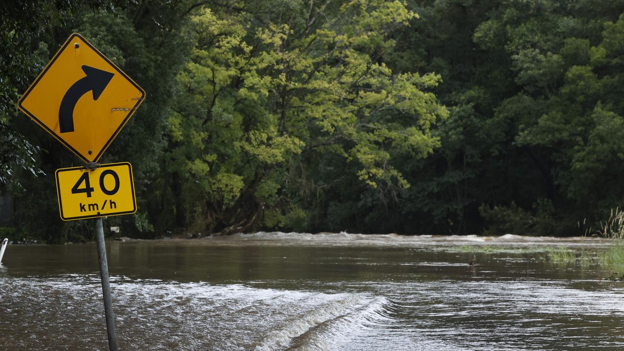
The Bureau of Meteorology has advised that moderate flooding is possible in Gympie on Thursday morning, following widespread heavy rainfall on Wednesday including isolated falls of up to 152mm in 24 hours.
The Mary River had risen to 6.21m by 9.40pm Wednesday, surpassing the minor flood level of 6m.
The bureau predicted that by 9am on Thursday, the river would be approaching the moderate flood level of 12m.
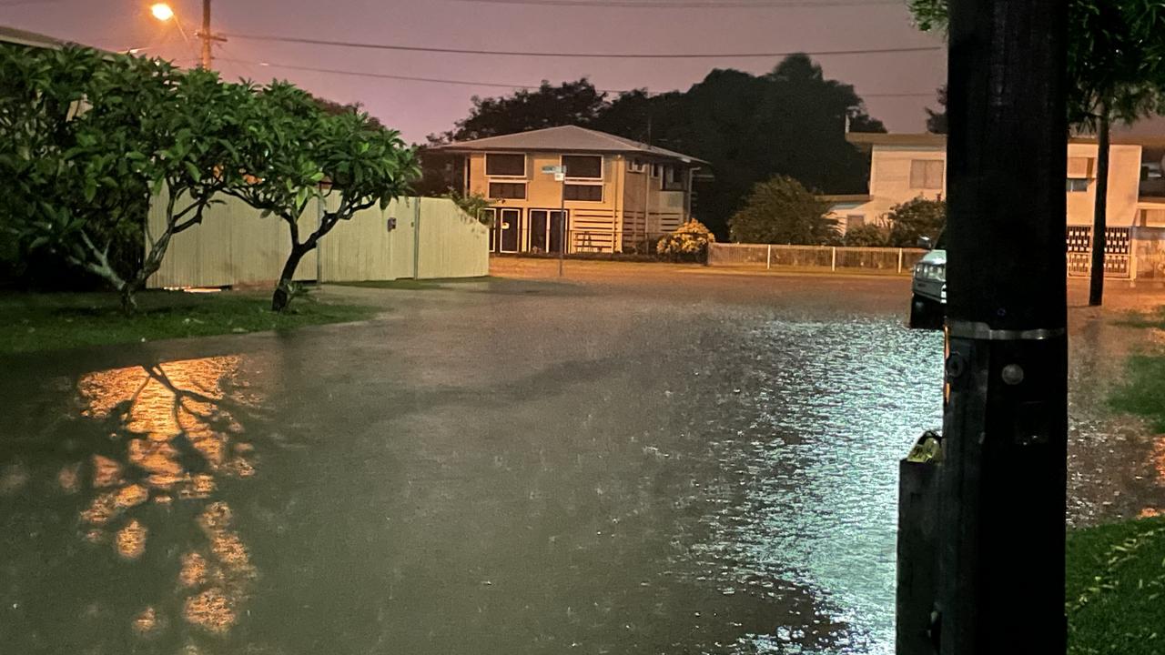
Meanwhile, residents in Brisbane’s west have been told to prepare for flooding as water levels rise following persistent rain that has headed south across the state.
Lower-lying areas of Brookfield and surrounding suburbs were warned about potential flooding from Moggill Creek.
The creek was at 5.98m and rising at 5.40pm on Wednesday, as nearby Gold Creek and Enoggera Reservoirs spill over.
Gold Creek was sitting at 150 per cent capacity at 4pm, while Enoggera was at 117 per cent.
Gap Creek Rd was also closed to all traffic between Boscombe Rd and Highwood Rd just after 2pm.
Flooding also forced the closure of Grandview Rd in Pullenvale outside Pullenvale State School, with parents advised to allow extra time for school pick-up.
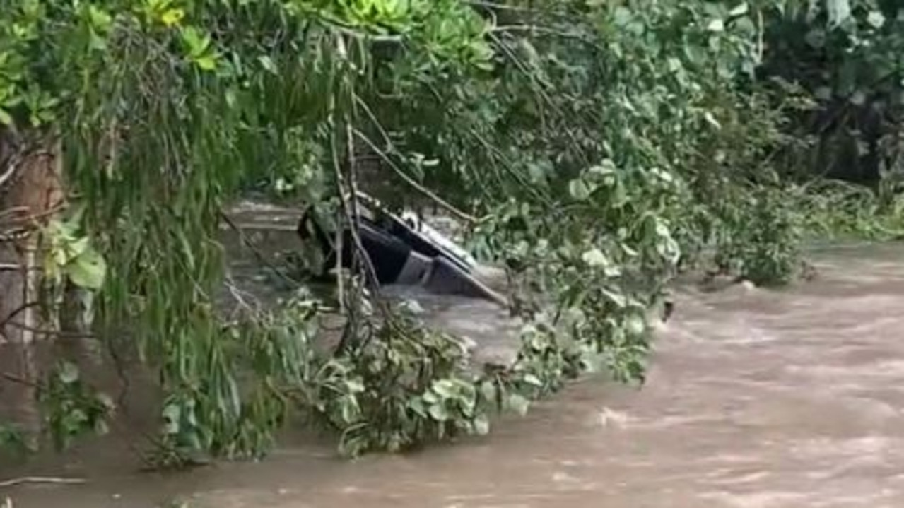
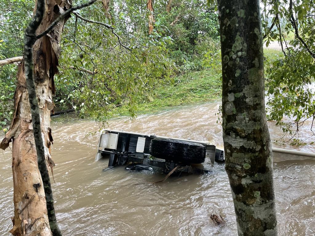
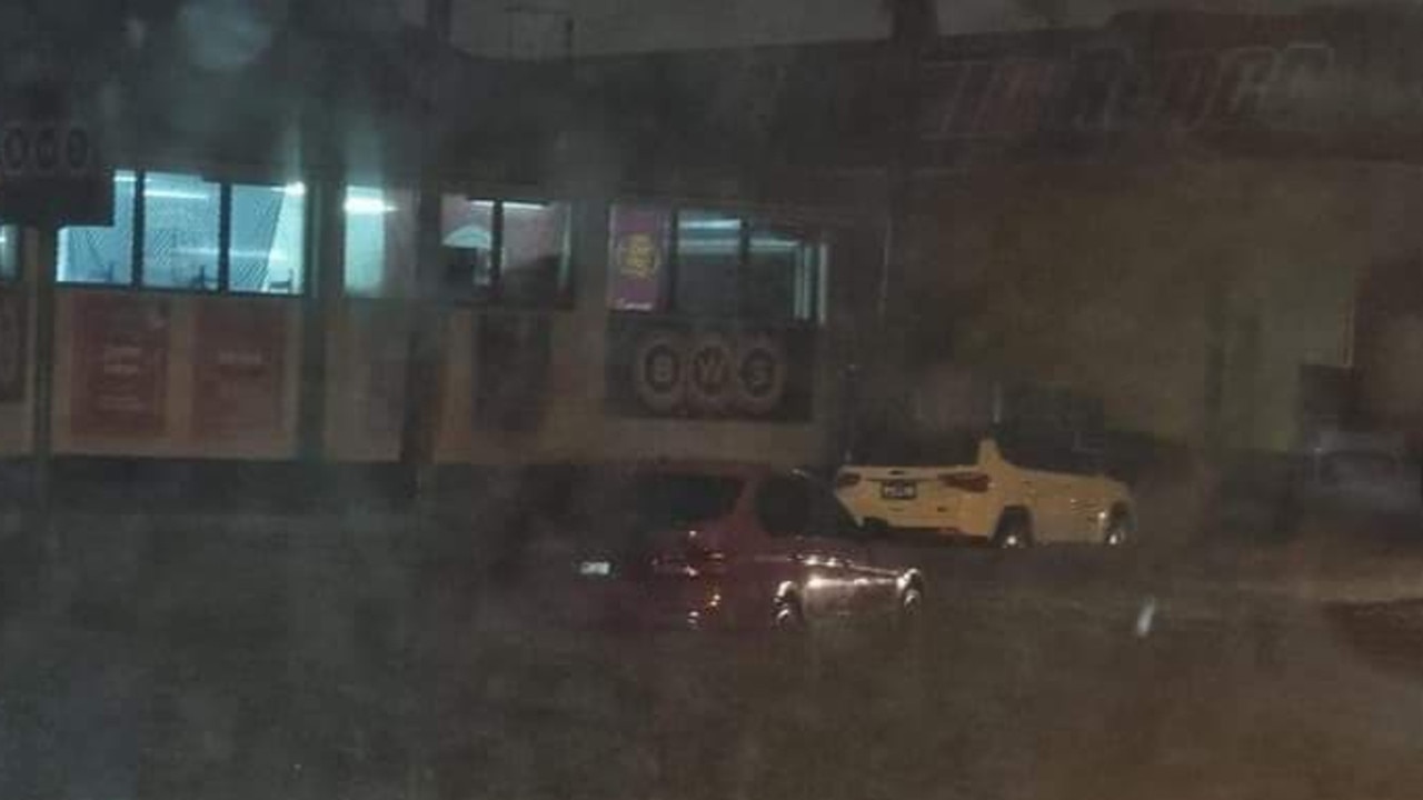
Meanwhile at Caboolture north of Brisbane, a number of parked cars were caught in floodwaters about 7pm.
Crews launched rafts and swiftwater rescue teams were on standby at Beachmere Rd and Hickey Rd, ensuring that nobody was trapped in any of the vehicles.
There were no reports of anyone needing to be rescued.
Wednesday’s heaviest falls were recorded across the southern region, with White Swamp near Killarney receiving 147mm in the 12 hours since 9am.
Other totals include Kluver’s lookout near Esk with 113mm and nearby Raynbird Creek with 106mm.
Neranwood on the Gold Coast received 65mm, while 74mm was recorded at Mountain Creek on the Sunshine Coast.
In the far north of the state, Rankin Creek near Innisfail had received 63mm since 9am.
Seqwater said releases from Wivenhoe Dam west of Brisbane were continuing, with Colleges Crossing, Burtons Bridge and Kholo Bridge expected to be impacted. Meanwhile, north of Brisbane, Youngs Crossing was closed as releases from North Pine Dam continued.
Meanwhile, two vehicles became stuck in flash flooding in Brisbane late on Wednesday afternoon.
Emergency crews were called to Paradise Rd and Radius Dr in Larapinta at 5.17pm.
A QFES spokesperson said that the cars had been pushed out of the water by pedestrians, with ambulance crews confirming that no one was injured.
Police are urging motorists to steer clear of flood waters, with more rain forecast throughout Wednesday night.
Residents north of Brisbane have been hit by further flash flooding into this evening, with meteorologists warning more heavy rain is on the way for the southeast.
While the rain totals thus far haven’t been close to the almost 200mm recorded in six hours near Townsville, the Bureau of Meteorology warns it isn’t taking much rain for creeks to respond quickly.
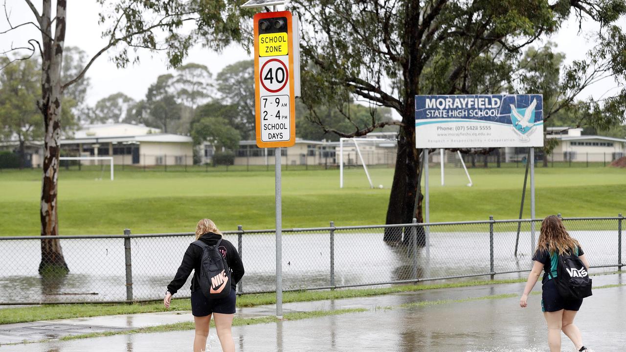
Water began flooding the road and parkland behind Morayfield Shopping Centre on Wednesday morning after about 25mm fell within three hours. About 48mm fell from 9am to noon at Landsborough while 39mm fell at Maleny and 42mm fell at the Glasshouse Mountains.
“We’ve got severe thunderstorms, locally heavy rain and damaging winds all possible across south east Queensland today,” BOM meteorologist Brooke Pagel said.
“And because the rainfall has been so consistent, even across the last couple weeks, nothing is absorbing into the ground and it is just staying at that surface levels and will increase that risk of flash flooding and riverine flooding,”
Ms Pagel said an initial flooding warning had been issued for the Upper Brisbane River, which the bureau’s hydrologists may extend into the Pine and Caboolture Rivers and catchments on the Sunshine Coast.
“We will be expecting that flood watch to be issued either later on today or later on tonight as well because that rain is increasing over today and tomorrow,” she said.
Ms Pagel said the trough that was inundating Northern Queensland was shifting south with rain ramping up across the Sunshine Coast and Brisbane.
She said it was unlikely flooding currently happening around Moreton region would recede today if heavy rain continues as expected.
Further north, a 31-year-old woman has been found dead in a vehicle submerged in floodwaters north of Mackay this morning.
Police say emergency services were called to reports a car with three people in it were swept away by floodwaters at a causeway on Surprise Creek Rd at Mt Ossa, north of Mackay.
The body of the woman, from Calen, was found about three hours later.
Two passengers, a 50-year-old man and a 30-year-old woman, managed to get free.
The man suffered a cut to his head.
Both passengers were taken to Mackay Base Hospital.
The Forensic Crash Unit is investigating and a report will be prepared for the Coroner.
It comes after massive downpours around Townsville overnight, and as pockets of rain span from the southeast up to Gladstone and inland.
Two highways were last night closed and multiple Townsville suburbs were experiencing flash flooding as rain lashes Queensland’s north.
The Bureau of Meteorology updated a severe weather warning for areas south of Townsville on Wednesday morning, with heavy rainfall which may lead to flash flooding expected. That has since been cancelled.
FULL LIST: North Queensland road closures as flooding hits
It comes after a huge rain dump in the area, with 191mm recorded at Upper Major Creek, near Townsville, in the six hours to 1am on Wednesday.
Black Weir recorded 172mm in the same period.
The Bureau Of Meteorology expects the Bohle River at Mt Bohle, located in the western suburbs of Townsville, will surpass record flooding levels set in January 1980, with the swollen catchment already sitting at 7 metres.
Twenty-four hour rainfall figures in parts of north Queensland tell the story, with more than 234mm at Cowley Beach, south of Innisfail, 184mm at Innisfail and 190mm at South Johnstone.
The Flinders highway was closed due to flash flooding between Charters Towers and Burra Range just before 9pm on Tuesday.
A minor flood alert was issued at 1.15pm for the Mary River, with water likely to surpass the minor flood level in Gympie on Wednesday night.
Widespread falls of between 60mm and 90mm fell across the Mary River catchment in the 24 hours to 9am on Wednesday, with isolated falls dumping as much as 150mm in the upper parts of the catchment.
The Mary River at Gympie was at 2.61m at 1.15pm, rising to 3.51m by 3pm.
The Bureau of Meteorology expect the Mary River in Gympie to exceed the minor flood level of 6m on Wednesday night and into Thursday morning.
Earlier, flash flooding also caused the closure of the Landsborough Highway between Cloncurry and Kynuna at 8.20pm.
Several other roads in the north have also been closed due to the weather, with emergency services advising those in affected areas to stay at home and avoid floodwaters.
Multiple suburbs in Townsville were on Tuesday night experiencing significant flash flooding.
Photos of cars almost completely covered by water at Cannon Park were posted to social media and a video taken near Kirwan Police Station showed at least half a metre of rain on the road around the precinct.
Helen Reid, from the Bureau of Meteorology, said the weather system was gradually moving east with a reduction in intensity with a warning for the Mackay/Ayr districts cancelled this morning.
“But that’s not to say we’re not watching it closely,” Ms Reid said.
“There’s still the potential for some thunderstorms to be severe in nature and that’s covering pretty much the central parts of the state and also through the north as well,”
“Almost the only parts that are missing are the southeast and the northwest.”
The Northern Goldfields and Upper Flinders districts are currently experiencing the heaviest rainfall, and pockets of heavy rain are impacting the state’s southeast all the way up to Gladstone.
It comes after intense rainfall on Tuesday slammed parts of the state, with Mourilyan near Innisfail receiving 113mm in an hour and Hughenden in central Queensland marking its wettest May on record with 46mm.
Bureau of Meteorology’s senior meteorologist Laura Boekel yesterday said more records could fall Wednesday as the wet weather moves towards the coast.
She said the location of intense rain would depend on where storms form. “ … along the coast, that’s up to 200mm within a six-hour period,” she said.
The heaviest rain on Thursday is expected to be around the Wide Bay and Capricorn.
Meteorologist Harry Clark said there was widespread rain across about two-thirds of the state, right down to the St George region, and catchments would begin responding.
Several flood warnings were issued on Tuesday afternoon for rivers and creeks across north Queensland while a flood watch was in place for a large part of north and central Queensland.
“In southeast Queensland, we’ve had fairly consistent showers now for a few days and the soil is getting quite wet,” Mr Clark said.
“While we’re not expecting the same magnitude of rainfall as further north, certainly moderate totals still have the potential for small creeks and rivers to respond fairly quickly. We’re not expecting widespread flooding but we certainly could see localised flooding over the next few days.”
In Brisbane and the Sunshine Coast, as much a 80mm is expected to fall today, 40mm forecast for the Gold Coast.
Beaches have been closed on both the Sunshine and Gold Coasts.
A wave of more than six metres has been recorded on the Sunshine Coast and one more than five metres on the Gold Coast.
Seqwater’s Flood Operations Centre is now active and monitoring the weather and dam conditions 24 hours a day with gated releases planned for Wivenhoe and Somerset Dam from 10am on Wednesday.
Meanwhile, gated releases from North Pine Dam are under way.
These releases, combined with river and creek flows downstream of the dam, are expected to inundate the following bridges and crossings – Youngs Crossing Road, Savages Crossing, Colleges Crossing, Burtons Bridge and Kholo Bridge.
Mt Crosby Weir Bridge remains closed.
The Moggill ferry will be out of action from 10am Wednesday.
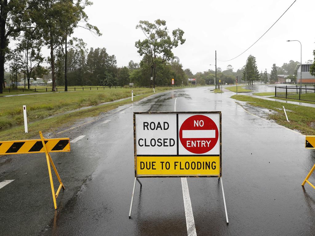
There are currently over 200 road closures across Queensland due to road damage, long term flooding or flash flooding.
There is flash flooding at Mott St in Brendale along with the Bruce Hwy, Buchanan Rd and William Berry Drive in Morayfield.
William Berry Drive is closed along with Buchanan Rd near Underpass Rd in Morayfield.
The northern basement carpark of the Morayfield Shopping Centre has been closed.
Brisbane Lord Mayor Adrian Schrinner urged residents across the region to prepare for up to 80mm of rainfall forecast by the Bureau of Meteorology.
He advised people to collect sandbags from Brisbane City Council depots if their homes were prone to flooding.
Sandbags can be collected from:
Darra – 38 Shamrock Road
Lota – 58 Herbert Street
Morningside – 9 Redfern Street
Newmarket – 66 Wilston Road
Zillmere – 33 Jennings Street
A Mount Isa man was yesterday recovering in hospital after being rescued from floodwaters Monday night.
He was being treated for hypothermia.
RAINFALL TOTALS
Since 9am Tuesday
Mourilyan (south of Innisfail) – 244mm
Cowley Beach – 234mm
Sweeney Creek (near Innisfail) – 209mm
Black Weir (near Townsville) – 198mm
Rollingstone – 166mm
Townsville – 154mm
Mt Bohle (near Townsville) – 154mm
Cardwell – 142mm
Maleny – 132mm
Maroochydore – 130mm
Cannonvale – 112mm
Mt Mee – 110mm
Ingham – 108mm
Eudlo – 108mm
Gordonvale – 101mm
Caboolture – 56mm
Redcliffe – 30mm

Join the conversation

Feels like -5.3C: Icy blast sends temps plummeting again
South East Queensland has again shivered through a freezing start to the day, as a brutal cold front continues to blast the region with subzero temperatures, made worse by chilling winds.
Read more

Feels like MINUS 7.1C: Brutal cold front blasts southern Qld
A brutal cold front is blasting across southern Queensland with subzero temperatures and widespread frost.
Read more