Gulf of Carpentaria weather: Tropical cyclone watch alert issued
A watch now cyclone alert has been issued by the weather bureau for parts of Queensland’s far north communities as the threat of a third tropical cyclone of the summer intensifies.
QLD weather news
Don't miss out on the headlines from QLD weather news. Followed categories will be added to My News.
A tropical cyclone watch now alert has been issued for communities in Queensland’s far north, the bureau of meteorology has warned.
The watch now was issued for the southern Gulf coast west of Burketown on Wednesday night.
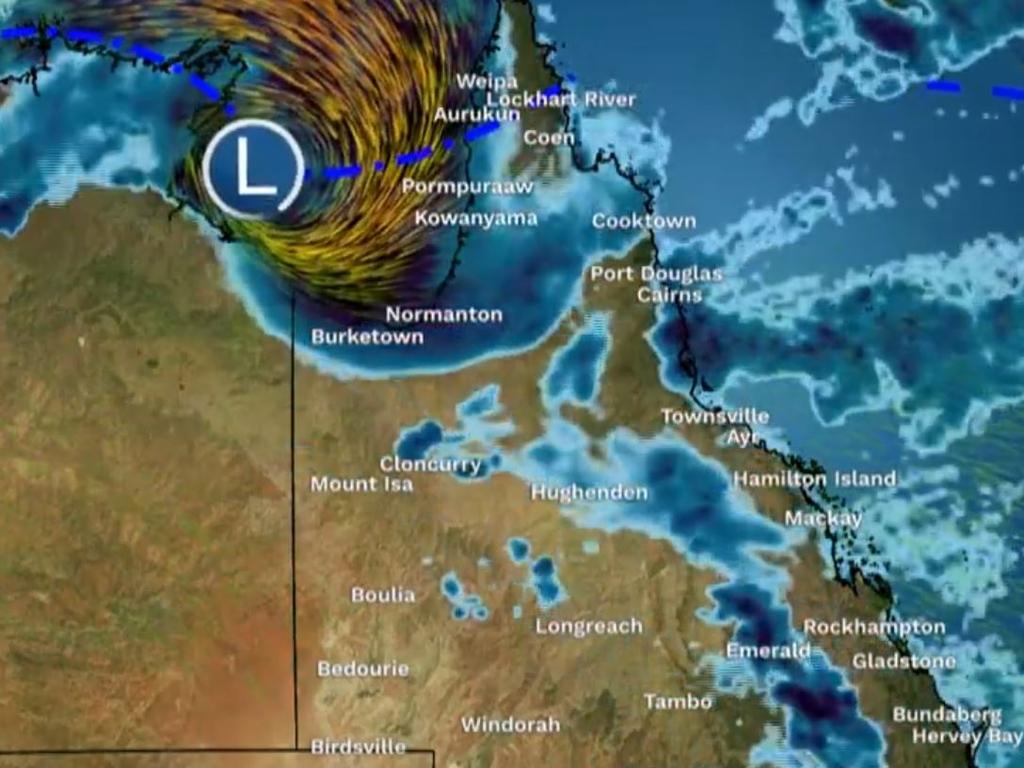
Tropical Low 07U is currently sitting in the western Gulf and has a moderate chance of developing into a Tropical Cyclone by Friday.
The low is likely to bring strong winds and heavy rainfall to the southern gulf of Carpentaria coast on Thursday afternoon and into Friday.
Port Roper (NT) to Burketown including Mornington Island and Borroloola are included in the watch zone issued by BOM on Wednesday night.
It comes as far north and western Queensland communities brace for falls of 200mm, gale force winds and flash flooding while Friday looms as D-Day for potentially the third tropical cyclone of the summer, the weather bureau has warned.
Forecasters expect 07U to start moving to southwest on Friday, taking it over The Gulf coast later that day or early Saturday, where it will weaken.

Speaking earlier on Wednesday, the bureau’s Felim Hanniffy said severe weather warnings could be issued from Thursday as 07U had moved into the far western parts of The Gulf of Carpentaria on Wednesday morning.
“Certainly Friday is probably the peak day in terms of potential tropical cyclone development or risk from the system,” he said.
“The majority of the modelling says it will remain west of Mornington Island, so not expected to kind of drift further east and reach across the Western Peninsula coast.”
Mr Hanniffy said the system’s chance of developing into a Tropical Cyclone had increased to 40 per cent on Friday.
🛰ï¸Enhanced satellite imagery over last 24 hours shows floodwaters moving towards #Birdsville. Minor flooding is likely there today, with moderate flooding from later this week and further rises likely.
— Bureau of Meteorology, Queensland (@BOM_Qld) February 14, 2024
See the warning here: https://t.co/jOlg5hOnQQpic.twitter.com/zMoMfJXwmW
“From the latter parts of Friday, the risk of developments increases to from very low all the way up to a moderate chance,” Mr Hanniffy said.
“Conditions are expected to be favourable for development, probably the hindrance to the system will be just how close are remains to The Gulf Coast.”

Parts of The Gulf coast could experience strong to gale force winds and heavy rainfall, even if it doesn’t form into a cyclone, according to the bureau’s tropical cyclone forecast.
A monsoon trough is also expected to deepen in coming days through The Gulf and Western Cape York Peninsula.
The combination of the monsoon trough and tropical low will increase rainfall around Far North Queensland into the weekend.
The bureau said widespread areas of heavy rainfall with daily totals of 100 – 150mm were likely from late Wednesday and during Thursday and Friday, with isolated 200mm possible each day.

Far north and western Queensland had already recorded rainfall totals of up to 45mm on Wednesday morning with Sweers Island in the gulf copped 31mm since 9am while Barcaldine had 45mm falls.
“The monsoonal showers and storms will probably tend to rain in the coming day or later today,” he said.
“There is the risk of some heavy to locally intense rain, particularly as that low starts to start to move further east and develop from tomorrow and into Friday as well.”
Mr Hanniffy said if the system remained close to the southern Gulf Coast it might not be able to fully consolidate.
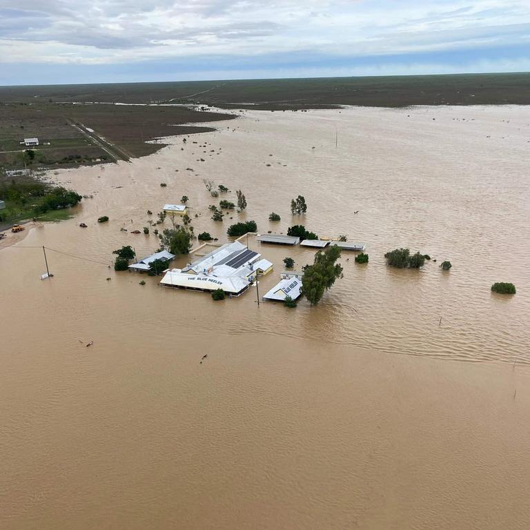
A flood watch was active for southern Gulf of Carpentaria catchments which remained saturated from rainfall recorded over the past few weeks and in recent days.
Catchments likely to be impacted included the Nicholson, Leichhardt, Upper Flinders, Lower Flinders, Cloncurry and Norman ivers.
As of Wednesday morning there was already major flooding at Flinders River, moderate flooding at the Nicholson River and minor flooding at Norman River.
Significant river, creek, and stream rises are likely with heavy rainfall, with renewed minor to moderate flooding possible across parts of the flood watch area.
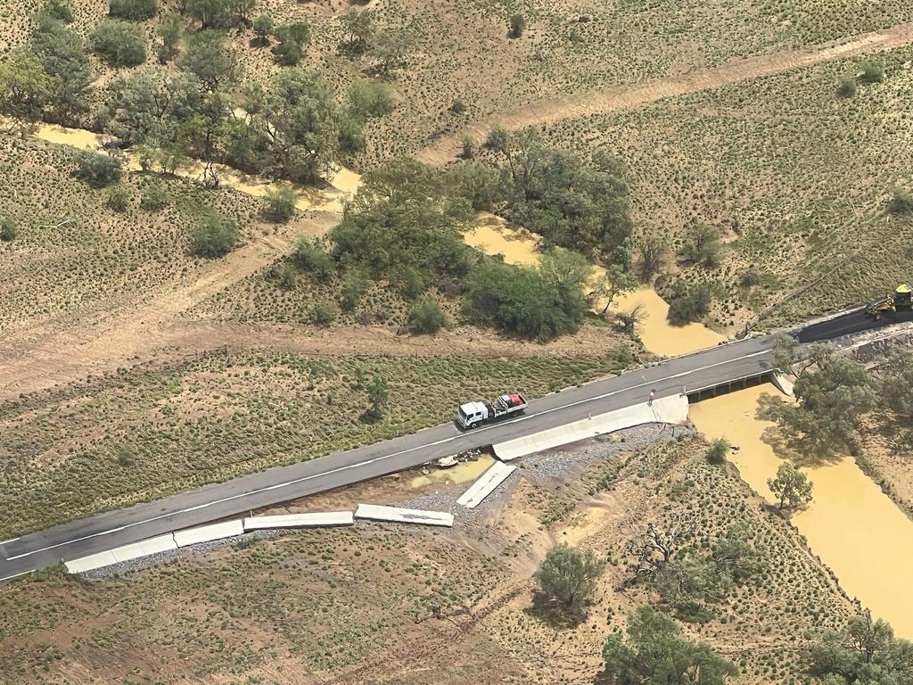
Many roads, and possibly primary and secondary highways may be affected with some communities and homesteads expected to become isolated.


