
Intense rain band dumps heavy rain across southeast Queensland
Parts of Moreton Bay and the Sunshine Coast are experiencing flash flooding as an intense rain band brings heavy falls with totals up to 136mm recorded. The rain is set to continue today.
QLD weather news
Don't miss out on the headlines from QLD weather news. Followed categories will be added to My News.
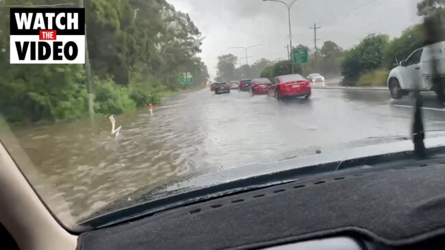
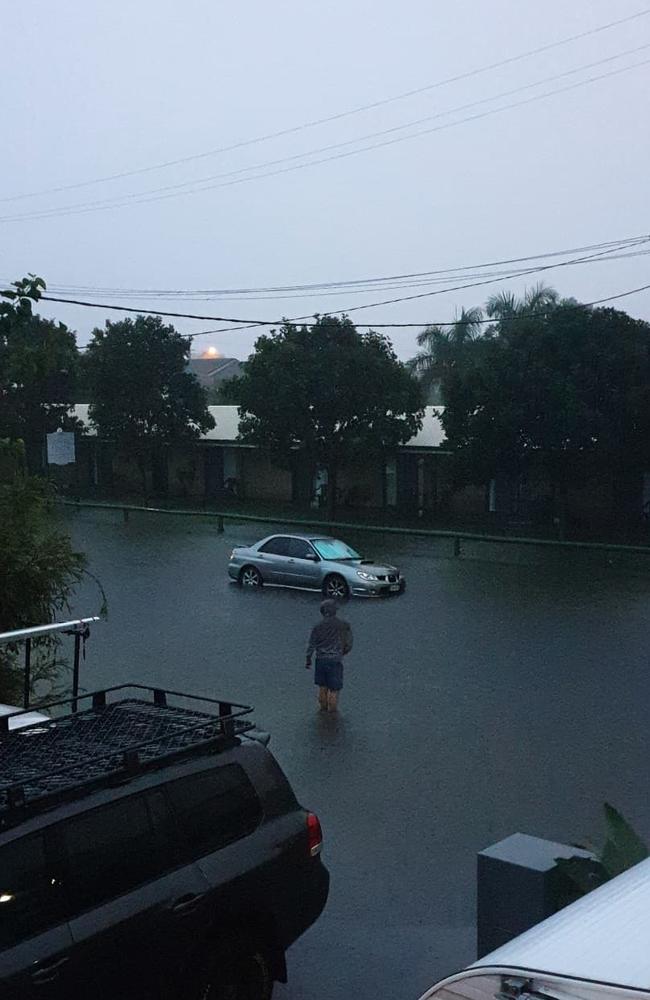
Heavy rainfall and localised flash flooding has lashed the southeast coast with water over roads and more rain on the way.
Up to 137mm of rain has fallen in parts of the Sunshine Coast as a coastal trough draws in high rainfall totals.
Caloundra has recorded 120mm in the last 24 hours to midday, while Bells Creek South has seen 137mm of falls.
Localised flooding in Sandgate and Carseldine has been caused by up to 78mm falling nearby in Kippa Ring.
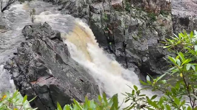
There is water over Gympie Rd at Carseldine and over Sandgate Rd in Boondall while Wappa Dam on the Sunshine Coast is flowing over after reaching 101.2 per cent capacity.
Meteorologist Peter Markworth said most of the rain would stick to the coastline.
“It is very much a coastal activity expected, not expected to penetrate further inland, maybe a little bit but the highest totals will be along the coast.”
Rain is expected to remain on the forecast until Wednesday.
“The Sunshine Coast, coastal Moreton Bay and parts of the Gold Coast will see further rainfall today and tomorrow.”
The fierce cell, which continues to hover over the region, also dumped 88mm at Bundilla, 87mm at Upper Doonan and 68mm at Coolum.
The Gold Coast also copped periods of heavy falls with up to 49mm on the northern end of the city at Monterey Keys and 43mm in the hinterland at Upper Springbrook.
Brisbane largely avoided the heaviest falls, recording between 10-20mm.
A man aged in his 20s was rescued after his vehicle became stuck in floodwaters near Byfield, north of Yeppoon, on Friday night.
Mr Markworth said there were several factors contributing to the damp conditions.
“We’ve got south-easterlies bringing in the moisture and we do have a surface trough at the moment along the coast.”
“Another big factor is an upper trough which is also enhancing these showers and the odd thunderstorm.”
He said the coastal trough would contribute to rainfall right across the southeast coast into the long weekend.
“We’re expecting generally for these conditions to continue, overnight is probably the best period to get the most of that rain but in saying that a lot of it will continue throughout the day as well.”
The rain is set to continue into Saturday with up to 60mm predicted for the Sunshine Coast, 30mm for the Gold Coast and 25mm for Brisbane.
The Bureau of Meteorology warns there will be moderate to locally heavy falls across Saturday, most likely during the morning, with a chance of thunderstorms also developing.
Showers are forecast to stick around for the long weekend with up to 35mm expected across parts of the southeast on Sunday and another 10mm on Monday.
RAINFALL SINCE 9AM FRIDAY:
Parreara Weir – 107mm
Bundilla – 114mm
Palmview – 115mm
Sippy Downs – 110mm
Bells Creek South – 136mm
Brisbane – 17mm
Moreton Island – 52mm
Bribie Island – 62mm
Kippa Ring – 73mm
Gold Coast Seaway – 25mm
Monterey Keys – 50mm
Tomewin – 56mm
Upper Springbrook – 54mm
Read related topics:Weather
Join the conversation
Tiny town braced for biggest flood in 30 years, set to cut off Bruce Hwy
Residents in a small town southeast of Townsville are braced for its biggest flood in three decades with the region facing another 500mm deluge that’s set to cut off the Bruce Highway.
Read more
‘Wall of water 50ft high’: Great Brisbane floods of 1893
In a freakish turn of weather Brisbane flooded three times in February 1893, leaving a third of the population homeless and claiming the lives of 35.
Read more