
Bureau of Meteorology issues flood watch for Queensland and New South Wales
Easter long weekend plans may be disrupted as southeast Queensland braces for heavy rainfall and possible flooding. LATEST FORECAST
QLD weather news
Don't miss out on the headlines from QLD weather news. Followed categories will be added to My News.
Heavy showers overnight has left parts of the southeast soaked, and more rain is on the way.
North of Brisbane in Mount Mee, 31mm of rain was recorded overnight, while the Sunshine Coast had 26mm of falls.
Bureau of Meteorology’s James Thompson said the southeast would continue to be impacted by showers on Good Friday.
“We are still seeing some showers move into the southeast, they have shifted a little bit north, the heavier showers have moved up to the northern Sunshine Coast and Fraser Coast,” he said.”
“We do have showers along most of Queensland's east coast today but just light and isolated for the most part and a little bit more scattered around the Fraser coast today.”
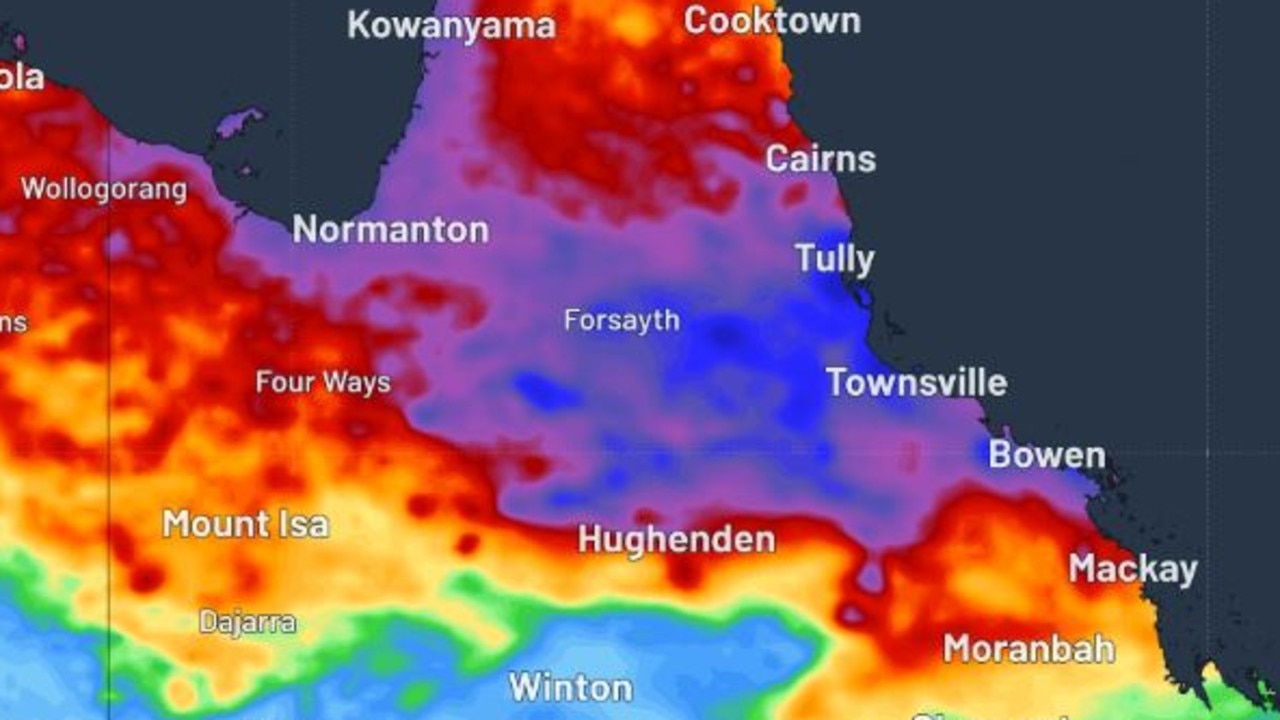
He said showers could span from the north tropical coast, central coast, parts of the Capricornia to the southeast coast.
Heavy rainfall of more than 100mm is expected to hit the southeast from Sunday and continue through to Tuesday.
The Gold and Sunshine Coast are expected to receive falls in excess of 100mm on Monday.
Mr Thompson said the heavy falls could have prompted a flood watch from St Lawrence south to the Queensland and New South Wales border.
“At this stage looking like any place south of Rockhampton has a chance of seeing those heavier showers or storms, but this is a system we’re keeping our eye on.”
“There is the risk that we could see some heavy showers from Sunday to Tuesday and the Sunshine Coast, as well as other parts of the greater southeast are definitely in that zone where they could see those heavier showers.”
“At this stage it’s really hard to pinpoint exactly where the heavier showers will be, but the Sunshine Coast is probably one of the more likely areas to see heavier showers and storms.”
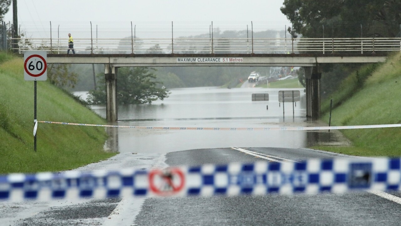
The Bureau of Meteorology issued the flood watch for coastal catchments from St Lawrence to the Queensland-New South Wales border, extending inland to the Darling Downs.
That covers a large part of southern Queensland, which includes the Mary River, the Noosa River, Sunshine Coast rivers and creeks, and upper and lower Brisbane river along with the Logan and Albert Rivers which experienced major flooding two weeks ago.
Sky News Weather chief meteorologist Tom Saunders said people in areas that had recently flooded should be careful.
âš ï¸A #Flood Watch has been issued for coastal catchments between St Lawrence and the Qld-NSW border extending inland to the Darling Downs, with minor to moderate flooding possible from Sunday evening. Details and updates: https://t.co/Z3UMegYHrapic.twitter.com/XY4svYJboe
— Bureau of Meteorology, Queensland (@BOM_Qld) April 1, 2021
“Catchments around the Gold Coast are completely saturated, which means any further rain will be running off into the creeks and the rivers, and as the result we’re looking at a quite high likelihood of flooding on Sunday and Monday across southeast Queensland,” he said.
Scattered showers are expected across the state tomorrow, but will increase heavily on Sunday and Monday as widespread rain hits across southeast Queensland coastline.
Up to 200mm of rainfall is expected along the southeast Queensland coast line this weekend, however localised falls could be heavier, said Mr Saunders.
Mr Saunders said the weather alert was concerning for commuters travelling throughout the Easter long weekend.
“Millions of Australians travel through the Easter long weekend and that could become an issue, particularly on Sunday and Monday.
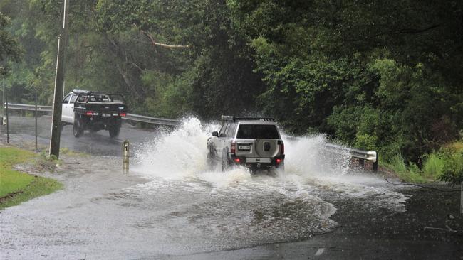
“People travelling up and down the coast will just have to be mindful that roads could be closed because of the flooding.”
Rockhampton to Gold Coast will be focus of heavy rainfall this Easter long weekend. Capricorn & Fraser coasts will see increasing rainfall with deteriorating conditions in southeast from Sunday to Tuesday. Stay safe & see #QLDweather forecasts & warnings https://t.co/Rtz4W8Pxf3pic.twitter.com/gw44ttlLTl
— Bureau of Meteorology, Queensland (@BOM_Qld) April 1, 2021
As the low moves right down the southern Queensland coast on Monday, holiday-makers should expect strong wings and possible warnings issued for damaging wind gusts and damaging surf due to high seas and swells.
A low-risk cyclone is also currently developing on the northwest coast off the Kimberley, however it poses no threat to the Eater long weekend, sitting at 500km off the coastline.
Mr Saunders warned commuters to never attempt to drive through flood waters.
Spokesman Jonty Hall said the Bureau of Meteorology would be closely monitoring areas most prone to flooding in the coming days as rainfall increased.
“What we are really worried about is Sunday and Monday, but we won’t know more until later in the long weekend,” Mr Hall said.
“For now, people should just be careful on the roads.”
Read related topics:Weather
Join the conversation
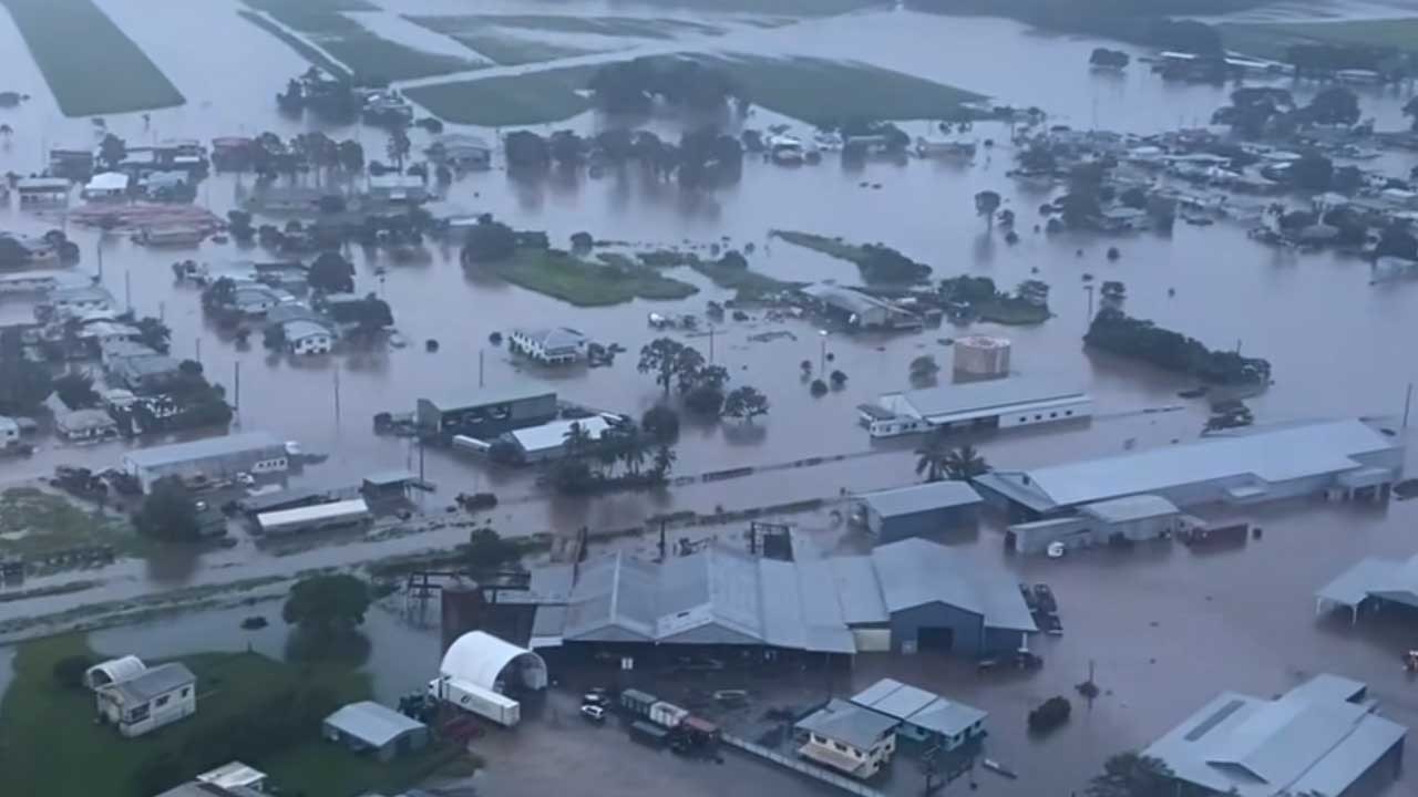
Hell and high water: Inside ground zero of North Qld’s flood nightmare
In the dead of night, as most of Ingham slept, a torrent descended. Nothing will ever be the same again. This is the untold true story of how the North Qld spirit conquered unimaginable tragedy and heartbreak.
Read more
Tiny town braced for biggest flood in 30 years, set to cut off Bruce Hwy
Residents in a small town southeast of Townsville are braced for its biggest flood in three decades with the region facing another 500mm deluge that’s set to cut off the Bruce Highway.
Read more