
‘24 more hours of rain to come’: Five dead, one missing as weather emergency rages
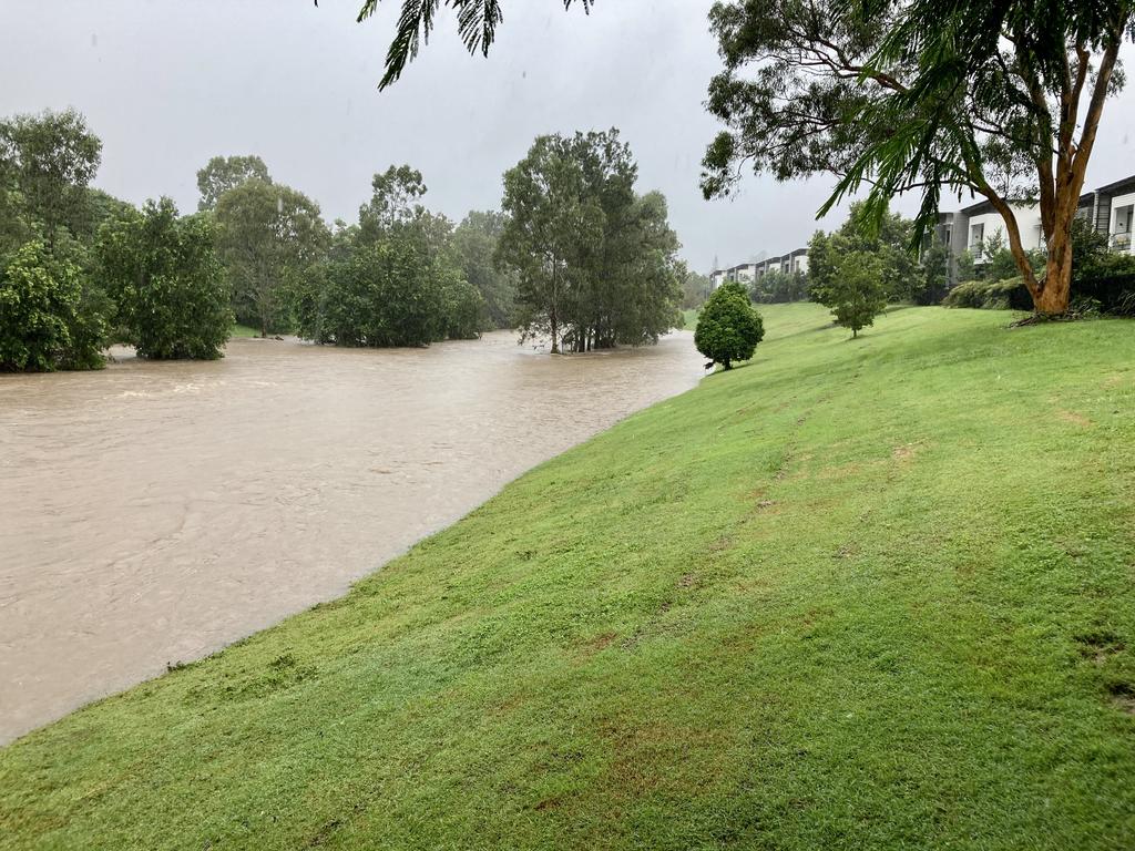
Brisbane’s Lord Mayor has issued an alert about potential for flooding in 16 Brisbane suburbs as catchment flows and dam releases coincide with high tide.
QLD weather news
Don't miss out on the headlines from QLD weather news. Followed categories will be added to My News.
Brisbane Lord Mayor Adrian Schrinner has issued a flood warning tonight based on the city council’s modelling.
In a thread of posts on Twitter, the Lord Mayor said a number of suburbs could be impacted in Brisbane early tomorrow.
“There’s concerns that overnight flows from the upper catchments into the Brisbane River, combined with possible Wivenhoe Dam releases, will coincide with tomorrow morning’s high tide,” Cr Schrinner wrote.
The alert could potentially impact several thousand properties including those in Brisbane City, Bulimba, Hamilton, Milton, New Farm, Newstead, Norman Park, Oxley, Rocklea, South Brisbane, St Lucia, Teneriffe, Toowong, West End, Windsor and Yeronga.
Cr Schrinner said it included cases where flooding would affect a front or back yard, and not the interior of a dwelling.
The Lord Mayor has also suggested that residents who may be affected prepare for potential flooding.
‼ï¸FLOOD WARNING‼ï¸
— Adrian Schrinner (@bne_lordmayor) February 26, 2022
I’ve just been updated on the latest Council flood modelling.
There’s concerns that overnight flows from the upper catchments into the Brisbane River, combined with possible Wivenhoe Dam releases, will coincide with tomorrow morning’s high tide (7-8am). pic.twitter.com/x59Zzoj0J1
Cr Schrinner said free sandbags would be available at four locations.
– 38 Shamrock Road, Darra
– 9 Redfern Street, Morningside
– 66 Wilston Road, Newmarket
– 33 Jennings Street, Zillmere
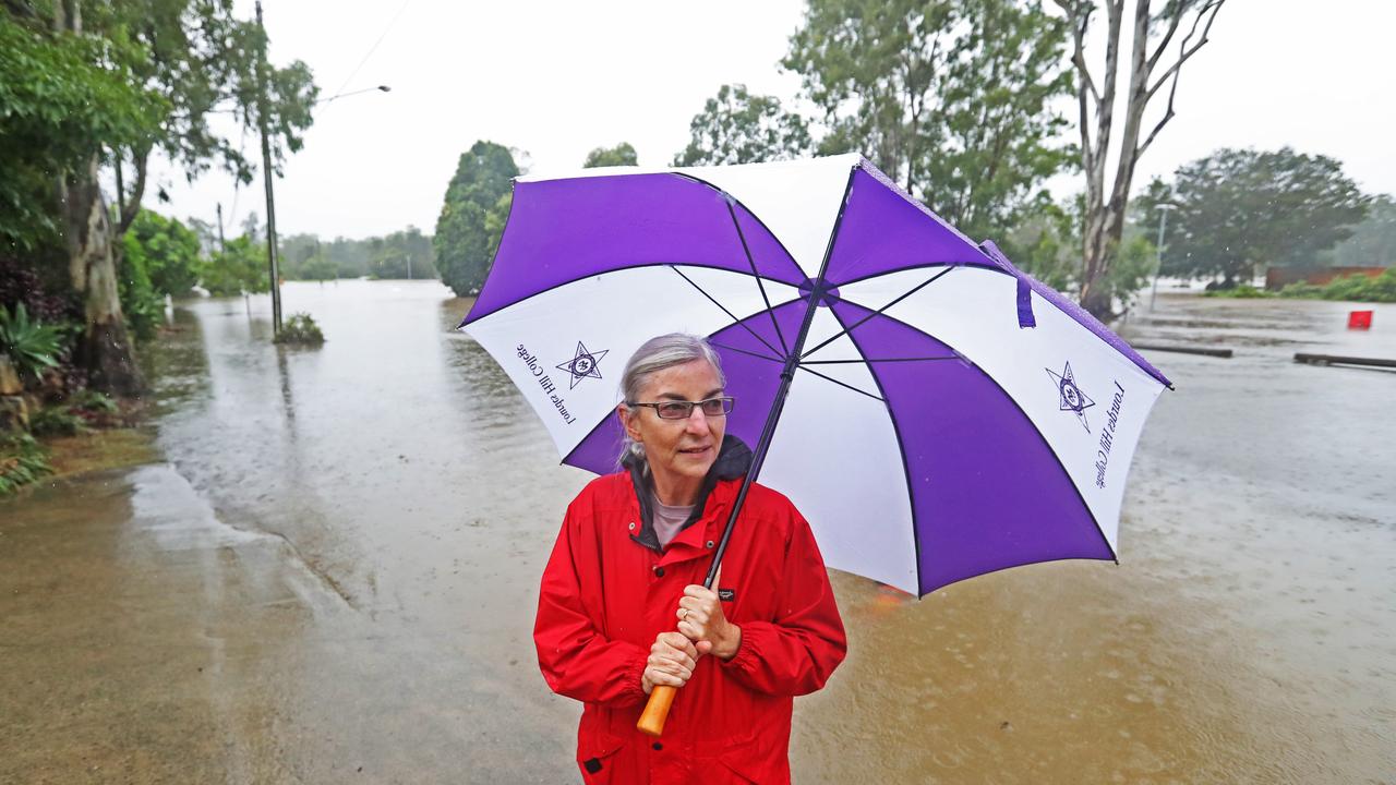
An emergency alert is in place for the Noosa area due to flooding.
The Noosa Local Disaster Management Group recommends that residents prepare as more areas could potentially become isolated.
Alternative routes should be considered as flooding may impact roads.
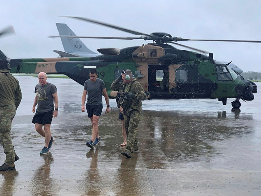
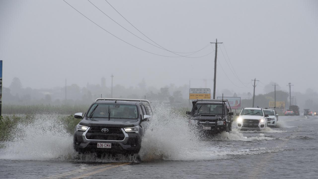
Meanwhile, more than a dozen people caught in South East Queensland’s catastrophic flooding have been winched to safety by the military as the army’s helicopters deal with “horrific” weather.
And more defence personnel and equipment is at the ready to help out during the disaster, should the State Government request it.
It comes as the fifth fatality from the floods was confirmed, a man swept away in his car near Gympie overnight.
Six-hourly rainfall of up to 300mm is possible overnight, as South East Queensland braces for another 24 hours of wild weather.
Three MHR-90 Taipan helicopters have been activated in South East Queensland to aid in rescue operations, with the Australian Defence Force confirming missions had largely been focused in the Lockyer Valley area.
This included the rescue of a mother, infant and four children northeast of Gatton on Saturday, with the army also rescuing three men from floodwaters after the tinny they were in washed away in strong currents.
It’s understood the men had been heading out to help a neighbour.
Army Aviation Training Centre Commandant Colonel David Lynch said the helicopter rescue teams had likely saved a man’s life, after they were called to reports a man was stranded atop an overturned tinny northeast of Gatton on Friday evening.
But it turned out the man was in the water, and Col Lynch said the outcome could have been vastly different if the rescue team hadn’t reached him when they did.
He said the timing was a coincidence, after a family of five allegedly needing to be rescued from their home--which was cut-off by floodwaters-- opted to stay in the house.
But the man was indeed in the water, and Col Lynch said the outcome could have been different if the crew had not reached him when they did.
Defence has been evacuating people to RAAF Base Amberley, where Queensland police have set up an area for them to shelter if needed.
The Insurance Council of Australia on Saturday evening declared Queensland’s ongoing flooding disaster a “catastrophe”, meaning insurance claims made by those in the region will be given top priority.
ICA chief executive Andrew Hall confirmed more than 3500 insurance claims had been lodged in southeast Queensland in just three days, but it was still too early to know the extent of the damage.
“The insurance industry has made this Catastrophe declaration to activate services and support for affected homeowners and businesses and reassure them that their insurer is there to help,” he said.
“As many areas are currently inaccessible due to damage and floodwater and evacuation orders in Gympie, insurers are expecting further claims in coming days as emergency services allow residents to return to their properties to examine the extent of their damage and losses.”
The ICA’s declaration will apply to claims made in northern regions of New South Wales.
The weather bureau has issued a new storm warning for the region, with the low expected to move south towards northern New South Wales on Saturday night and into Sunday morning
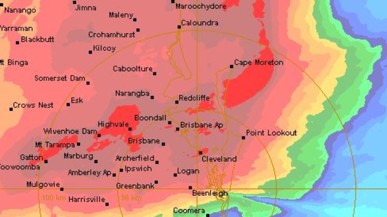
Latest rainfall figures show some areas have copped a huge amount of rain overnight and today, with rainfall at Mt Glorious exceeding 900mm over the past 24 hours.
SCROLL DOWN TO SEE THE LATEST BIG RAINFALL FIGURES
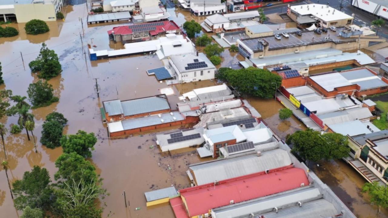
The latest update comes as Gympie City and Gympie Southside residents have been urged to evacuate as Mary River levels rise to 21.8m.
Southern Queensland’s weather emergency has claimed three more lives, including an SES volunteer involved with a rescue west of Brisbane and a man whose car was swept away near Gympie.
One other person is missing at Yandina.
Almost 2000 calls for help have been made to emergency services with 132 swift water rescues as some regions deal with there biggest flood threat in three decades.
It comes as a severe weather warning remains in place for southern Queensland, with large downpours forecast again for today and flood warnings in place.
Authorities say the weather event is not over, with the system moving slower than expected and rain set to intensify in some places.
WHAT YOU NEED TO KNOW
SES volunteer dies while responding to call for help in Coolana in Ipswich
Body of Camp Hill man found in water at Stones Corner in Brisbane’s south
–Gympie braced for worst flooding in living memory
Very dangerous storm warnings continue for the South East
– Dozens of rescues under way across region
All beaches closed on Sunshine and Gold coasts
Wind gusts of up to 90km/h recorded in coastal areas
Major flood warnings for: Mary and Mooloolah rivers, Maroochy and Noosa rivers, Upper Brisbane and Stanley rivers and the Bremer River, along with Laidley, Lockyer and Warrill creeks
– Ferry, buses cancelled
– 40m piece of concrete pier floating eastbound down Brisbane River toward Gateway Bridge
– Ipswich residents leave inundated homes for evacuation centres
– The Premier has provided an update on flooding across the South East and says there is no concerns at this stage about Wivenhoe Dam, which is at capacity
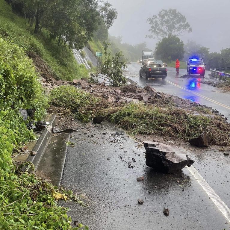
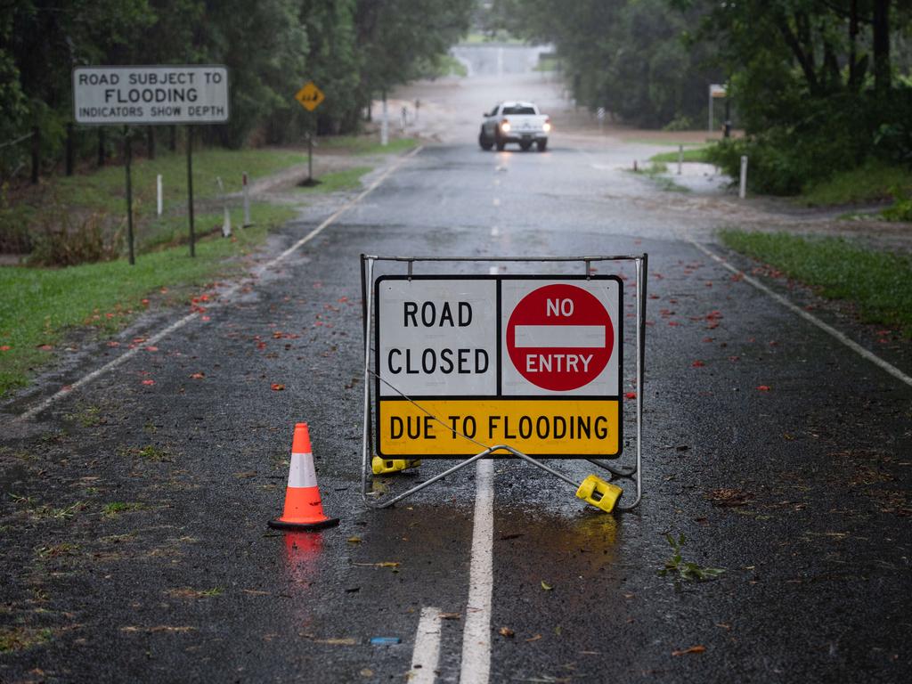
– Bruce Hwy between Brisbane and Maryborough currently cut in several spots
– Ipswich pound has been evacuated
– Emergency Alert issued for Logan
– The Bremer River at Ipswich is currently at 12.97 metres and rising, with major flooding, the BOM has reported.
– Gympie City and Southside residents told to evacuate
– New storm warning issued for SEQ with falls of up to 300mm over a six-hour period possible.
SCROLL DOWN FOR MORE DETAIL ON ALL THESE ISSUES
NEW STORM WARNING
South East Queenslanders have been warned to brace for more storms for “the remainder of the weekend,” with heavy rainfall and life-threatening flash flooding forecast to continue impacting the state on Saturday night.
At 4.25pm the Bureau updated its severe storm warning for the state’s South East, as a surface trough deepens into a low over the Wide Bay and Burnett Districts.
The low is expected to move south towards northern New South Wales during Saturday night and Sunday morning, producing further intense rainfall with six-hourly rainfall totals in excess of 300mm.
The Bureau said the system remains slow moving and will “continue to cause significant and prolonged impacts across the southeast for the remainder of the weekend.”
Locations which may be affected include Gold Coast, Toowoomba, Brisbane, Maroochydore, Gympie, Kingaroy, Caboolture, Coolangatta, Ipswich, Jimboomba, Mount Tamborine and Redcliffe.
The Bureau said six-hourly rainfall totals between 80-120mm are likely but rainfall totals could still reach well above 300mm.
“Six-hourly rainfall totals between 80 and 120mm are likely to continue, reaching up to 180mm over areas east of Kingaroy to Toowoomba,” the Bureau said.
“Six-hourly rainfall totals in excess of 300mm are possible.”
A warning for damaging wind gusts in excess of 90km/h has also been issued to the Sunshine Coast; however, this warning is expected to be extended to coastal areas further south on Saturday night and Sunday as the low moves towards the NSW border.
TOP RAINFALL FIGURES
Rainfall to 9am Saturday:
Mt Glorious -709mm
Pomona -541mm
Tin Can Bay -444mm
Upper Doonan -427mm
Dayboro -381mm
Gatton -301mm
Brisbane City -236mm
Ipswich -224mm
Rainfall from 9am Saturday to 4pm Saturday:
Mount Glorious -198mm
Elimbah -186mm
Beerburrum -177mm
Wamuran -168mm
Rose Ck Road -165mm
Delaneys Ck -159mm
Mount Mee -159mm
‘24 MORE HOURS TO GO’: PREMIER PROVIDES FLOOD UPDATE
Premier Annastacia Palaszcuk has provided an update on the flood disaster hitting South East Queensland.
Ms Palaszczuk says there is no reason for alarm over the amount of rain falling in the region’s dams, despite plans for further mitigation at Wivenhoe dam as it remains over capacity.
The Premier says rain levels in Gympie are expected to exceed flood levels of 21m.
“We will be issuing some evacuation alerts,” Ms Palaszczuk said.
The evacuation alert will apply to about 700 people in the Gympie area.
Police and SES crews will be deployed to help assist with the evacuation order.
Gympie’s flood levels have already exceeded the 2011 and 2013 flood peaks.
Maryborough’s flood levels could also exceed a peak that was experienced in January this year.
Flood peaks are expected to begin today and continue throughout tomorrow.
Authorities are also monitoring low-lying areas on the Sunshine Coast, including Tewantin.
Ms Palaszczuk said in Logan, the Logan River and Albert River were being monitored. She urged Beaudesert residents to be on alert.
Higher flood levels are expected in Maryborough tomorrow.
There are currently 1000 road closures in Queensland, with the Premier urging people to avoid flooded roads.
“If you are in any areas surrounding these areas, please listen to the advice that will be coming,” Ms Palaszczuk said.
There have been 92 swift water rescues.
Ms Palaszczuk said the weather system had moved much slower than expected.“We can’t control Mother Nature unfortunately,” she said.
Ms Palaszczuk said the situation was “something that is completely unpredictable” and urged people to be cautious over the next 24-48 hours.
The weather bureau is warning that South East Queensland is in the middle of a “season-defining event”.
The heaviest rainfall is now being experienced in the Brisbane and Ipswich areas.
The bureau is warning there is the potential of more heavy falls on Saturday night in those areas currently experiencing a reprieve.
Officials are warning of localised landslides, with more flood warnings expected during the weather event, meanwhile buildings have been swamped with water in Caboolture and Morayfield.
The bureau says it is too early to call flood peaks.
Deputy Police Commissioner Steve Gollschewski said three people reported missing near Marburg had been located and rescue crews were working to bring them to safety.
Mr Gollschewski said an emergency alert was going out in the Gympie region this afternoon.He urged residents to follow the alert so that they can be safely evacuated from the worst affected areas.
There are 20 evacuation centres in operation in the South East corner, with 500 people currently using them.
As of this morning, there were about 7700 power outages in the South East corner – with police warning there will likely be more.
QFES Commissioner Greg Leach said authorities were currently responding to inundated buildings in the Caboolture and Morayfield area.
“If you are experiencing a life-threatening emergency, then please dial Triple-0,” he said.
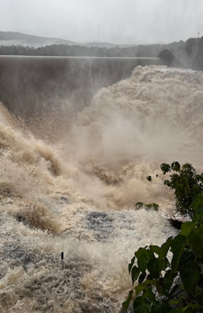
The combined level of the Seqwater grid is now about 97 per cent.
As of about midday today, Wivenhoe topped 100 per cent of its drinking supply level, but is well short of the levels seen in the 2011 floods.
Wivenhoe still has capacity for an extra 2 million megalitres of floodwaters.
The Bruce Highway is cut in multiple places between Brisbane and Maryborough, while the highway from Brisbane to Toowoomba is also cut in several places.
Some train lines are expected to be cut for several days.
SES VOLUNTEER DIES DURING RESCUE EFFORT
The SES worker died while responding to a call for assistance in Coolana, near Marburg.
Three other SES personnel were rescued from floodwater when the vehicle they were travelling in was swept off the road.
They were assisting a family after flood water threatened to inundate their home.
The other person was a 55-year-old Camp Hill man whose body was found in water at Gladys St at Stones Corner, in Brisbane’s inner south, just after 1.30am.
Police were at the scene this morning.
Leftover cars in the nearby car park that backed onto the Stones Corner Busway Station were left stuck in growing flood waters.
Overnight, tow trucks were organised to remove around 20 empty parked cars that were stuck after flash flooding filled the undercover area.
Two other people died in floodwaters earlier in the week, a woman at Belli Park and a man near Gympie.
RESCUES AS SUNSHINE COAST, GYMPIE FACE MAJOR FLOODING
On the Sunshine Coast, where a severe thunderstorm warning was issued earlier this morning, two people have been stuck on a roof at Yandina and a motorist was trapped in water near Nambour.
The warning was later cancelled, but there is a high chance of storms redeveloping.
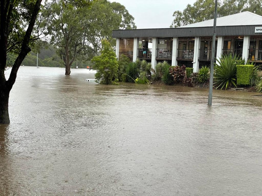
The Bureau of Meteorology says the Sunshine Coast is in the midst of its worst flooding for 30 years and parts of Brisbane have had more than one month’s worth of rain in one day.
In Gympie, the CBD is under water and an emergency alert has been issued to residents as the Mary River rises.
It is feared it could top 22 metres, which would be the worst flooding in the city since 1999.
EMERGENCY ALERT ISSUED FOR LOGAN CITY
As of 2pm Logan was under an ‘emergency alert’ as flooding in the area continues.
The city’s catchments have had varying levels of rainfall over the past 24 hours – from 40mm to more than 200mm.
City of Logan Mayor Darren Power said residents must prepare for the possibility of becoming isolated due to flooding, and to stock up in the event some areas become cut-off.
“Schmidts Rd at Logan Reserve is already isolated, and other areas could also become affected by rising waterways. “
“We need our community to be aware and alert of how they might be impacted and also be sensible about how they handle the conditions,”
“Now is the time to be prepared – make sure you have essential food and medication, and that your family and pets are safe” Councillor Power said.
Communities that could be potentially impacted include:
• Logan Village and Buccan around Dairy Creek, Ooah Creek and Quinzeh Creek
• Jimboomba and Glenlogan, around Henderson Creek and the Logan River
Councillor Power urges Logan residents to not leave their homes unless necessary.
“Do not go sightseeing, and remember – if it’s flooded, forget it”
“Anyone who enters a flooded road, creek or drain not only endangers their own life but they also risk the lives of those who may
SEASON-DEFINING’: BIGGEST WEATHER EVENT IN DECADES
Queensland’s Police Minister Mark Ryan this morning warned that the weather event was not over, saying it would be the biggest event some will have experienced in a number of decades.
Mr Ryan said the rain in some areas was intensifying, with water catchments saturated.
He paid tribute to the SES volunteer who died.
“Tragically two people have died,” he said. “We’ve lost one of our own. It’s often said that those who wear the SES uniform are orange angels.”
A spokesman from the Bureau described the situation as a “season-defining event”, which would continue until tomorrow because it was moving slower than expected.
With numerous flood warnings in place, more will be declared in coming days.
Further rapid rises are expected in the Lockyer. Valley throughout today and tomorrow.
EMERGENCY SERVICES INVOLVED IN MULTIPLE RESCUES
A person clinging to a tree had to be rescued in Woodford and some residents in Beachmere have been evacuated by boat amid worsening flood conditions in the Moreton Bay region.
It is understood the Moreton Bay Regional Council is also working to rescue five people stranded on a property on Smiths Rd, Caboolture.
Moreton Bay Regional Council Mayor Peter Flannery confirmed 23 people took refuge in evacuation centres overnight.
He warned there was a real risk of inundation on Saturday and the likelihood more roads— in the addition to the existing 150 already shut— will be cut off.
At least four swift water rescues have already been carried out in the Moreton Bay region, including a precarious situation at Neurum Rd, outside Woodford, where a man was rescued from a tree after having to abandon his vehicle.
“Beachmere Lake is full, so it will likely swell into people’s backyards. We’re not expecting water to go through houses but it’ll definitely go into backyards,” Cr Flannery said.
“In particular we’re watching rising water levels in Dayboro township right now.
“But I urge all residents to stay at home. Stay off the roads, do not go outside.”
The Queensland Ambulance Service reported several weather-related rescues overnight, including at Windsor in Brisbane’s inner north.
Paramedics assessed a woman in her 70s following a floodwater rescue at a location of Noble St and Newmarket Rd, about 3.50am.
They were also called to rescues at Booubyjan, Widgee Crossing, Amberley and Caboolture.
It’s understood there are rescues under way on the Sunshine Coast early this morning.
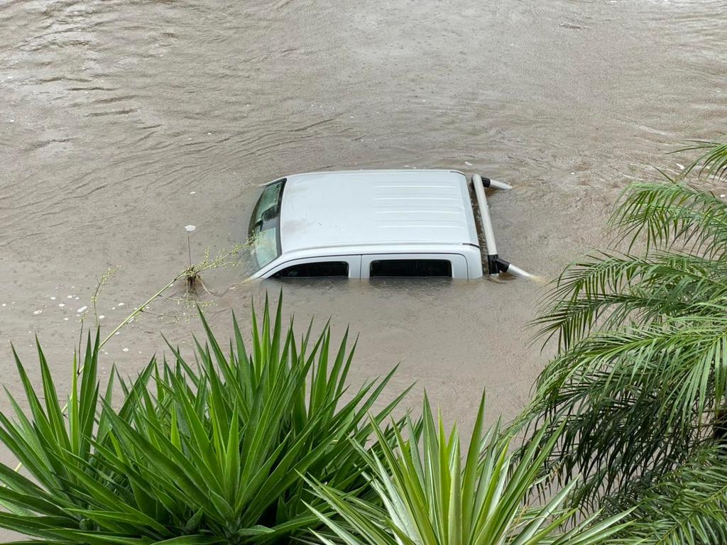
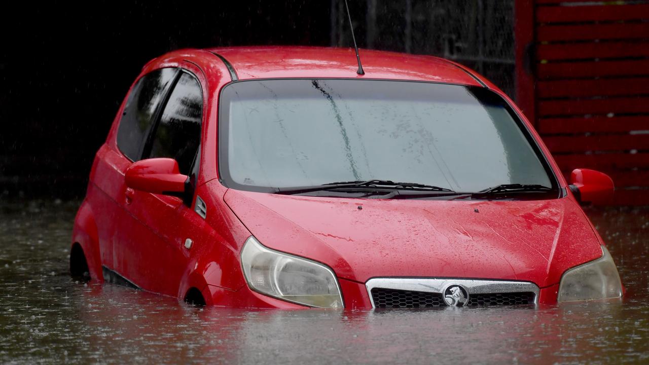
Water has inundated Minnippi Parklands in Carindale where a car has gone completely underwater.
Residents believe it was an Uber driver who attempted to drive through the flood waters on Friday night before becoming stuck and having to remove himself and abandon the car.
Meg Quinn has lived in the area for 14 years and said the flooding was reminiscent of the 2011 floods.
“Everyone who lives here knows the drill. But it’s different to 2011… this all happened just last night,” she said.
Ms Quinn said although her house was fine, neighbouring properties to the floods would be stuck in their days as the water is likely to take days to flow out.
Cars were seen testing the limits at intersection towards the flooded park as they drove through rising water that had come up over the road.
QFES commander of state operations Brad Commens said there were currently 25 swift water rescues underway in southeast Queensland on Friday at noon.
Mr Commens said residents under immediate threat should call Triple-0, but stressed people should have already made an evacuation plan based on historic flooding maps.
“In the event you become flooded in, certainly call Triple-0 on every occasion and we will get our people activated to assist,” he said.
Mr Commens said it was critical that people avoided travelling on roads unnecessarily.
“If people don’t need to be on the roads, today is not the day to be on the roads,” he said.

IPSWICH RESIDENTS EVACUATED
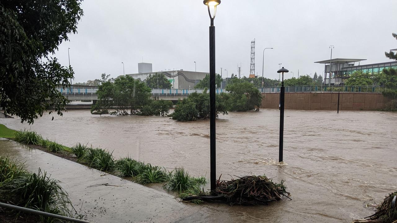
The Bremer River at Ipswich is currently at 12.97 metres and rising, with major flooding, the BOM has reported.
Major flood levels are expected to continue throughout the weekend with further slow rises during Saturday.
River levels similar to the January 2013 flood level (13.90 metres) are possible overnight Saturday into Sunday and further rises are expected during Sunday dependant on forecast rainfall and dam releases.
North Booval resident Rizalday Auld knows he’ll be returning to a flooded home when he leaves the Ipswich refuge centre at the city’s showgrounds.
Mr Auld said he expected his home to be fully inundated just like it was in 2011.
He is currently camped out at the refuge centre with his wife and three children, including a three month old baby.
“It’s going to get flooded,” he said.
“We just have to get through it, it’s all about showing resilience.”
Asked how it would feel to be flooded twice in just over a decade he said:
“We just have to pull through what can you say, it happens, people need to understand you just have to live with it.”
Mr Auld expects his home to be inundated when the flood peaks about midday.
He’s one of about 30 people who have taken refuge in the cavernous showground exhibition room.
Ipswich Mayor Teresa Harding said council had closely monitored the situation since Tuesday when the Bureau of Meteorology issued an alert on Tuesday, issuing sandbags the following day.
About 9pm yesterday new data came in that “dramatically changed the picture”.

The data showed increased rainfall and council scrambled to send out text message alerts by about 11pm to residents.
About 20 volunteers door knocked vulnerable low lying areas.
Based on forecasts Ms Harding said the refuge centre would likely be turned into an evacuation centre meaning people can spend the night there.
“We’re expecting more people because the land is saturated and there’s only one way the rain can go,” she said.
Ms Harding said the major flood warning for the Lower Brisbane River meant Karalee and Barellan Point would get cut off.
She said the announcement of a planned release from Wivenhoe Dam caused “a lot of anxiety” in the community due to memories from 2011.
Ms Harding didn’t believe the Bremer River would peak as high as it did 11 years ago.
However she said with the rain forecast to continue a second peak was expected tomorrow.
“I don’t want to scare people but they need to be alert for those low lying areas,” she said.
Lockyer MP Jim McDonald offered his condolences following the death of a SES volunteer at Coolana overnight.
“Our love and thoughts to her family and friends and to her colleagues,” he said.
Churchill resident Tash Speechley-Williams is “100 per cent” sure her home will flood based on forecasts.
Ms Speechley-Williams left her home at 6am for the Ipswich refuge centre with son Samuel, dog Indi and three cats.
“100 per cent I think it will get flooded” she said.
“Who doesn’t dread floods.
“I don’t have much hope with the rain today.”
The family home was flooded in 2011 so Ms Speechley-Williams said she was keen to leave this morning with water covering the driveway.
“We learnt from our mistake last time,” Samuel said.
The Ipswich City Council is residents to visit its Disaster Dashboard at https://disaster.ipswich.qld.gov.au/
POUND EVACUATED
Over a 100 animals are being evacuated from the Ipswich pound which sits by the flooded Bremer River.
The pound put a call out this morning and saw a “great response from the public.”
“Some people have just said what do you want me to take and some have taken both a cat and a dog,” a worker said.
Dozens of dogs were also taken to the showground.
A pig and a pigeon were also fostered.
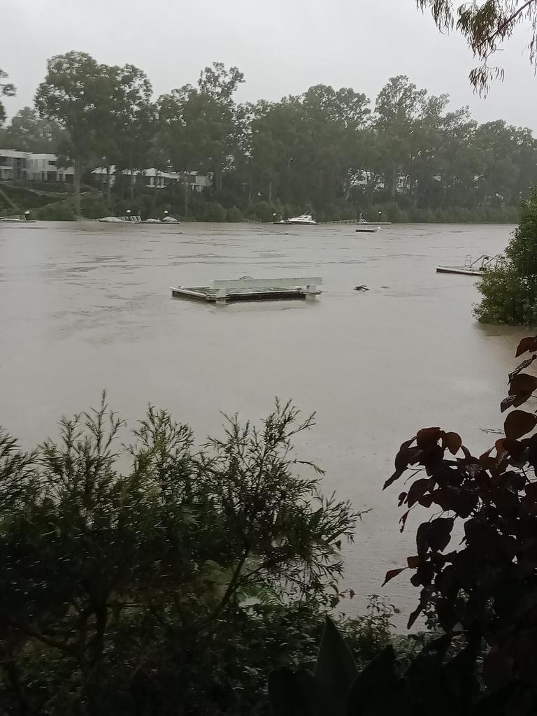
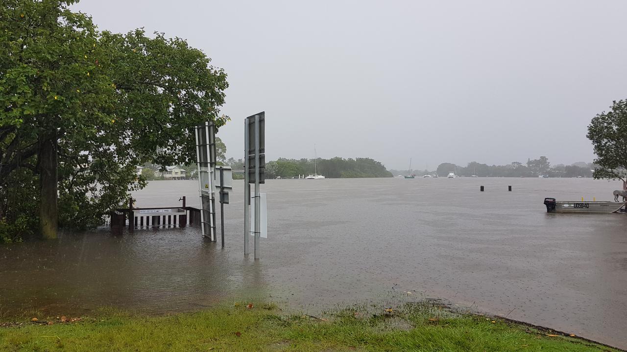
RIVER DANGER: BOATS, PONTOONS FLOAT FREE, FERRIES SUSPENDED
Boats on Brisbane river have been dragged downstream by the current after being hit by a loose concrete pontoon.
It’s understood two concrete pontoons were floating down stream when one hit a boat and cut its anchor.
The pontoon was secured by rescue teams on the side of the river while the other is believed to have continued downstream.
Two boats were dragged down the strong current as good Samaritans in tow boats and tinnies worked hard to pull them to shore.
People on board the boat appeared panicked as ropes were attached and tinnies were used as tug boats.
The boats were brought to safety at Rivergate Marina with one missing both
it’s engine and anchor.
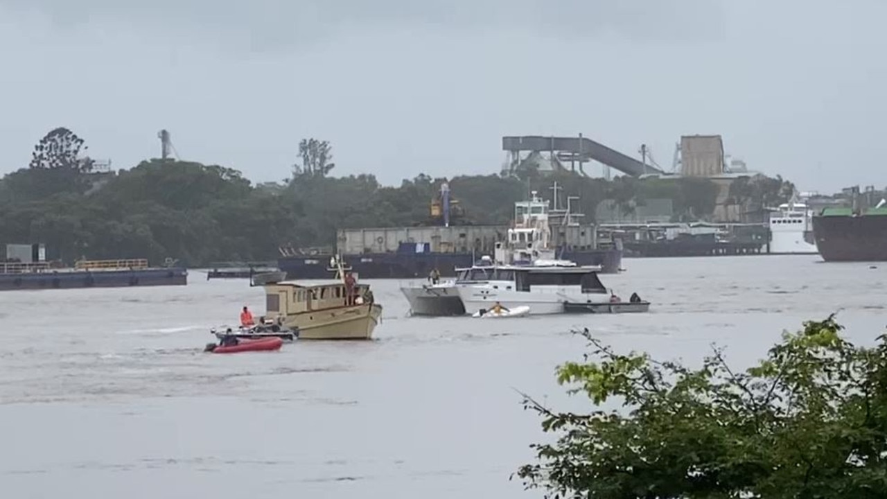
Earlier, police issued an urgent alert for boaties in the Brisbane River after a 40m piece of concrete pier broke away and was floating eastbound towards the Gateway Bridge.
It was first spotted at Hamilton.
The large piece of concrete is believed to have broken off from a rowing club pier near Sandgate and Breakfast Creek roads. Queensland Police water police crews were called in.
It comes as Brisbane Lord Mayor Adrian Adrian Schrinner announced all CityCat and ferry services would be suspended due to the dangerous conditions.
“Please avoid ferry terminals and do not walk or drive through flood water,” Cr Schrinner said.
TransLink has also announced some bus services have been cancelled until further notice due to severe weather and local flooding.
Commuters are urged to check timetables.
DEFENCE FORCE CALLED IN
The Australian Defence Force has been assisting with rescue missions in support of Queenslanders trapped by rising flood waters.
“I have authorised Defence to provide support to Qld Police to assist with air evacuations from flood affected areas,” Minister for Defence Minister Peter Dutton said.
“Two helicopters have been tasked from Amberley and will join the effort.
“It is a dangerous situation unfolding so please don’t travel on our roads unnecessarily.”
FLOOD WARNINGS, DAM RELEASES
Flood warnings are in place across the Southeast and Wide Bay, with major flood warnings for the Mary and Mooloolah rivers, Maroochy and Noosa rivers, Upper Brisbane and Stanley rivers and the Bremer River, along with Laidley, Lockyer and Warrill creeks.
There is also a major flood warning for the Logan River.
Seqwater late last night advised of flood releases from Wivenhoe Dam from 10pm, to continue overnight, with the likelihood of inundation of Twin Bridges, Savages Crossing, Burtons Bridge, Kholo Bridge and Colleges Crossing.
Minister Ryan said there was no further plan to release more floodwater from the dam after the controlled releases.
“We’re continuing to have a very close look at it,” he said.
HUGE RAINFALL TOTALS
The Bureau of Meteorology has forecast between 70mm and 120mm for Brisbane on Saturday, 90mm to 150mm for Toowoomba and Gatton, up to 100mm for Gympie and up to 150mm for Noosa Heads.
Heavy rains continued overnight, with 329mm at Pomona in the six hours to 4am this morning. There was 268mm at Boreen Point, 190mm at Black Mountain and 172m at Moy Pocket.
Rainfall totals in the 24 hours from 9am include a whopping 589mm at Mt Glorious, 444mm at Tin Can Bay, 343mm a Cooran, 284mm at Wivenhoe Dam, 274mm at Gatton and 196mm in Brisbane city.
BOM meteorologist Felem Hanniffy said the slow-moving system meant the primary risk for intense rainfall remained in areas which received significant totals on Friday.
He said areas to receive the most rain included the Lockyer Valley, northern suburbs of Brisbane and into the Sunshine Coast and southern Wide Bay.
“Given the fact we‘ve already seen significant rainfall, that’s a significant concern,” Mr Hanniffy said.
He said up to 300mm of rain could fall on some areas in the 24 hours to Saturday night.
“The trough system has slowed up over that area and the upper feature driving it all is very slow moving so there‘s nothing to shift that trough further north,” Mr Hanniffy said.
“The problem is, if that trough shifts slightly south, then the risk of heavy falls shifts right down to the Gold Coast.
“At this stage, the particular risk is the Lockyer Valley area into Saturday after we‘ve already seen intense falls today.”
Mr Hanniffy said updated weather models on Friday night showed the rain was unlikely to ease until Sunday.
“The slow-moving nature of the current system is causing difficulty in the models so there‘s potential that we could still have that risk early into Sunday,” he said.


Ice ice baby: Spectacular images of unseasonal frost as Qld freezes
Queensland’s overnight temperatures will increase to double digits in the coming days, following the coldest start to winter in 16 years, bringing frost and ice to many regions. SEE THE PHOTOS

City’s coldest June start in 16 years, feels like MINUS 9.8C out west
Southeast Queensland is shivering through its coldest morning in more than 15 years but feels-like temperatures have dropped to insane levels in the southern inland.