
Queensland weather: Brisbane in firing line as supercells bring deluge across the southeast
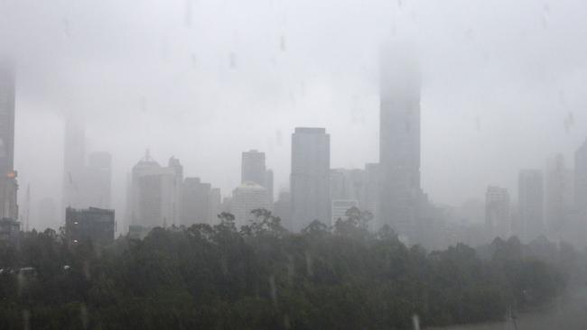
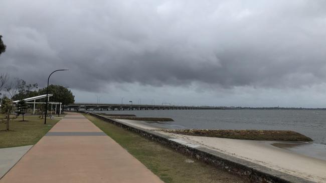
Brisbane and parts of southeast Queensland have been smashed by a torrential downpour, causing flash flooding and chaos on the roads. Warnings have now been cancelled but there’s a chance of more severe storms on Wednesday.

QLD weather news
Don't miss out on the headlines from QLD weather news. Followed categories will be added to My News.
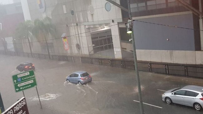
Southeast Queensland has been hammered by an afternoon of severe thunderstorms, with warnings of flash flooding realised in many places.
And the forecast is for much the same on Wednesday, with a 90 per cent chance of rain and the chance of severe storms from late morning.
The Bureau of Meteorology says up to 40mm could be on the cards for Brisbane.
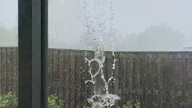
It comes as big falls were recorded across the southeast on Tuesday, with 80mm at Beachmere in an hour to 4pm. There was 48mm recorded at Kalbar in an hour, 62mm at Helidon and 70mm at Upper Lockyer.

The highest rainfall totals from 9am to 7pm Tuesday were 100mm at Beachmere, 92mm at Caboolture, 76mm in Brisbane, 75mm in the Upper Lockyer and 67mm in Holland Park West.
Late on Tuesday afternoon flooding was reported on Southern Cross Way, Gympie Rd and at Vulture St in Woolloongabba, with some 65mm of rain battering Brisbane in the afternoon.
Flash flooding closed one lane of Fairfield Road in Yeronga and Muriel Avenue at Moorooka.
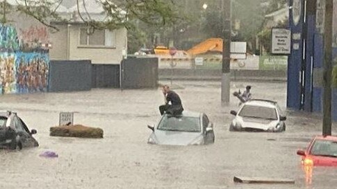
Bribie Island Road was closed with all lanes blocked due to flooding.
Eatons Crossing Rd in Eatons Hill was closed due to a two vehicle crash just before 6pm. Paramedics were on scene and police are assisting with traffic control.
Wet weather is also causing congestion on the Pacific Motorway. Allow extra travel time, turn on your lights and drive to conditions. #BneTraffic pic.twitter.com/roKSYxyNMp
— RACQ (@RACQOfficial) October 27, 2020
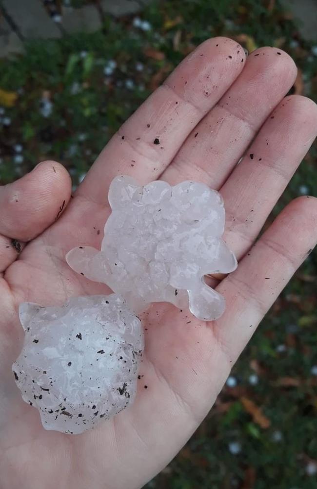
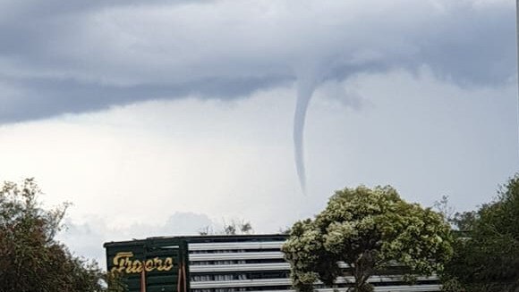
There were reports of mini tornadoes in Warwick, large hail on the Sunshine Coast and flash-flooding in the Western Downs across the day, with the storms now tracking further southeast, toward the Gold Coast.
The Bureau warned of “heavy rain which may lead to flash-flooding” with more than 80mm of rain dumped on Caboolture today alone.
Another 70mm was recorded in the Upper Lockyer with 57mm falling in under 30 minutes.
West, in Fulham, more than 4300 Energex customers were left without power as a consequence of the severe weather.
Please move vehicles from low-lying areas in Caboolture and take care on the roads this afternoon. If it's flooded, forget it! #FloodedForgetIt https://t.co/XSzrQC6LZI
— RACQ (@RACQOfficial) October 27, 2020
The Sunshine Coast train lines were suspended between Eudlo and Mooloolah as trains are unable to proceed due to flooding.
Man recounts terrifying moment he was hit by tree in storm, fracturing his skull
Man seriously hurt, power out until Monday after storm chaos
In a series of tweets, RACQ warned Brisbane residents to avoid driving in the conditions and to tie down any outdoor furniture or equipment.
“Turn your lights on, drive to conditions and leave plenty of place to stop,” the tweets read.
“There’s a lot of rain coming our way. Avoid driving and if you do get caught in the storm, pull over in a safe place (never under a tree) and wait until it’s safe to continue.
“If you’re at home – shut the windows, bring the washing in and keep an eye out for any leaks in your roof and blocked gutters.
“If you haven’t tied down your trampoline yet … lock it down now and don’t let it become a flying weapon.”
Bureau of Meteorology’s Rosa Hoff said Brisbane was unlikely to see storms develop quickly in the region, but would be hit by the storms coming in from the west.
“At this stage it’s more likely that they would weaken out inland but we can’t rule out a chance of seeing storms pass over Brisbane,” she said.
“In terms of formation they’re much more likely to form inland and then move over Brisbane than to suddenly pop up over Brisbane itself.”
She said it was important to keep an eye out for the warnings as they were updated because the situation could evolve rapidly and storms could pop up quickly.
There are reports of flooding on the Bunya Highway at Pirrinuan in the Western Downs, while heavy rain and hail have already hit parts of the Sunshine Coast, with residents in Beerwah, Burnside and Nambour having reported small amounts of hail in the area.
Kalbar, just north of Boonah, recorded 48mm of rain in just under an hour.
Ms Hoff said there were a number of supercells that had tracked across the state on Tuesday.
“We do have a number of severe storms in that (Somerset) region … Generally they’re heading in a very south-easterly direction, the majority of them, and a couple around the Somerset region are heading in a more easterly direction,” she said.
“At this stage it is likely for them to continue propagating that way however if they were to split then they could be moving in two different directions.”
âš ï¸Severe Thunderstorm Warning - #SEQld updated âš ï¸
— Bureau of Meteorology, Queensland (@BOM_Qld) October 27, 2020
Severe storms have developed and are moving E-SE. Locations which may be affected incl. #SunshineCoast #DarlingDowns #WideBay. These storms may produce damaging winds, heavy rain & large hail. Warnings: https://t.co/ENRxDpfHSo pic.twitter.com/MwcIdzKe8A
Earlier, Ms Hoff said the Bureau expected storms from late morning with the weather to reach its peak this afternoon.
“Really there’s a good chance the threat of storms extends all the way through the evening, overnight and into early tomorrow morning,” Ms Hoff said.
She said the weather would be “reinvigorated” with more storms expected to develop tomorrow afternoon.
It comes as RACQ revealed they have received 458 insurance claims since Sunday’s destructive storms.
More than 100 claims have been for motor vehicle damage and 325 have been reported for damage to property.
âš ï¸ Severe Thunderstorm Warning âš ï¸ issued for #SEQld. Severe storms are developing over #SunshineCoast & #WideBay & may produce damaging winds, large hail & heavy rain. Locations which may be affected incl. #Maroochydore #Noosa #Gympie #Redcliffe.
— Bureau of Meteorology, Queensland (@BOM_Qld) October 27, 2020
Warnings: https://t.co/gEpC8fVIGF pic.twitter.com/5feK3TrdfE
These storms come after southeast Queensland residents were told to prepare for more severe and damaging weather today.
After a weekend in which there were more than 80,000 lightning strikes across the southeast, the Bureau of Meteorology has predicted giant hailstones could hit the region as La Nina sets in for a summer of dangerous storms.
Meteorologist Jonathan How said there was the potential for dangerous conditions in the region on Tuesday and Wednesday.
“Tuesday will be a dangerous thunderstorm day right across southeast Queensland,” he said.
“Severe thunderstorms are likely, and these could produce damaging to destructive wind gusts in excess of 100km/h, large to giant hail in excess of 5cm, and heavy rainfall leading to flash flooding.
Severe thunderstorm warnings were issued when large hailstones of 2cm in diameter or greater, damaging wind gusts or heavy rainfall that could cause flash flooding were likely.
The warning follows a destructive storm on Sunday that left an Ipswich man hospitalised with several serious injuries after a tree fell on him.
He suffered a fractured skull, eye socket and rib.
Meanwhile, Queensland farmers have welcomed the recent heavy downpours, but say they’re not out of the woods yet, with some properties needing about 100-150mm of rain for their soil to even be wet enough to plant crops.
AgForce’s water chair Kim Bremner said farmers were looking forward to the wet after a brutal last summer.

“We’ve had a couple of years since we’ve had any decent rain and particularly the beginning of last summer was horrendous, the lowest ever rainfalls we’ve ever seen between October and November,” Mr Bremner said.
“We take the rain when we can get it because we never know when the next will be.”
Queensland Farmers’ Federation chief executive Georgina Davis warned that farmers needed to be ready for anything.
“With almost 70 per cent of Queensland drought-declared, many farmers will be welcoming rainfall associated with the development of La Niña in the Pacific Ocean and forecasted thunderstorms this week,” Dr Davis said.
“Planning ahead is critical for disaster resilience and will ensure Queensland’s farmers can get back to doing what they do best – producing world class food, fibre and foliage.”
Parents Lindsay and Emma Hewitt run a raspberry farm in Wamuran and say that the past couple of years have been quite dry.
“We haven’t a lot of rain at all, but we’ve had enough water to supply what raspberries we have had, so we’ve been pretty fortunate,” Emma Hewitt said.
“Generally if all of Queensland can hopefully pick up a bit more rain as last year wasn’t a good one for anyone really, especially in Western Queensland where they need a bit of rain,” Mr Hewitt said.
Queensland Fire and Emergency Services advises that people should:
* Move your car under cover or away from trees.
* Secure loose outdoor items.
* Never drive, walk or ride through flood waters. If it’s flooded, forget it.
* Seek shelter, preferably indoors and never under trees.
* Avoid using the telephone during a thunderstorm.
* Beware of fallen trees and powerlines.
* For emergency assistance contact the SES on 132 500.
HIGHEST FALLS IN 24 HOURS TO NOON YESTERDAY:
Camp Hill: 92mm
North Stradbroke Island: 70mm
Brighton: 56mm
Brisbane Airport: 56mm
Burbank: 50mm
Geebung: 42mm
Lytton: 40mm
Rochedale South: 38mm