
Brisbane weather: Last week of soggy spring to bring more rain
Wild weather continues to impact large parts of Queensland, with southeast communities hit by flash flooding while further north hail and 101km/h wind gusts have been recorded.
QLD weather news
Don't miss out on the headlines from QLD weather news. Followed categories will be added to My News.
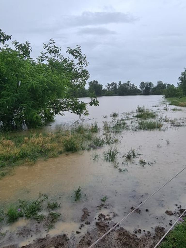
Widespread flooding, drenching rain and hail have been recorded across Queensland today as parts of the state are battered by an extreme weather system.
More than 80mm of rain fell in some parts just west of Brisbane – including Ipswich and Plainland – on Monday morning as slow-moving storm cells rolled across the state’s southeast.
By the afternoon, the severe weather had shifted north with hail and a 101km/h wind gust recorded in and around Rockhampton.

Staff at the Marlborough Motel, north of Rockhampton, captured large hail about 2.10pm.
A severe storm warning remains active for Bundaberg, Gladstone, Rockhampton, Yeppoon, Moranbah and Mount Morgan.
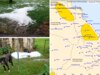
The Bureau of Meteorology warned large hailstones, heavy rain and damaging wind could be on the way for residents from the Wide Bay and Burnett up to the Central Coast and Whitsundays.

The storms could lead to flash flooding.
“Locations which may be affected include Bundaberg, Gladstone, Rockhampton, Yeppoon, Moranbah and Mount Morgan,” a statement from the bureau said.
“Large hail has been reported near Marlborough, west of Rockhampton.”
Severe thunderstorms are no longer occurring in the Darling Downs and Granite Belt district and the warning for this district has been cancelled, but not before 72mm fell in one hour at Ma Ma Creek in the Lockyer Valley in the hour to 8am.
A total of 45mm was recorded at Gatton in the 30 minutes to 6:30am, with 43mm recorded at the same time at ‘Little Egypt Alert’.
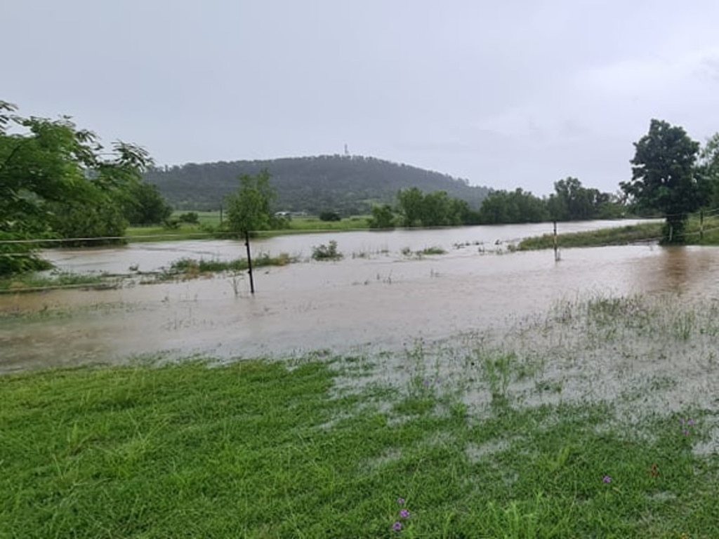
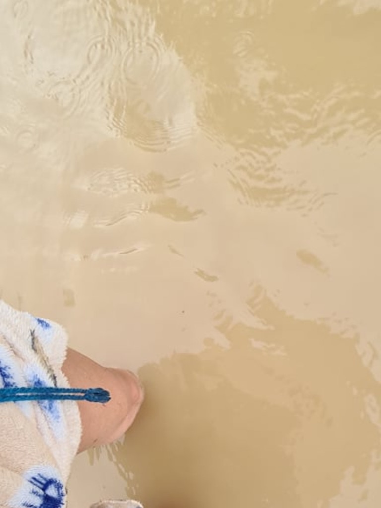
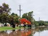
Amy Knox swapped her heels for gumboots when she was flooded in at her Plainland property on Monday morning.
The executive assistant who works in Brisbane City expects she will have a few extra days working from home this week.
“It started raining here at 6.30am as I was getting ready for work and by 7.30am we were flooded in,” Ms Knox said.
“We were still pretty wet from storms two weeks ago, so just 5mm would have been great today.
“What we got was ridiculous.”
Ms Knox had recorded more than 80mm since 6.30am.
Overnight, 99mm in two hours was recorded at Jeffries Rd, south of Dalby, to 11.30pm last night, while 51mm fell in an hour near Oakey in the early hours of Monday morning.
There has been flash flooding on Toowoomba Cecil Plains Rd at Linthorpe.
It’s been a very wet start to what’s expected to be a wet week to end a wetter-than-average spring with more rain on the way for the week.
On Sunday, Bureau meteorologist Kimba Wong said two weather systems expected to move across the state would make for gloomy weather through to the weekend.
“Already looking out the window in Brisbane, it’s quite overcast, and a lot of that cloud cover is being brought to us by an upper trough that is amplifying over southern Queensland and northern New South Wales at the moment,” Ms Wong said yesterday.
“It’s starting to bring some patchy rain to west and south of Brisbane at the moment, so through the Lockyer Valley we’re starting to get some rainfall as well as around the Scenic Rim and southern Border Ranges.
The wet weather will continue into Monday, which is expecting to begin with showers in the southeast.
Moderate to heavy falls are on the cards for the southern corner, but it appears Brisbane could miss out.
Further north, the weather system poses a risk of severe thunderstorms for the Wide Bay and Burnett regions.
The rain is expected to move off the coast on Tuesday, and Wednesday should be uneventful before another trough moves over the southeast on Thursday, bringing showers.
“It’s a bit of an unsettled period of weather,” Ms Wong said.
“Next weekend looks a little bit calmer, maybe a bit windy.”
Queenslanders can’t expect a reprieve from the wet weather as they welcome summer, as the Bureau of Meteorology’s seasonal outlook suggests above-median rainfall.
CURRENT TEMPS & 7-DAY FORECAST
More Coverage


Cold and wet … but will it snow in Qld this weekend?
Queensland is bracing for a blistering cold snap as meteorologists weigh in on the likelihood of snow in parts of the state’s south this weekend.

Storm shield: How AI will protect our state of disaster
Queensland has secured world-first AI storm detection technology in a $3m partnership between Suncorp and the state government to revolutionise natural disaster response.