
Brisbane weather: City drenched by 181mm of rain overnight
BOM reveals why the biggest deluge since the 2022 floods wasn’t predicted earlier, with residents waiting hours for warnings.
QLD weather news
Don't miss out on the headlines from QLD weather news. Followed categories will be added to My News.
The Bureau of Meteorology has revealed why a 180mm deluge - said to be the worst since the devastating 2022 floods - wasn’t predicted earlier as residents hit out at Brisbane City Council’s alert system.
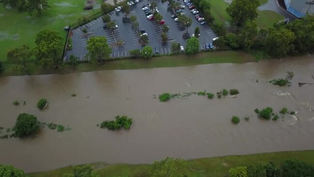
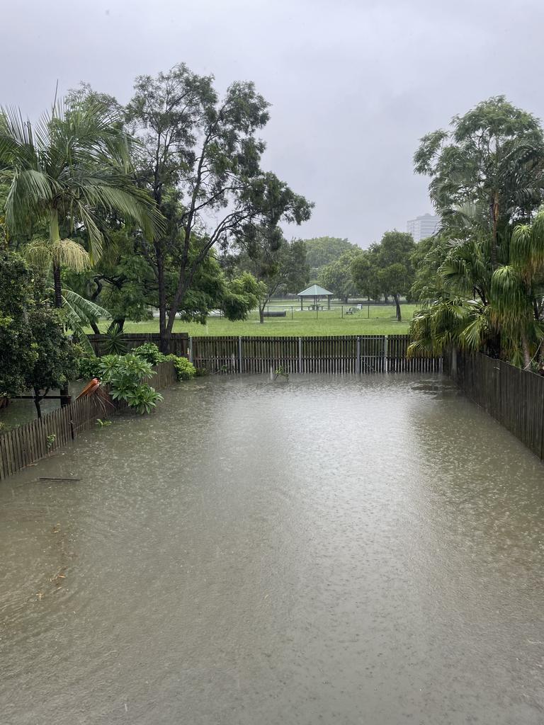
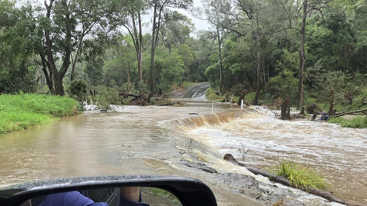
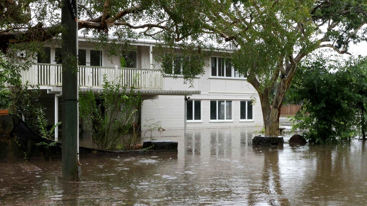
Brisbane was smashed by some of the heaviest rainfall since the 2022 event overnight with totals rising to as high as 181mm in Paddington.
Several other suburbs copped more than 150mm as the deluge, which began about 1am, continued into the middle of the morning.
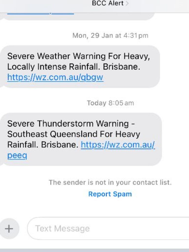
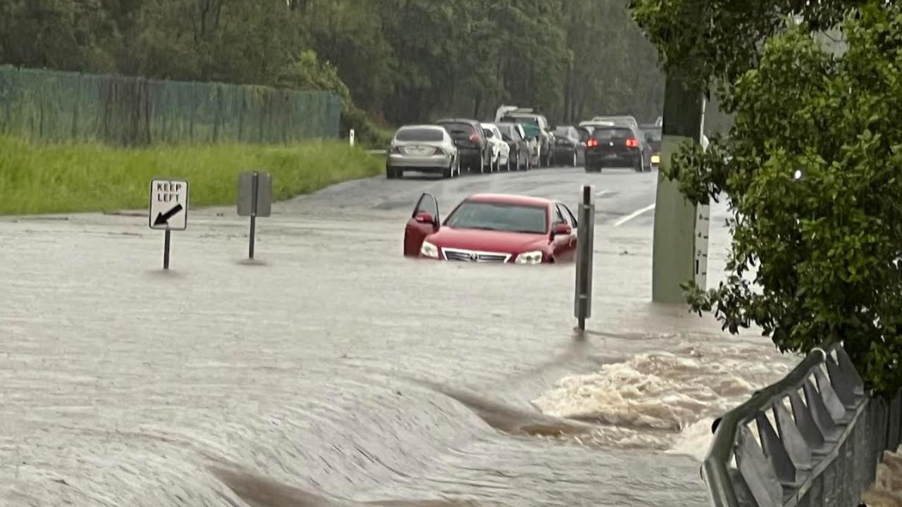
But many residents were left in the dark by the city council’s weather alert system, with numerous reports of people not receiving messages warning of flash flooding until after 8am.
Brisbane City Council issued the severe weather alert at 1.53am, but many residents reported not receiving the warning until after 8am.
The weather bureau’s Daniel Hayes on Friday said a coastal tough that formed without warning overnight was why the deluge wasn’t predicted earlier.
“The expectation was there (on Thursday) that we would have an upper-level trough coming through and there would be some shower and storm activity with it, but the formation of the coastal trough overnight is why we’ve seen those heavy totals,” Mr Hayes said.
“There was really intense rain in the six hours from 1am to 7am, with widespread falls up to 150mm. It eased after that, but still continued to add to the totals.”
Mr Hayes said the intense rainfall had moved further north away from Brisbane and up towards the Sunshine Coast by 11.30am.

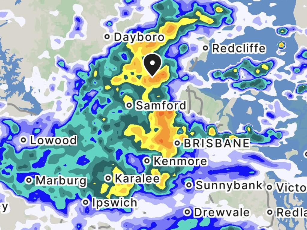
Between 1am and 7am, Rosalie recorded 151mm, Mt Coot-tha saw 148mm, Green Hill Reservoir in Chapel Hill received 140mm, Brisbane City had 135mm, Bowen Hills registered 135mm, Toowong had 134mm, and Gold Creek Reservoir in Brookfield recorded 125mm.
Between 9am and 11am, Brisbane saw an additional 10-20mm fall and the Gold Coast received 10mm or less, but parts of Ipswich recorded close to 30mm in these two hours.
Brisbane residents have received text messages advising that the Seqwater Flood Operations Centre has moved to the alert activation level due to the weather forecast.
Fifteen of the 25 dams operated by Seqwater are spilling - Borumba, Cedar Pocket, Enoggera, Ewen Maddock, Gold Creek, Hinze, Lake Macdonald (Six Mile Creek), Lake Manchester, Leslie Harrison, Little Nerang, Maroon, Moogerah, Sideling Creek (Lake Kurwongbah), Wappa, and Wyaralong.
On the Sunshine Coast, Yandina saw 65mm of rain after 9am on Friday, while Maroochydore and surrounding areas registered 20-40mm in the rain gauges after 9am.
Mr Hayes said the upper-level trough and coastal trough that combined to generate the heavy rain may extend up into the Noosa and Rainbow Beach areas on Friday afternoon.
“The coastal trough and upper-level system should move through later on Friday and overnight, so that from Saturday, we should just see some shower activity and then some blue skies coming through,” he said.
“Temperatures should edge back up as well. It was 26-28 degrees (on Friday) in the South East, but in the coming days we should see 30-31 degrees and it will still be fairly sticky.”
In it, the Council warned of heavy falls in the city and its western suburbs that could lead to flash flooding.
In another case, an East Brisbane resident reported flooding began in the suburb about 2am, but flooding alerts from Brisbane City Council didn’t get sent to residents until about 8am.
Leader of the Opposition, Councillor Jared Cassidy, took aim at the reported delays, saying they “failed Brisbane”.

“It shouldn’t take five hours to get flood warnings out to residents,” he said.
“We are seeing a repeat of the poor response from the LNP Council during the devastating floods in February 2022. It’s just not good enough.
“Lord Mayor Adrian Schrinner has failed to learn from his mistakes and neglected the residents of Brisbane when it comes to this unreliable weather alert system.”
Herston resident Avril Bowie posted that the flood warning system on Butterfield St, near Royal Brisbane and Women’s Hospital, did not go off despite the normally busy street being closed by floodwater.
Brisbane City Council’s Civic Cabinet Chair for Finance Fiona Cunningham said it was “disappointed” that a technical error with alert operator Weatherzone’s system resulted in some overnight alerts to Brisbane residents being sent out late.
“We have expressed our strong disappointment to Weatherzone who have operated the system since 2015,” she said.
“Weatherzone has assured us that the technical error has now been fixed and we apologise to residents.”
It is understood a storm warning was issued by The Bureau at 1am Friday morning, and council officers raised an issue with Weatherzone about alerts not being distributed at 4:12am.
By 8am Weatherzone rectified technical issue.
Urban Utilities spokeswoman Michelle Cull said crews were still responding to a burst water pipe on Sandgate Rd in Virginia which occurred about 8.30am.
“Some customers in the area may experience no water or low pressure while repairs are under way,’’ she said.
“Two southbound lanes on Sandgate Rd are closed while these essential works are completed and we apologise for the inconvenience.
“We’re responding to heavy rainfall across parts of our service region and we have crews working 24/7 during this weather event.
“We’re reminding people to follow the advice of authorities during this time and to avoid contact with flood waters.’’
Forecaster at The Bureau Daniel Hayes said the deluge brought some of the heaviest falls the region has seen since 2022.

“We don’t have a flood watch for the southeast, but there could of course be flash flooding,” he said.
“We are seeing some very heavy rainfall rates, it is looking like some of the heaviest rainfall really since the 2022 flooding.
“So, some significant rainfalls in places that obviously have already been impacted by heavy rainfall and other weather events this year, this season.”
Residents with rain gauges have reported huge falls overnight and this morning including: 130mm at Wilston State School; 180mm at Windsor, with a flood marker nearing the 2015 flood level; 117mm at Mt Crosby; 115-150mm at Wavell Heights; 130mm at Bilsen Rd near Downfall Creek, which is flooding; 140mm at Indooroopilly near low-lying Ambrose Treacy College.
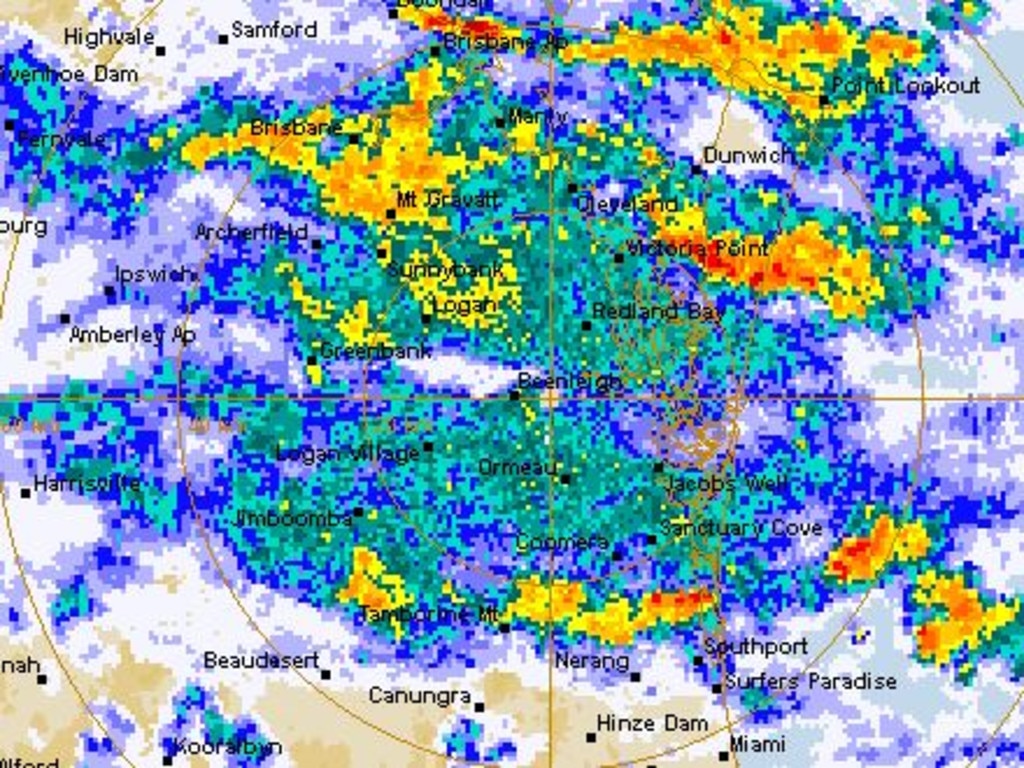
During the most intense period of rainfall, the city recorded 85mm of rain in just two hours at 2.30am, while Toowong copped 88mm in the two hours to 2.45am, and Rosalie received 98mm in three hours.
Water levels in Enoggera Reservoir at The Gap were rising very rapidly and had passed 124 per cent by about 9am.
It has been spilling for about a fortnight but water was roaring over the spillway this morning.
However state Labor MP for the area, Jonty Bush, posted that the dam was safe and in 2022 had passed 200 per cent capacity with no problems.
While other parts of South East Queensland appear to have experienced moderate falls of 10mm-23mm, Brisbane recorded 166mm of rain overnight, with the figure still rising and the downpour continues.
FULL LIST: Every road closure due to flooding across Brisbane, SEQ
Some Gold Coast suburbs have seen nearly half a month’s worth of rain in only a few hours. Coombabah copped the brunt of the wild weather on Friday morning with an hourly fall of more than 30mm recorded to 6am.
Mr Hayes said the rain was triggered by an inland trough lying through inland Queensland and a humid air mass across most of the state east of that trough.
“That does include the southeast at the moment, so all together, the onshore flow, the existing moist air mass and that upper level trough is bringing some very significant rainfalls, shower and thunderstorm activity through the southeast,” he said.

Conditions have since eased in the Brisbane area, but the heavy rain continues on the Sunshine Coast.
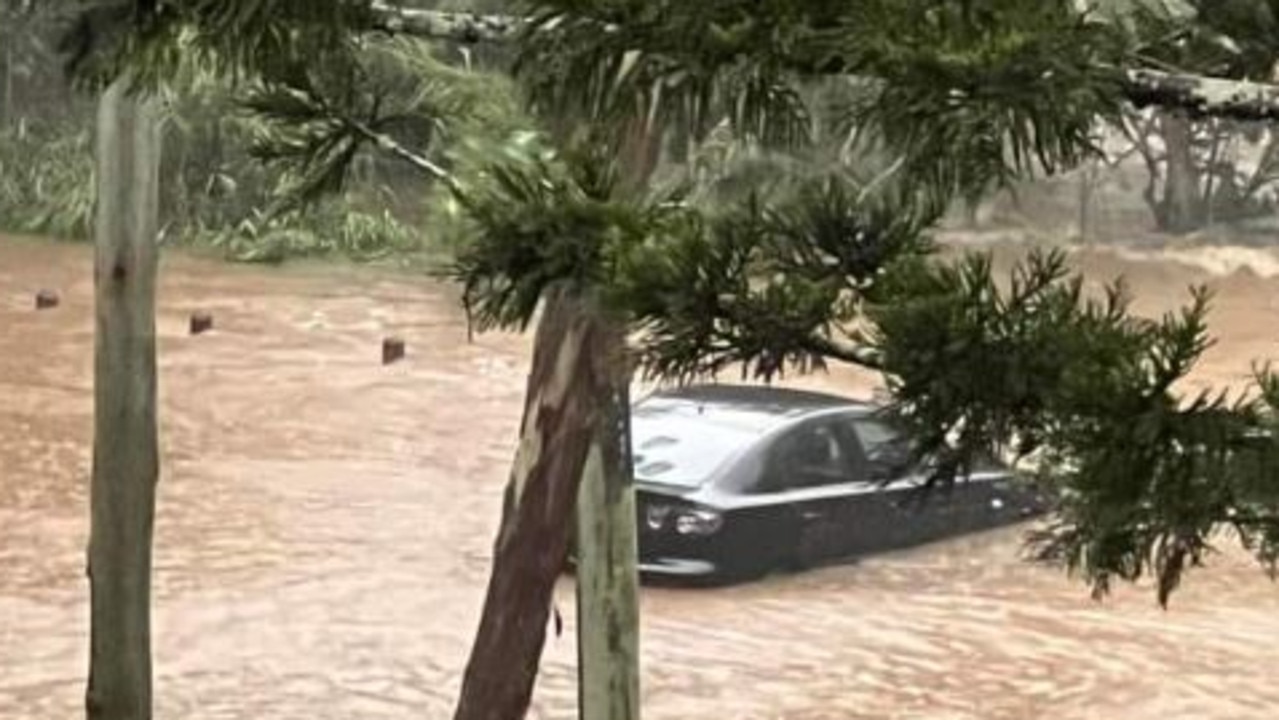
At Ninderry, on the Sunshine Coast, emergency services have found a vehicle that had been driven into floodwaters.
A Queensland Fire and Emergency Services spokesman said that all occupants of the vehicle were able to self-evacuate.
“There were four people who were able to self-evacuate out of the vehicle,” the spokesman said.
Kedron Brook has broken its banks and cut off at least two roads in the process, at Shaw Road in Kalinga and on Widdop Street beside Toombul shopping centre.
Northbound lanes of Gympie Road at Carseldine are also affected.
Illaweena Street in Drewvale is also closed due to flash flooding.
Fortunately, there have been no calls for rescues received by Queensland Fire and Emergency Services or Queensland Police Service.

Overnight, there were about 20 calls to SES for sandbagging and tarping jobs in southeast Queensland.
About 10 of those jobs were in the Brisbane area.
Around the southeast, other locations to receive overnight rain included Beaudesert (38mm), Coolangatta (46mm), Beerburrum (44mm) and Tewantin (11mm).
Mr Hayes said the rain would persist into Friday morning and afternoon before the upper trough moves offshore.
“There is still the potential for some heavy rainfall with thunderstorms through more western parts of the southern interior,” he said.

“There will still be a chance of some shower activity across the south east through the weekend, but not the sort of force that we’re seeing today.”
It comes two weeks after the city’s western and northern fringes were smashed by a rain bomb that delivered more than 300mm of rain in a matter of hours, flooding multiple properties.
Meanwhile, Burketown in Gulf Country copped 131.4mm in the 23 hours to 8am, as a Tropical Cyclone Warning remains current for tropical low 07U which sat over the southwestern Gulf of Carpentaria on Friday morning.
The warning zone stretched from Port Roper in the Northern Territory to Burketown in Queensland, including Mornington Island and Borroloola, but not including Ngukurr.
Mr Hayes said significant rainfall there would exacerbate existing flooding in that area.

“We have major flooding in the catchment, at Lower Flinders river, moderate flooding in the Nicholson river and minor at Norman,” he said.
“There is obviously already flooding in that area so significant rainfall is just going to exacerbate that situation.”
The flood watch issued for Gulf of Carpentaria catchments said widespread areas of heavy rainfall with daily totals of 100-150mm likely from late Thursday and Friday, with isolated 250mm and higher rainfall possible each day.
There was a moderate – 40 per cent – chance the system would escalate into a Tropical Cyclone on Friday morning, however parts of The Gulf coast were likely to experience strong to gale force winds and heavy rainfall.
Forecasters expected 07U was to cross The Gulf coast on Friday afternoon, and then on Saturday be inland and weakening.
Mr Hayes said once the system crossed the coast the chance of it developing into a cyclone would significantly drop.

“We’re talking from 40 per cent chance to just a 10 per cent chance, really once it moves overland and becomes less so as it moves further overland throughout the weekend,” he said.
“Even once the low has moved away in the north, we still have monsoon activity across the northern tropics.”
The forecaster said there will still be the potential for some significant rainfalls across the cape and the North Tropical Coast over the course of the next few days.
At 4am the system was recorded with wind gusts of 95 kilometres per hour and was located approximately 155 kilometres east northeast of Borroloola and 190 kilometres northwest of Mornington Island.


Alfred’s shock stats spark push for new buy back scheme
A voluntary home buy back program is among the recommendations of a review into Cyclone Alfred, with the report revealing just how many properties previously bought out would have flooded again.
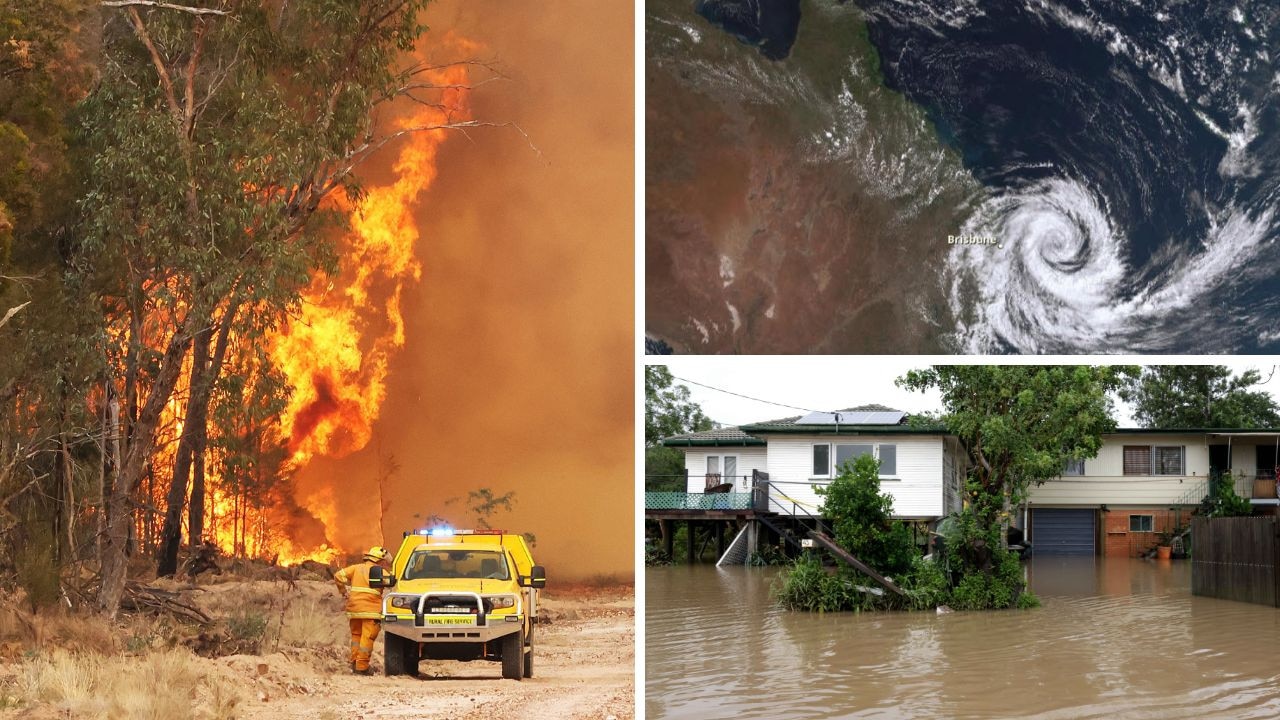
Fires, floods, cyclones, storms: How to check YOUR disaster risk
More than 2.7m Australian addresses have been identified by a major insurer as being at high risk of at least one extreme weather threat. FIND OUT YOUR RISK LEVEL