
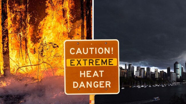
Brisbane City Council warns residents to prepare for trifecta of extreme weather events
Brisbane residents are being urged to prepare for a trifecta of extreme weather events, with warnings that “we need to take this seriously”.
QLD weather news
Don't miss out on the headlines from QLD weather news. Followed categories will be added to My News.
Brisbane residents have been urged to prepare for a trifecta of extreme weather events over coming months.
Lord Mayor Adrian Schrinner warned residents not to be complacent amid heightened bushfire risks, storm season and the potential for severe heatwaves.
“We need to take this seriously,” Cr Schrinner said, adding people needed to be aware of the risks and prepare.
“We live in the most disaster-prone state in Australia and severe weather could strike at any time.
“One of the most important things you can do is sign up to the free Brisbane’s Severe Weather Alert service.”
The Brisbane City Council has completed 17 planned burns, covering more than 342 hectares – equivalent to 46 Suncorp Stadiums – this year to prepare for the bushfire season.
A free green waste drop for residents will be made available at four Resource Recovery Centres from October 7-8 and November 11-12.
“We know everyone is feeling the cost of living right now, but that’s no reason to pull back on preparations, so our free green waste drop off days will make it easier and cheaper for everyone,” Cr Schrinner said.
“We’ve also recently written directly to more than 26,000 property and landowners in suburbs with higher bushfire risk, providing steps that will help them prepare for the upcoming summer months.
“El Nino doesn’t just increase the risk of bushfires, but also heatwaves, and I urge residents to take heed of the warnings, prepare your family and pets, and listen to advice from authorities.”
Meanwhile, the Bureau of Meteorology has issued a strong wind warning for parts of Queensland this weekend with an increased risk of bushfires in central regions.
Senior forecaster Felim Hanniffy, said there was a chance of heavy rain in some isolated regions.
“Today we‘ve got a strong south-easterly air flow moving up right along the east coast,” he said.
“That’s what’s bringing extensive strong marine warnings along much of the east coast this weekend.”
â›ˆï¸ âš¡No thunderstorms are expected in #QLD today but are possible in western QLD on Sunday (08/10). Locations include #MtIsa, #Windorah, #Cloncurry, & #Bedourie. No severe activity is expected. Check forecasts: https://t.co/Or6I9CvdzLpic.twitter.com/eAYb5zXBAg
— Bureau of Meteorology, Queensland (@BOM_Qld) October 6, 2023
Mr Hanniffy said central and inland regions will see ‘blustery south-easterly winds’ and dry conditions, which would will elevate fire risks.
“There is potential we see some localised extreme fire-dangers for parts of the Central Highlands and Coalfields regions.
High #Fire Dangers will persist in central and northern interior districts this weekend, easing early next week. Cooler temperatures with gusty southeasterly winds. Bushfire info @QldFES. Forecasts:https://t.co/0CAMbuRogHpic.twitter.com/NxutVohdGe
— Bureau of Meteorology, Queensland (@BOM_Qld) October 6, 2023
“It’s driven by the fact that the wind is gusty and due to that strong south-easterly flow that's developing along the east-coast.”
More Coverage


Ice ice baby: Spectacular images of unseasonal frost as Qld freezes
Queensland’s overnight temperatures will increase to double digits in the coming days, following the coldest start to winter in 16 years, bringing frost and ice to many regions. SEE THE PHOTOS

City’s coldest June start in 16 years, feels like MINUS 9.8C out west
Southeast Queensland is shivering through its coldest morning in more than 15 years but feels-like temperatures have dropped to insane levels in the southern inland.