
BOM issues flood warnings for southwest Queensland rivers, as rain, flooding expected for region
It’s shaping up to be a wild weekend of weather across southwest Queensland, with multiple warnings issued by the Bureau of Meteorology. Here’s what to expect.
QLD weather news
Don't miss out on the headlines from QLD weather news. Followed categories will be added to My News.
It’s shaping up to be a wild weekend of weather, with multiple warnings issued by the Bureau of Meteorology across parts of the state.
Flood warnings have been issued for major rivers in the southwest as the region faces a daunting amount of rain leading up the weekend.
Here’s what you need to know.
• LATEST
FRIDAY, MIDDAY
It’s looking like the southwest may see a reprieve over the weekend with the latest advice from the BOM suggesting the trough is moving towards the South East coast.
Bureau of Meteorlology’s Daniel Hayes said there’s still a chance for heavy rain in parts of the southwest, but are likely to be isolated to areas around Roma, St George and Goondiwindi.
“The trough is moving out of the Warrego to the western parts of the Darling Downs,” he said.
“It’s approaching Roma in terms of rainfall but is fairly slow moving, with potential for bigger falls this afternoon.
“The main focus area (of the trough) is northern New South Wales, around the Queensland border.”
Mr Hayes said the Warrego River at Augathella saw overnight falls of between 50-60mm, with a moderate flood warning now in place.
“It’s unlikely we’ll see big falls in that area again overnight, if we do see more there may be some rises and flash flooding.
A flood watch remains in place for the Moonie, Balonne and Warrego Rivers, with flooding no longer expected in the Wallam and Mungallala Creeks.
River’s likely affected over the weekend:
• Condamine Rivers
• Macintyre River
• Weir River
• Paroo River (Qld)
• Bulloo River (Qld)
• PREVIOUSLY
FRIDAY, 11AM
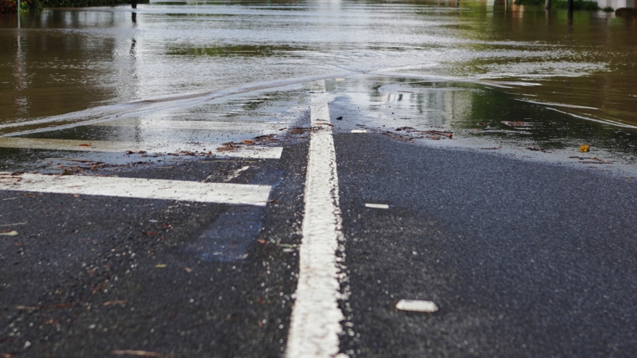
The latest information from the BOM suggests that major flooding is likely at Charleville from Friday evening, with a warning issued to residents just after 8.30am.
Parts of the Warrego River to Charleville have already seen flooding, occurring at Biddenham and the 27 Mile Garden with water sitting at 5.51m as of 7.24am.
Rainfall totals of between 30-90mm have been observed overnight across the Warrego River catchment, with the BOM predicting further showers and thunderstorm to become more widespread during Friday.
A Queensland Fire and Emergency Services spokesman confirmed there have been no recorded swiftwater rescues overnight in southwest Queensland.
CURRENT FLOOD WARNINGS, WARREGO CATCHMENT:
• Major flooding likely at Charleville from Friday evening
• Moderate flooding occurring at Augathella
• Minor flooding occurring at Cunnamulla Bridge
DARLING DOWNS & GRANITE BELT
The BOM have since cancelled the warning to sheep graziers in the Darling Downs and Granite Belt.
THURSDAY, 1PM
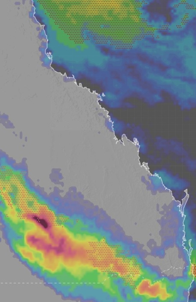
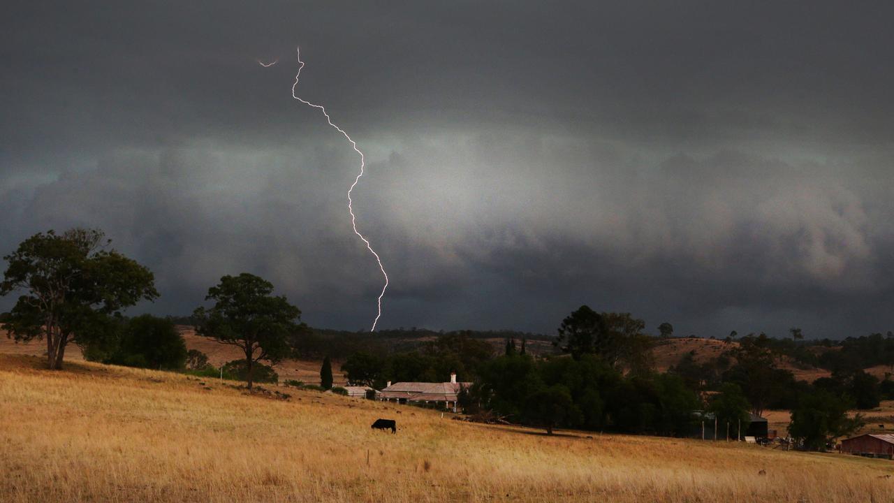
According to the BOM, two intense storm systems are forecast to collide along Australia’s east coast today, dumping 300mm of rain and delivering 100 km/h winds in a rare event.
The system is forecast to bring thunderstorms and heavy rain over inland parts of southern Queensland, and northeast NSW, producing intense falls of up to 300mm across three days.
A storm warning has been issued for the Maranoa and Warrego and Central West forecast areas, with several rivers and catchment areas on flood watch in anticipation of further drenching from the near-stationary trough.
The Bureau warns sheep graziers that cold temperatures, rain and south-easterly winds are expected today. Areas likely to be affected include parts of the Maranoa, Warrego, Darling Downs and Granite Belt forecast districts. There is a risk of losses of lambs and sheep exposed to these conditions.
The Bureau says “slow-moving clusters of heavy showers and thunderstorms” are expected to lash the southern interior for several hours, with Mitchell and Augathella in the direct firing line.
Widespread minor flooding is forecast in the Macintyre, Weir and Moonie River catchments from Thursday night, with the Bureau warning flash flooding would cut off transport routes and communities.
The Bureau’s Harry Clark on Wednesday said Queensland’s southern interior close to the border with NSW was already seeing the effects of the trough.
“Inland areas in the southeast could see heavy rainfall from this afternoon into this evening,” Mr Clark said.
“And then as we go into Thursday and Friday, basically the trough … is going to intensify a little bit.
“We could begin to see isolated thunderstorms and heavy rainfall from tomorrow in the southeast.”
Amateur weather forecaster Dylan McKenna said while widespread falls of 50-150mm were possible for South East Queensland, severe thunderstorms could see some totals exceed 200mm.
Mr McKenna predicted the heaviest falls to occur on the Gold Coast, Beaudesert and communities along the NSW-Queensland border.
“This general area of rain and storms will likely remain slow moving to near-stationary, eventually becoming an area of near-stationary rain and embedded heavy falls early Thursday morning over southern South East Queensland, northern NSW and the Darling Downs and Granite Belt, including areas as far north as Brisbane,” he said.
RIVERS AND CATCHMENTS LIKELY TO BE AFFECTED
Condamine Rivers
Macintyre River
Weir River
Moonie River
Balonne River (Minor flood warning current from earlier rainfall)
Wallam and Mungallala Creeks
Warrego River (QLD)
Paroo River (QLD)
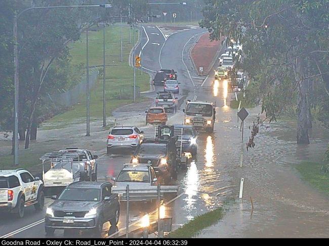
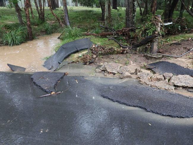
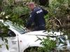
Tragically, a man has died in floodwaters Thursday morning.
Peter Wells, 71, died on Thursday when the car he was driving was swept away in floodwaters on Begley Rd about 5.20am.
The area was battered with torrential rain overnight, with more than 150mm recorded in Greenbank.

35mm in 30 mins: Inland Qld hammered by storms
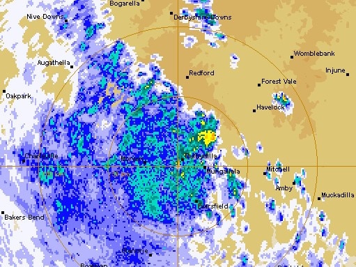
Severe thunderstorms were producing heavy rainfall in parts of inland Queensland on Friday night, with one area in the state’s south-west recording more than 30mm in 30 minutes.

Former MP withdraws senate ticket to focus on new role
A former Newman government minister has has stepped away from his senator ambitions to instead focus on helping flood-wrecked North Queensland rebuild.