
Brisbane weather: ‘Very dangerous’ storms leave 18,000 without power across southeast
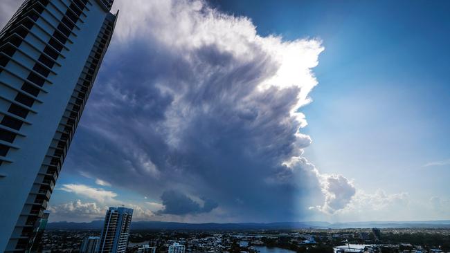
Multiple fast-moving storms, including two “very dangerous” system have swept across Brisbane and the Gold and Sunshine coasts, leaving more than 18,000 homes without power, and one house west of Brisbane without a roof as winds tore through.
QLD News
Don't miss out on the headlines from QLD News. Followed categories will be added to My News.
UPDATE: Power is being restored to homes across the southeast after severe weather caused a number of emergency outages.
At 10pm Energex was reporting 9905 homes are still without power, with that number reducing hourly.
At the peak of the storm, that number exceeded 19000, with the more than 15000 of the affected homes and businesses being in the Sunshine Coast.
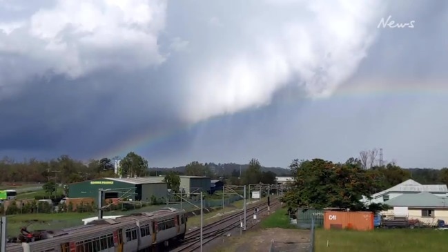
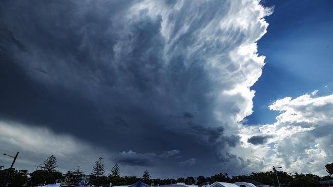
Residents in parts of the southeast have faced severe thunderstorms for the second day in a row, with multiple systems sweeping across the region.
Two “very dangerous” storms swept across the Gold and Sunshine coasts during the late afternoon, leaving more than 18,000 properties without power, as lightning strikes, heavy rain and strong winds battered the region from Gympie to the NSW border and inland to Toowoomba.
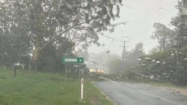
Severe winds across the Sunshine Coast tore down power poles and trees, while Nambour was pelted with more than 55.2mm of rain since 9am, and the wet weather is expected to persist throughout the evening.
Energex is reporting 18,590 homes are still without power, mainly in the Sunshine Coast (15,010) and Somerset (1204) regions.
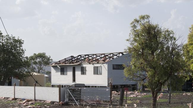
Winds have torn the roof from a house south of Toowoomba as another day of extreme weather battered the state.
Three people were inside the house when winds ripped the roof from the Clifton property at 3.44pm.
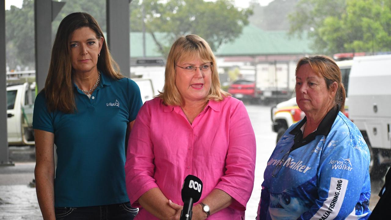
Firefighters and paramedics were at the scene, however a Queensland Fire and Emergency services spokesperson said conditions were inhibiting reparations.
For the second day, congestion is reported northbound on the Pacific Motorway.
Westbound traffic on the Ipswich Motorway is travelling slowly, with authorities warning road users to drive safely in the coming weather.

At 5.58pm, all severe storm warnings were cancelled by the Bureau of Meteorology.
Surf Life Saving Queensland announced mass closures of Sunshine Coast beaches as the “very dangerous” storm approached the region.
Beaches at Alexandra Headland, Boardwalk Beach, KawanaWaters - Buddina, Kings Beach, Marcoola, Mooloolaba, Peregian, Wurtulla and Twin Waters were all closed about 4.40pm.
A second, more general warning was issued at 4.44pm for the Wide Bay and Burnett and Southeast Coast Forecast Districts, but was also cancelled about 6pm.
EARLIER: The Bureau of Meteorology is predicting more storms across southeast Queensland today before temperatures start to climb.
The forecast in Brisbane today is of showers, with falls of up to 15mm possible. A storm, possibly severe, is also expected.
The forecast is similar for the Gold and Sunshine Coasts.
A warm start to the morning in Brisbane - an apparent temperature approaching 30C at 6am - is a sign of what’s to come, with southeast Queensland bracing for hot conditions for the rest of the week.
More storms lashed the region yesterday, leaving 19,500 houses without power.
Beaudesert and the Scenic Rim were among the hardest hit on Monday, but the outages ran right up to Gympie and included 3446 homes without power in the Ipswich, Logan and Brisbane City areas.
⛈ï¸FORECAST: Severe #QldStorm possible in #SEQld today, likely over northern SE Coast & southern Wide Bay/Burnett districts. Severe storms may produce damaging winds, heavy rainfall & large hail. Warnings issued as storms develop: https://t.co/oQJP0oAXFT pic.twitter.com/HT3K5FKMMb
— Bureau of Meteorology, Queensland (@BOM_Qld) January 21, 2020
Severe heatwave conditions are predicted for eastern Queensland in coming days, with temperatures up to 6C above average, according to the Bureau of Meteorology’s Peter Markworth.
“We’re seeing warmer temperatures up in north Queensland, and they’re going to filter down the eastern side of the state and we will see above average temperatures across most locations,” he said.
“Around the coast, we’re seeing temperatures in the mid-30s, which is typically about 3C to 4C above average, but as you move inland you see values in the high-30s, so again 5C or 6C above average for January. We have a lack of cooling over those days, so both the maximums and minimums are quite above average.”
Rain is forecast to offer some reprieve, but levels at the Atkinson, Clarendon and Bill Gunn Lake Dyer dams remain below minimum levels.
“At this stage, most of northern and eastern Queensland should see some rain, showers and storms,” Mr Markworth said.
It follows a tumultuous weekend of flash-flooding, where multiple areas saw rainfall totals above 200mm.
Last Saturday saw Miami and Burleigh Waters record 305.6mm and 292mm of rain, respectively.
Piles of heartbreak: Ingham counts devastating cost of floods
The Hinchinbrook region has begun counting the cost caused by the “perfect storm” as talk turns to potential buybacks and re-building homes ravaged by the floods.

‘Useless woke protests’: War of words over bus driver’s MAGA cap
A Brisbane bus driver’s decision to wear a MAGA cap as part of ongoing union protests has ignited a war of words over the action. HAVE YOUR SAY