
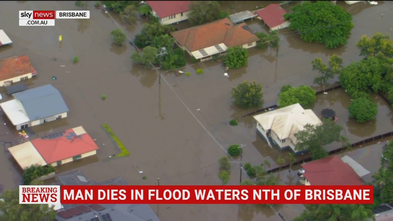
Warwick, Killarney floods: Warnings issued as Condamine River expected to exceed flood levels
Dozens of roads across Warwick and the wider area remain closed as the Condamine River hits its peak height, with the focus now on the region’s third round of damages and clean-up bills in less than a year. FULL UPDATE HERE.
Warwick
Don't miss out on the headlines from Warwick. Followed categories will be added to My News.
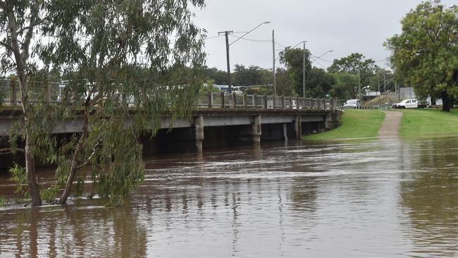
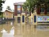
The Condamine River at Warwick appears to have peaked just above its minor flood level, with the region’s focus now turned to repairing damaged roads and infrastructure for the third time in a year.
BOM data indicates the river levels at Warwick were holding steady at 5.36m as of 1.10pm on Monday, slightly above the predicted peak of 5.22m.
The Condamine River is still rising at Pratten and is expected to exceed a moderate flood level to peak at 6.1m by about 10pm on Monday.
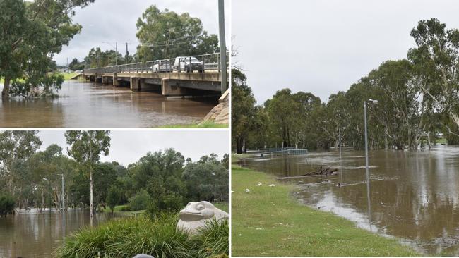
According to the latest river level data from BOM, the Condamine River at Warwick had already reached 5.21m by 9.53am on Monday and was still rising both in town and at The Head.
Water levels are already falling in other areas such as Murrays Bridge, which hit 7.3m earlier on Monday morning.
Initial flood warnings suggested river heights at Warwick could potentially reach major flood levels by Monday evening should the weekend’s heavy rainfall continue, but this has since been downgraded due to minimal rain forecast.
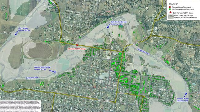
Southern Downs Regional Council also issued a flood alert for Killarney residents on Sunday night, advising the area could be impacted by a 5m moderate flood overnight.
SDRC Local Disaster Management Group co-ordinator Michael Bell said the below-expected flood levels had spared residents in Warwick and Killarney significant damage to their properties, with no reports of water reaching any houses.
He said four-day rain totals of more than 300mm in some areas of the northern region meant several roads had been significantly damaged and likely would not reopen immediately.
“It’s not just about the floodwater itself, but the damage underneath and making sure they can take the weight of vehicles again,” Mr Bell said.
“While there’s been some minor levels of flash flooding and roads closed down at the Granite Belt, they haven’t been at the levels of the Condamine.
“While we might have hit peak, it could be some time before the water starts to drop.
“We are out and about assessing for flood damage. We ask for patience, but we are ultimately trying to open these roads as quickly as we can.”
Killarney and its surrounds has recorded the highest rainfall totals across the region, with BOM gauges at Spring Creek Rd and Queen Mary Falls collecting 200mm and 190mm respectively since 9am on Friday.
Warwick has received 68mm and Yangan 80mm within the same time period.
Current forecasts indicate more rain could be on the way for Warwick for much of this week, with up to another 20mm is then expected between Thursday and Sunday.
Dozens of roads across the Southern Downs are now closed due to flooding, with motorists being urged to take care and avoid driving unnecessarily.
See the full list of current closures below:
Victoria St, Warwick
East St, Warwick
Churchill Dr, Warwick
Rosehill Rd, Warwick
Grafton St, Warwick
Condamine River Rd, The Head
Warwick Killarney Rd, Murrays Bridge
Forest Springs Goomburra Rd, Goomburra
Doyle Rd, Clintonvale
Kadow Rd, Clintonvale
N Branch Rd, Goomburra
Berat Forest Springs Rd, Berat
Hermitage Emuvale Rd, Yangan
Backhouse Rd, Killarney
Strudwick Rd, Yangan,
Junabee Rd, Junabee
School of Arts Rd, Pratten
Wheatvale Plains Rd, Upper Wheatvale
Dwan Lane, Bony Mountain
Toolburra Plains Rd, Toolburra
Britannia St, Stanthorpe
Granite St, Stanthorpe
Folkestone St, Stanthorpe
Contact the SES on 132 500 for flood emergency assistance or triple-0 in the case of life-threatening emergencies.

Join the conversation
Motorcyclist fighting for life after crash near Qld-NSW border
A man has been airlifted to Princess Alexandra Hospital in a life-threatening condition following a crash between a Mitsubishi Triton and motorcycle.
Read more
Vale John Hanna: Respected Toowoomba businessman laid to rest
Toowoomba has lost one of its most well-known and respected businessmen, John Hanna, who was laid to rest earlier this week.
Read more