
Southwest Qld to escape the brunt of severe storms
Large parts of Queensland’s eastern region is facing the chance of damaging thunderstorms, that could include large hail. Here’s what’s in store for the wider region.
Warwick
Don't miss out on the headlines from Warwick. Followed categories will be added to My News.
Residents in Queensland’s southwest and southeastern regions could be in for a wet Tuesday afternoon with the Bureau of Meteorology predicting widespread showers and the chance of possibly severe thunderstorms.
An updated forecast posted to social media by Higgins Storm Chasing is now depicting isolated storms rapidly developing across the Scenic Rim and Darling Downs particularly near Millmerran, and are soon expected to become severe.
For the wider Southern Downs region, Bureau of Meteorology forecaster Patch Clapp said while the severity of the storms is more likely to affect the eastern region into the Lockyer Valley and Scenic Rim areas, residents should still be on the lookout for storms.
“It’s mostly looking like your garden variety of storms for the Southern Downs with the severity farther east,” he said.
“However, residents in the Southern Downs should keep half an ear and eye out for storms.”
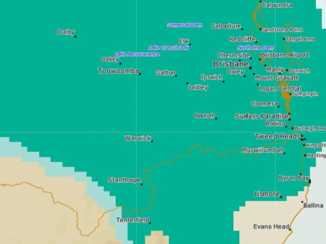
The BoM has forecast that severe thunderstorms could be seen across parts of the South East as well as the Wide Bay Burnett and Darling Downs.
Areas that could see thunderstorms include Gympie, stretching down into Oakey and Toowoomba, and across much of the southeast.
Mr Clapp said thunderstorms predicted across the South East are expected to bring damaging winds at speeds greater than 90km and the possibility of large hail.
According to the forecaster from Wednesday the watch points for storm activity will extend into the northern areas of Miles and Chinchilla, and is expected to skirt the Southern Downs region over both days.
It’s understood storm and shower activity could continue into the week with an easing trend predicted from Thursday and into the weekend.
Temperatures will remain quite warm across the southwest throughout today with a maximum of 27 in Dalby, 29 in Goondiwindi, 19 in Stanthorpe, 21 in Toowoomba and 23 in Warwick.
The content summaries were created with the assistance of AI technology, then edited and approved for publication by an editor.
More Coverage
Originally published as Southwest Qld to escape the brunt of severe storms

Boy rushed to hospital after machinery incident
A 10-year-old has been rushed to hospital after he was injured by a piece of machinery in the Southern Downs.

Will robots replace kelpies in the future?
A glimpse into what AI and robotics could mean for the future of Australia’s humble working dog has gone viral, however one of the nation’s top working dog trainers says it’ll be a long road until kelpies are put out to pasture.