
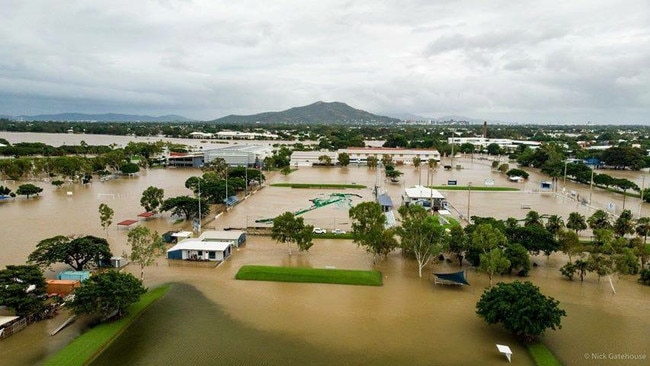
Super charges satellites track Townsville flood devastation
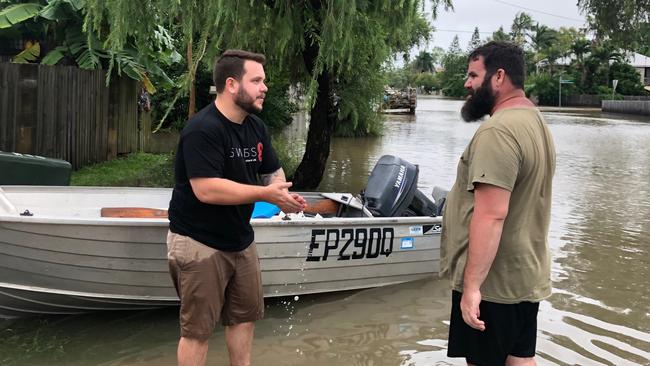
A pair of super charged “eyes in the sky’’ 700km above North Queensland played a key role in tracking the Townsville floods.
QLD News
Don't miss out on the headlines from QLD News. Followed categories will be added to My News.
A PAIR of super charged “eyes in the sky’’ 700km above North Queensland played a key role in tracking the Townsville floods last week.
Synthetic Aperture Radar, with a developmental history dating back to the late 1940s when the British Air Force developed radar to find German aircraft through cloud cover, has evolved in 21st century to provide stunningly accurate pictures of developments on the ground.
Townsville floods: Queensland Floods Appeal launched by Premier
Premier deflects question over flood water release to Townsville City Council
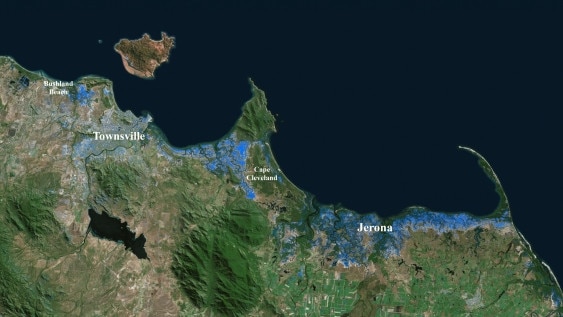
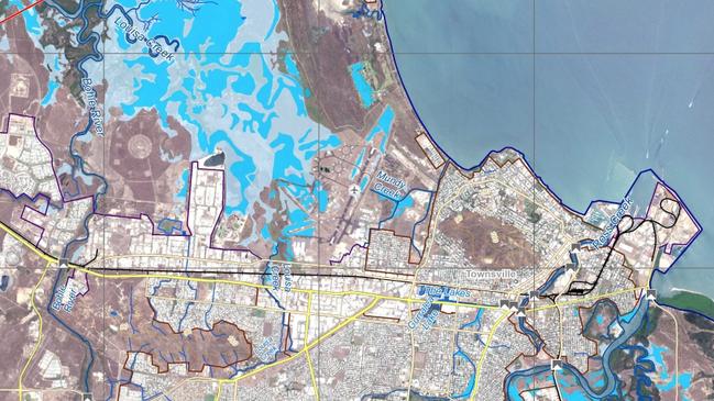
Professor Linlin Ge of University of NSW said the radar equipment could snap ground images across a width of up to 250km in one hit. But, when a series of images are incorporated into one, authorities can get detailed images of land masses stretching across a width of 2000 kilometres.
“The radar technology was actually used in Queensland during the 2010/11 floods but what we used for the North Queensland floods was much more advanced, and much more effective,’’ Prof Ge said.
The technology uses European satellites which send powerful radar beams through cloud cover which then bounce back and provide authorities with an identical simulation of what is occurring at ground level.
The technology can generate a massive field of detailed and vital information stretching across 2000km.
Electricity suppliers can be alerted to flood waters creeping up on sub stations and shut down power.
Isolated road and bridges that have gone under water can be identified and emergency services workers directed to critical areas of need.
“You can use it for a guide but you can also have that big picture where you can know exactly what segment of road is inundated,’’ Professor Ge says.
Meteorologists and hydrologists and also expected to be take up the new technology.
“This technology can be used to validate their predictions.’’
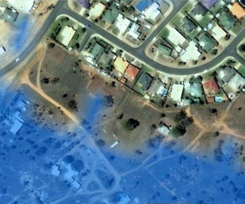
Professor Ge said an image could clearly capture a residential block.
“For example, I can tell whether my house is flooded or if my neighbour’s house is ok,” he said.
“We could only tell the suburb with the older technology.”
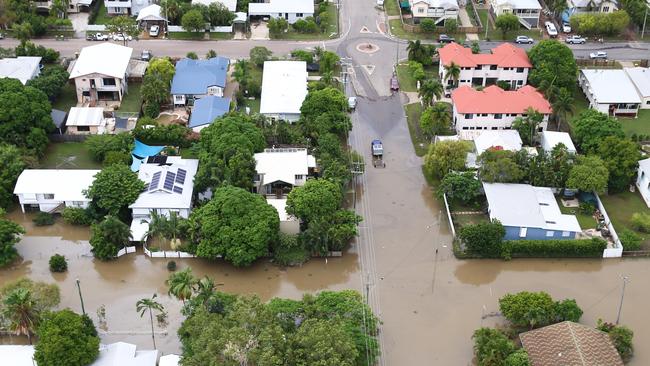
He said mapping of floodwaters can help with emergency work to safeguard infrastructure including roads, dams, bridges, railways and power substations.
Comparing the images captured by the radar can help to identify the extent of the flood and even assist in predicting where the water may flow next, enabling actions to be taken to prepare the area, such as shutting power off or closing roads in advance.
Last week’s flooding, which impacted a 700km stretch from Cairns to Mackay, covered such a broad area that Professor Ge said along with being restricted by weather, it was difficult for conventional weather and mapping methods to fully capture the entire picture at once.
“Winds may be too strong to take off and land at an airport or, another factor is lightning,” he said.
“You don’t want a pilot to fly into a storm.
“The third one is it’s a wide area, so too much to cover for an aircraft.”
Professor Ge said the imaging radar was not to be confused with conventional weather satellites, which cannot see through clouds.

“A conventional optical satellite can take a photo every 15 minutes, but it’s 36,000 kilometres in orbit,” he said.
“And it can’t see anything on the ground if there’s cloud cover.”
The SAR can penetrate cloud cover and also take photos at night thanks to a special in-built camera and sensor similar to a torch.
The radar itself can detect different types of ground features, including bodies of water, houses or roads.
The first images relating to the Townsville floods were taken on January 6, 18 and 30 and used to generate a detailed, accurate flood map of the area.
The images have been sent to the Queensland State Disaster Coordination Centre and already been used by the Department of Natural Resources, Mines and Energy to help complement their work with the Far North Queensland floods.
“They’ve been comparing what we have obtained from space to what they have taken from an aircraft,” Professor Ge said.
The data can be viewed by following the Twitter hashtag #UNSW-GEOS.

Daughter’s heartbreaking act in wake of Vyleen White’s death
A daughter of Vyleen White has revealed how her mother’s violent death at a shopping centre car park near Brisbane almost sparked a second tragedy for her family.

Popular Thai restaurant finds new riverside home
A popular Thai restaurant forced to close because of the redevelopment of its inner-city home is about to open in a new spot.