
Emergency alert declared for North Burnett as intense rainfall, flooding set to continue
A dangerous weather system is causing havoc across the Burnett with parts of the region battered by incredible amounts of rain overnight and more on the way. Full details:

South Burnett
Don't miss out on the headlines from South Burnett. Followed categories will be added to My News.
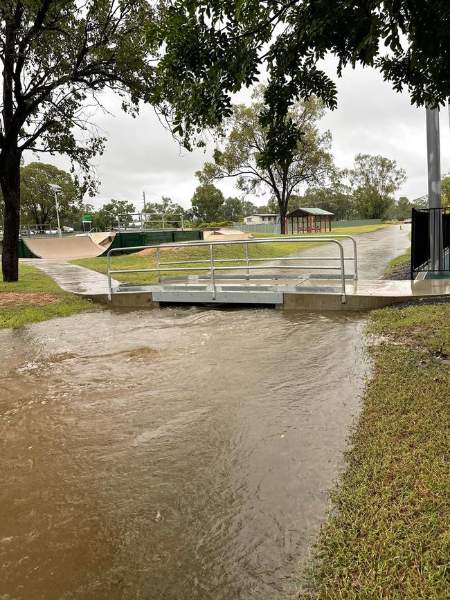
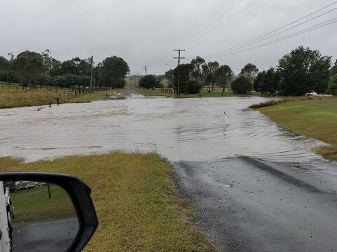
A flooding emergency is again unfolding throughout the Burnett as more than 200mm of rain lashed parts of the region overnight, with more wet weather on the way.
An emergency alert was issued by North Burnett Regional Council on Thursday night, warning residents to remain vigilant with intense rainfall forecast to lash the region and urging drivers to stay off the roads.
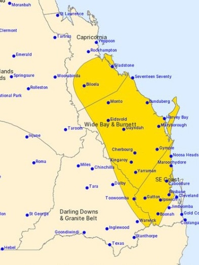
BOM meteorologist Helen Reid said several places in the North Burnett were hit with well over 100mm of rain, with some areas soaked under a 200mm downpour.
“It’s quite a broad region that’s picked up that amount,” Mr Reid said.
“Gin Gin’s picked up 180mm, and then as you head down to Gayndah, we’ve still got 120mm through there.”
With multiple flooding disasters striking Queensland in past months, Ms Reid said the wet catchments have quickly caused flooding that has cut roads.
“It’s been a very wet season and those rivers are just ready to go over the banks again,” she said.
Ms Reid said rainfall amounts in the triple figures were expected throughout Friday in the northern parts of the region.
Deputy chair of the Local Disaster Management Group and councillor Melinda Jones said Mt Perry has been hit the hardest across the region, with residents isolated in their homes by the floods.
Cr Jones said the team will be standing up Mt Perry’s LDM sub-group to monitor the situation with more rainfall predicted to drench the town into Friday.
They will be keeping an eye on how long residents will be isolated from the main town, whether food drops will be required, and if anyone trapped in their home requires medical attention.
Rain across the North and South Burnett will ease off by Saturday, with “50-odd millimetres, maybe 100mm” and thunderstorms expected.
South Burnett Local Disaster Management Group has moved its status to alert as wet weather continues across the region, with residents warned “if it’s flooded, forget it”.
South Burnett Mayor Brett Otto has urged residents to take care driving in bad weather conditions, as “we do not want to have tragedy strike our community through careless or bravado driving”.
“If you are informed and prepared, then you will make better and safer decisions about travel, home, work, and care of family and business,” he said.
“There are also sections on road conditions, emergency news, COVID-19, Sunwater and Gordonbrook Dam and links to Qld government sites and emergency contacts.”
The Kilkivan to Kingaroy Rail Trail is also closed from Murgon to the border of Goomeri due to some flooding and damage to the track, and will not reopen until Tuesday.
Road closures as listed by the North Burnett Regional Council
Boondooma Rd, Glenrae
Coonambula Rd, Mundubbera
Stony Creek Rd, Mount Perry
Kerwee Rd, Ceratodus
Sandy Camp Rd, Mount Perry
School Ln, Mount Perry
Harpurs Hill Rd, Mount Perry
Hidden Valley Rd, Mount Perry
Wetheron Rd, Bon Accord
Burnett Highway, Mount Perry / Tellebang
Maryborough Biggenden Road, Lakeside
Gooroolba Biggenden Road / Mingo Street, Degilbo / Gooroolba
Monto Mount Perry Road, Mount Perry
Gayndah Mt Perry Road, Mount Perry
Heusman Street, Mount Perry
Road closures as listed by the South Burnett Regional Council
Kangaroo Yard Rd, Ficks Crossing
Byee Rd, Wondai
Wondai Proston Rd, Wheatlands
Clovely Ln, Redgate
Chinchilla Wondai Road
Memerambi Gordonbrook Rd, Gordonbrook
Glenmore Rd, Sandy Ridges
Kingaroy Barkers Creek Road
Robin and Lee Rd, Sandy Ridges
Mondure Crossing Rd, Booie
Aerodrome Rd, Taabinga
Paige Road, Barker Creek Flat
McNamara Rd, Nanango
Darley Crossing Rd, Brooklands
Kumbia Rd, Brooklands
Tarong Railway Rd, Tarong
Maidenwell Bunya Mountain Rd, Wengenville
Maidenwell Upper Yarraman Rd, Maidenwell


‘Intensive’ student nurse program launches in South Burnett
A successful program that has already placed dozens of nursing graduates into aged care jobs has expanded to the South Burnett.

Qld man accused of rape to be tested for ‘sexsomnia’
A man facing charges of rape and attempted rape will undergo a special study to determine if he suffers from a rare sleeping disorder in which people engage in sexual behaviour while unconscious.