
Rockhampton Regional Council new flood mapping for 3500 properties
Rockhampton Regional Council has undertaken new flood studies to update flood mapping, looking at properties that haven’t been modelled before. Find out if your home is on the map.
Rockhampton
Don't miss out on the headlines from Rockhampton. Followed categories will be added to My News.
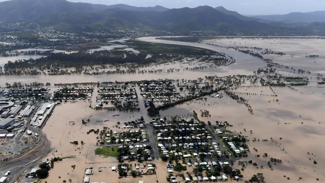
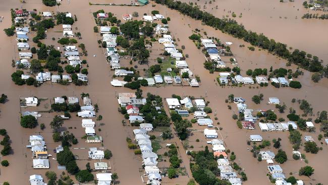
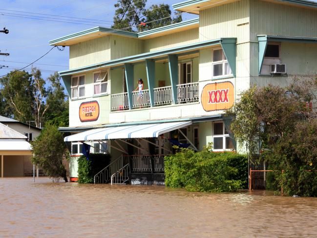
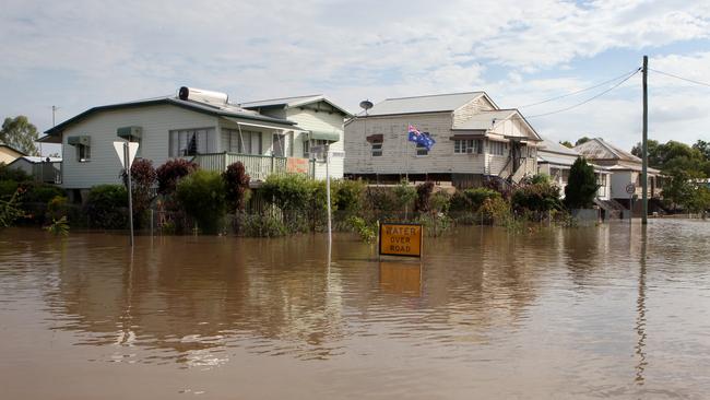
Areas of the Rockhampton region have been reviewed in a flood study for the first time as council updates its flood mapping.
Rockhampton Regional Council has recently completed several flood studies, updating the regional flood model and local catchment studies.
Around 3,500 properties are affected in the new changes which are now being proposed to be added to the council’s planning scheme.
Updated flood overlay maps with the most current flood modelling is crucial in understanding flood behaviour and flood hazards of the Fitzroy River, creeks and the local catchment areas.
Some of the new properties may not have been previously assessed by a flood study or show flood inundation, but are being planned for in terms of unprecedented floods.
“If the recent events in southeast Queensland and New South Wales have taught us anything, it is the value of improving community resilience when it comes to large scale flood events,” Rockhampton region Mayor and Local Disaster Management Group chair Tony Williams said
“Council has taken this opportunity to improve upon its current flood information, and this has resulted in updated riverine flood mapping and updated or new local catchment flood mapping.
“The flood models combine a range of land and meteorological data to identify areas of the catchment that are predicted to be impacted by flooding during flood events of different sizes and durations.”
Updated flood studies have been conducted for the local catchment flood overlay mapping for the North Rockhampton Creek Catchments including Ramsay Creek, Splitters Creek, Limestone Creek, Moores Creek, Frenchmans Creek, and Thozets Creek.
Unmodelled local catchments in South Rockhampton (Rockhampton City, Allenstown, Depot Hill and The Range), West Rockhampton, Wandal, Gracemere North, and Mount Morgan have also been reviewed.
The council documents discuss what the new flood risks could mean for home insurance premiums.
It is noted that flood risk is only one of the factors affecting insurance premiums and other factors can include building type, building age, security and vulnerability to other natural hazards such as cyclones, bushfire, storms, earthquakes etc.
Most insurance companies use their own flood mapping to determine premiums relating to flood risk.
These studies may not be as detailed as council studies and may use outdated flood data, resulting in higher premiums.
Council states its flood mapping is shared with the Insurance Council of Australia to ensure insurance companies have access to reliable and detailed flood mapping and information.
Residents are being urged to check the updated flood mapping for their property.
Information packs with letters, updated maps and facts have been sent to the 3,500 affected properties, explaining what the updates mean.
Council has a consultation period open until June 3 and residents can provide feedback through the engagement platform on council’s website, or at council customer services offices.
Pop up information times:
Allenstown Square – Wednesday May 11, 9am-4pm, main corridor
Gracemere Shopping World – Wednesday May 18, 9am – 4pm, outside Woolworths.
Mt Morgan – Wednesday May 25, 10am – 2pm, Information Booth – Morgan Street – Rotunda across from the Bakery
For information and to have your say visit https://engage.rockhamptonregion.qld.gov.au/


‘My babies gone’: Mum’s heartbreak after children, fiance killed in crash
The mother of two young children killed in a horror head-on collision has revealed ‘her babies’ and fiance died while heading home from a camping trip.

DV attack: Mechanic punched woman in the eye
A Central Queensland mechanic has faced court for punching a woman in the eye during a domestic violence attack.