
Flood emergency: BOM reveals expected peak of Mary River in Gympie
Receding floodwaters in the Gympie region’s west have revealed the true extent of the damage caused by the weekend’s floods, with roads left shredded and key facilities damaged.

Gympie
Don't miss out on the headlines from Gympie. Followed categories will be added to My News.
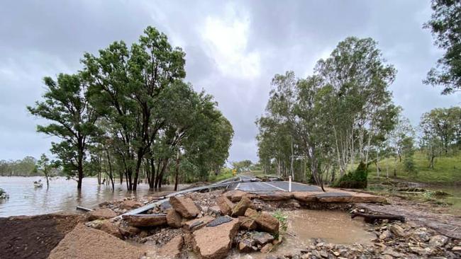
Shocking images of the extent of damage at Goomeri and its surrounds continue emerge as flood waters recede following the torrential downpour which sparked an emergency across the Wide Bay.
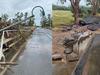
Multiple roads including the Burnett Hwy have been shredded by the flood waters, with one cut in half so badly it severed the water supply to the town’s residents.
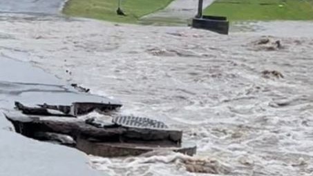
The town’s pool bore the brunt of the floods too, with fences pushed over and the facility itself inundated.
The receding levels are exposing damaged vehicles caught in the chaos of Friday night when hundreds of millimetres of rainfall was dropped by the remnants of ex-tropical cyclone Seth.
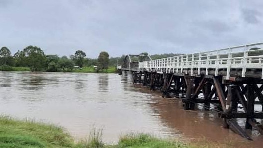
Gympie city has experienced moderate flooding due to the swollen Mary River but Normanby Bridge is expected to stay open with water levels not predicted to hit the same peak as in the 2013 flood.
As of 12.44pm Sunday the Mary River at Gympie was sitting at 13.61m and holding stead.
This was more than 1m below the height needed to inundate the bridge.
Kidd bridge remains under almost 4m of water, according to the Bureau of Meteorology.
The river is expected to stay above the 12m moderate flood level until Sunday afternoon.
“Unless there is adverse weather Normanby Bridge will remain open and hopefully the river subsides,” Mayor Glen Hartwig said.
For residents in Gympie’s western regions he said an online contact point had been established to help the council prioritise road repairs not likely to be picked up by Transport and Main Roads.
Mr Hartwig asked residents to please send photos of the damage and as much detail as possible to floodingdamage@gympie.qld.gov.au
The bridge at Inglewood across East Deep Creek has been cut by floodwaters; diversions are in place.
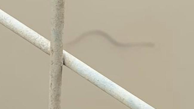
Residents are being urged by authorities to stay out of floodwaters across the region with resident Kim Milham capturing the perfect reason why: a red belly black snake taking a swim in waters at One Mile.
With rainfall across the region now largely finished the full extent of the damage to Gympie’s north and west has been revealed.
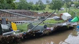
Fences at Goomeri’s pool have been washed over and the facility itself flooded with dirty water, with the town itself largely cut off and inundated as a result of the downpour.
At Dickabram water is lapping just beneath the 21m tall bridge.


Roads, rail, housing: How Qld will benefit before, after the Games
Millions of Queenslanders will have access to faster, more frequent and better-connected rail and bus services, and an upgraded Bruce Highway, while thousands of new homes will be available after the athletes leave.

‘Predatory’ ex resort manager raped, gave Viagra to young boy
This 70-year-old Qld man’s vile sexual abuse of two young boys included editing one’s face onto pornographic images and giving him sickening nicknames. *DISTRESSING